
“Dallas Is a Major Target Area!” — Know Where Your Nearest Fallout Shelter Is
by Paula Bosse

by Paula Bosse
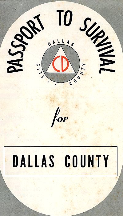
During the Cold War, the fear of nuclear attack was very real in the United States, reaching its peak of anxiety in the late 1950s and early 1960s. In 1958, the Dallas City-County Civil Defense Commission published a free informational pamphlet titled Passport to Survival, which contained evacuation maps for Dallas County, preparation tips, an emergency supply checklist, etc. Though the information contained in this publication could be applied to any disaster or emergency (nuclear-based or otherwise), it was printed a time when visions of Soviet atomic bombs were dancing in the heads of many concerned Americans. And this mild-mannered-looking pamphlet made sure you, Mr. and Mrs. Dallas County, knew that it was talking about a potential direct strike by nuclear missiles: “DALLAS IS A MAJOR TARGET AREA!” (See images from this pamphlet at the end of this post.)
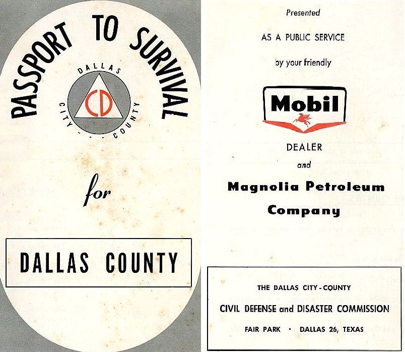
The arrival of Passport to Survival (“presented as a public service by your friendly Mobil dealer and Magnolia Petroleum Company”) was heralded by a newspaper ad in November, 1958 (its eye-catching “DISASTER CAN HIT DALLAS!” artwork is seen above). (The full ad — with an exhortative letter by Commission chairman John W. Mayo, addressed to the people of Dallas — can be seen here.) I’m not sure how much “survival” there would be in case of a nuclear attack, but, like a good Boy Scout, one should at least be prepared.
Backyard bomb shelters were necessary in Britain during World War II and saved countless lives during the almost nightly German air raids (I wrote about these shelters on another blog, here), but it was a new concept to post-war America. It wasn’t long, though, before bomb shelters became all the rage in the early ’50s as the Cold War heated up. If it’s becoming a common reference-point on the country’s funny-pages, it’s hit mainstream acceptance.
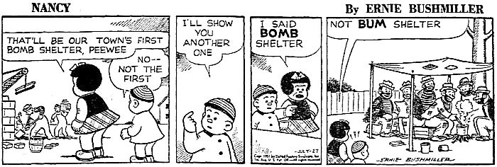 “Nancy” by Ernie Bushmiller, July 27, 1951
I’m not sure how many people were building these shelters, but they were certainly talking about them. When Highland Park Village announced their new underground parking garage in 1953, owners Flippen-Prather made sure to note that the two subterranean parking levels (the lowest of which was 20 feet below street level) would not only accommodate 300 vehicles, but, if needed, it could serve as a bomb shelter for 3,500 very well-dressed Park Cities residents seeking refuge.
But what really caused the mania for nuclear fallout shelters to reach its zenith was the Bay of Pigs Invasion in April of 1961. In May, 1961, ground was broken for construction of the $180,000 Civil Defense Emergency Operating Center at Fair Park (the first such center in Texas), adjacent to the Health and Science Museum. The underground bunker was to serve as a government operating and communications center for Dallas County in the event of a nuclear attack or natural disaster. It would house about 30 people (which would include the mayor and other city officials) and would be stocked with provisions for 14 days. It had its own water supply, electric generators, radios, and telephones. It was built to withstand a 20-megaton nuclear blast three miles away (i.e. downtown, where, presumably, the mayor and other city officials would be working when the 20-megaton bomb lit up Big D). When not in use as a shelter, it was to be maintained by the Health and Science Museum staff, and operated as a center for survival training. For many years it was open to the public, seven days a week. (It’s worth noting that the Civil Defense headquarters in Dallas was also located in Fair Park, at the building housing radio station WRR.)
The man behind the everything-you-need-to-know-about-Civil-Defense website CivilDefenseMuseum.com did a really interesting video walk-through of the surprisingly large decommissioned (if that’s the correct word to use here) Fair Park shelter in 2013:
*
1961 was THE year if you wanted to get into the bomb-shelter business. There was even a three-day “Fallout Survival Show” at Market Hall. You couldn’t open the pages of a magazine or newspaper without seeing ads for personal bomb shelters.
Some of the ads were kind of cozy:
 Sept., 1961
Some were not:
 Sept., 1961
Again, not all that many people were actually building them, but everyone was certainly talking about them. But in just a few short months … no one cared anymore. The ads disappeared. A lot of people who had been trying to sell them went broke. Those who survived (as it were) repurposed their products as “storm shelters” — turns out tornadoes were more of a pressing threat to Dallasites than Russian A-bombs.
Public shelters, however, didn’t disappear. In September, 1962, the very first public fallout shelter in Dallas was officially designated: the Southland Life Insurance Building could accommodate a staggering 30,000 people in the event of disaster. (The plan for this shelter was actually announced in 1954, and the Southland Center opened in 1959, but the official designation was not made until 1962.)
In 1966, Dallas had more than 300 official shelters, able to house 971,000 people:
…323 buildings in the city have been approved as shelters. The owners and managers of 204 of them have entered into agreements with the federal government and with the city to permit their use in emergencies as public shelters…. Shelters in Dallas can house 971,000 persons. Many of the buildings are permanently stocked with water, food supplies and medical supplies sufficient to sustain about 300,000 people for approximately two weeks. (“Maps at Fire Stations To Pinpoint Shelters,” Dallas Morning News, March 9, 1966)
Some of the permanent provisions kept in these places were water, food, “fortified crackers,” hard candy, bandages, iodine, and Geiger counters.
As one might expect, many of the city’s fallout shelters were in downtown buildings, their exteriors adorned with official Civil Defense signage. My favorite? Neiman-Marcus, of course, seen below in 1965, decorated for the Austrian Fortnight.
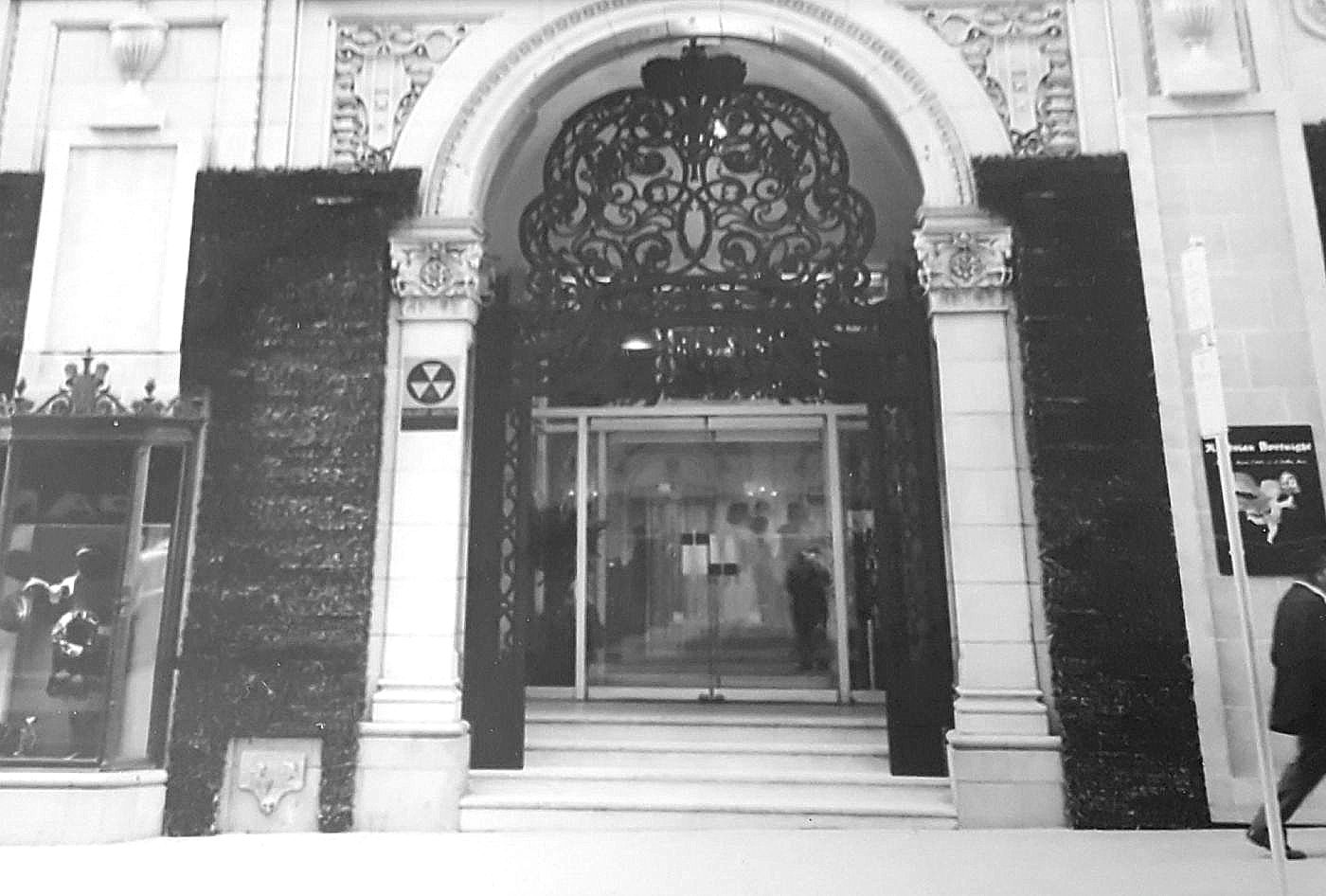 Neiman-Marcus, the most elegant bomb shelter in town…
If I were able to choose where to huddle during a nuclear attack, I think I’d choose Neiman’s. I’m sure Mr. Stanley made sure his basement was comfortable, tasteful, and well-appointed. …And one would have to expect he wouldn’t have had his guests living off hard candy and fortified crackers.
**
Below are images from the 1958 publication Passport to Survival (thanks to Jeff Hanning for his original scans, which precipitated this post) — all images are larger when clicked.
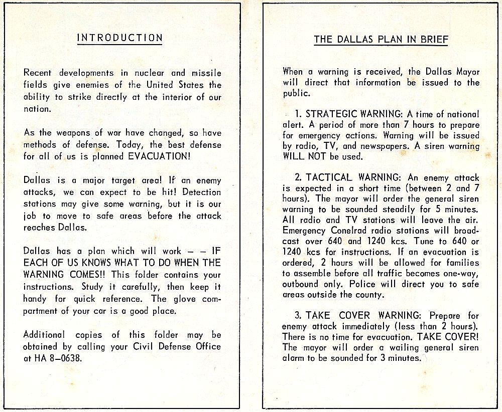
“Introduction” / “The Dallas Plan in Brief” (more information of CONELRAD is in this YouTube video):
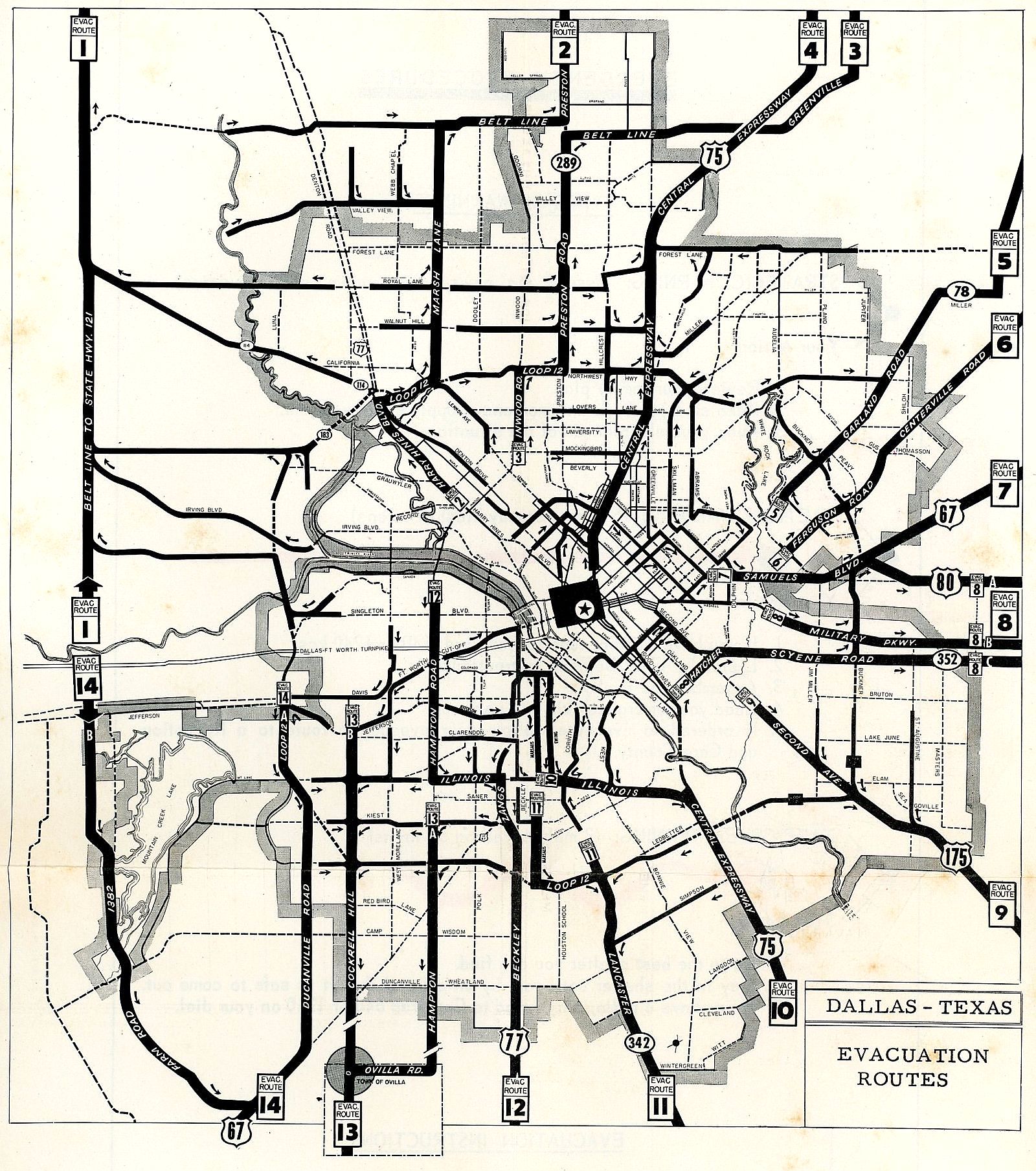
“Evacuation Routes.” (This plan did not sit well with the citizens of Grand Prairie as they were not included in the evacuation plans of either Dallas County or Tarrant County — this seems to have been a particularly odd oversight, seeing as Grand Prairie was a military aviation hub — home to Hensley Field and Chance Vought — and a likely target if DFW were attacked. As an editorial in the Grand Prairie Daily News-Texan stated somewhat bitterly: “Dallas seems to have it all sewed up.”) (Also interesting in these evacuation plans was that the county was divided into four divisions, the boundaries of which corresponded to school districts: District I covered the Dallas Independent School District, Division III covered the Highland Park Independent School District, District IV covered the “Negro Unit,” and District II covered every other school district in Dallas County not covered in the other divisions.)
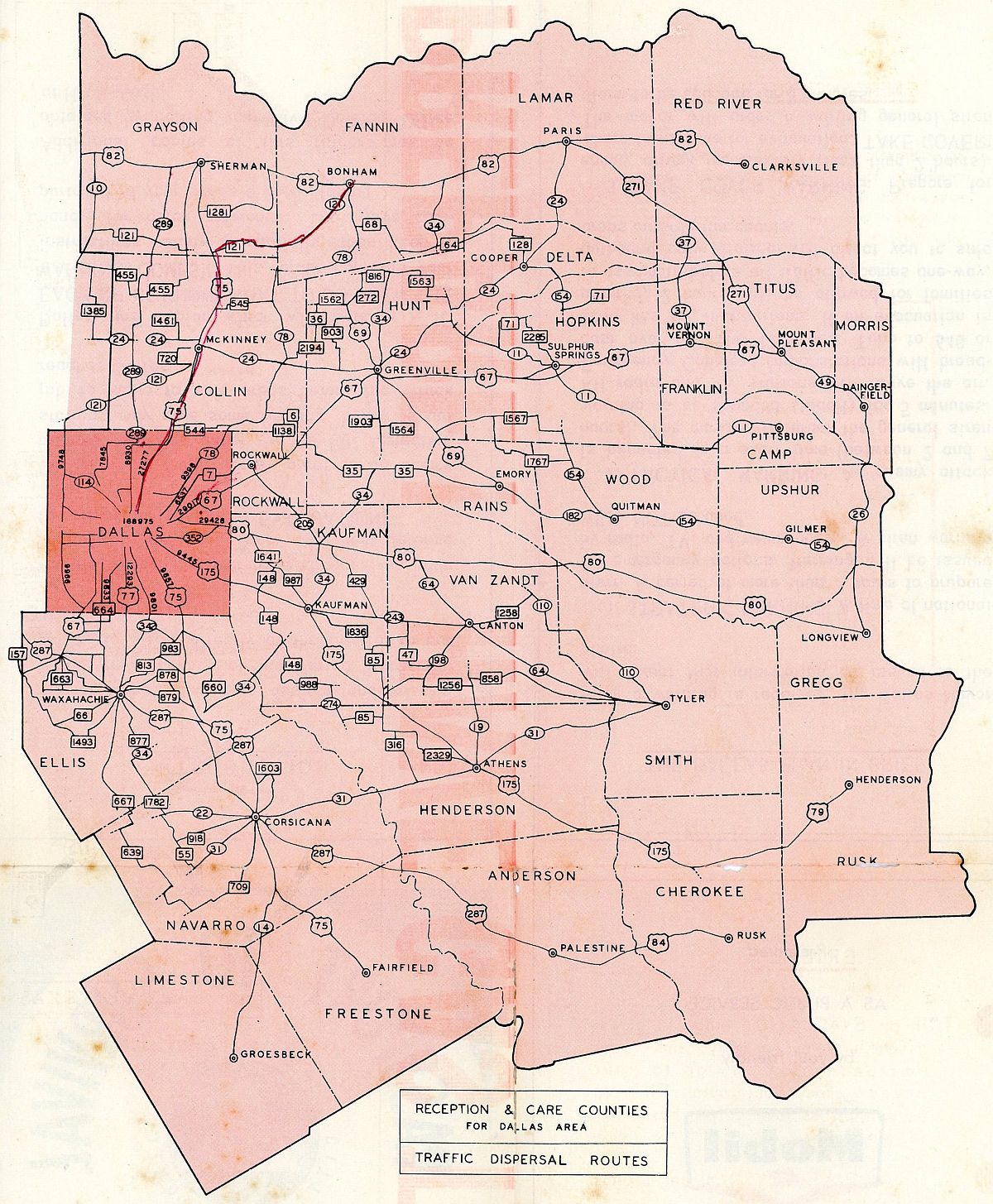
“Reception & Care Counties For Dallas Area Traffic Dispersal Routes” (the person who owned this pamphlet was planning to hightail it to Bonham):

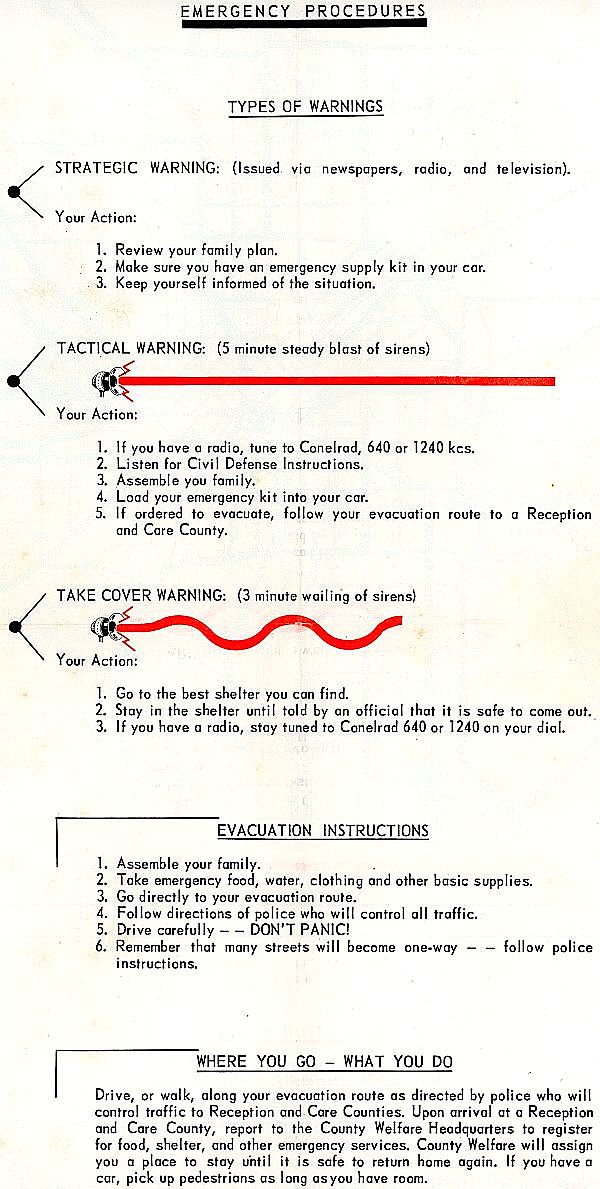
“Emergency Procedures”:
“Emergency Supply Kit” (do NOT forget the can opener!) / “Taking Cover”:

***
Sources & Notes
Thanks again to Jeff Hanning for sending me scans of his Passport to Survival, Dallas County pamphlet.
The photo of Neiman-Marcus is from the DeGolyer Library at SMU. The above image is a really bad photo I took as a reference photo for a project I was working on at SMU last year. The actual photograph in the DeGolyer collection is, of course, much better! Apologies to the DeGolyer Library! I would link to the photo in SMU’s online database, but a scan of that particular photo is not available.
As mentioned above, if you’re interested in Civil Defense in Dallas, the CivilDefenseMuseum.com site is where you need to be. There’s TONS of stuff there. In addition to the great video walk-though of the old Fair Park shelter, there are also several pages of photos here (click through all the pages by following the links at the bottom of each page).
More on the history of United States Civil Defense, here.
And two stories from the Lakewood Advocate on Dallas’ Civil Defense shelters and preparedness can be found here and here.
A related Flashback Dallas post: “A-Bomb in Akard Street! — 1950,” with an eerie illustration of a smoldering downtown Dallas.
*
Copyright © 2018 Paula Bosse. All Rights Reserved.

I noticed on the map that Midway Road was labeled as Dooley Road? When did the name change and why? I’ve lived in Dallas my entire life and never knew that!
LikeLike
Hmm. I think it may just be a misprint. I see mentions of Midway going back to the 1920s and Dooley going back to the 1930s, but Dooley looks like it might have been the name of Midway as it left the city limits. It definitely wasn’t Dooley south of Forest Lane — looks like the names changed near where LBJ was built. Maybe “Dooley” was on the map because that was the name of the road that got you OUT of Dallas during an evacuation? Kind of strange, though. You can see Midway/Dooley on maps through the years on this incredibly helpful site: http://www.dfwfreeways.com/old-highway-maps (some of the links show very high-resolution scans).
LikeLike
To further confuse matters it was called Midway Church Road on the 1936 and 1942 maps at dfwfreeways.com. The church the road was named after burned down in 1931: goo.gl/QwNoN3
Like you said the 1956, 1960, 1962, 1965 and 1973 maps at dfwfreeways.com show Midway becoming Dooley Road at Forest Lane. However, this 1967 map shows the name change at the Farmers Branch, Dallas border of Valley View: https://i.imgur.com/G7td2S4.jpg
I couldn’t find anything official but based on newspaper articles Dooley Road in Farmers Branch started to be called Midway around 1970. Here Greenhill School is described as being on Dooley in 1969: goo.gl/GHv7gq
And here Greenhill School is described as being on Midway in 1970: goo.gl/wG7eUC
However through to the mid 1970s there are still mentions of the intersection of Dooley Road and Belt Line but after that the Midway name is consistent. All that remains of Dooley is a small section near Addison Airport: https://goo.gl/maps/yNRcU9hfLj42
LikeLiked by 1 person
This is beyond great – thank you Paula!
LikeLiked by 1 person
Thank you!
LikeLike
[…] about Dallas bomb shelters, and this photo became one of my favorite parts of the resulting post, “‘Dallas Is a Major Target Area!’ — Know Where Your Nearest Fallout Shelter Is.&… (Source: DeGolyer Library, SMU — the original photo is of much higher quality than my […]
LikeLike
[…] “‘DALLAS IS A MAJOR TARGET AREA!’ — KNOW WHERE YOUR NEAREST FALLOUT SHELTER … […]
LikeLike
I have two comments for this post. To begin with, Dooley Rd. was MIdway Rd. north of Forest Ln. when we moved to the Disney Streets (officially MIdway Hills) in 1955. We regularly took Sunday drives north on Midway and at the time the old Dooley farmhouse still stood on the west side of the road between Forest and Belt Line. I believe is was Dooley all the way into Addison. There were still members of the Dooley family living in Addison in the 70’s.
The really startling thing about this post is that I think the pamphlet may have been printed by Johnston Printing Co., which was run by my grandfather at the time. My father and uncle also worked there and I know they did a lot of printing for Magnolia/Mobil. I turned 10 in April of 1959 and as part of my birthday “celebration” we hopped in the station wagon and drove our preferred nuclear evacuation route (looks like Rt.2). We drove up to Celina, stopped for ice cream and came back down through Denton. In those days that was an all day trip
LikeLiked by 1 person
Thanks, Victoria! Nice to know ice cream was part of the evacuation-field-trip route!
LikeLike
[…] There were bomb shelters all over the Dallas area. There was a (surprisingly) large shelter on the grounds of Fair Park. Watch a video tour here. And read the Flashback Dallas post “‘Dallas Is a Major Target Area!’ Know Where Your Nearest Fallout Shelter Is.̶… […]
LikeLike
I remember the bomb shelter at Fair Park. I think they even let us tour it when I was very little (around 1968). There is a house at the corner of Turtle Creek and Lakeside Dr (4125 Lakeside Dr) directly behind PCPC that has a rather extensive bomb shelter (for a residential house). Interestingly, that house was designed by my great uncle (Thomas D. Broad). There was an estate sale there about 10 years ago and we were able to go check it out. Even found blueprints for the house in a drawer but alas, they would not let us have them or sell them to us.
LikeLiked by 1 person
[…] MENTION: Two old posts had more hits than any of the posts above, one of which is a bit sobering: “‘DALLAS IS A MAJOR TARGET AREA! — KNOW WHERE YOUR NEAREST FALLOUT SHELTER IS.R… Interest in this post on the threat of nuclear war exploded (as it were) in February, when Russia […]
LikeLike