
Reverchon Park Flyover
 Reverchon Park — photo by Squire Haskins (click for VERY large image)
by Paula Bosse
Another of photographer Squire Haskins’ fantastic aerial shots, this one taken over Reverchon Park, looking northeasterly: the Katy tracks are running up and down on the right side, what is present-day Harry Hines is at the bottom, squiggly Turtle Creek Blvd. runs up the middle from the park, Fairmount and Maple run across the photo near the top, and Hood St. runs along the very far left edge. What looks like a date of “6-13-56” is on the back of the photo.
A present-day map of the area, looking north (to zoom out or in, click here):
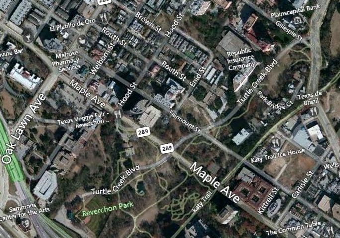 *
*
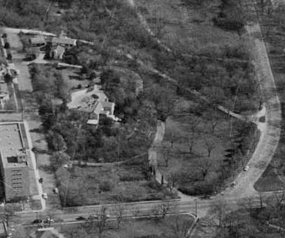
A couple of questions. What are the two large buildings in the crops below?
The first one is the large white building on property bounded by Fairmount, Enid, Turtle Creek and a street that no longer seems to exist (an extension of Brown?):
 *
*
The second is on Maple, near Hood — across from the amphitheater in the park, where the Heritage Auctions building is now:
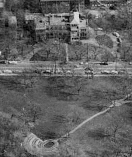
The top one appears to be a (large!) home (I’d love to know who owned it), but I’m not sure what the one at the bottom is. Anyone know? (UPDATE: Thanks to my mother for informing me that the building immediately above is the Bradford Memorial Hospital for Babies.)
***
Sources & Notes
Photo by Squire Haskins, via the Portal to Texas History, here. (Back of photo is here.)
Map from Bing.
*
Copyright © 2015 Paula Bosse. All Rights Reserved.
