 Art Deco Love Field!
by Paula Bosse
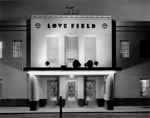
I’m a huge-fan of the modern 1950s-era Love Field (the one with the Mockingbird Lane entrance), but even that can’t trump this fantastic building! Designed by architect Thomas D. Broad, the new Love Field administration building and terminal — which faced Lemmon Avenue — was unveiled on October 6, 1940, to rapturous acclaim. The night view above is pretty breathtaking. Forget the airfield. For me, it’s all about this entrance. Those windows. And those doors. And that font! And those little airplane pictographs!
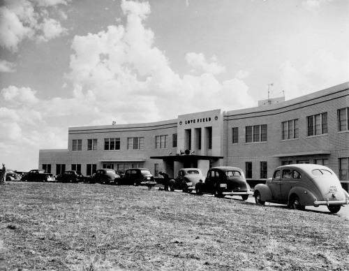 It wasn’t bad in the daytime, either — just nowhere near as dramatic. And in dire need of landscaping.
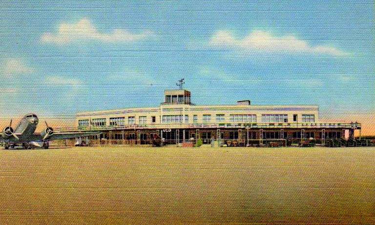
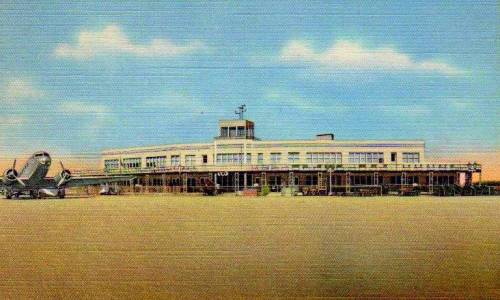 And here it is from the field side. Still swoon-worthy. The back of this postcard reads:
LOVE FIELD — NEW $225,000 ADMINISTRATION BUILDING
One of America’s finest air terminals which takes care of more airline passengers, more air mail and more air express in ratio to population than any other airport in the country.
**
What happened to this beautiful building? I searched through the Dallas Morning News archives until I felt I had to throw in the towel, never finding a definitive answer. But here’s what I did find. When the brand-spanking-new terminal (the one we know today) opened in 1958, the 1940 terminal was vacated. A better word might be “abandoned.” Most assumed the building would be razed very soon after. But I got as far as September of 1964, and the old terminal was still standing. And it wasn’t pretty. This excerpt from a Dallas Morning News article is painful to read:
…The old terminal building cowers in desolation…. Virtually every window has been smashed, carpeting the deserted terminal with a dangerous floor of broken glass. Loose wires stick out here and there, and blinds hang in twisted postures from broken cords. The building’s big sign DALLLAS is missing its D. (DMN, July 2, 1961)
(And even more thoroughly painful is the article in the Dallas News archives by Kent Biffle, “Ghosts Wait by Runway” — DMN, Feb. 2, 1961.)
Apparently, the old building had to remain standing until a “much-debated” new multi-million-dollar runway was agreed upon.
The point at which I threw in the towel in my quest to discover when the old terminal building had been demolished was a DMN photo from September 25, 1964, with the caption “$4,000,000-Plus Runway Progress. The 8,800-foot parallel runway at Dallas Love Field, left center, is two-thirds completed and should be ready for use next spring.” I am assured the photo has a hard-to-see old terminal still decaying in it. I assume they razed that sucker pretty soon afterward. …Possibly.
***
Sources & Notes
Top two photos are from the Love Field Collection, Dallas History and Archives, Dallas Public Library; accession numbers are PA83-13-8 for the swoony one at the top, and PA83-13-4 for the daylight exterior photo. I originally found these in the post “The New Love Field” by Jacob Haynes, here.
Click pictures for larger images — the first two are HUGE!
*
Copyright © 2014 Paula Bosse. All Rights Reserved.

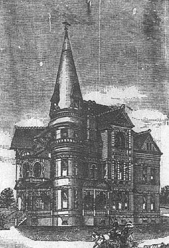
 1912
1912 1908
1908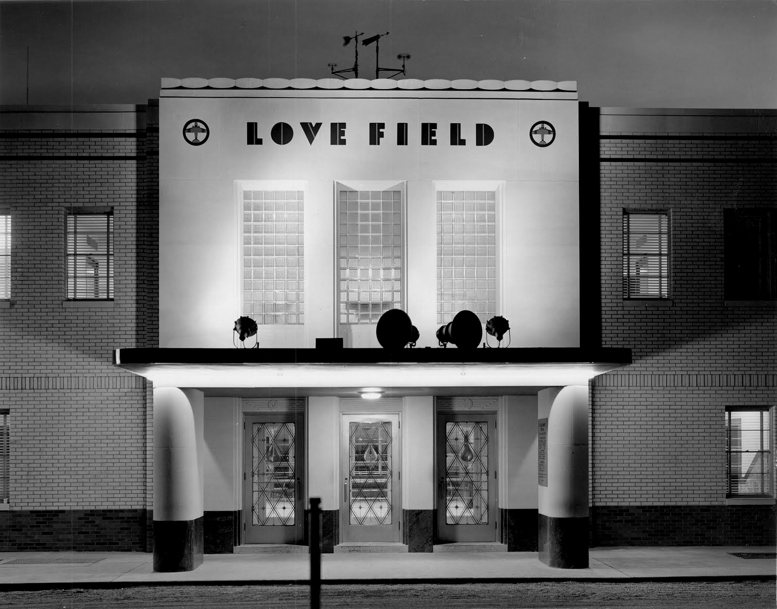


 DMN, Jan. 1, 1909
 DMN, Aug. 11, 1914