
Fisher’s Addition, West Dallas
by Paula Bosse
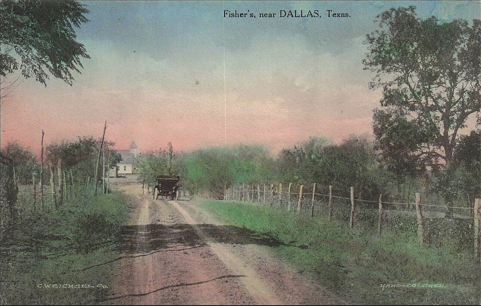 Fisher’s, Near Dallas, Texas
by Paula Bosse
I’ve never seen this postcard before, and I’d never heard of Fisher’s (“near Dallas”).
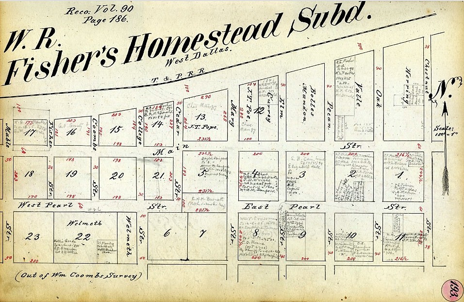
W. R. Fisher’s Addition was in West Dallas, possibly bordered by what is now N. Edgefield, Fort Worth Avenue, Sylvan, and West Commerce (just below the old T & P railroad tracks). …I think. Lots of real estate transactions were going on in “Fisher’s” in the 1880s and ’90s, when West Dallas was its own community and before the area became part of Dallas.
*
This is a very pretty postcard. I just picked a random intersection on Google to see what the general area looks like now. It’s mostly built-up, of course, but here’s a very attractive view, at Seale and Obenchain here (Jan. 2024).
As far as what looks like a church in the distance — it might be the West Dallas Christian Church (later the Western Heights Church of Christ), which was affiliated with West Dallas Cemetery (later Western Heights Cemetery), where William R. Fisher is buried, along with many members of the family of his first wife, Mary Coombes/Coombs, a familiar name in the settlement of the area.
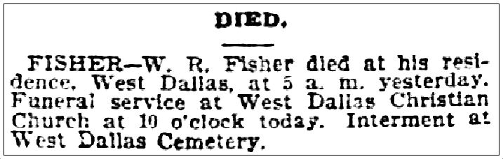 Dallas Morning News, Oct. 19, 1900
*
UPDATE: Thanks to reader Linda Donnelly for sending a link that shows this same view these days — with the same church in it! See the Google Street View here. Here’s the church up close (see it on Google Street View here). (1900 block of N. Winnetka, just off Stafford.)
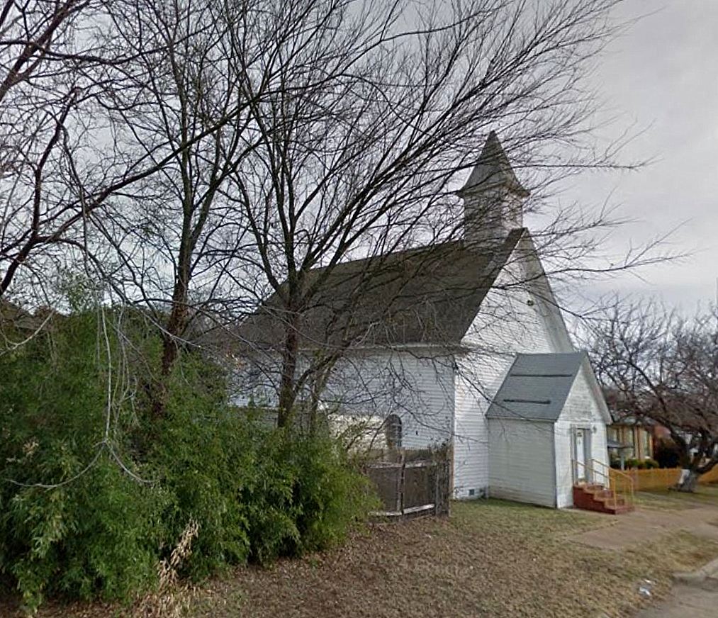
The former West Dallas Christian Church was built around 1890 and has a historical marker, which was placed at the site in 1972, when it was the Western Heights Church of Christ.
***
Sources & Notes
Early-20th-century postcard by Weichsel found on eBay.
Image showing William R. Fisher’s Homestead Subd. (out of the Wm. Coombs’ Survey) is from the Murphy and Bolanz block book scanned by the Dallas Public Library and available online, here.
Read about W. R. Fisher in the History of Dallas County, here.
This post appeared in an earlier version on the Flashback Dallas Patreon page.
![]()
*
Copyright © 2025 Paula Bosse. All Rights Reserved.

I went on a bunny rabbit trail, Paula, when I saw the cool white structure peeping through the trees (in the link to the pretty Seale tree-lined road). Turns out it’s the Belmont Hotel. It reminded me of the famous hotel in Los Angeles where the golden age stars went to party because photographers were not allowed. The hotel is currently shuttered although Google maps has a few cars parked there. The history nerd in me would love to know the backstory on the Belmont Hotel.
LikeLiked by 1 person
Glad you like to do historical research, it is difficult for me to do since I have became old & disabled. I was so disappointed when I saw the google photo of that road covered with toxic asphalt. It is a shame that Dallas became a target for land grabbing realtors & land developers, they ruin everything with their greed, corruption & evil.
LikeLike
https://maps.app.goo.gl/shsxhwP76JC698Yu8
I think this is the same view! The church is the same (as you get closer you can see the placement of the windows is unchanged) and the road even jogs around a little like it does in the postcard. 🥰
LikeLiked by 1 person
This is fantastic! Thank you!! I will add more info when I get back to my computer, but I’d like to give you credit if you leave your name. The historical marker says the church was built on land given by Fisher around 1888. It’s at N. Winnetka and Stafford. Thank you again!
LikeLike
Hi Paula! I’m Linda Donnelly, and I volunteer as a Master Naturalist at Western Heights Cemetery with Van Johnson and Patti and Steve Erickson, who have done TONS of research on the cemetery occupants, including the Fishers. I drug them over to this intersection this morning and we oohed and aahed. The photographer’s back was to a dead end and the fence line on the right of the photo still exists, with a lovely (though modern) home. I wonder if the automobile in the postcard belonged to the prior property owner? It’s so much fun to imagine! Thank you for your wonderful work!
LikeLiked by 1 person
Hi Linda! Thanks! I’m glad you popped over. The historical marker is around the corner.
LikeLike
I was so excited to find this on Google Street view! It looks as though Van’s friend James Barnes came to the same conclusion 😊
LikeLiked by 1 person
Mr Fisher is buried along with Clyde Barrow @ Western Heights. I’ll have to check out his grave next time I go over there.
LikeLiked by 1 person
I wonder if the “Elm” street running N-S in the plat, is today’s “Elmo” street? None of the other street names even come close to matching.
LikeLike
[…] “FISHER’S ADDITION, WEST DALLAS” […]
LikeLike
[…] 4. “FISHER’S ADDITION, WEST DALLAS” (August) […]
LikeLike