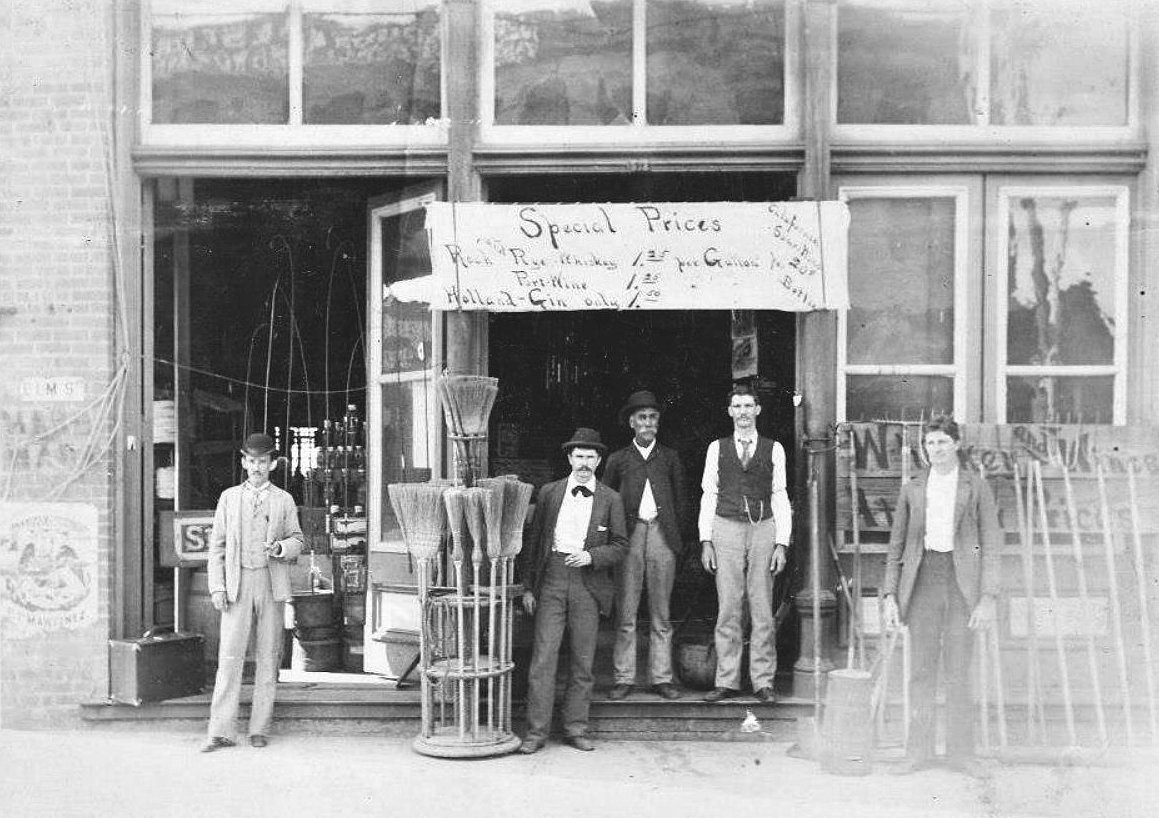
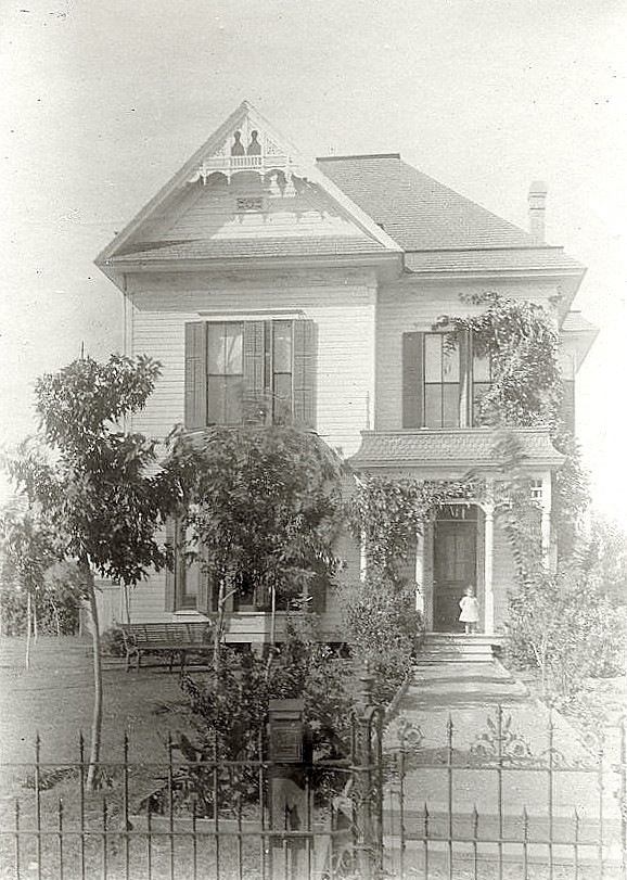
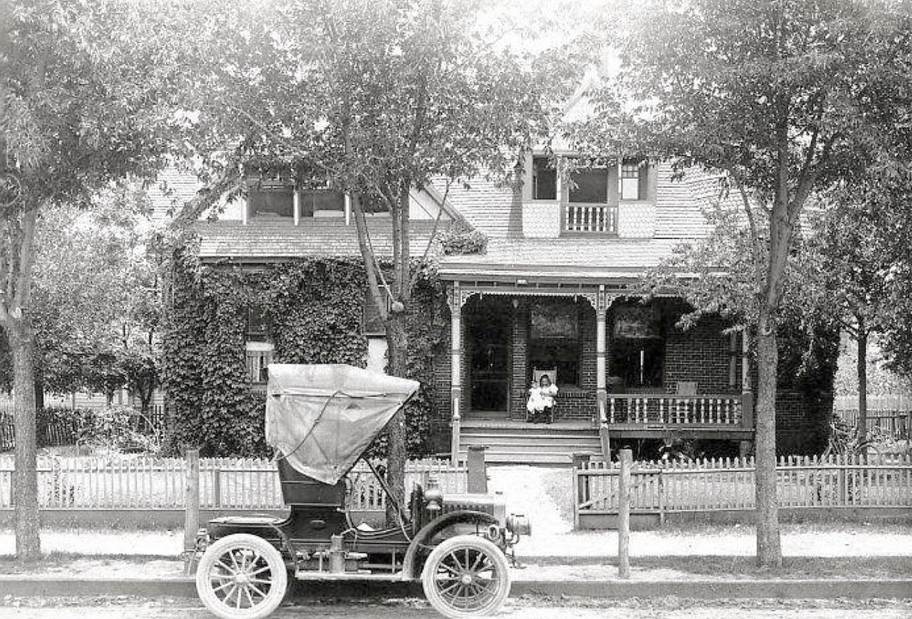
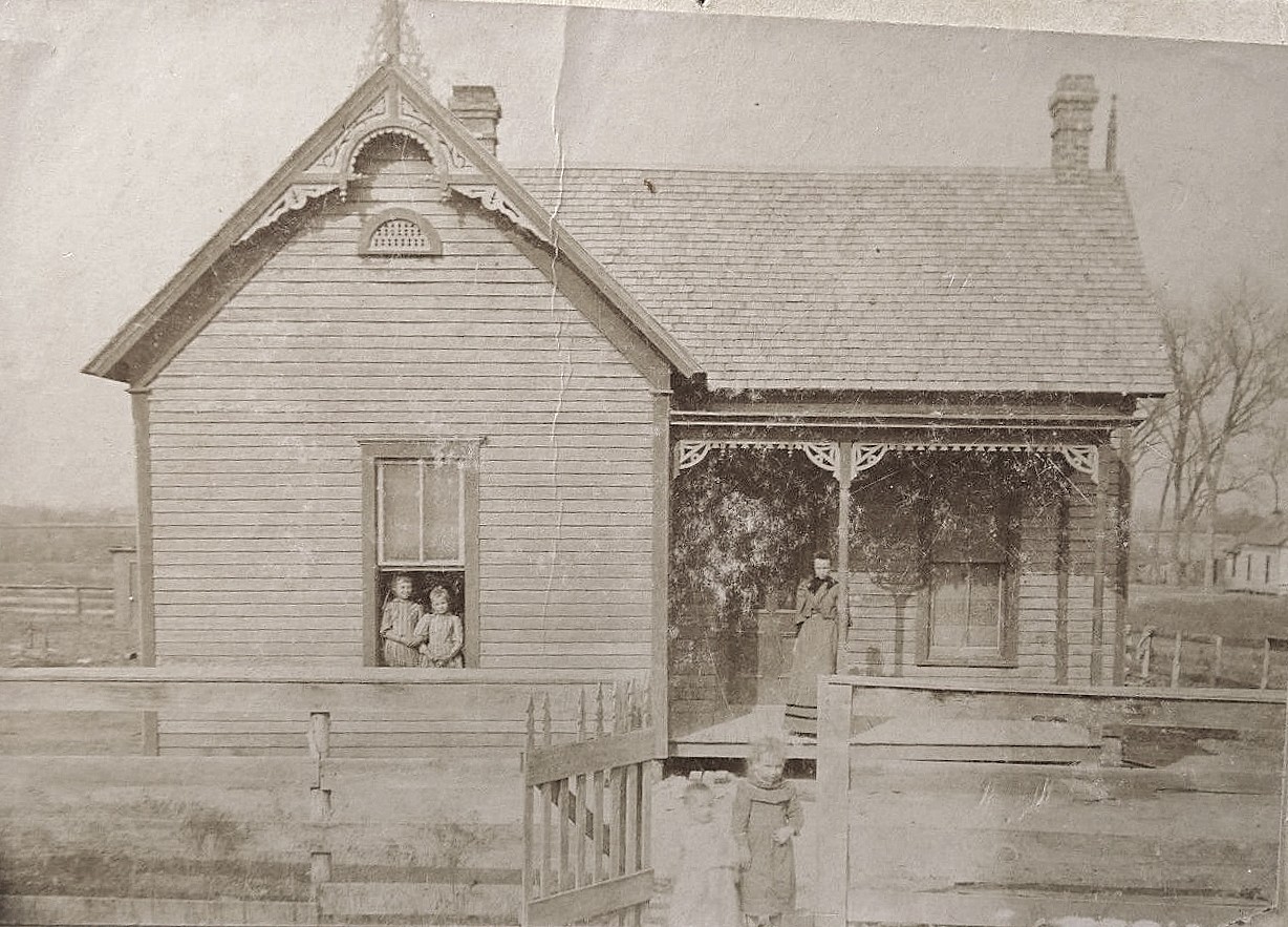
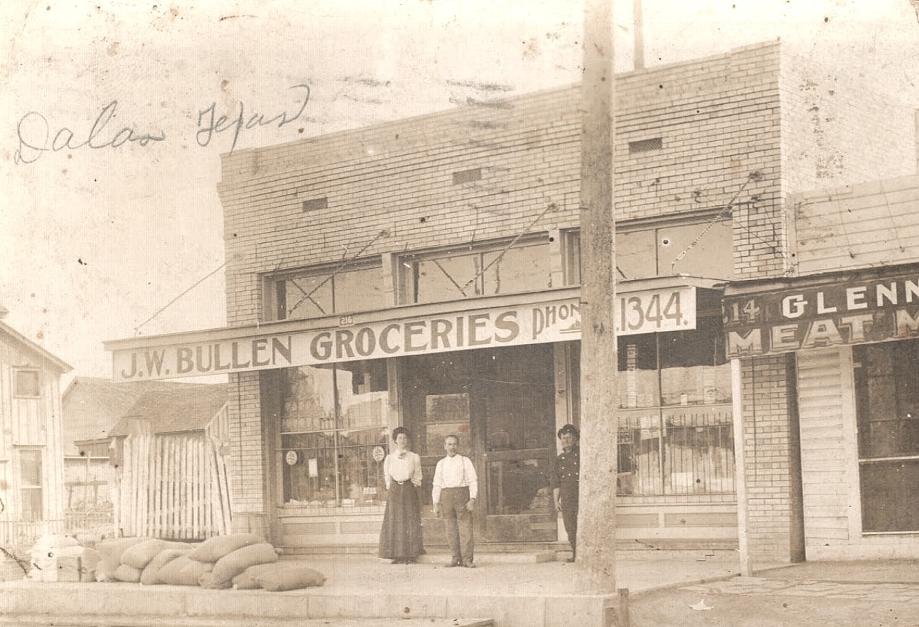
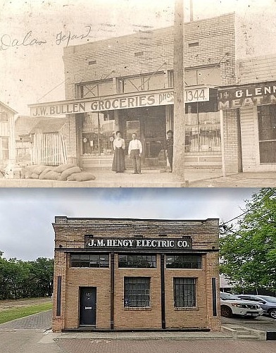
 Exposition Ave., ca. 1905 (photo: Bullen family, used with permission)
by Paula Bosse
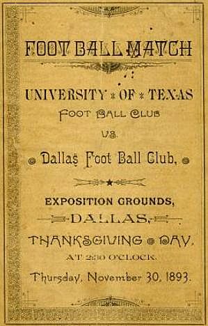
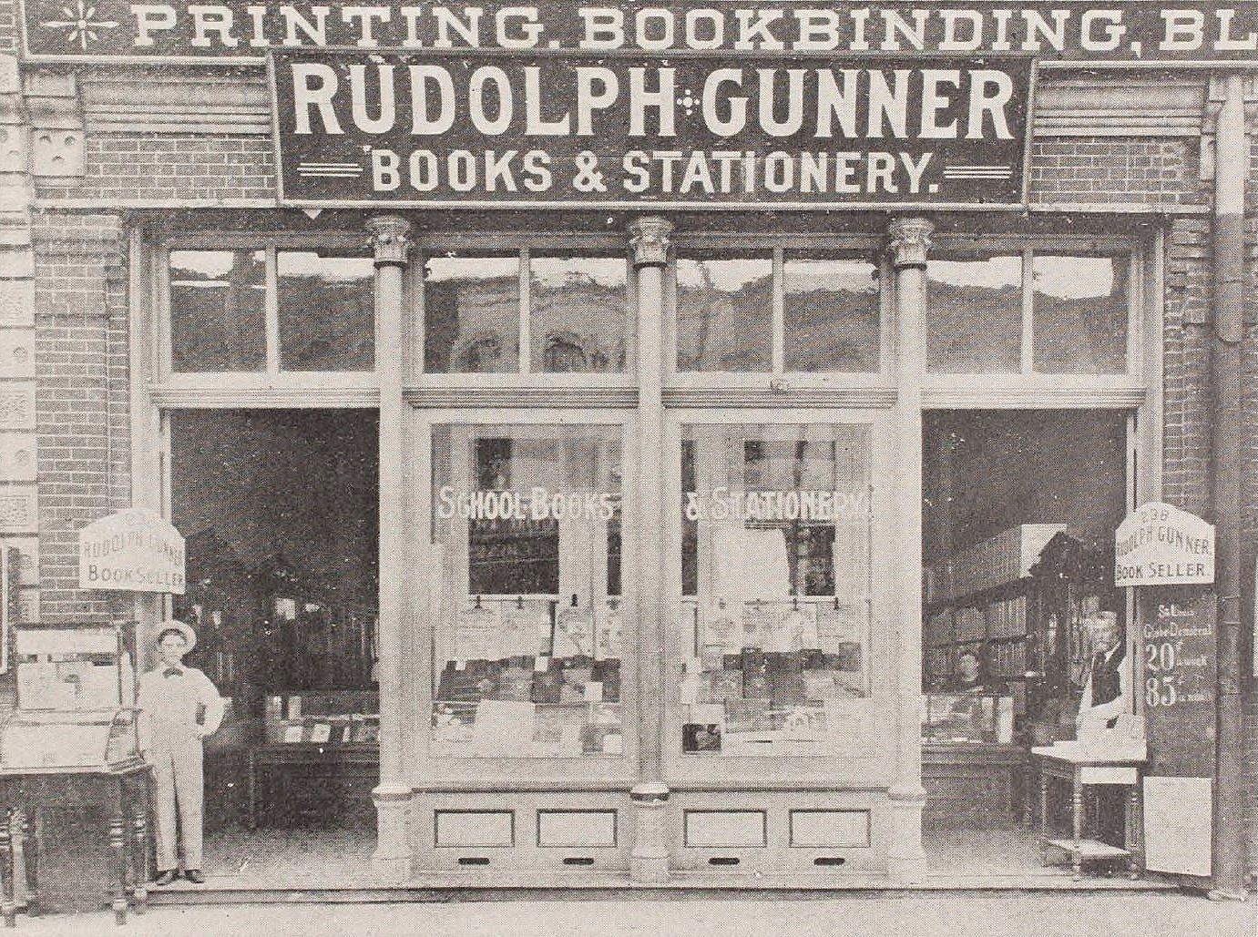
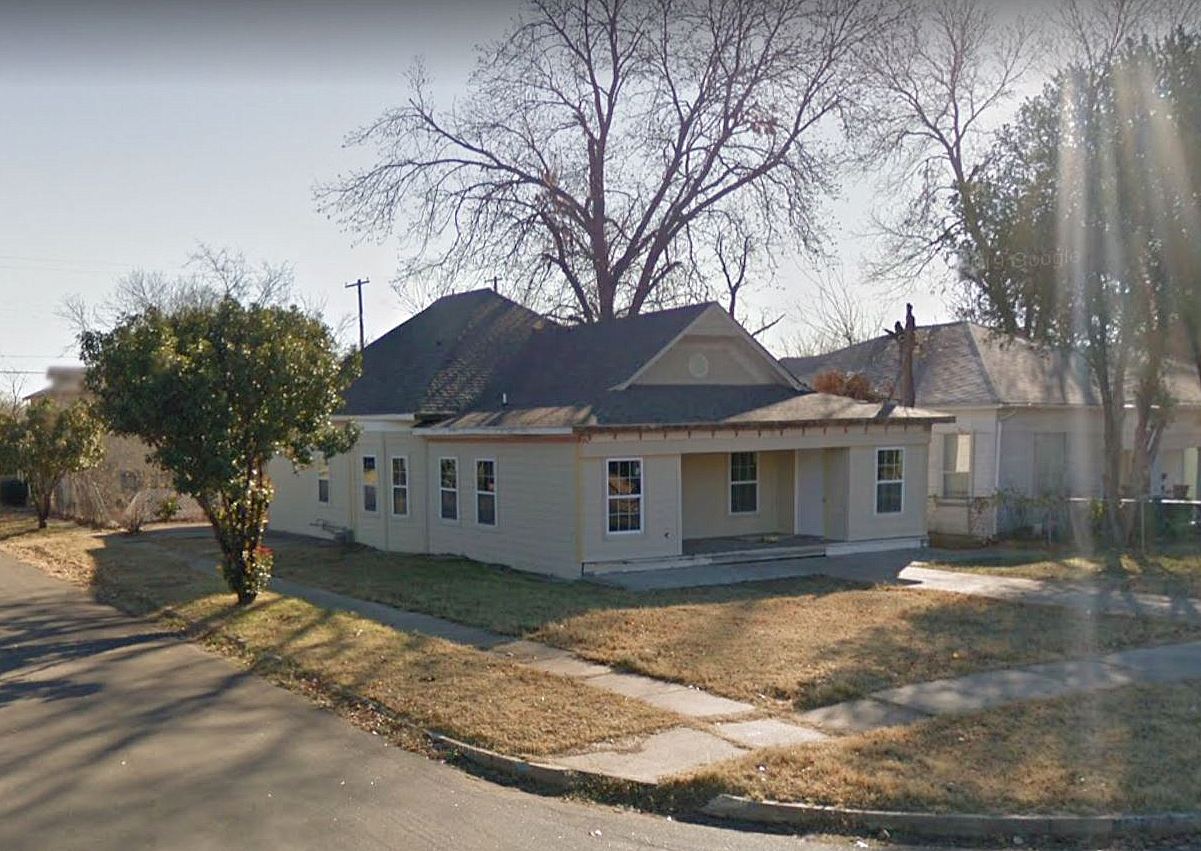
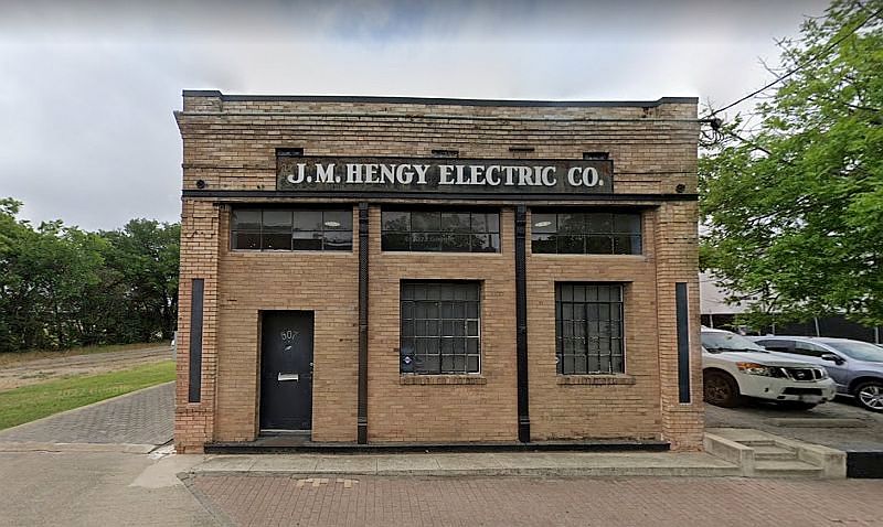
If you’re reading this, you probably have a fascination with old buildings. When was it built? What had it been? How has it not been torn down? One such building — which, though interesting, doesn’t really strike one as particularly old — is the small building at 507 Exposition Avenue, a few blocks from Fair Park. Actually, the thing that jumped out at me was the sign on the building reading “J. M. Hengy Electric Co.” — back in 2015 I wrote a long post about the exceedingly litigious Hengy family (“F. J. Hengy: Junk Merchant, Litigant”) (J. M. was the grandson of F. J.). The Hengy Electric Co. was in business at that location from at least the 1930s until at least the 1960s. I’m not sure why the current owners kept this sign, but I’m glad they did, because it’s why I noticed it.
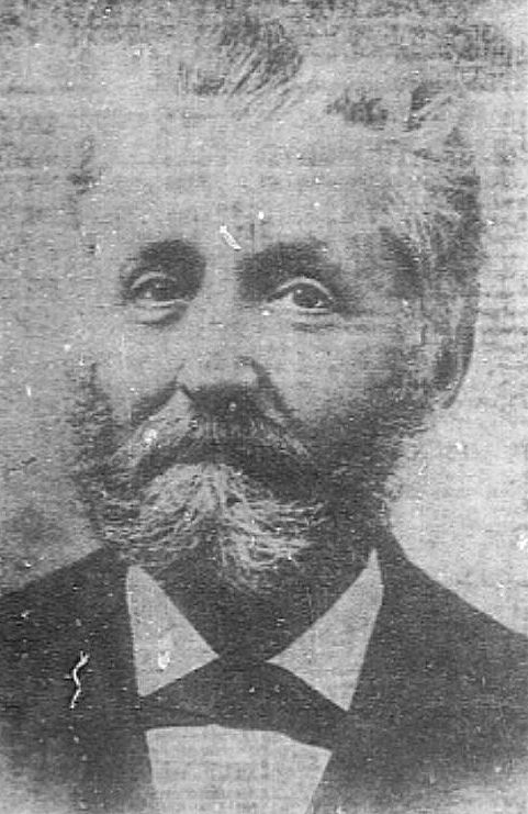
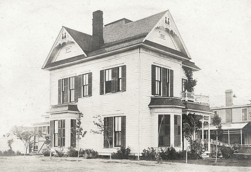
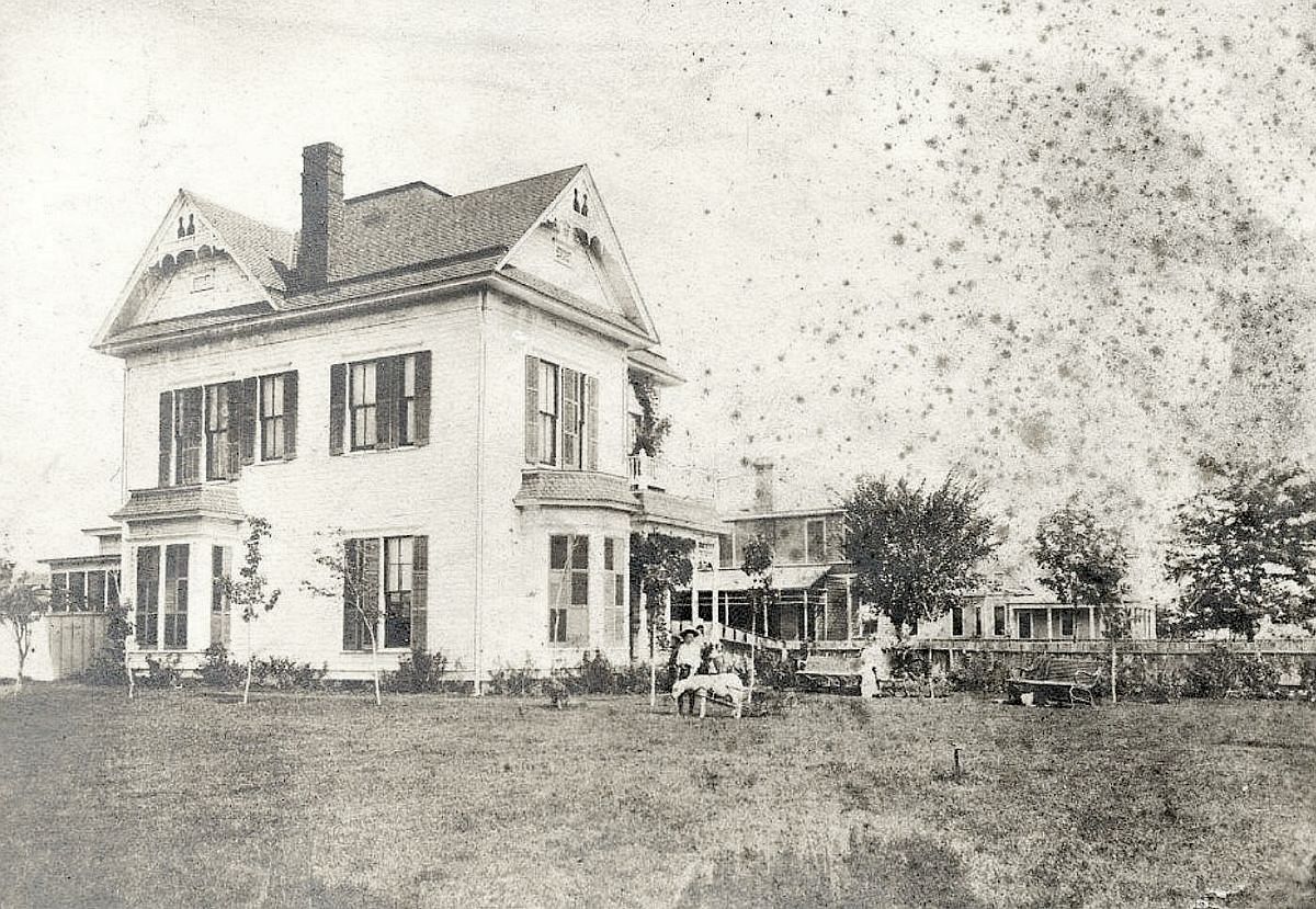
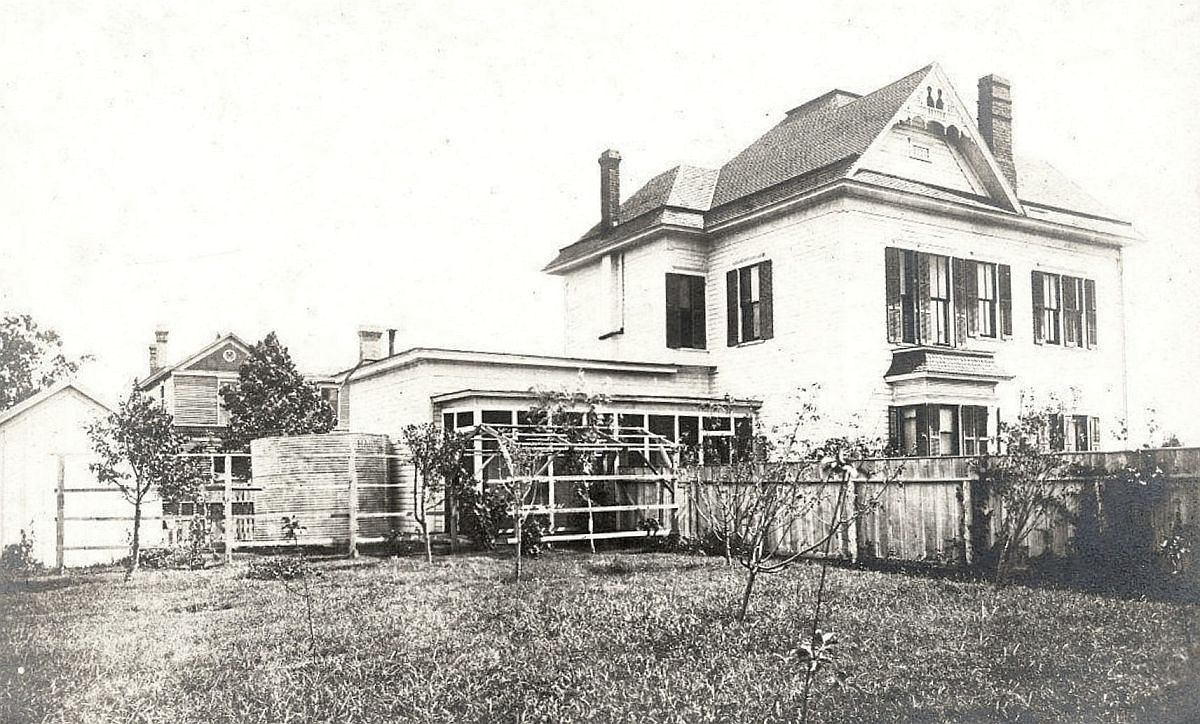
This building was most likely built in the 1890s, and it was home to a grocery store owned by J. W. Bullen (John Wesley Bullen Sr.), a Tennesse native who came to Texas in the late 1870s and, after a few years of farming in the area, settled in Dallas. He worked for the Santa Fe railroad for a while before opening this grocery on Exposition Avenue in the 1890s — easy to give directions to because the Gulf, Colorado and Santa Fe (GC&SF) Railway tracks ran right alongside the store. Bullen’s grocery was a neighborhood mainstay for at least 40 years. He retired in 1936, and he and his wife, Mary, eventually moved to California to live with their daughter. J. W. Bullen died in California in 1948, at the age of 89 — his life spanned the Civil War to the advent of television.
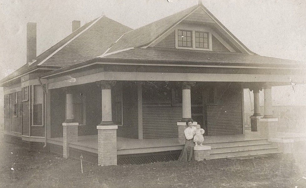
Below, J. W. Bullen is shown with his brothers, Thomas, James, and Joseph — he is at the bottom right.
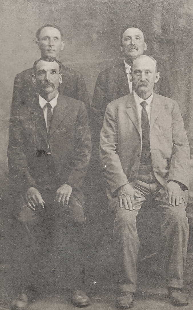 via Ancestry.com
I came across the photo at the top of this post on the Dallas Historical Society discussion forum (“The Phorum”) back in 2017 (it’s taken 5½ years for me to finally write this!) — the thread is here. A Bullen relative posted this photo, and I was ecstatic to see it! It’s such a great image — I have never seen a photo of Exposition Park from this period. (I asked Mr. Bullen — the man who posted this photo — if I could reproduce it, and he very nicely gave me permission.)
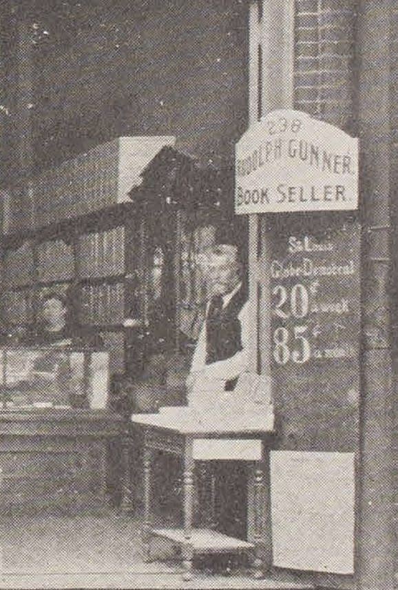
I would guess that the photo dates from sometime around 1904-1906, when the Glenn Brothers meat market occupied the space next door (originally 214 Exposition and later 505 Exposition).
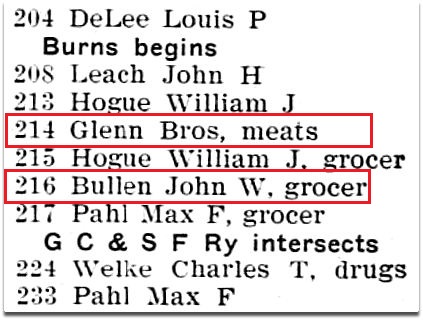 1905 Dallas city directory
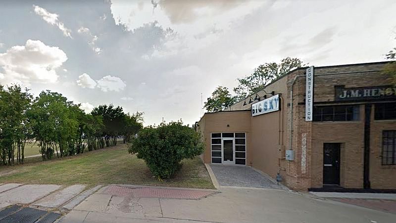
The Hengy business originally occupied the Glenn Bros. space for several years, from at least 1930. After Bullen’s retirement, Hengy moved into the larger space at 507 Exposition. Today it is occupied by Big Sky Construction.
Google Street View, May 2022
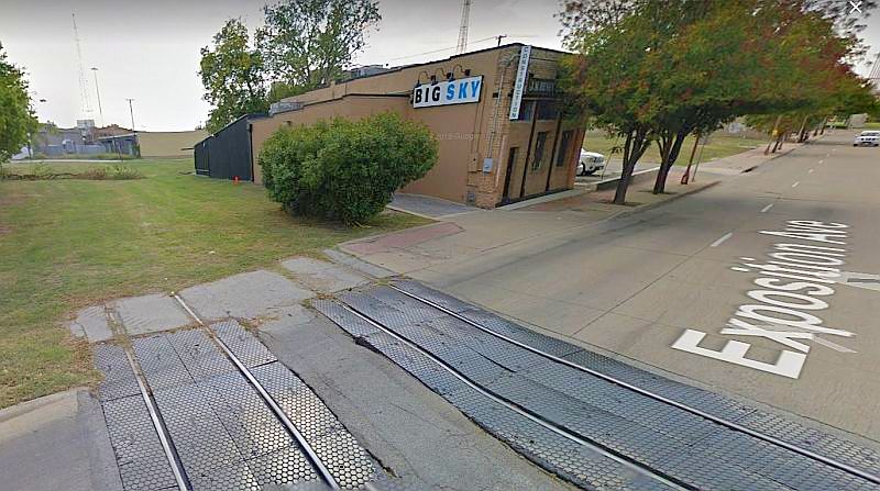
The railroad tracks have been pulled up, but below are two Google Street Views from 2012 showing where they once were — they couldn’t have been much closer to Bullen’s store! That’s got to have rattled the merchandise (and the store’s occupants) several times a day.
 Google Street View, Sept. 2012
 Google Street View, Sept. 2012
*
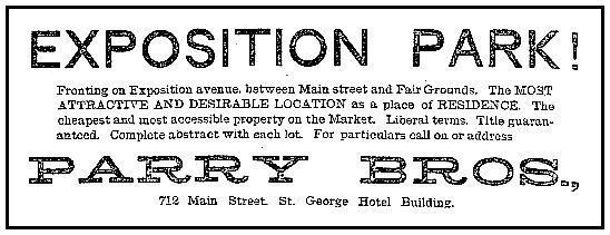
The address of Bullen’s store was originally 216 Exposition Avenue. After the citywide address change in 1911, it became 507 Exposition Avenue. The store was in business by at least 1896, but a newspaper article on the 62nd wedding anniversary of Mr. and Mrs. Bullen says that the business began in 1893. At this time, development of Exposition Park was exploding (see the 1889 ad I posted yesterday, here).
 1889
1889
If you look at Sanborn maps of this area (the 1899 map is here, the 1905 map is here, and the 1921 map is here) you see that almost all of the buildings in the area are houses (designated by the letter “D,” for “dwelling”). Having only ever known the area in recent times, it’s hard to imagine this ever having been an almost entirely residential neighborhood. And, back in the 1890s, it was also full of livestock.
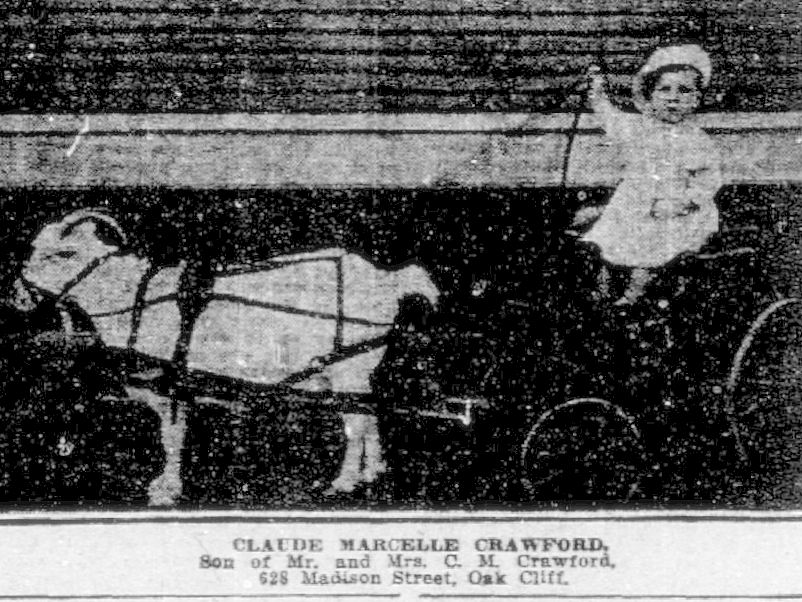
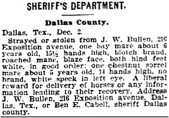 Dallas Morning News, Dec. 3, 1897
*
Here’s a map of Dallas from 1898, with Bullen’s store way on the edge of the world, under the star.
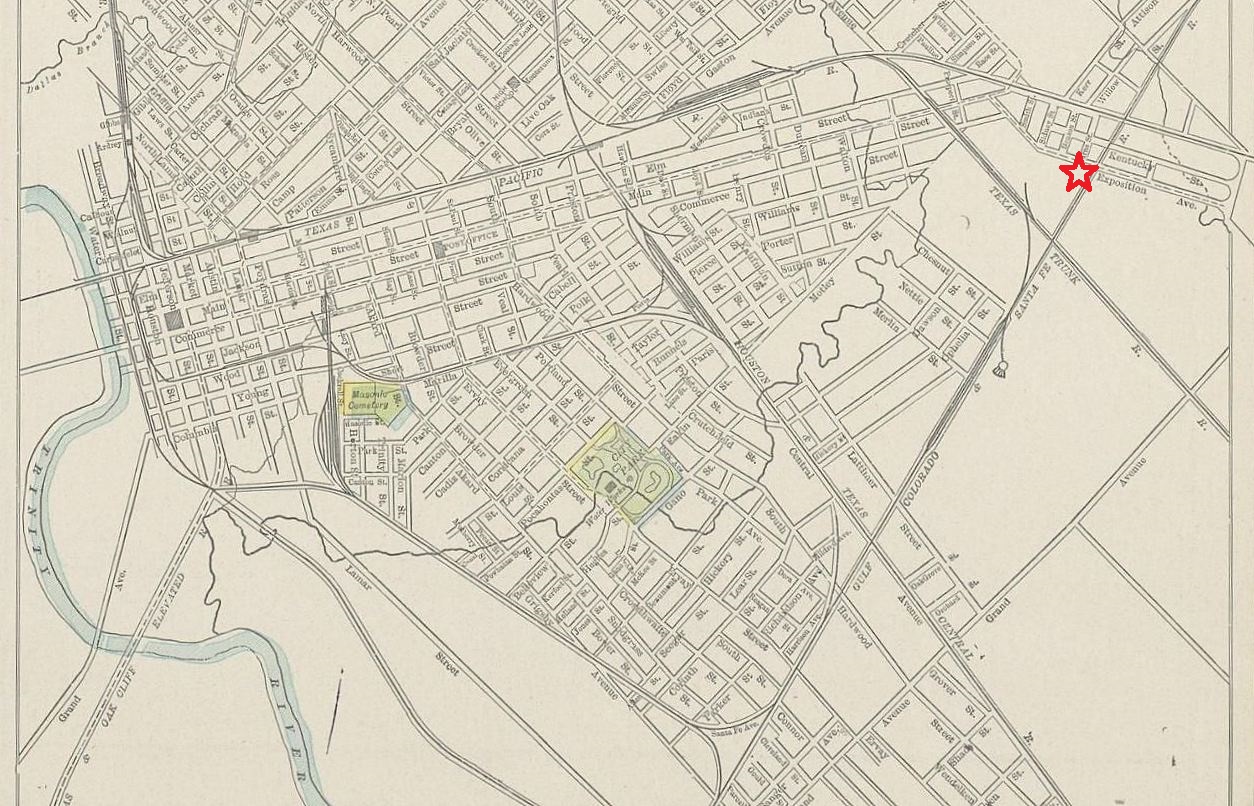 via Portal to Texas History
*
***
Sources & Notes
Photo is from the family collection of Joseph Bullen II, used with permission.
I would LOVE to see historical photos of the Expo Park area — from any time, really, but especially from the time it was primarily residential. If you have any photographs, please let me know!
See this building today on Google Street View, here.
Biographical information on J.W. Bullen from “J. W. Bullens Observe Their Anniversary” (Dallas Morning News, Nov. 22, 1942).
More Flashback Dallas posts on Exposition Park can be found here.

*
Copyright © 2023 Paula Bosse. All Rights Reserved.

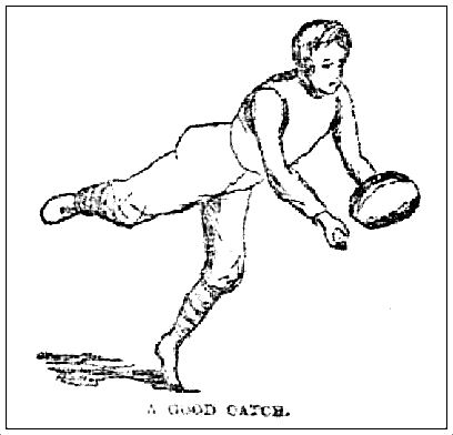
 Kinder, gentler times…
 Dallas Morning News, Sept. 7, 1891