Flashback : Dallas

A Miscellany: History, Ads, Pop Culture

Category: Lower Greenville/M Streets

Bel-Vick’s Anchor: The Angelus Arcade and The Arcadia Theatre — 1920s

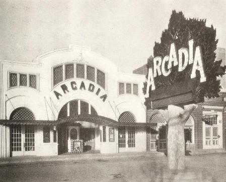
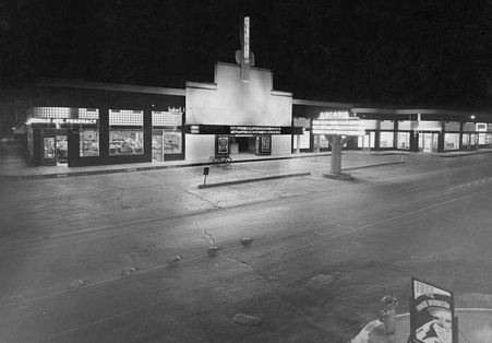
arcadia-theater_exhibitors-herald-world_060730The 2000 block of Greenville Avenue, 1930… (click for larger image)

by Paula Bosse

I’ve written about the Arcadia Theatre before (here and here), but until I discovered the above photo from 1930, I’d never really thought about what had been on that site previously (the northwest corner of Greenville Avenue and Sears Street, now the home of a Trader Joe’s). There’s a lot going on in that photo, not the least of which is the fabulous Arcadia “tree” sign/marquee, made of sculpted concrete.

Greenville Avenue in the 1920s had a small business district with buildings clustered between Ross Avenue and Belmont, an area which many now call “Lowest Greenville” (the stretch of Greenville a little farther north which is now generally refered to as “Lower Greenville” was being developed but was not really an area of note yet — and “Upper Greenville” — which I don’t really hear people say anymore — was a rural highway which passed through small communities and was mostly surrounded by a lot of open farmland).

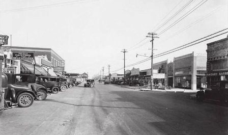
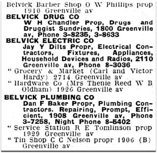
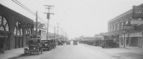
A look at city directories of the early 1920s suggests that business owners were trying to establish “Belmont” as the name of the area between Ross and Belmont, and many used the word in their business name (“The Belmont Pharmacy,” for instance). But things began to change in 1922 as development picked up, and “Belmont” suddenly became “Belmont-Vickery” (in a nod to the Vickery Place neighborhood), and then that very quickly became “Bel-Vick” or “Belvick” (a couple of rebel business owners went with “Belvic” but that didn’t seem to catch on). In the 1927 directory there were eight Belvick businesses, almost all of which were in the 1800 and 1900 blocks of Greenville, the blocks seen in the photo below (you can see the Arcadia “tree” in the distance on the left).

greenville-avenue_1930
Greenville Avenue, 1930 (Dallas Public Library)

belvick_1927-directory
1927 Dallas directory

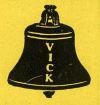
At least one business came up with a cutesy “Belvick” logo:

belvick-plumbing-logo_1908-greenville_1928-directory_ad-det
Belvick Plumbing logo, 1928

(One of these businesses, Belvick Electric Co., ended up on Garland Road, owned by the family of “King of the Hill” writer and producer Jim Dauterive, a name which should be familiar to all “King of the Hill” fans; I wrote about that tidbit of hyper-trivia at the end of this post.)

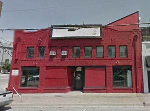
There was even a small theater at 1804½ Greenville Ave. for a year or two, pre-dating the Arcadia by five years. The Belmont Theatre opened in Sept. 1922, but when it changed ownership a few months later it became, you guessed it, the Belvick Theatre. I hope patrons didn’t get too attached, because it was out of  business by the time the 1924 directory was published. Here’s what that building looked like in 2012 (sadly, it no longer looks anything like this) — the theater was, I believe, in the right half of the building.

belvick-theater_google_2012
Google Street View, 2012

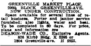
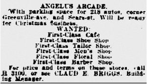
In 1923, a Greenville Avenue developer, Albert J. Klein, built a large building called the Angelus Arcade in the 2000 block of Greenville, at Sears Street. Here are a couple of woefully fuzzy classified ads for the under-construction “Greenville Market Place” and a list of the types of “first-class” businesses wanted to occupy the new arcade (click for larger-but-still-hard-to-read images).

angelus-arcade_070423
July, 1923

angelus-arcade_112823Nov., 1923

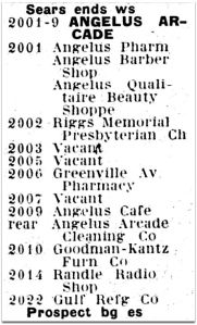
The arcade had several tenants and served as something of a public meeting place for the neighborhood — politicians frequently appeared in front of the large building to give speeches or talk to crowds in impromptu town-hall-like meetings. Like the use of “Belvick,” the name “Angelus” showed up in many of the less-than-imaginitively-named (first-class) businesses:

angelus-arcade_greenville-ave_1927-directory1927 Dallas directory

In 1927 Klein made a deal with the Dean Theatre company to build a new movie theater on the same premises as the Angelus — there would be additions and modifications made to the building, but it would still be home to several other businesses — there’d just be a movie theater inside. It would continue to be an “arcade.” Even though one newspaper article attempted to tie the name “Arcadia” to the new theater’s Italian garden motif which suggested a pastoral harmony with Nature, it seems more likely that people were already calling the building “the arcade,” and “Arcadia” was the next logical step.

The Arcadia Theatre opened on Nov. 4, 1927 with the Mary Astor movie “The Sunset Derby.” A newspaper report noted that “in spite of its remote location” the crowd-size was healthy. Patrons could even pop next door for a chicken dinner if so inclined.

arcadia-theater_exhibitors-herald-world_060928_front1928

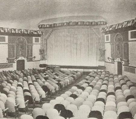
One of the unusual things about the theater was the seating. The backs of the chairs were in a variety of colors (desert sand, cafe au lait, light blue, orchid, green, and “Chinese red”) which were placed in a randomly pattern throughout the auditorium. I think the operators probably thought this design-breakthrough was quirky and cutting edge, but it just looks a little odd. The Dallas Morning News described this feature as being reminiscent of a fun carnival; the Arcadia publicity person wrote that “the effect is as startling as it is pleasing.” …I’ll give you “startling.”

arcadia-theater_exhibitors-herald-world_060928_toward-screen1928

*

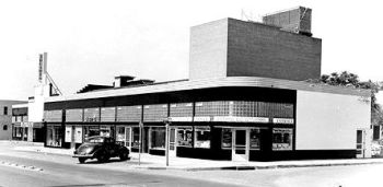
Below are a few more images of the Arcadia Theatre through the years.

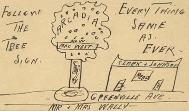
First, just an odd little postcard from 1934 which found its way into SMU’s archive — a drawing of that cool tree!

arcadia-sign_postcard_1934_cook-collection_degolyer-library_SMUvia George W. Cook Collection, DeGolyer Library, SMU

arcadia-marquee_1941_ad-det1941

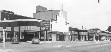
The Deco years, and a painfully pruned tree, in the daytime, and at night:

arcadia-theater_ca-1941_DHS1941, via Dallas Historical Society

arcadia-theater_mcafee_degolyer_SMUvia DeGolyer Library, SMU

arcadia-theater_mid

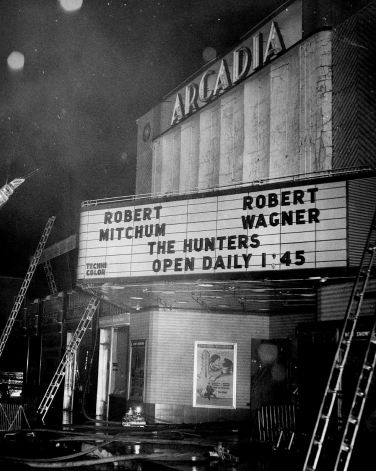
There were a few fires over the years — here’s one from November, 1958.

arcadia_fire_nov-1958_portalDallas Firefighters Museum, via the Portal to Texas History

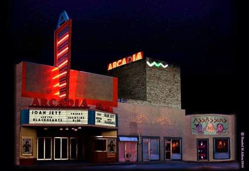
Eventually its days as a second-run suburban theater dwindled, and it became a live-music venue for a while in the 1980s, as seen in this absolutely fabulous photo from 1985 (Joan Jett played the Arcadia on June 13, 1985) taken by Dan Allen, owner of super-cool clothing boutique Assassins.

arcadia-theatre_june-1985_daniel-m-allen-photo_FB©Daniel M. Allen 2014, via Facebook

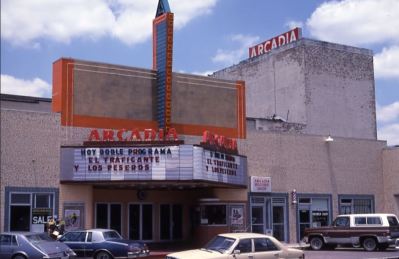
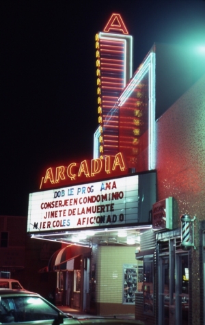
It also showed Spanish-language films for a few years.

arcadia_spanish-language-theater_dayvia American Classic Images

arcadia_spanish-language-theater_nightvia American Classic Images

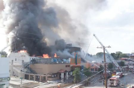
But, ultimately, a fire ended it all, on June 21, 2006: 120 firefighters responded to a six-alarm blaze caused by a fire that originated in a restaurant — all the businesses in the block were destroyed.

arcadia_on-fire_2006via Cinema Treasures

Bel-Vick hasn’t been the same since. RIP, Angelus/Arcadia.

***

Sources & Notes

Top photo from Exhibitors Herald World, June 7, 1930.

The 1930 view of Lowest Greenville, looking north from Alta, is from the Frank Rogers Collection, Dallas Public Library; titled “[Lower Greenville Avenue],” the call number is PA84-9/49.

The two photos from 1928 are from Exhibitors Herald World, June 9, 1928. To see the full 4-page article on the still-new Arcadia (with many photos of the interior) as well as a 2-page article from April 12, 1930 about how the Angelus Arcade building had been renovated to accommodate a theater — complete with floor plan — see a PDF here.

More on the Arcadia Theater — including additional photos of the ever-changing facade — can be found in these Flashback Dallas posts:

**

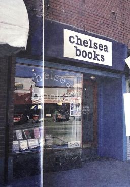
Here are a couple more photos of Greenville looking south from Sears, one from 1927 with buildings I’ve never seen, and one from 1930 with brand new buildings replacing those unfamiliar ones. Here’s the first, from 1927, which shows an unusual building with arches and a church (?!), Riggs Memorial Presbyterian Church, at the northeast corner of Greenville and Oram. (I used to have a little bookstore — Chelsea Books — at 1925 Greenville, in the space occupied by Criswell Furniture in this photo.)

greenville-ave_1920s_DPL
1927, Dallas Public Library, call number PA78-2/1047

chelsea-books_dallas_1925-greenville-avenue

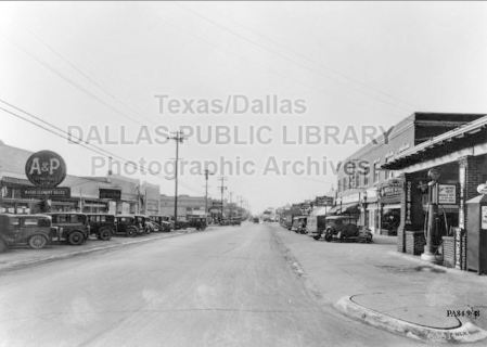
And then, just three short years later… bye-bye, weird building and church. The buildings seen in the 1930 photo below are still standing (except for the gas station at the southwest corner at Sears). I love that this street has been immediately recognizable for decades, even though there has been some unfortunate architectural revision going on in ol’ Bel-Vick in recent years.

greenville-ave_south-from-sears_bud-biggs-collection_1930_DPL
1930, Dallas Public Library, call number PA84-9/48 

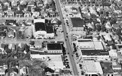
And here’s a detail from a 1931 Fairchild Aerial photo showing the Angelus/Arcadia at the center left (you can see the tree sign).

arcadia_fairchild-aerial_1931_detail_DPL
Dallas Public Library, call number
PA83-32/16 

And, finally, the mural inside Trader Joe’s, located on the spot of Arcadia Theater.

trader-joes_arcadia_mural_dec-2020

*

arcadia-theater_exhibitors-herald-world_060730-sm

*

Copyright © 2020 Paula Bosse. All Rights Reserved.

Private Education in Dallas — 1916

dallas-educational-center_ursuline_ca-1916_degolyer-library_smu_photoThe looming Ursuline Academy in Old East Dallas

by Paula Bosse

Here is a collection of photos and mini-histories of several of the top private schools that Dallas parents were ponying up their hard-earned cash for in 1916. Some were boarding schools, some were affiliated with churches, some were rooted in military discipline, some were medical schools, and some were places to go to receive instruction on the finer things in life, such as music and art. Sadly, only one of these buildings still stands. But two of the schools in this collection have been operating continuously for over 100 years (Ursuline and Hockaday), and two more are still around, having had a few name changes over the years (St. Mark’s and Jesuit). Here’s where the more well-to-do girls and boys of Dallas (…and Texas — and many other states) were sent to become young ladies and gentlemen. 

**

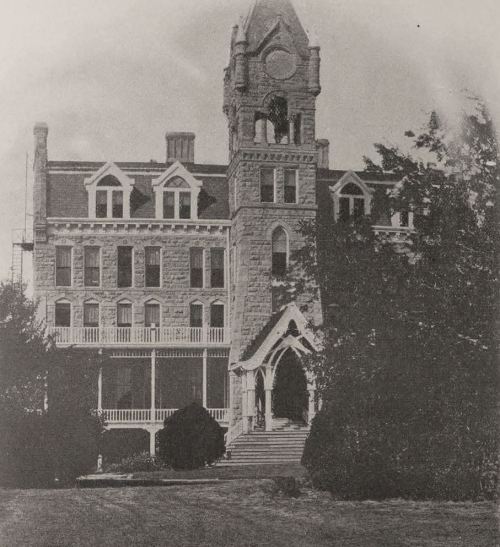
THE URSULINE ACADEMY (above) — Mother Mary Teresa, superioress — the block bounded by Live Oak, Haskell, Bryan, and St. Joseph. This school for girls and young women was established in Dallas by the Ursuline Sisters in about 1874 — and it continues today as one of the city’s finest institutions. The incredible gothic building was… incredible. So of course it was demolished (in 1949, when the school moved its campus to its present-day North Dallas location). See what it looked like at its Gothic, grandiose height in a previous Flashback Dallas post here.

dallas-educational-center_ursuline_ca-1916_degolyer-library_smu

*

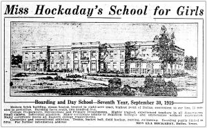
MISS HOCKADAY’S SCHOOL FOR GIRLS — Miss Ela Hockaday, principal — 1206 N. Haskell. Hockaday was (and is) the premier girl’s school of Dallas society — like Ursuline, it is still going strong (and, like Ursuline, it moved away from East Dallas and is now located in North Dallas). In 1919, three years after these photos were taken, Miss Hockaday would buy the former home of Walter Caruth, Bosque Bonita, set in a full block at Belmont and Greenville in the Vickery Place neighborhood — there she built a large campus and cemented her place as one of the legendary educators in Dallas history. (In 1920, Hockaday’s annual tuition for boarding students eclipsed even the hefty tuition of The Terrill School for Boys: Miss Hockaday had parents lined up to pay her $1,000 a year — now the equivalent of about $13,000 — to educate and refine their daughters at her prestigious institution.)

dallas-educational-center_hockaday_ca-1916_degolyer-library_smu

dallas-educational-center_hockaday_tennis_ca-1916_degolyer-library_smu

dallas-educational-center_hockaday_ca-1916_degolyer-library_smu_text

*

MISSES HOLLEY’S SCHOOL FOR GIRLS — Miss Frances Holley and Miss Josephine Holley, principals — 4528 Ross Avenue (at Annex). Another somewhat exclusive school that catered to young society ladies was the Holley school, established in 1908 by the two Holley sisters, who limited their student body to only 35 girls. The school (which is sometimes referred to as “Miss Holley’s School” and “Holley Hall” — and which was located behind the sisters’ residence) closed in 1926.

dallas-educational-center_holleys-school_ca-1916_degolyer-library_smu

dallas-educational-center_holleys-school_ca-1916_degolyer-library_smu_text

*

ST. MARY’S COLLEGE — Miss Ethel Middleton, principal — Garrett and Ross Avenue.  This Episcopal-Church-associated boarding and day school for girls and young ladies was one of the Southwest’s leading institutions of learning for young women. When established in 1889, it was built outside the city limits on a “hill” — back then the area around the school was often referred to as “College Hill.”

dallas-educational-center_st-marys_b_ca-1916_degolyer-library_smu

dallas-educational-center_st-marys_ca-1916_degolyer-library_smu

dallas-educational-center_st-marys_ca-1916_degolyer-library_smu_text

*

THE TERRILL SCHOOL FOR BOYS — M. B. Bogarte, head master — 4217 Swiss Avenue (at Peak). The exclusive boys school in Dallas (which, after several mergers, continues today as St. Mark’s); the cost of a year’s tuition for boarding students in 1920 was $850 — the equivalent of about $11,000 — a very pricey school back then. More on the Terrill School can be found in previous Flashback Dallas posts here and here.

dallas-educational-center_terrill-school_ca-1916_degolyer-library_smu

dallas-educational-center_terrill-school_ca-1916_degolyer-library_smu_info

*

THE HARDIN SCHOOL FOR BOYS — J. A. Hardin, principal — 4021 Swiss Avenue. This prep school was affiliated with the University of Texas. It was located for a while in downtown Dallas and for a time at the location seen below in Old East Dallas, but in 1917 it either bought out and merged with the Dallas Military Academy or that school went out of business, because the Hardin School settled into the military academy’s location, which had been Walter Caruth’s old home, Bosque Bonita, at Belmont and Greenville, where boys were marching around doing drills until Miss Hockaday moved in two years later in 1919.

dallas-educational-center_hardin-school_ca-1916_degolyer-library_smu_photo

dallas-educational-center_hardin-school_ca-1916_degolyer-library_smu

*

DALLAS MILITARY ACADEMY AND SCHOOL OF ENGINEERING — C. J. Kennerly, superintendent — Belmont & Greenville Ave. This “practical school for manly boys” opened up in 1916 in a large house which had been built by Walter Caruth in the area now known as Lower Greenville. The Dallas Military Academy lasted for only one year until the large house became home to the Hardin School for Boys in 1917 (and, two years later in 1919, it became the longtime home of the Hockaday School). If you didn’t click on the link for it above, now’s your chance to read more about the history of Caruth’s grand house, Bosque Bonita, here.

dallas-educational-center_pre-hockaday_dallas-military-academy_ca-1916_degolyer-library_smu

dallas-educational-center_pre-hockaday_dallas-military-academy_ca-1916_degolyer-library_smu_text

*

UNIVERSITY OF DALLAS — Very Rev. P. A. Finney, president — Oak Lawn Ave. & Gilbert. When it opened in 1906, this school was known as Holy Trinity College; its name was changed to the University of Dallas in 1910. The University of Dallas closed in 1928 because of lack of money; it was later known as Jesuit High School until Jesuit moved to North Dallas — the grand building was demolished in 1963. (See an aerial view of this huge building here.)

dallas-educational-center_univ-of-dallas_trinity_jesuit_ca-1916_degolyer-library_smu_photo

dallas-educational-center_univ-of-dallas_trinity_jesuit_ca-1916_degolyer-library_smu

*

THE MORGAN SCHOOL (formerly the Highland Park Academy) — Mrs. Joseph Morgan, principal — 4608 Abbott. A co-ed school.

dallas-educational-center_morgan-school_b_ca-1916_degolyer-library_smu

dallas-educational-center_morgan-school_ca-1916_degolyer-library_smu

dallas-educational-center_morgan-school_ca-1916_degolyer-library_smu_text

*

POWELL TRAINING SCHOOL — Nathan Powell, president — Binkley & Atkins (now Hillcrest) in University Park. I believe this is the only building in this post still standing — more can be read in the earlier post “Send Your Kids to Prep School ‘Under the Shadow of SMU’ — 1915,” here. (That is, in fact, a bit of the very, very young SMU campus seen in the distance at the bottom right.)

dallas-educational-center_powell-school_ca-1916

dallas-educational-center_powell-school_ca-1916_info

*

BAYLOR MEDICAL COLLEGE — E. H. Cary, dean — 720 College Ave. (now Hall Street).

dallas-educational-center_baylor-medical-college_ca-1916_degolyer-library_smu_photo

DALLAS POLYCLINIC/POST-GRADUATE MEDICAL SCHOOL — John S. Turner, president — S. Ervay & Marilla (affiliated with Baylor Medical College).

dallas-educational-center_dallas-polyclinic_ca-1916

dallas-educational-center_baylor-medical-college_ca-1916_degolyer-library_smu

*

STATE DENTAL COLLEGE — 1409 ½ South Ervay, across from the Park Hotel (more recently known as the Ambassador Hotel).

dallas-educational-center_state-dental-college_ca-1916_degolyer-library_smu_photo

dallas-educational-center_state-dental-college_ca-1916_degolyer-library_smu

*

HAHN MUSIC SCHOOL — Charles D. Hahn, director — 3419 Junius. 

dallas-educational-center_hahn-music-school_ca-1916_photo

dallas-educational-center_hahn-music-school_ca-1916

*

AUNSPAUGH ART SCHOOL — VIvian Aunspaugh, director — 3409 Bryan. A well-established Dallas art school for 60 years. Miss Aunspaugh died in 1960 at the age of 90 and was said to have been giving lessons until shortly before her death. (The photo below of the exterior is the only one here not from about 1916 — that photo is from 1944.)

dallas-educational-center_aunspaugh_interior_ca-1916_degolyer-library_smu

aunspaugh-art-school_james-bell_1944_DHSvia Dallas Historical Society

dallas-educational-center_aunspaugh_ca-1916_degolyer-library_smu

*

dallas-educational-center_ca-1916_degolyer-library_smu

dallas-educational-center_front-cover_ca-1916_degolyer-library_smu

***

Sources & Notes

All images (but one) from the booklet “Dallas, The Educational Center of the Southwest” (published by the Educational Committee, Dallas Chamber of Commerce, and Manufacturers Association, Dallas, ca. 1916), from the collection of the DeGolyer Library, SMU Libraries, Southern Methodist University; more information on this publication — and a full digital scan of it — can be found at the SMU site, here.

The exterior photo of the Aunspaugh Art School is from the Dallas Historical Society, taken in 1944 by Dallas resident James H. Bell; more information on this photo is at the DHS site, here.

dallas-educational-center_aunspaugh_interior_ca-1916_degolyer-library_smu_sm

*

Copyright © 2019 Paula Bosse. All Rights Reserved.


Paving Matilda — 1971

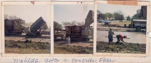
milazzo_album_matilda_1971_3_120“Matilda gets a concrete face”… (click for larger image)

by Paula Bosse

A couple of days ago I wrote about the history of Matilda Street in regard to its role as a railway for the Sherman-Denison interurban and the Belmont streetcar line. I noted that I had childhood memories from the 1970s of Matilda being a dirt street — which seems hard to believe these days since it carries a fair amount of traffic and is generally a quicker drive than Greenville Avenue, one block west. 

In response, one of the many Milazzo siblings (whom I remember not as individuals but as one large flock of children who regularly accompanied their parents to visit my father’s bookstore in the 1970s and ’80s) sent me some photos from a family album showing, yes, Matilda Street being paved! They lived in the 5700 block of Goodwin, and the photos were taken in 1971, from their yard, looking east across Matilda.

The streetcar tracks were abandoned in 1955 but were not removed — it took a full sixteen years for them to be paved over! Before that? Dirt street. If you look closely at the Google Street View capture from Oct. 2017, you can see the old rails peeking through.

Below are three photos from the Milazzo’s family album showing the Matilda “street improvements.” The construction vehicle seen in the first two photos is pretty weird-looking — like a cross between a locomotive and a tank. In fact, at first I thought the thing was actually running on the rails it was working to pave over, until I saw that what I had thought were train wheels look more like tank treads. Whatever it is, it doesn’t look like something you’d expect to see on a residential street in the 1970s. In the third photo, you can see part of Robert E. Lee Elementary School at the left. (All photos are larger when clicked.)

matilda_milazzo_1971_a_120

matilda_milazzo_1971_b_120

matilda_milazzo_1971_c_120

Thank you, Milazzo family!

***

Sources & Notes

Photos from the collection of the Milazzo family, used with permission. The third photo shows a date-stamp of April, 1971.

The related Flashback Dallas post “Ghost Rails of the Belmont Streetcar Line” is here.

All photos are larger when clicked.

*

Copyright © 2018 Paula Bosse. All Rights Reserved.


Ghost Rails of the Belmont Streetcar Line

matilda-richmond_dan-parr-photo_FB-dallas-history-guild_april-2018Matilda & Richmond, April, 2018… (photo: Dan Parr)

by Paula Bosse

I grew up on Ellsworth, between Greenville Avenue and Matilda — just south of Mockingbird, just north of the M Streets. When I was a child, Matilda was only partially paved — in my neighborhood, maybe only from Mockingbird down to Kenwood? Otherwise, it was a dirt street (!) — and this was in the ’70s! Right around Kenwood was a weird mound which might not have looked like much to an adult, but to a child it was pretty strange. I can’t remember if the rails were visible — I’m pretty sure they were.

That line was the Belmont Line, which ended (began?) at Mockingbird (I think there was a later extension of sorts, but I think Mockingbird was the end of the line for streetcar passengers). As a kid, I knew that Matilda had been a long-gone streetcar line, but never having seen a streetcar outside of a movie, I couldn’t really imagine what it must have been like to have streetcars (and an interurban! — more on that below) moving up and down a street which was less than a block from my house.

A few years ago I stumbled across the YouTube video below and was surprised to see actual footage of that streetcar rolling up Matilda. The first five minutes of the video contains 16mm footage (both black-and-white and color) shot around Dallas in 1953 and 1954 by Gene Schmidt. It’s GREAT! You’ll see streetcars-galore moving past all sorts of familiar and vaguely familiar sights around the city, from Oak Cliff to downtown to way out to Mockingbird and Matilda. It ends with the Belmont-Seventh car (car 603) pulling to the end of the line — the view is looking south down an unpaved Matilda Street from Mockingbird, with a glimpse of the Stonewall Jackson playing field at the left, on the other side of the fence. (The Matilda footage begins at 4:17.)

*

belmont-line_matilda-from-mockingbird_youtube-cap_ca1954Matilda, south from Mockingbird, ca. 1954 (Gene Schmidt)

Above, a screen capture from the video showing Matilda looking south from just south of Mockingbird. Stonewall Jackson Elementary School is at the left. Today the view looks like this.

*

Before the streetcar arrived, Matilda was the artery that led the Texas Traction Company’s Sherman/Denison interurban into Dallas. This electric interurban service from the north, which closely followed the H&TC railroad line, arrived in Dallas in 1908, back when the official entry-point into the Dallas city limits was just off Matilda, near Greenville Avenue and Bryan Street.

1908_interurban_sherman-dallas_dmn_011608
DMN, Jan. 16, 1908 (click to read)

The interurban route connecting Sherman/Denison with Dallas opened on July 1, 1908 and lasted for 40 years, until its final run on December 31, 1948. (Read the Dallas Morning News article on the 1908 inaugural trip for big-wigs, “Many Make Trip Over Interurban,” July 1, 1908, here. Below is the accompanying photo. Image that running up and down Matilda — and, later, along other streets in Dallas — several times a day!)

interurban_sherman-dallas_dmn_070108
DMN, July 1, 1908

Dallas’ ever-increasing population began to move northward and eastward, necessitating public transportation which would connect these developing areas with the rest of the city. One of the early “suburban” lines was the Belmont Line, which branched off the Bryan Street line and served the Belmont Addition and beyond; it opened in 1913, but these early days appear to have been more of a private “dinky” service (see SMU’s dinky car on the beyond-the-city-limits tracks at Hillcrest and McFarlin, here). The Belmont line — as well as the Vickery Place and Mount Auburn lines — became part of the city’s official streetcar system in 1922.

Before the dinky service, riders were able to get on and off the large interurban cars at stops between Mockingbird and the area around Bryan and Greenville Ave. Even though interurbans and streetcars were able to travel on the same rails, it took years for dedicated streetcar tracks to be laid along Matilda.

This detail of a real estate ad shows that the Belmont line had reached at least as far as Richmond by 1914 (I felt I had to include this because the finger is pointing at the exact location of the exposed rails in the photo at the top!):

1914_matilda-richmond_lakewood-heights-ad_det_050314
May, 1914 (detail from Lakewood Heights real estate ad — see full ad here)

By 1922 the Belmont line had extended north to Velasco; by 1925 it had gotten to McCommas; by 1936 it had made it up to Penrose; and by 1939 it had finally reached Mockingbird (in time for the opening that year of Stonewall Jackson Elementary School, located at Mockingbird and Matilda).

Dallas streetcars began to be phased out in 1955, and the Belmont line was one of the first to go — its last run was March 6, 1955: “The Belmont-Seventh streetcar line will go out of existence Sunday to be replaced by service with new Diesel buses” (Dallas Morning News, March 6, 1955). The new bus route in the Lower Greenville area would, for the most part, be along Greenville Avenue, one block west of unpaved Matilda Street.

In March, 1955, it was reported that the abandoned Belmont-Seventh streetcar tracks were deeded to the city by the Dallas Railway and Terminal Co., with the understanding that they would eventually be paved over. The tracks were on Matilda, Bryan, Cantegral, Live Oak, St. Paul, King’s Highway, Edgefield, Seventh, Bishop, and Colorado. In April, 1956, it was reported that the City Council had approved the sale of the streetcar viaduct over the Trinity River and the Matilda street right-of-way.

But what about that paving of Matilda? Mrs. K. E. Slaughter had thoughts on the matter in a letter-to-the editor in April, 1955:

Since removal of the Belmont streetcar line in part — Matilda and Bryan streets — would it not be advantageous to develop this section into an important use to the heavy automobile traffic? Matilda now is no more than useless tracks built up between a cow path. (DMN, April 7, 1955)

“Cow path” — ha!

Another annoyed News reader wrote in 1963 — eight years after the tracks had been abandoned — about the useless unpaved thoroughfare:

The abandoned almost-private right of ways, such as Matilda, nearly two miles south from Mockingbird, received by the city in a deal to permit an all-bus operation, have not yet been paved or otherwise improved. (DMN, Oct. 21, 1963)

I’m not sure when that paving finally happened — early ’70s? — I think it must have been done in stages. I don’t remember a time when the stretch between Mockingbird and Kenwood wasn’t paved, but I do remember Matilda being a dirt road south of Kenwood. I don’t have a good recollection of the year, but kids remember all sorts of weird things, and those mysterious mounds were pretty memorable. (UPDATE: See photos of Matilda being paved at Goodwin in 1971 here.) I wish I’d known what an interurban was when I was a child. That would have made my neighborhood seem a whole lot more interesting! Heck, it used to the Gateway to Sherman!

I’ve long despaired of having missed the streetcar age. But it’s nice to know that one ran so close to the house I grew up in.

belmont-line_matilda-mockingbird_youtube-cap_ca1954End of the line, ca. 1954… (Gene Schmidt)

belmont-car_lakewood-heights-ad-det_050314

***

Sources & Notes

Top photo taken by Dan Parr on April 15, 2018; it was originally posted to the Facebook group Dallas History Guild and is used here with permission. (Thanks, Dan!) The photo was taken at Matilda and Richmond, looking south on Matilda. See it on Google Street View, here. (Roadwork along Matilda is awful at the moment, but much-needed. Apparently it is being reduced to three lanes for automobiles with two bike lanes being added — read about it in the Lakewood Advocate, here.)

YouTube video shot by Gene Schmidt in 1953 and 1954; the direct link is here.

Another interesting video on YouTube was made by the City of Allen and contains period footage of the interurban that served North Texas. It’s a breezy 6-and-a-half  minutes, and it includes some cool shots of Dallas.

If you want to see a whole bunch of North Texas interurban photos, check out this great 83-page PDF compiled by DART, “History of the Interurban Railway System and Monroe Shops,” here.

Speaking of DART, they posted a cool 1925 map of streetcar and interurban lines, here — click the map to see a larger image. (In 1925, the Belmont line ended on Matilda at McCommas).

ALSO extremely cool is a Google map showing Dallas’ Historical Streetcar (and Interurban) Lines laid over a present-day Google map, here. Zoom in and out. Very useful!

streetcar_belmont_color_ebayeBay

belmont-streetcar_new-moon_1940_palace_ebay1940, eBay

belmont-streetcar_1954_ebay1954, eBay

*

Copyright © 2018 Paula Bosse. All Rights Reserved.

Even Lower Than Lowest Greenville

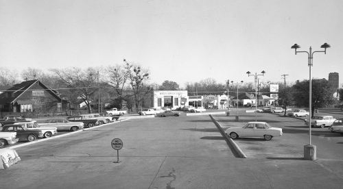
greenville-ave_lindell_bryan-pkwy_sears-parking-lot_squire-haskins_UTAWhere Greenville begins to peter out… (click for larger image)

by Paula Bosse

The photo above shows the lowest part of Greenville Avenue, between Lindell and Bryan Parkway, almost down to where Greenville turns into Munger. It was taken from the parking lot of the Sears store at Ross and Henderson (a shopping center now anchored by a Fiesta grocery store), a place where I spent many hours as a child. I have vivid memories of that store, especially the intense smell of popcorn that hit you like a buttery thunderclap as you entered from the parking lot.

I love that fact that a couple of the buildings seen in this photo (including the Munger Place Church, seen partially at the far right) are still standing.

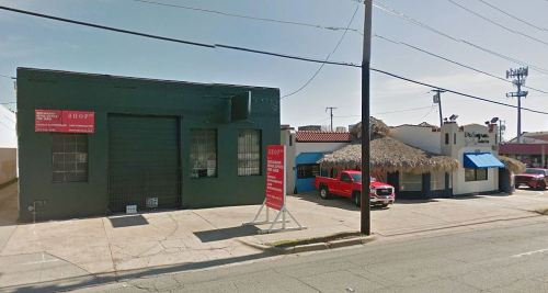
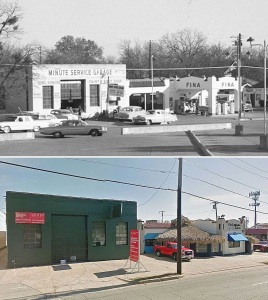
That cool Fina station seen in the top photo — at the corner of Greenville and Bryan Parkway — has been “modified” somewhat under the thatched hut roof of the Palapas Seafood Bar, but it’s definitely still recognizable. And Fina’s next-door neighbor, the Minute Service Garage, is still alive, too, looking a little less garage-y these days, but still looking pretty good.

greenville_google-street-view_feb-2017Google Street View, Feb. 2017

Then and now:

greenville-ave_from-sears_then-now

Keep on keeping on, Greenville Avenue!

***

Top photo by Squire Haskins from the Squire Haskins Photography, Inc. collection, University of Texas at Arlington Libraries, Special Collections; more info on the photo is here — click the thumbnail on that page to see a very large image.

More Squire Haskins photographs taken around the perimeter of this Sears store (which opened in September, 1947) are here, here, here, and here.

Click pictures to see larger images.

*

Copyright © 2017 Paula Bosse. All Rights Reserved.

Belmont & Greenville: From Caruth Farmland to Hub of Lower Greenville

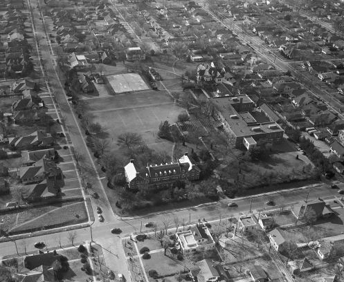
hockaday-campus_aerialHockaday campus — Greenville Ave. at the right (click for larger image)

by Paula Bosse

If you’ve driven down lower Greenville Avenue lately, you’re probably aware that the buildings that most recently housed a retirement home at the northwest corner of Belmont and Greenville were scheduled to be been torn down. When I drove past that intersection a few weeks ago and saw the entire block leveled, I was shocked. It’s weird suddenly not seeing buildings you’ve seen your entire life. It got me to wondering what had been on that block before. I’d heard that Hockaday had occupied that block for several years, but even though I’d grown up not too far away, I’d only learned of that within the past few years. When I looked into this block’s history, the most surprising thing about it is that it has passed through so few owners’ hands over the past 140 or so years.

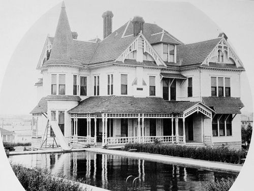
As far as I can tell, the first owner or this land was Walter Caruth (1826-1897), a pioneer merchant and farmer who arrived in this area in the 1840s (some sources say the 1850s), along with his brother, William. Over the years the brothers amassed an absolutely staggering amount of land — thousands and thousands of acres which stretched from about Inwood Road to White Rock Lake, and Ross Avenue up to Forest Lane. One of Walter Caruth’s tracts of land consisted of about 900 acres along the eastern edge of the city — this parcel of land included the 8 or 9 acres which is now the block bounded by Greenville, Belmont, Summit, and Richard, and it was where he built his country home (he also had a residence downtown). The magnificent Caruth house was called Bosque Bonita. Here is a picture of it, several years after the Caruths had moved out (the swimming pool was added later).
caruth_bosque-bonita_dallas-rediscovered

Most sources estimate that the house was built around 1885 (although a 1939 newspaper article stated that one of Walter’s children was born in this house in 1876…), but it wasn’t until 1890 that it began to be mentioned in the society pages, most often as the site of lavish parties. (Click pictures and  articles to see larger images.)
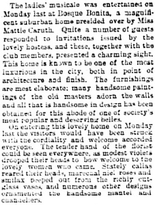
bosque-bonita_dmn_020390Dallas  Morning News, Feb. 3, 1890

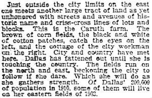
At the time, the Caruth house was one of the few buildings in this area — and it was surrounded by endless acres of corn and cotton crops. It wasn’t long, though, before Dallas development was on the march eastward and northward. This ad, for the new Belmont Addition, appeared in April of 1890, and it mentioned the Caruth place as a distinguished neighboring landmark.

belmont-addition_dmn_041690
DMN, April 16, 1890

By the turn of the century — after Caruth’s death in 1897 — it was inevitable that this part of town (which was not yet fully incorporated into the City of Dallas) would soon be dotted with homes and businesses.
caruth-farm_dmn_092703
DMN, Sept. 27, 1903

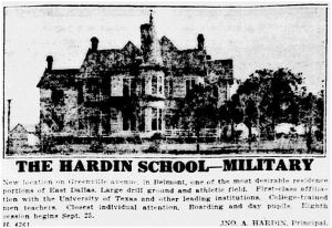
At one time the Caruth family owned land in and around Dallas which would be worth the equivalent of billions of dollars in today’s money. After Walter Caruth’s death, the Caruth family became embroiled in years of litigation, arguing over what land belonged to which part of the family. I‘m not sure when Walter Caruth’s land around his “farmhouse” began to be sold off, but by 1917, the Hardin School for Boys (established in 1910) moved into Bosque Bonita and set up shop. It operated at this location for two years. The Caruth house even appears in an ad.
hardin-school_dmn_071517_bosque-bonita_ad
DMN, July 15, 1917

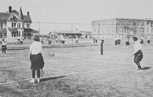
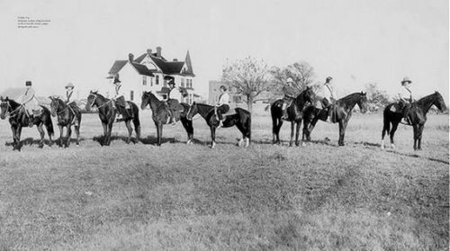
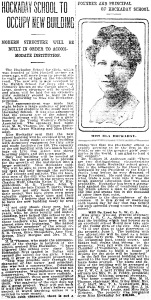
I’m not sure if the Hardin School owned the land or was merely leasing it and the house, but in 1919, Ela Hockaday announced that she had purchased the land and planned to move her school — Miss Hockaday’s School for Girls (est. 1913) — to this block and build on it a two-story brick school building, a swimming pool (seen in the photo above), tennis courts, basketball courts, hockey fields, and quarters for staff and girls from out of town who boarded.
hockaday_dmn_051119DMN, May 11, 1919

hockaday_dmn_070619
DMN, July 6, 1919

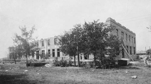
Ground was broken in July of 1919, and the first session at the new campus began on schedule in September. Below, the building under construction. Greenville Avenue is just out of frame to the right.
hockaday_greenville_construction_hockaday100Photo: Hockaday 100

hockaday_greenville-ave_1919_reminiscences

hockaday_greenville-belmont_1920s_horses

The most interesting thing I read about the Hockaday school occupying this block is that very soon after opening, the beautiful Caruth house was moved from its original location at the northwest corner of Belmont and Greenville. It was rolled on logs to the middle and back of the property. “Bosque Bonita” became “Trent House.” Former student (and later teacher) Genevieve Hudson remembered the moving of the house in an oral history contained in the book Reminiscences: A Glimpse of Old East Dallas:
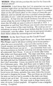
caruth-house_hockaday_reminiscences-bk

You can see the new location of the house in the top aerial photo, and in this one:
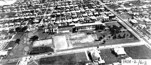
hockaday_aerial_dplDallas Public Library

Another interesting little tidbit was mentioned in a 1947 Dallas Morning News article: Caruth’s old hitching post was still on the property — “on Greenville Avenue 100 feet north of the Belmont corner” (DMN, May 2, 1947). I’d love to have seen that.

After 42 years of sustained growth at the Greenville Avenue location (and five years after the passing of Miss Hockaday), the prestigious Hockaday School moved to its current location in North Dallas just after Thanksgiving, 1961. Suddenly, a large and very desirable tract of land between Vickery Place and the M Streets was available to be developed. Neighbors feared the worst: high-rise apartments.

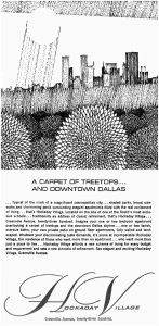
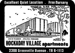
The developer proposed a “low-rise,” “semi-luxury” (?) group of four 5-story apartment buildings, each designed to accommodate specific tenants: one for swinging singles (“where the Patricia Stevens models live”), one for single or married adults, one for families with children, and one for “sedate and reserved adults.” It was to be called … “Hockaday Village.” The architect was A. Warren Morey, the man who went on to design the cool Holiday Inn on Central and, surprisingly, Texas Stadium.

Bosque Bonita — and all of the other school buildings — bit the dust in preparation for the apartment’s construction. Hockaday Village (…what would Miss Hockaday have thought of that name?) opened at the end of 1964.
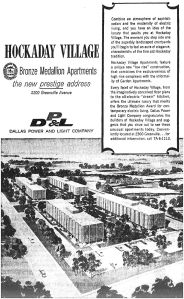
hockaday-village_dmn_101864
Oct., 1964

hockaday-village_dmn_101864_carpet-of-treetops
Oct., 1964

hockaday-village_dmn_031365
March, 1965

And then before you knew it, it was the ’70s, the era of waterbeds and shag carpeting. (Miss Hockaday would not have tolerated such tackiness, and I seriously doubt that Mr. Caruth would have ever understood why shag carpeting was something anyone would actually want.)
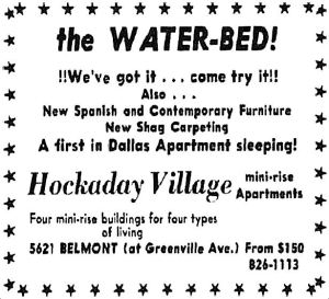
hockaday-village_dmn_052271_waterbeds
1971

Then, in 1973, the insistently hip ads stopped. In April, 1974 this appeared:
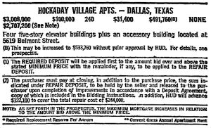
hockaday-village_FWST_042874
Fort Worth Star-Telegram, April 28, 1974

The apartments were being offered for public auction by the “Office of Property Disposition” of the Federal Housing Authority and HUD. Doesn’t sound good. So who bit and took the plunge? The First Baptist Church of Dallas, that’s who. The plan was to redevelop the existing apartments into a retirement community called The Criswell Towers, to be named after Dr. W. A. Criswell. But a mere three months later, the Baptists realized they had bitten off more than they could chew — the price to convert the property into a “home for the aged” would be “astronomical.” They let the building go and took a loss of $135,000. It went back on the auction block.

Two years later, in the summer of 1976 … the old Hockaday Village became Belmont Towers — and the new owners must have thought the Baptists’ idea was a good one, because Belmont Towers advertised itself as “mature adult living at its finest” — “perfect for retired or semi-retired individuals.”
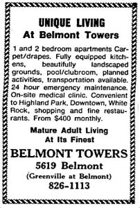
hockaday-village_dmn_043083_belmont-towers
April, 1983

It was Belmont Towers for 20-or-so years. In 1998, the buildings were renovated and updated, and it re-opened as Vickery Towers, still a retirement home and assisted living facility. A couple of years ago it was announced that the buildings would be demolished and a new development would be constructed in its place. It took forever for the 52-year-old complex to finally be put out of its misery since that announcement. Those buildings had been there my entire life and, like I said, it was a shock to see nothing at all in that block a few weeks ago.
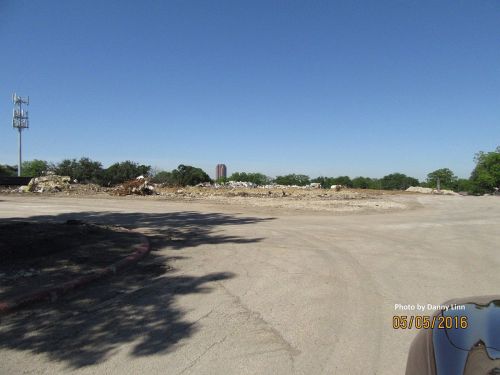
vickery-towers_050516_danny-linn-photoPhoto: Danny Linn

In the 140-or-so years since Walter Caruth acquired this land in the 1870s or 1880s, it has been occupied by Caruth’s grand house, a boys school, the Hockaday School, and four buildings which have been apartments and a retirement community. And that’s it. That’s pretty unusual for development-crazy Dallas. I’ll miss those familiar old buildings. I hope that whatever is coming to replace them won’t be too bad.
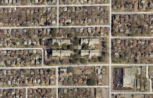
greenville-belmont_bing_aerial
Bing Maps

***

Sources & Notes

The top aerial photograph is from the Vickery Place neighborhood website, here. Belmont is the street running diagonally at the left, and Greenville is the street running diagonally at the right. I’m not sure of the date, but the Hockaday Junior College (which I had never heard of before) can be seen at the northwest corner of Belmont and Greenville — the original location of Bosque Bonita before it was rolled across the campus.

That fabulous photo of Bosque Bonita is from the book Dallas Rediscovered by William L. McDonald.

Photo of Hockaday girls playing tennis is from the book Reminiscences: A Glimpse of Old East Dallas.

Photo of girls on horseback … I’m not sure what the source of this photo is.

Photo of the block, post-razing is by Danny Linn who grew up in Vickery Place; used with permission. (Thanks, Danny!)

All other sources as noted.

In case you were confused, the Caruth Homeplace that most of us might know (which is just south of Northwest Highway and west of Central Expressway) was the home of Walter Caruth’s brother William — more on that Caruth house can be found here.

The Hockaday School can be seen on the 1922 Sanborn map here (that block is a trapezoid!).

More on the history of the Hockaday School can be found at the Hockaday 100 site; a page with many more photos is here. Read about the history of the school in the article “Miss Ela Builds a Home” by Patricia Conner Coggan in the Spring, 2002 issue of Legacies, here.

Additional information can be found in these Dallas Morning News articles:

  • “Proposal to Change Hockaday Site to Apartment Zoning Opposed” (DMN, Oct. 29, 1961)
  • “Retirement Home Plans Going Ahead” (regarding the purchase by the First Baptist Church of Dallas) (DMN, June 15, 1974)
  • “Church Takes $135,000 Loss on Property” (DMN, Sept. 10, 1974)

*

If you made it all the way through this, thank you! I owe you a W. C. Fields “hearty handclasp.”

Photos and clippings larger when clicked.

*

Copyright © 2016 Paula Bosse. All Rights Reserved.


Happy Flag Day from the Girls of Miss Hockaday’s School — 1957

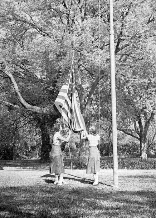
flag_hockaday-yrbk_1957On flag detail in lovely Vickery Place (click for larger image)

by Paula Bosse

Today is Flag Day. This seems an appropriate day to post this photo of Hockaday girls on flag duty in 1957, a few short years before the prestigious school moved from this Lower Greenville campus which once occupied the entire block at the northwest corner of Belmont and Greenville to its present location in North Dallas.

***

Photograph from the 1957 Hockaday yearbook.

Click picture for larger image.

*

Copyright © 2016 Paula Bosse. All Rights Reserved.

Vickery Place: “Above the City” — 1911

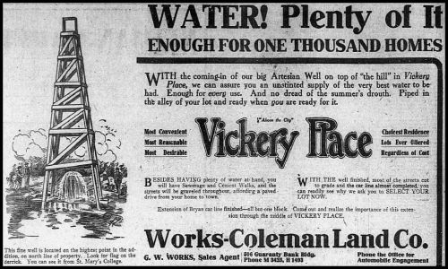
vickery-place-dmn_061111“An Unstinted Supply of the Very Best Water” (click for larger image)

by Paula Bosse

Vickery Place is the place to be!

  • Most Convenient
  • Most Reasonable
  • Most Desirable

And the water! Gobs of it! Look for the flag on the derrick over the artesian well — you can see it from St. Mary’s College on Ross!

***

Ad for the new Vickery Place Addition appeared in the June 11, 1911 edition of The Dallas Morning News.

Vickery Place website is here.

Vickery Place wiki is here.

*

Copyright © 2014 Paula Bosse. All Rights Reserved.


Happy 75th Anniversary, Stonewall!

1938-stonewall-jackson-elementary-school_renderingStonewall Jackson Elementary School, 1938 rendering (click for larger image)

by Paula Bosse

Classes begin today for students in DISD schools, one of which is Stonewall Jackson Elementary School, located at Mockingbird and Matilda. Stonewall turns 75 years old this year (2014), and I’m proud to say it’s where I spent many years as a happy student. When I learned recently that the school had originally been built as a single-story building (instead of the two stories we know today), I was pretty surprised, and this little unknown nugget prompted me to look into the early years of my alma mater.

In the 1920s and ’30s, Dallas was expanding very quickly northward from Vickery Place, the residential neighborhood around Belmont and Greenville. As the area we now know as Lower Greenville and the M Streets was developed, the two elementary schools (Vickery Place School, then at Miller and McMillan, and Robert E. Lee, at Matilda and Vanderbilt) were soon filled to capacity. Building a new school to serve burgeoning “Northeast Dallas” was an immediate necessity. So in 1938, the city purchased a 9-acre chunk of land along Mockingbird, one block east of Greenville Avenue and right alongside the Denison interurban tracks that ran on Matilda (when I was growing up a couple of blocks away, I used to see remains of those tracks but didn’t know what they had been used for — I wrote about those tracks here and here). The land had been part of the vast Caruth land holdings.

The building was designed by architect C. H. Griesenbeck. It had eleven classrooms, a cafeteria, and an auditorium with a seating capacity of 400. Although originally built as a one-story building, Griesenbeck was mindful that expansion would be necessary in the future, and his design took into account that a second story would be added in the years to come. Construction began in late 1938 and was scheduled to be completed for the opening of the 1939-40 school year.

The name of the new school was decided upon a few months later:

“Stonewall Jackson’s name was chosen for the new school, Dr. Norman R. Crozier, superintendent, said because of the high ideals of Thomas Jonathan Jackson, one of the unique and romantic figures of the War Between the States, and as a companion to its nearest school, Robert E. Lee.” (Dallas Morning News, Feb. 1, 1939)

But if you’re going to sink a hundred thousand dollars into a school, you’ve got to have houses for families to live in to make sure your future student pool doesn’t run dry — and at that time very few houses had been built that far north. Cut to W. W. Caruth, Jr., son of the Caruth family patriarch who basically owned everything north of Mockingbird (Caruth owned a huge expanse of land once estimated at being over 30,000 acres). Not long after selling the land at Mockingbird and Greenville to Dr Pepper, Caruth fils began to develop the land around the then-under-construction school — he called the new neighborhood “Stonewall Terrace.”

The property went fast.

stonewall-terrace_dmn_092339September, 1939

As the neighborhood was taking shape and the construction of the school building was nearing completion, the school’s official boundaries were announced:

“Boundaries of the Stonewall Jackson School will be from the alley south of Morningside on the east side of Greenville Avenue and from the alley south of Mercedes on the west side of Greenville to the M-K-T Railroad on the north.” (DMN, Sept. 3, 1939)

Despite some problems with labor shortages, the school managed to open on time, on Sept. 13, 1939, the start of the new school year.

The school and the neighborhood grew quickly, and the number of students soon doubled. In 1950 the school board approved preliminary plans for an addition to the school. This addition (which would cost $369,000 and be handled by the architectural firm of Tatum & Quade) would include a first-floor wing with four classrooms, a gymnasium, and a lunchroom, and a second story containing eight classrooms, a library, and a music room. (The cost of construction would probably have been quite a bit more had the original architect not had the foresight to design the building with the expectation that a second story would be added in the future.)

The construction was substantial enough that it had to be done during the 1951-52 school year. Because the old lunchroom was being dismantled while the new wing was being built, students were required to bring their lunches the entire year. All they could get at school was milk. No fish sticks, no Salisbury steak, no chess pie. Just milk. Sorry, kids.

The new addition was completed in time for the beginning of the 1952 school year. And that’s the version of the building that stands today, looking pretty much unchanged.

stonewall_front

It was a cool building then, and it’s a cool building now. It’s sad to see how much of the playing fields keep disappearing as ugly portable buildings take over, but the new garden is a great new addition — I wish they’d had that when I was there.

I really loved that school. When I was a student there, grades went from 1st to 7th, and I loved all seven years I spent there. Thanks for the great childhood memories, Stonewall. And Happy 75th Anniversary!

stonewall-nowPhoto: DISD

***

Sources & Notes

Top image is architect C. H. Griesenbeck’s architectural rendering of Stonewall Jackson Elementary School, originally a one-story building.

Here are a few articles to check out in the Dallas Morning News archives:

  • “$11,250 Offer Made for New School Site” (DMN, Oct. 26, 1938)
  • “Contracts for $104,150 Let on Northeast Dallas School” (DMN, Dec. 22, 1938)
  • “New Northeast Dallas School Named Jackson; Board Pays Tribute to Famous General” (DMN, Feb. 1, 1939)

And, yes, it probably sounds weird to outsiders, but students actually do call the school “Stonewall” — just like we call Woodrow Wilson High School (the high school Stonewall feeds into) “Woodrow.” It’s like a secret handshake.

Below, an undated photo from DISD’s Pinterest board (if you squint, you can see the Piggly Wiggly at the southwest corner of Mockingbird and Matilda).

stonewall_DISD-pinterest

UPDATE: After years of controversy, Stonewall Jackson Elementary School will be rechristened “Mockingbird Elementary” in 2018. Whatever its name, it’s still a great school!

*

Copyright © 2014 Paula Bosse. All Rights Reserved.

Tietze Park

tietze_1946_c

by Paula Bosse

Tietze Park was my neighborhood park growing up — it’s where I learned to swim and got sunburned every summer because I stayed there so long. It straddles 75206 and 75214, in that area that’s not quite Lower Greenville, not quite M Streets, and not quite Lakewood. It’s on Skillman, bordered by Llano and Vanderbilt. You’ve probably seen the famous tree at the Vanderbilt corner. And you’ve probably jokingly referred to it as “Tsetse” Park while suppressing a power-of-suggestion sleeping-sickness-inspired yawn (like right now). It’s a cute little park, with wonderful WPA touches. Here are photos from 1946 of some repair work being done on the stone buildings and construction of a new pool. It looks pretty much the same today.

tietze_1946_b

tietze_1946_a

To see a photo of what the pavilion looks like today, check out a great photo by Sarah Whittaker from CultureMap, here.

***

Photos from the Dallas Municipal Archives, accessed through the Portal to Texas History site.

A history of the park — which started out as “Keith Park” in 1924 but was re-named in 1934 in honor of William R. Tietze, former Parks Department superintendent — can be found on the Friends of Tietze Park Foundation website here.

Here’s a nice drawing of the plan for the park (I came across this somewhere on Facebook, I think, but neglected to make note of the source):

tietze park_plan

A nostalgic look back at the park can be found in the Lakewood Advocate article “Memories of Tietze Park Pool” by Patti Vinson, here.

For a video that captures the laid-back feel of the neighborhood surrounding the park, check out the video of the catchy song “We’ll Go Walkin'” by local band The O’s. It’s great. The first line is “We’ll go walkin’ to Tietze Park.” And then they do. If you’re familiar with the neighborhood, you’ll recognize everything along their walk. And they end it in front of *that tree.* So it’s totally worth it. (The band’s website is here.)

*
Click photos for larger images.

*

Copyright © 2014 Paula Bosse. All Rights Reserved.

%d bloggers like this: