
Main & Murphy — ca. 1907
by Paula Bosse
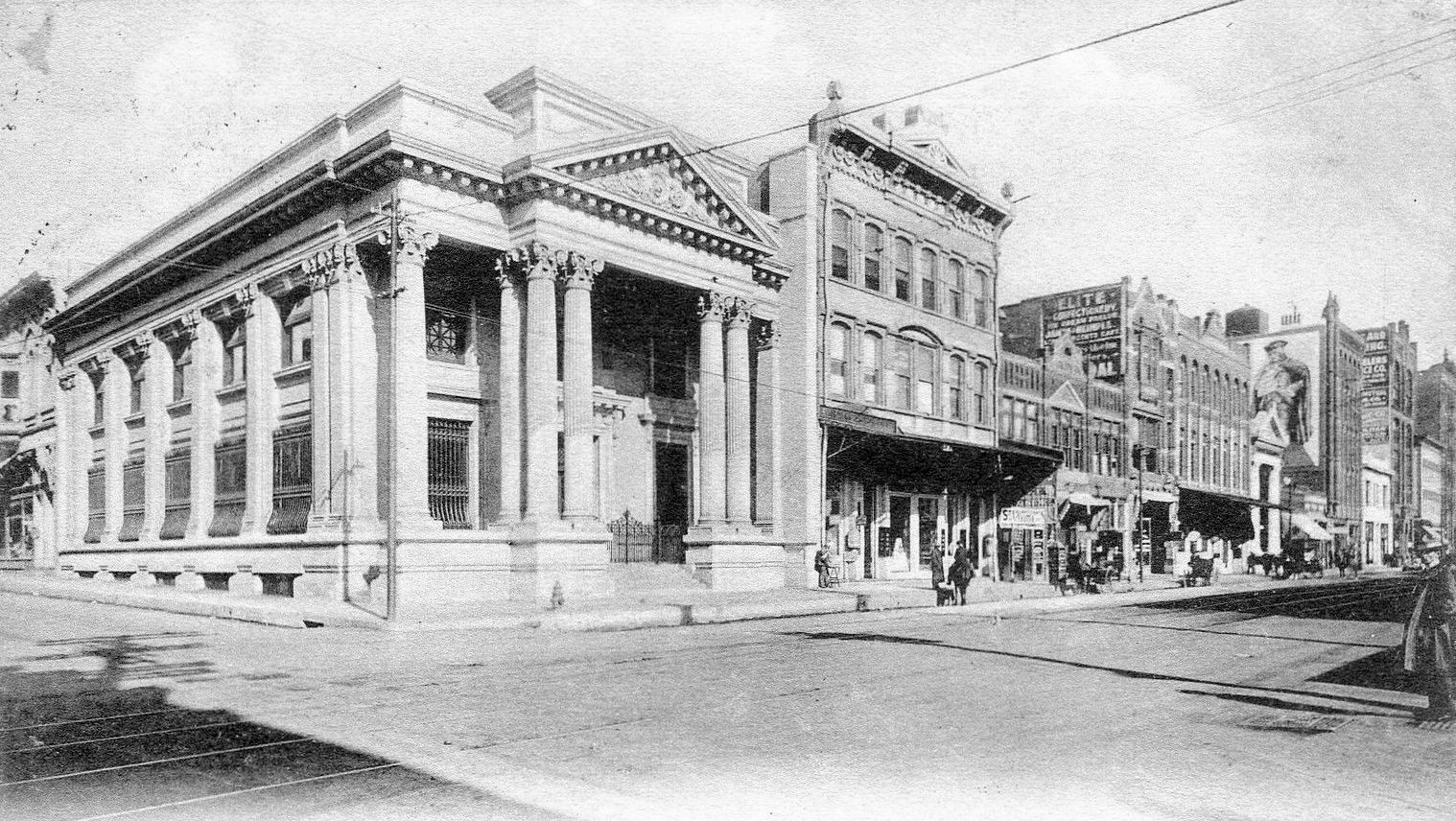 Main St. looking east
by Paula Bosse
Above, Main Street looking east, taken from Murphy, anchored by the beautiful City National Bank, built in 1903. This block today? One Main Place. Whatever old buildings were left in this block in 1965 (including the old City National Bank) were bulldozed into oblivion to make way for the skyscraper.
The same view today:
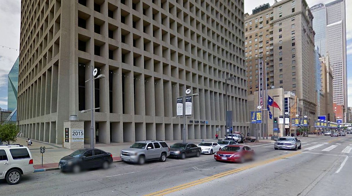 Google Street View, 2015
***
Sources & Notes
Top image from a postcard found on eBay.
Imagine looking up to the sky from the photographer’s vantage point in the top photo and seeing what things would look like a century later.
Murphy no longer exists — it was between what is now Griffin and Field. A map from 1898 showing the location:

See another photo of the same view taken at about the same time, only with horse-and-buggy traffic, here.
*
Copyright © 2016 Paula Bosse. All Rights Reserved.

Murphy Street may not exist, but believe it is now called Murphy Crosswalk. Check your google map, located just east of Belo Park.
LikeLiked by 1 person
Thanks for sharing. Do you have any idea how far Murphy would be from the corner of Elm near Houston? Thanks for listening.
LikeLike
Hi, Alan. Downtown streets have changed over time — some have disappeared and some new ones have appeared. Murphy is now only a 1-block walkway (“Murphy Crossing”), between Main and Commerce. To see where the 2-block Murphy street was in relation to Elm and Houston, check out this very helpful 1962 map (click to enlarge it): http://dallasfreeways.com/dfwfreeways/old-highway-maps/1962_enco_dfw_downtown_dallas_detail_med.jpg
Depending how you measure blocks, it would be about 6 or 7 blocks from Elm and Houston.
LikeLike
Thank You!, very MUCH for your prompt and detailed response. It is appreciated. Enjoy your day.
LikeLiked by 1 person
[…] Flash Back Dallas […]
LikeLike