 In the shadow of the Praetorian — Main Street, 1907
by Paula Bosse
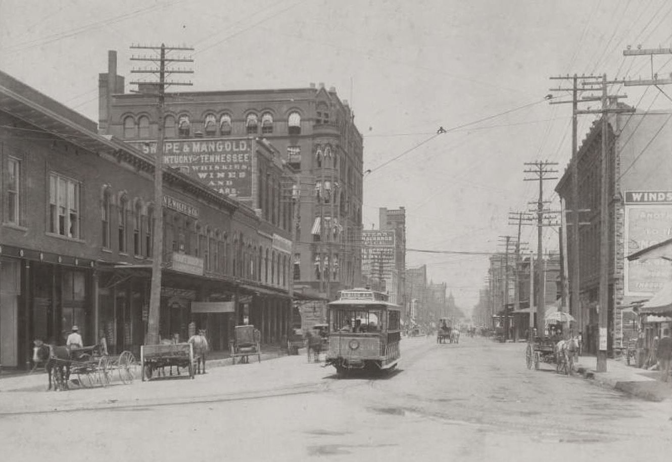
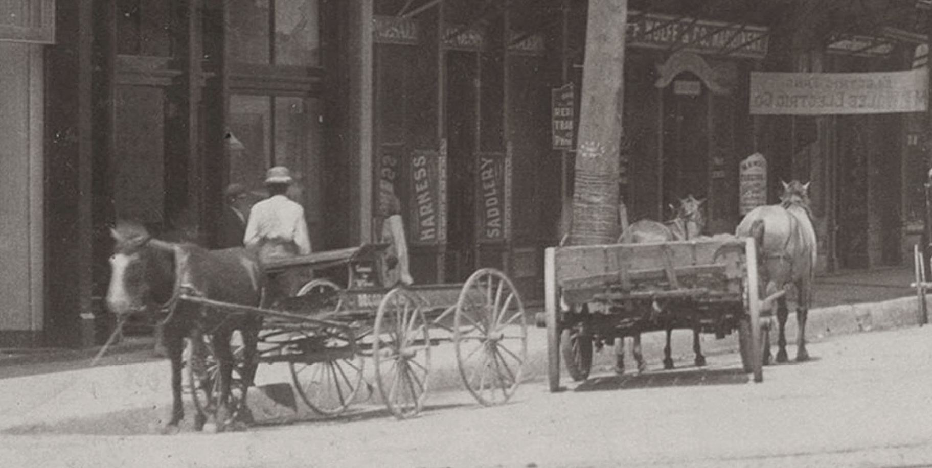
The photo below is a detail of a larger photo from the George W. Cook Collection treasure trove at SMU’s DeGolyer Library, which shows the Praetorian Building under construction. It appeared on a real-photo postcard which shows a postmark of July 25, 1907. What I found most interesting about this photo are the two buildings standing in its shadow, just west of Stone Street (now Stone Place). Here’s a close-up (click to see a larger image):
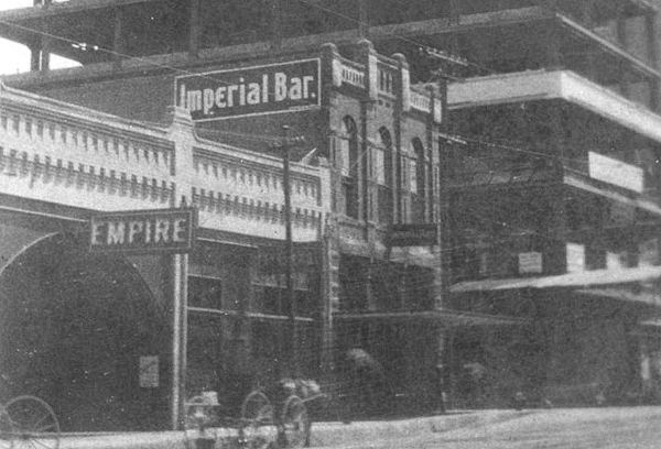
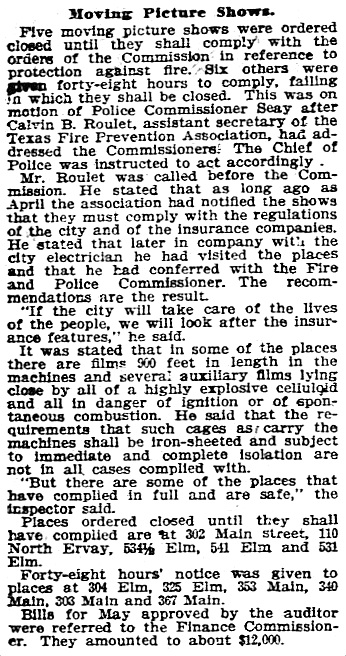
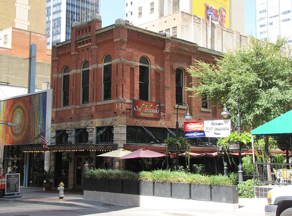
I knew that the building with “Imperial Bar” on the side is still standing (the Sol Irlandes restaurant at 1525 Main has been its occupant for several years), but I wondered about the one with the “Empire” sign. It took a bit of digging, but I’m happy to report that it was a very early movie theater. I had determined that the address of the building with the Empire sign was 353 Main Street (in what is today the 1500 block of Main) and found this article from 1907 about officials closing down “moving picture shows” which had not complied with fire precautions in the storing and projection of highly flammable celluloid film — one of these movie houses was at 353 Main (clippings and photos are larger when clicked):
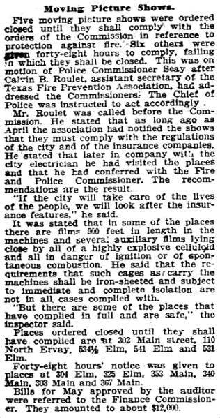
Dallas Morning News, June 25, 1907
Below is a clipping from the Dallas city directory issued in 1907 — the first year a special “Moving Pictures” category was included in the directory.
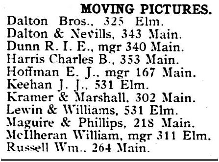
1907 Dallas directory
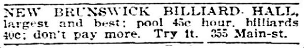
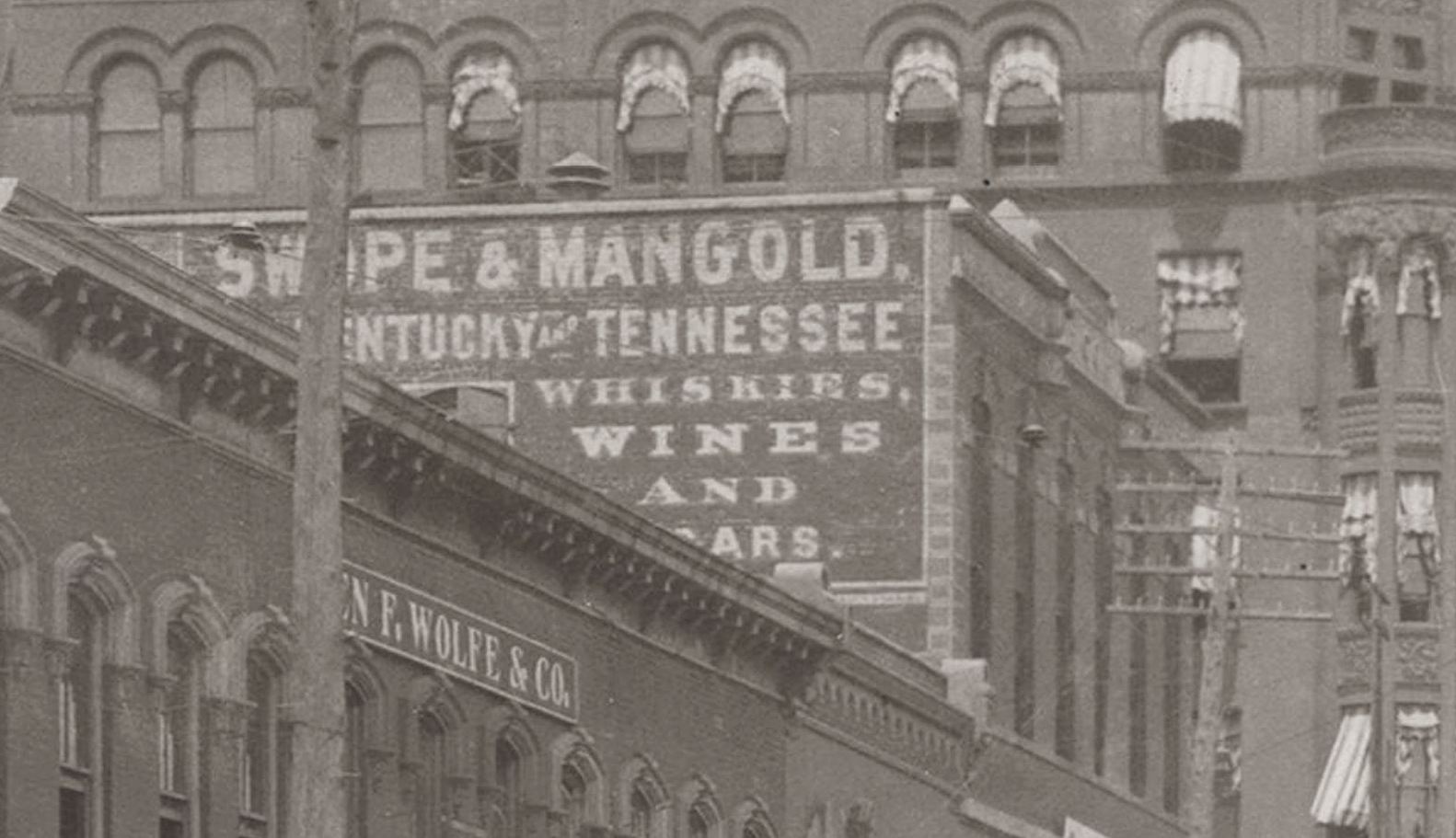
These “picture shows” were listed not by theater name (if they had one), but by owner or manager. (This was the era of nickelodeons, which were not so much “theaters” as “viewing rooms” — a great article from 1908 about the sudden surge in popularity of the nickelodeon — what they were and what they were like — can be read here.) The theater at 353 Main was owned by Charles B. Harris (usually referred to as C. B. Harris, who had previously worked as a wholesaler for the Edison Phonograph Co. a couple of doors down the block). When the picture above was taken, the Empire was showing movies at 353 Main, men were playing pool for 45¢ an hour at the New Brunswick Billiard Hall next door at 355 Main, and Bartholomew Lynch was running the Imperial Bar on the corner, at 357 Main.
DMN, April 13, 1907
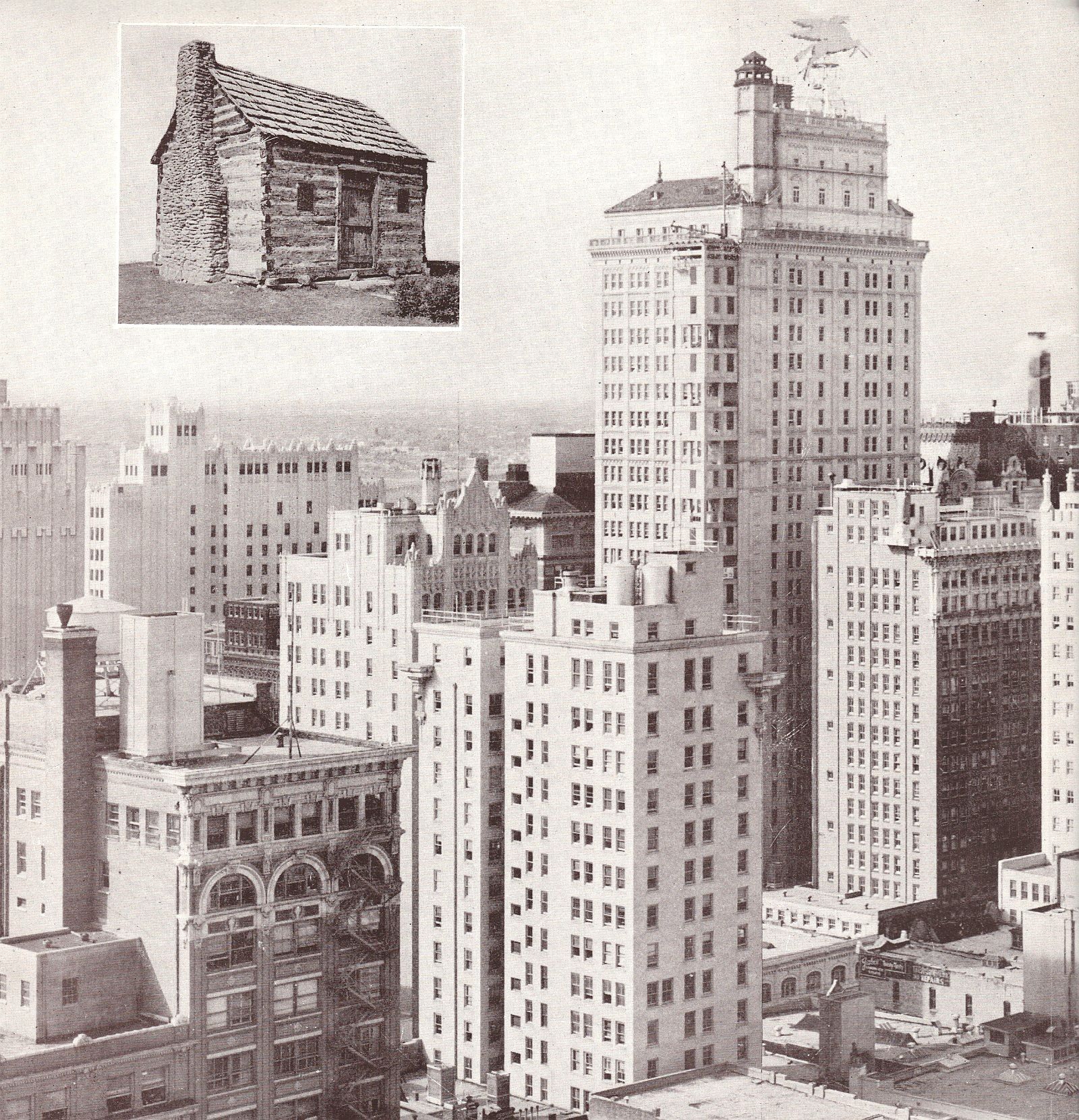
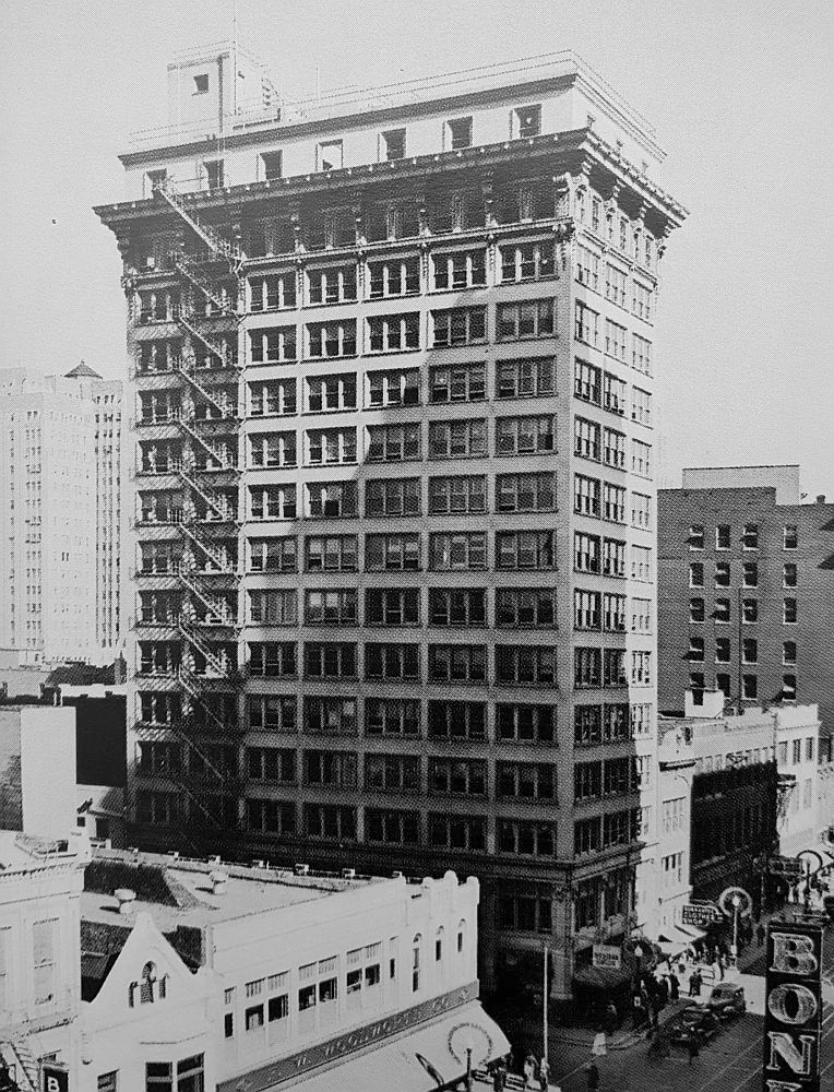
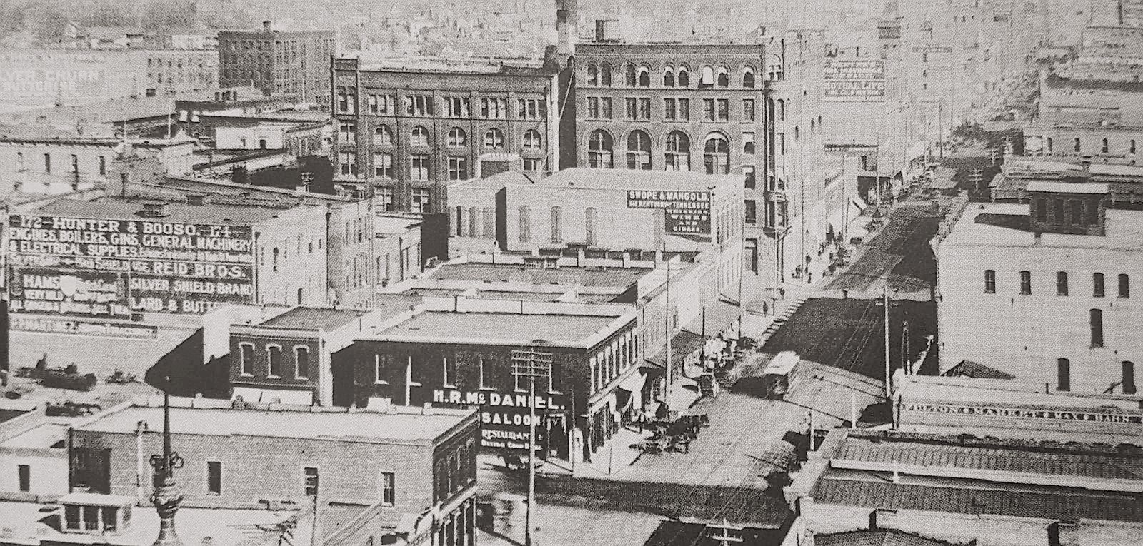
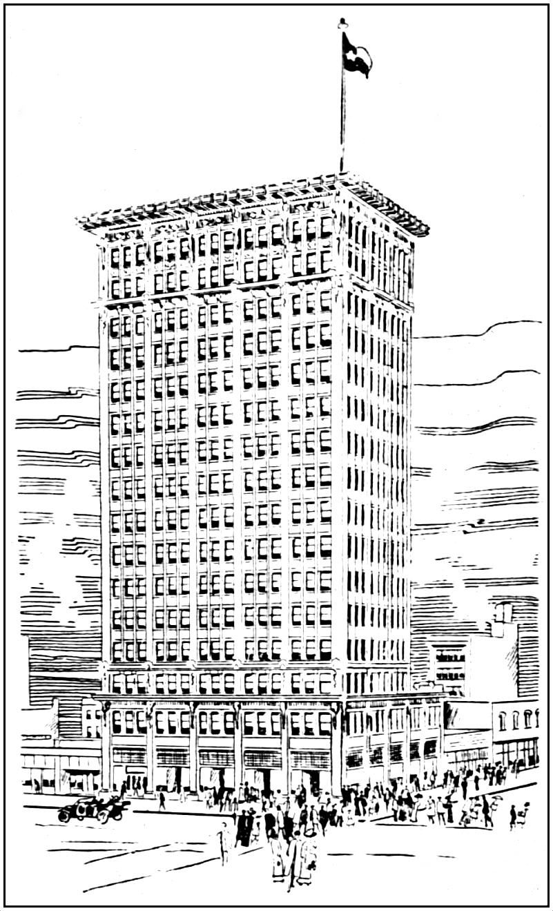
Construction of the C. W. Bulger-designed Praetorian Building — Dallas’ first skyscraper (14 stories!) — had begun in September, 1906. Here’s what it looked like in March, 1907:
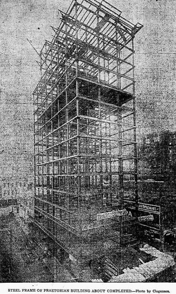
DMN, March 17, 1907
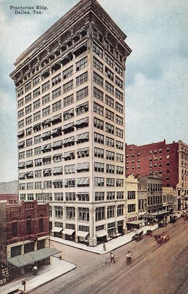
And here it is shortly after completion:
In January, 1909, C. B. Harris decided to expand up and into the space next door. The Empire Theater stopped showing movies, and in March, 1909, it became a venue for live stage productions.
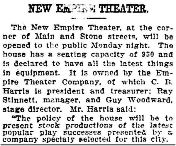
DMN, March 21, 1909
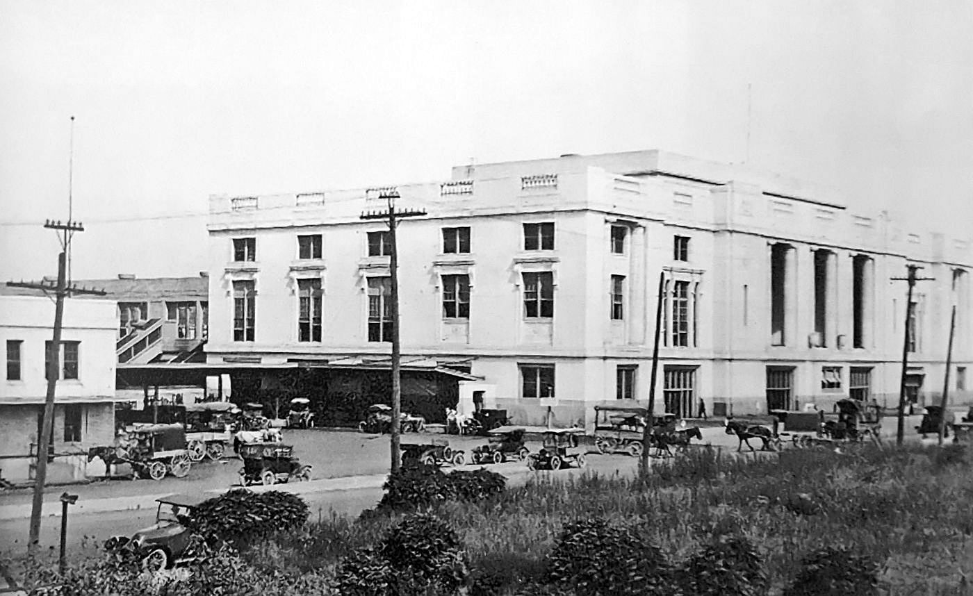
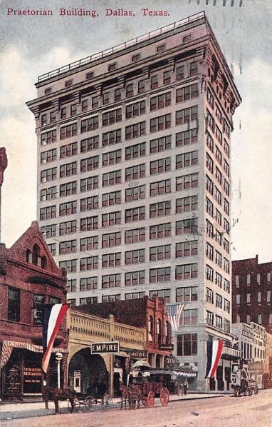
Here are a few photos showing the Empire and the finished Praetorian Building, around 1909. The first one may be one of the few to show the short-lived Colonial Theater (352 Main), a vaudeville house, across the street.
 via Flickr
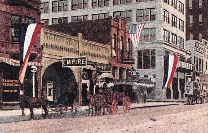
Here is another postcard view, showing the Empire (the detail of this image is at the top of this post).
Below, a detail of a larger photo, also from around 1909.

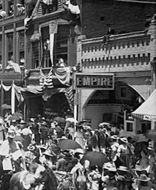
And below, a detail from a larger photo, with spectators watching a parade in August, 1909, showing the Empire with its new construction.
In December, 1909, Harris changed the name of the theater to the Orpheum — it became a vaudeville house.
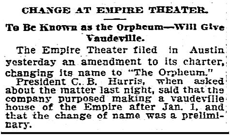
DMN, Dec. 14, 1909
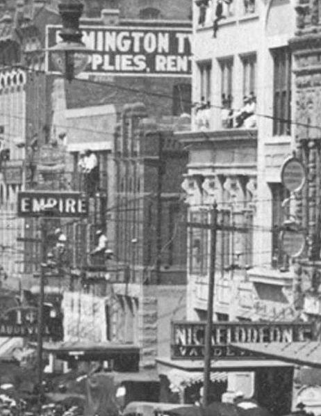
You can see the Orpheum Theater sign in this detail of a larger photo (click thumbnail on page to see full image). (Note that the Happy Hour Theater has taken over the Colonial’s space.)

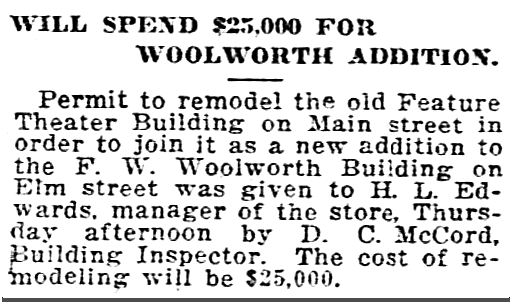
By 1914, the building’s address was 1521 Main (or, more specifically, 1521-23 Main), and ownership of the theater (which was now featuring “tabloid musical comedy”) had changed hands (to the Dalton brothers, who owned the Old Mill Theater). In October, 1914, the Daltons sold the theater. It was extensively remodeled and became the Feature Theater, a motion picture house (once again!).
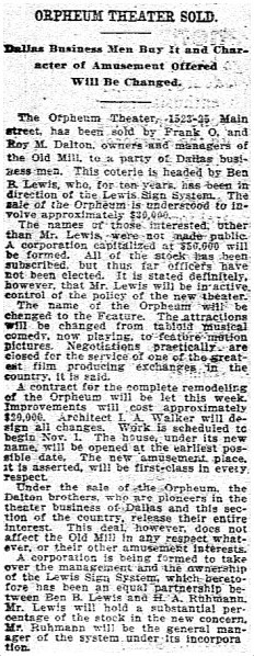
DMN, Oct. 18, 1914
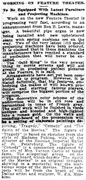
DMN, Nov. 15, 1914
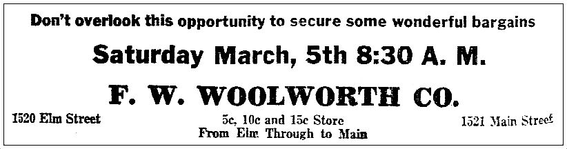
The Feature hung on through the Great War, but finally sputtered out in 1919. In 1920, Woolworth’s expanded into the space (they were already located on Elm Street, and the expansion afforded them entrances on both Elm and Main — and, I think, Stone. Woolworth’s had already been occupying the old Imperial Bar building on the corner when they took over the old Empire space (1525 Main). That was a big Woolworth’s store.
DMN, Dec. 24, 1920
 DMN, March 4, 1921
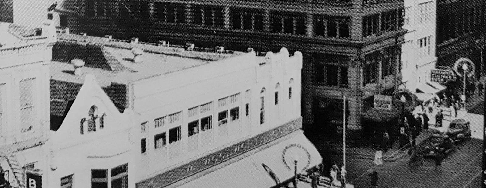
Here’s what our old pal, The Praetorian, and NKOTB, Woolworth’s, looked like around 1930.

Here’s Woolworth’s closer up — you can see how the two buildings (the old Empire and the old Imperial Bar) have been joined together a little oddly.
Here’s a street-level view from the 1940s.

via Dallas Public Library
Fast-forward to 1953: the Shaw Jewelry Company moved into the old Empire Theater space at 1521 Main.
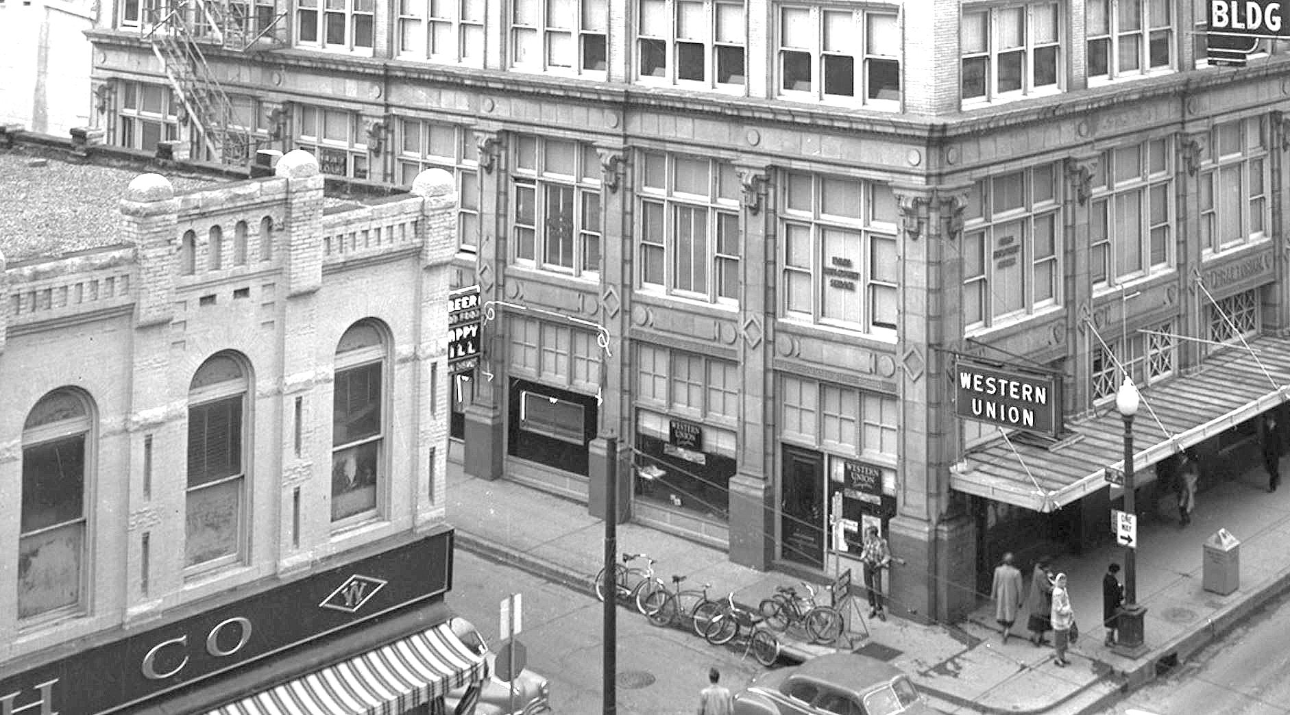
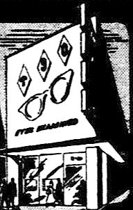
Meanwhile, next door, the old Imperial Bar space had become Texas State Optical. Sadly, someone thought it would be a good idea to wrap the original brick building (which has been estimated as having been built around 1895) in, I don’t know … aluminum siding? Here are before-and-after photos of that corner (Imperial Bar) building. It looked pretty good before TSO took over. (The detail below is from a Squire Haskins photo, via UTA — full photo is here — click thumbnail on UTA page to see a larger image). (I love the delivery boys’ bicycles parked at the curb outside the Western Union office.)
And here’s the same corner after “improvements” (this is another detail from another of Squire Haskins’ fab photos from the UTA collection — see the full photo here — click on thumbnail), circa 1950s.
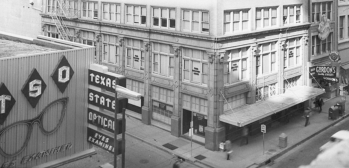
Oh dear. There should be a law….
1955 (ad detail)
Speaking of “oh dear,” a few short years after this, the Praetorian Building expanded and was … argh … “re-clad.” Here’s a shot of it, mid-cladding, about 1961 (Squire Haskins photo info from UTA here).
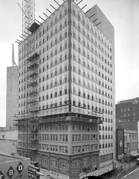
I believe it was … yellow.
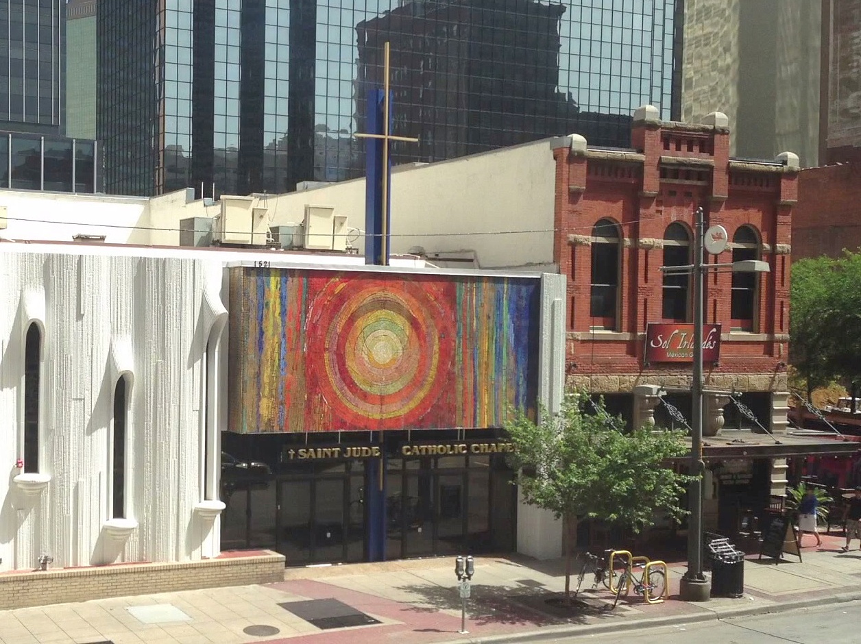
In 1968, the Saint Jude Catholic Chapel moved into 1521 Main — the old Empire Theater space. The front was adorned with a vivid mosaic by Gyorgy Kepes (I wrote about the mosaic here).
 via St. Jude Chapel website
The chapel is still there.
TSO — and later Pearle Vision — lasted at 1525 Main for years. In 2001, renovation and restoration efforts to develop Stone Place began. 1525 Main was restored as closely as possible to its original design and became home to a succession of restaurants (it has been occupied by Sol Irlandes for several years). ArchiTexas did a GREAT job with the building’s restoration!! (Read a 2001 Dallas Morning News article about this project — and about the historic 1525 building: “Historic Downtown Buildings To Be Restored — Shops, Restaurants Will Breathe New Life Into Stone Place,” DMN, Feb. 21, 2001.)
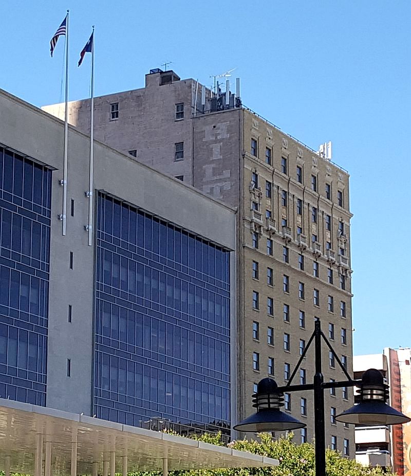
So. Back to the top photo. There’s good news and bad news. Empire Theater building: still there. Imperial Bar building: still there. But the Praetorian Building — the most historically important of the three? The fabulous “skyscraper” was demolished in 2013 and replaced by a giant eyeball. Here’s a 2012 Dallas Morning News photo of it in mid death spiral, being slowly dismantled.

See what this view looks like in the most recently updated Google Street View, here.
**
Interested in seeing the development of this block, as chronicled in Sanborn maps? Of particular interest is the northwest corner of Main and Stone — before 1911 the addresses of these two building were 353-355 Main and 357 Main; after 1911 the addresses changed to 1521-23 Main and 1525 Main. It appears that both buildings were built between 1892 and 1899.
- 1885 — not a lot in this block yet — but there is a well
- 1888 — a building has appeared one lot off Stone
- 1892 — that building from 1888 is now nothing but “ruins” — likely the result of a fire
- 1899 — the buildings we’ve been looking at in this post have appeared
- 1905 — C. B. Harris’ Empire would occupy 353 Main by 1907 — possibly by 1906 (in 1905, Harris was working three doors down, at 347 Main, as an agent for the Edison Phonograph Co.)
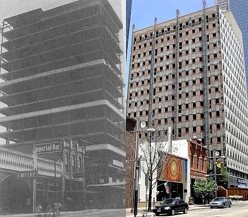
- 1921 — This map indicates that the 1521-23 building is two stories. Pictures going back to 1909 (see a couple above) seem to show three stories, but pictures of the building as part of Woolworth’s appear to show two floors (for comparison, the building on the corner at 1525 was two stories). So … what looks like a third floor on 1521-23 Main might be … architectural trompe l’oeil? Either that, or there was demolition and construction and demolition of the two-story building currently occupied by the St. Jude Chapel. This is confusing. Whatever the case, the renovation/restoration of these two buildings in 2001 shows them to look pretty much as they did in the top 1907 photo — once again, that original roofline is present. Below, the 1907 photo is on the left, a 2012 photo is on the right.
And here the buildings are today, minus the dearly departed Praetorian (RIP).
Pretty cool.
***
Sources & Notes
Top photo from the George W. Cook Dallas/Texas Image Collection, DeGolyer Library, Central University Libraries, Southern Methodist University; more info is here. (I have edited the image slightly — and rather poorly — please see link for original image.)
The photo and detail showing Woolworth’s, circa 1930, is from William L. McDonald’s book Dallas Rediscovered; photo credit cites Cushman & Wakefield, Inc.
Sources of all other images noted, if known.
For an entertaining history of the construction of the Praetorian Building (which had MANY detractors and doubters), read check the archives of The Dallas Morning News for the article by Kenneth Foree, “First Skyscraper Had Its Skeptics” (Oct. 27, 1948).
More on the Praetorian Building on Wikipedia, here.
*
Copyright © 2017 Paula Bosse. All Rights Reserved.

 “B-A-R-T-H-E-L-M-argh!”


 Squire Haskins, UTA Special Collections