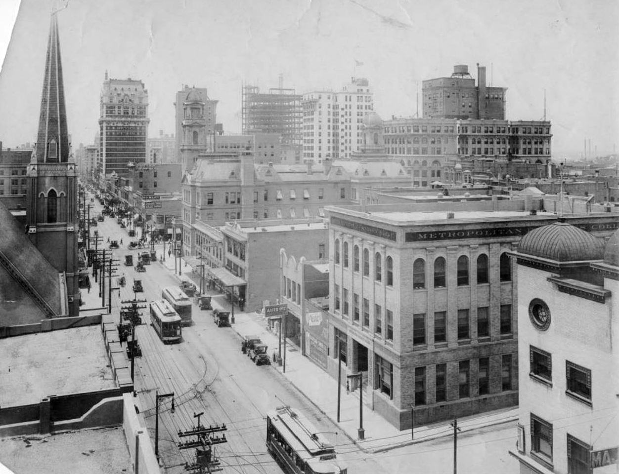
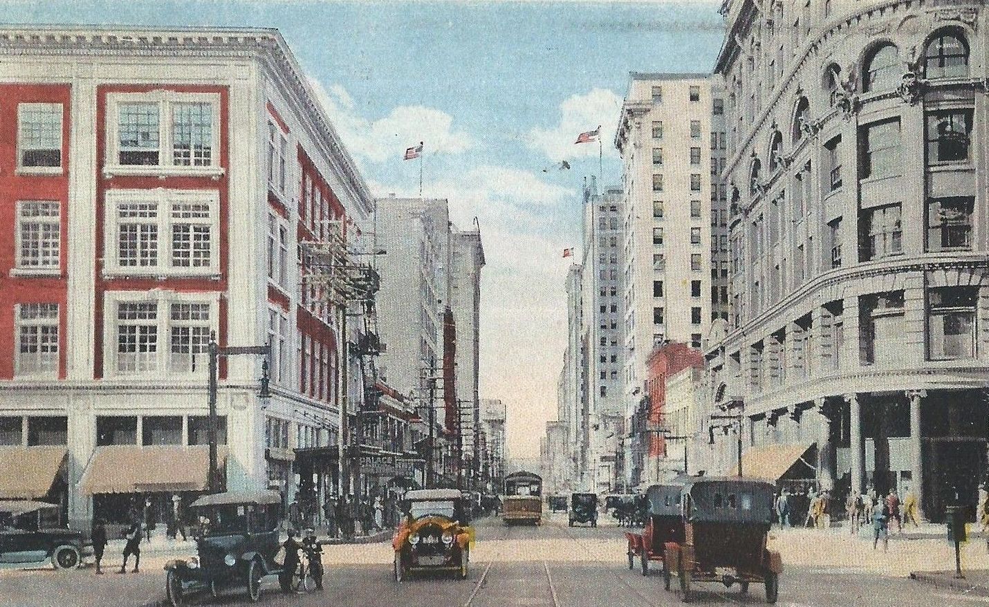
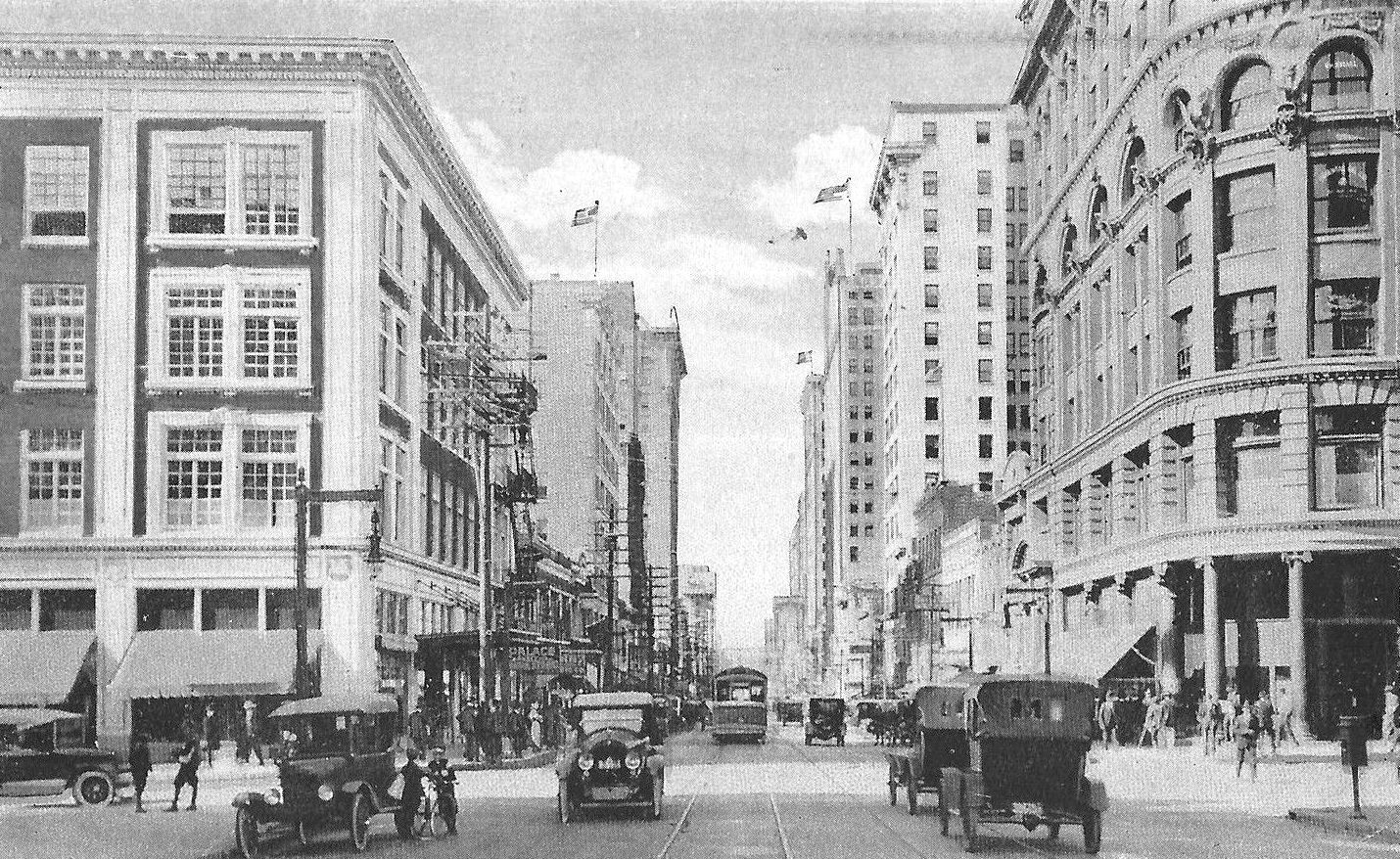
Main Street Looking East — 1920s
 East from the 1200 block of Main (photo courtesy Erik Swanson)
by Paula Bosse
This great photo (sent in by reader Erik Swanson) shows Main Street around 1925. The white building seen in the lower right is Hurst Bros., a men’s clothing shop, which was at the southeast corner of Main and Field (1300-1304 Main). It was a little confusing to me at first because it looks like there is a street behind it (to the south), which would have been Commerce, but then the Magnolia Building and the Adolphus would all be out of place. But what appears to be a street was just a wide alleyway/passage (seen on the 1921 Sanborn map here — Main east of Akard can be seen on the Sanborn map here).
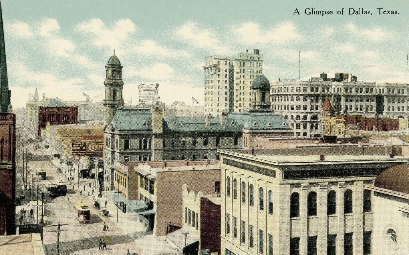
The very tall building is the Magnolia, at Commerce and Akard (it opened in 1922 — Pegasus wasn’t added until 1934); to the right, across Akard, is the Adolphus Hotel and the Adolphus Annex. The tall building to the left of the Magnolia is the Southwestern Life Building (southeast corner Main and Akard, demolished in 1972, now a small open plaza area). The 4-story building at the southwest corner of Main and Akard is the Andrews Building. The white building in the center is Hurst Bros. (southeast corner Main and Field), and across Main can be seen the sign for the men’s clothing shop Benson-Semans.
Hurst Bros. was gone by 1929 when it became Hoover-Lehman, another clothing store, and Benson-Semans appears to have vacated that space around 1926, helping to date the photo between 1922 and 1926.
*
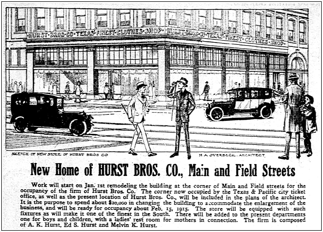
The Hurst brothers, Melvin K. Hurst and Edgar S. Hurst (along with their father, Alfred K. Hurst) began their men’s clothing business around 1912 and moved into the building seen in this photo in 1915 (it was renovated by prominent Dallas architect H. A. Overbeck, whose still-standing courts building and jail was built at about the same time). The business was dissolved in 1929, and its stock, fixtures, and lease were acquired by a longtime employee who, with a partner, remodeled the store and reopened it as the Hoover-Lehman Co. (A present-day Google Street View of this southeast corner of Main and Field can be seen here.)
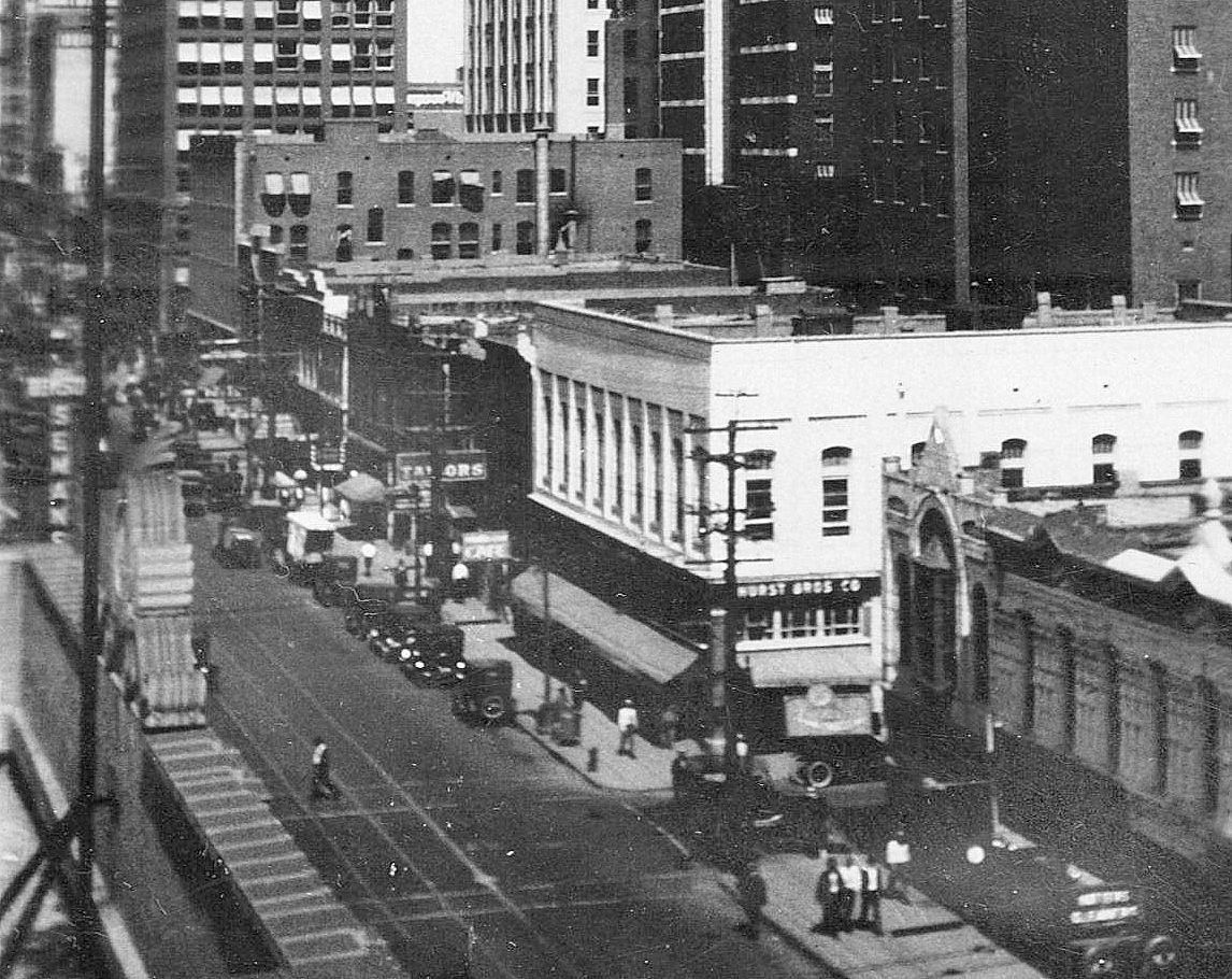 Detail from top photo, ca. 1925 (click for larger image)
 Ad from Nov., 1914
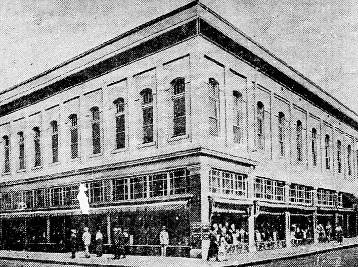 Late 1920s
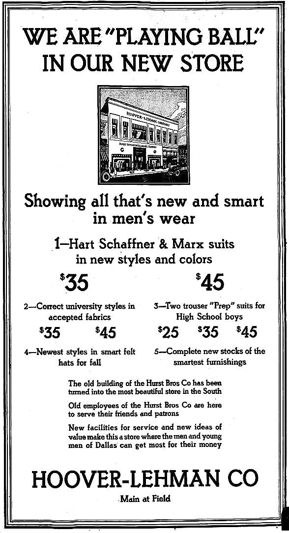 Sept., 1929
***
Sources & Notes
Top photo sent in by Erik Swanson, used by permission. The photo may have been taken by his grandfather, F. V. Swanson, an optometrist (see the post “Thompson & Swanson: ‘The Oldest Exclusive Optical House in Dallas,” here). Thanks for the great photo, Erik! (Update: Sadly, local music favorite Erik Swanson died on Feb. 16, 2021 at the age of 57 — he had been suffering from ALS. RIP, Erik. And thanks for the great music.)
All images are larger when clicked.
*
Copyright © 2018 Paula Bosse. All Rights Reserved.