Flashback : Dallas

A Miscellany: History, Ads, Pop Culture

Category: Downtown

The Official Government Reenactment of the Kennedy Assassination — Nov. 27, 1963

reenactment_agent-at-window
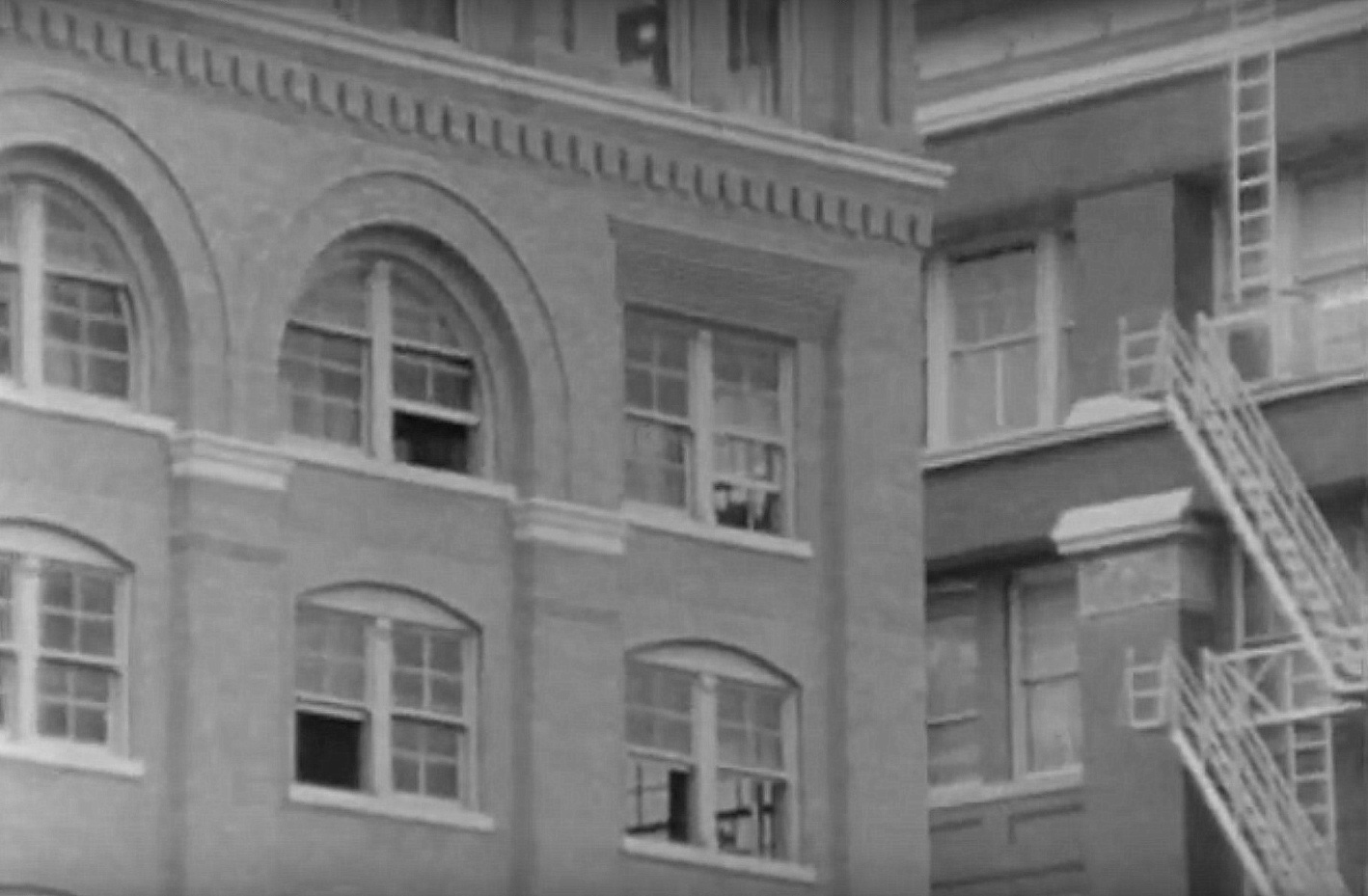
Agent Howlett at window with “rifle”

by Paula Bosse

Yesterday I received a comment on a previous post I wrote about the first official reenactment of the Kennedy assassination, and that got me to wondering if that film was online anywhere. The film was made as part of the Secret Service investigation and was filmed in Dealey Plaza and in the Texas School Book Depository; the motorcade sequence was filmed on November 27, 1963, just five days after the assassination. Even though my knowledge of the events of November 22 is fairly limited (and what I do know is mostly due to osmosis), just growing up here you kind of feel you’ve seen everything connected with the assassination. But I’d never seen this film or the one made a few months later with the production assistance of local TV station KRLD, which included much of the same footage. Apparently, the original film had not been made public until fairly recently.

It’s very interesting to watch, and the fact that there is no sound makes it appropriately eerie. I have to admit that I was most interested in seeing the footage of downtown streets. And the interior of the Texas School Book Depository beyond just the “sniper’s nest” we always see. (I can now say I’ve sneaked a peek inside the depository’s employee lunchroom.)

So here are the two films. The first one was made by the Secret Service, with the Dealey Plaza reenactment filmed on Nov. 27, 1963. It has no sound. I thought it was interesting, but a lot of people might find it a little dull and repetitive. Below this video is one which uses this footage to lay out the government’s findings, with lots of details and no-nonsense narration by KRLD’s Jim Underwood. (I’m not sure why — or for whom — this educational film was made. It doesn’t seem to have been screened for the public.) The silent film has more footage, but the narrated film is easier to follow. And below that are screenshots from the government’s “reconstruction.” (UPDATE, Jan. 2024: The two videos I had originally linked have been removed from YouTube. I’m linking a video I found recently below.)

*

Below, a few screenshots from the government footage. The one at the top of this post shows Special Agent John Joe Howlett sitting at the sixth-floor window, as if holding a rifle.

Below, Elm St. looking east from Dealey Plaza, with the white Records Building at center right.

reenactment_elm*

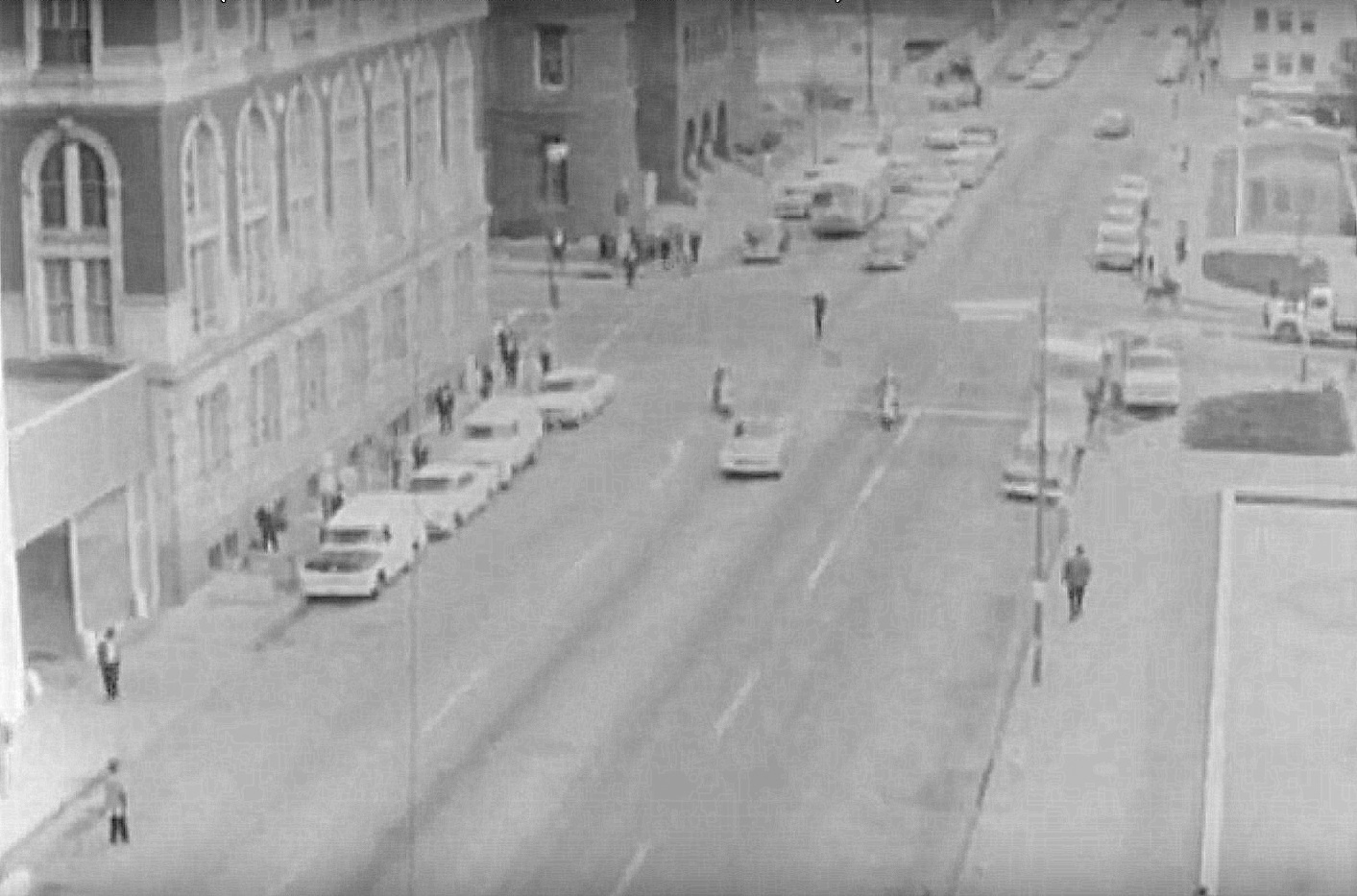
The one-car-two-motorcycle motorcade turning from Main onto Houston St. Looking south from … you know where.

reenactment_houston-st*

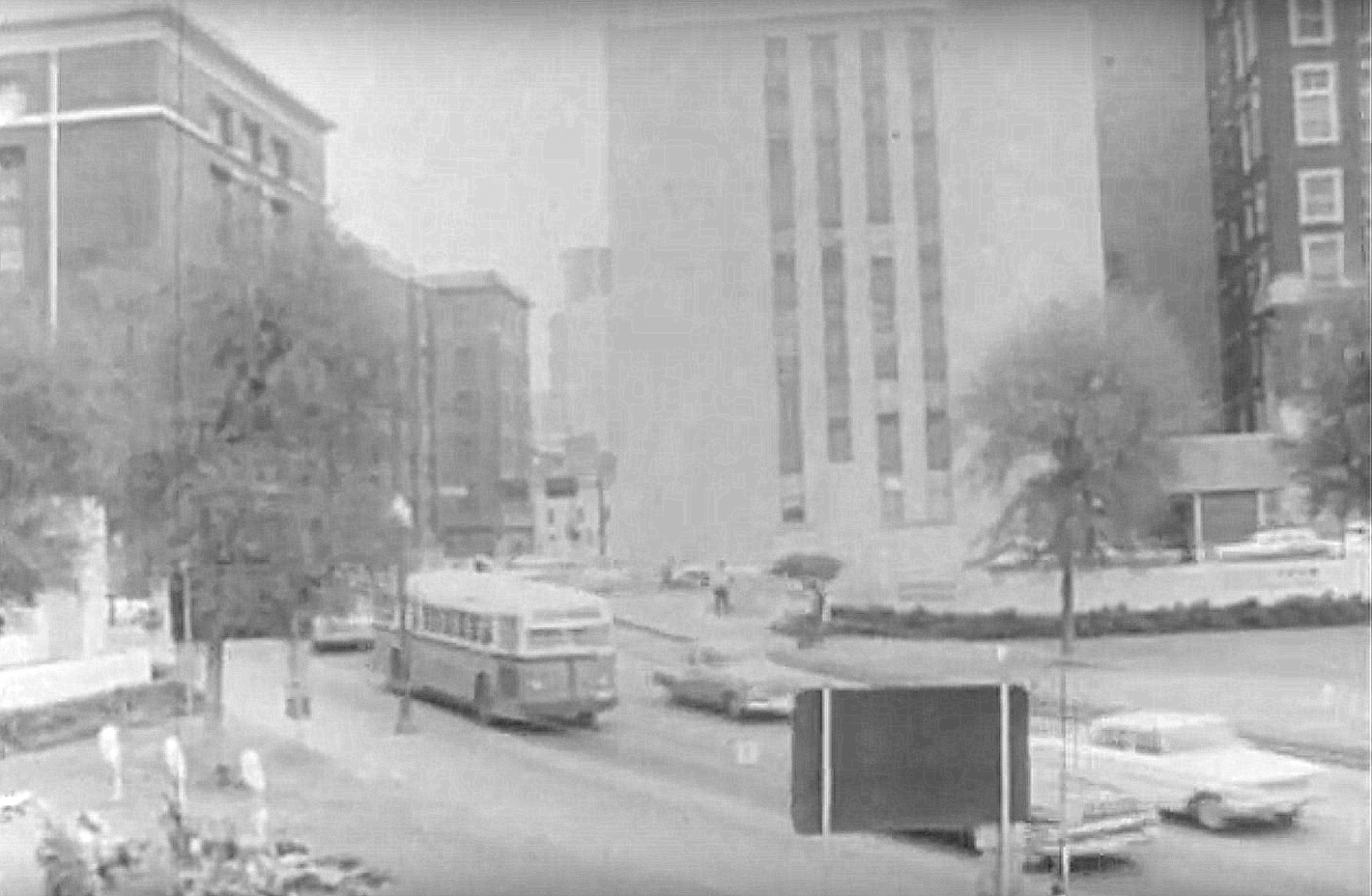
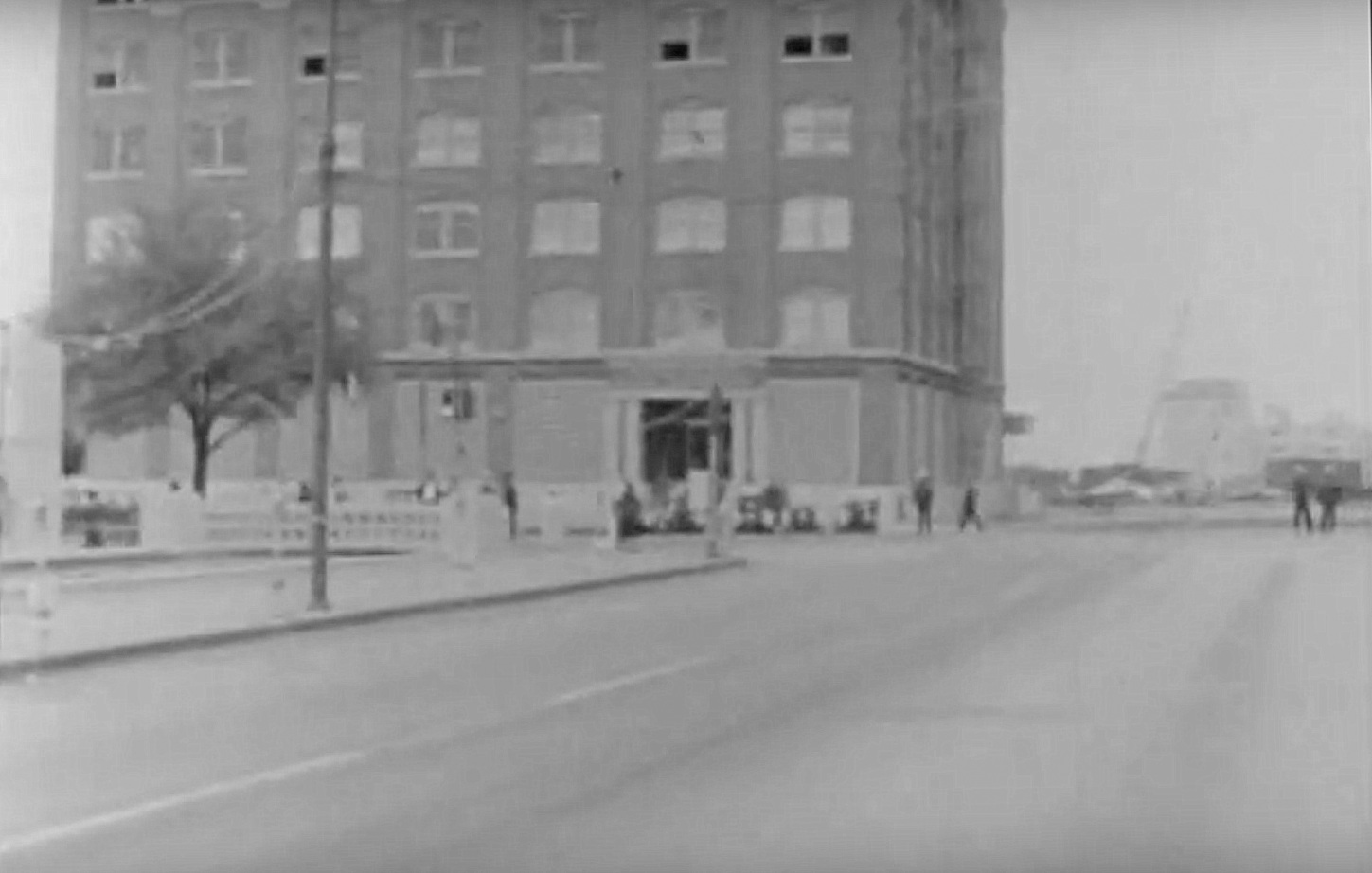
Houston St. looking north, with the School Book Depository on the left and a disconcertingly empty space straight ahead.

reenactment_houston-st-north*

A nice artsy shot of the book depository and the old John Deere Building.

reenactment_tsbd-ext*

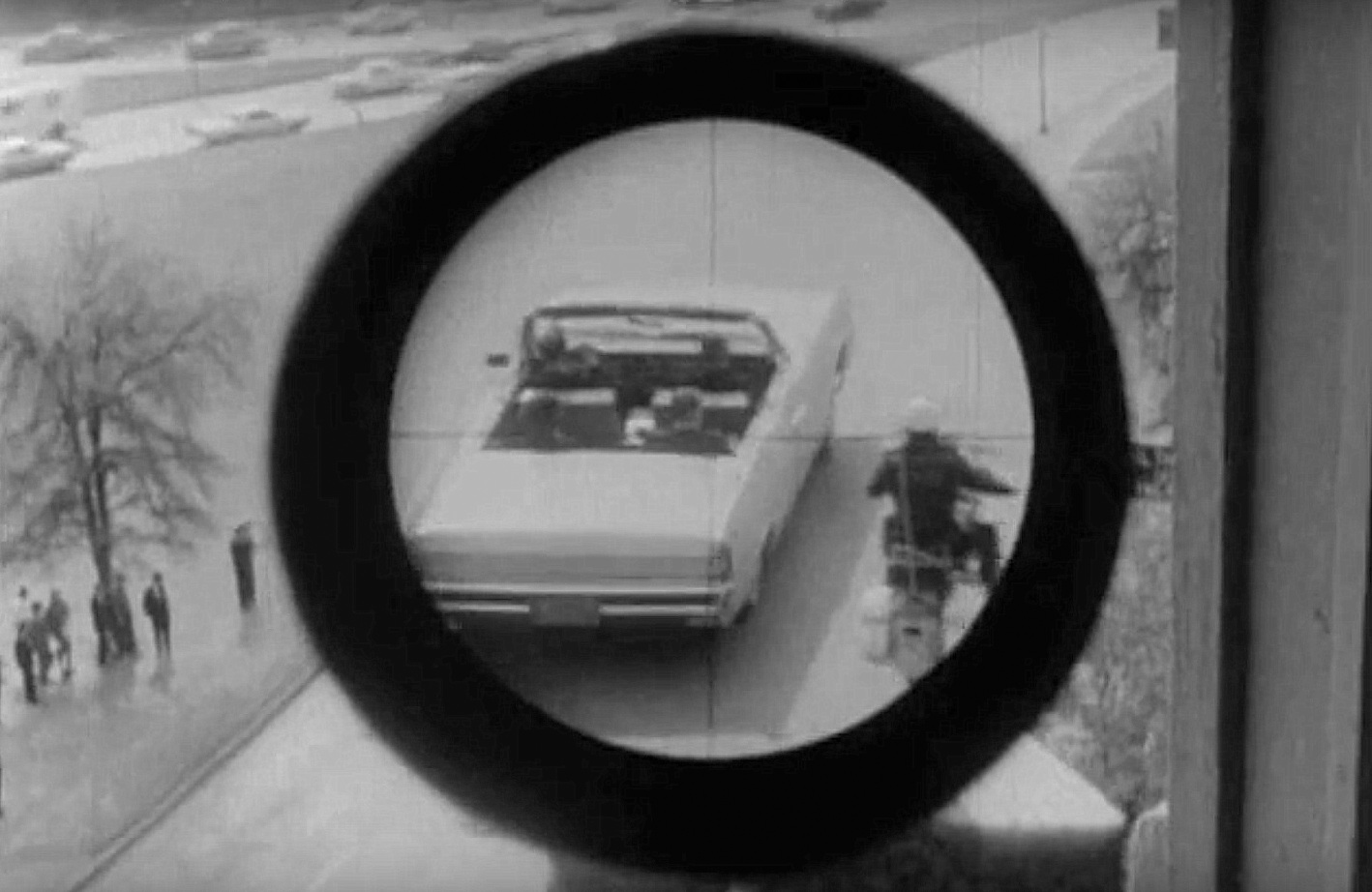
Camera with “scope” attachment.

reenactment_scope*

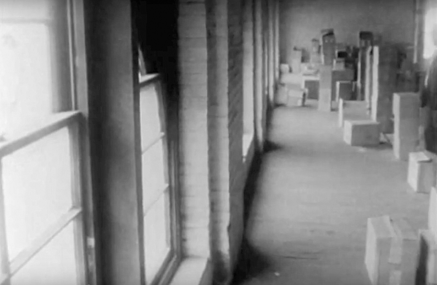
Windows, boxes, looking toward the west end of the building from the “nest” end of the sixth floor.

reenactment_tsbd-int*

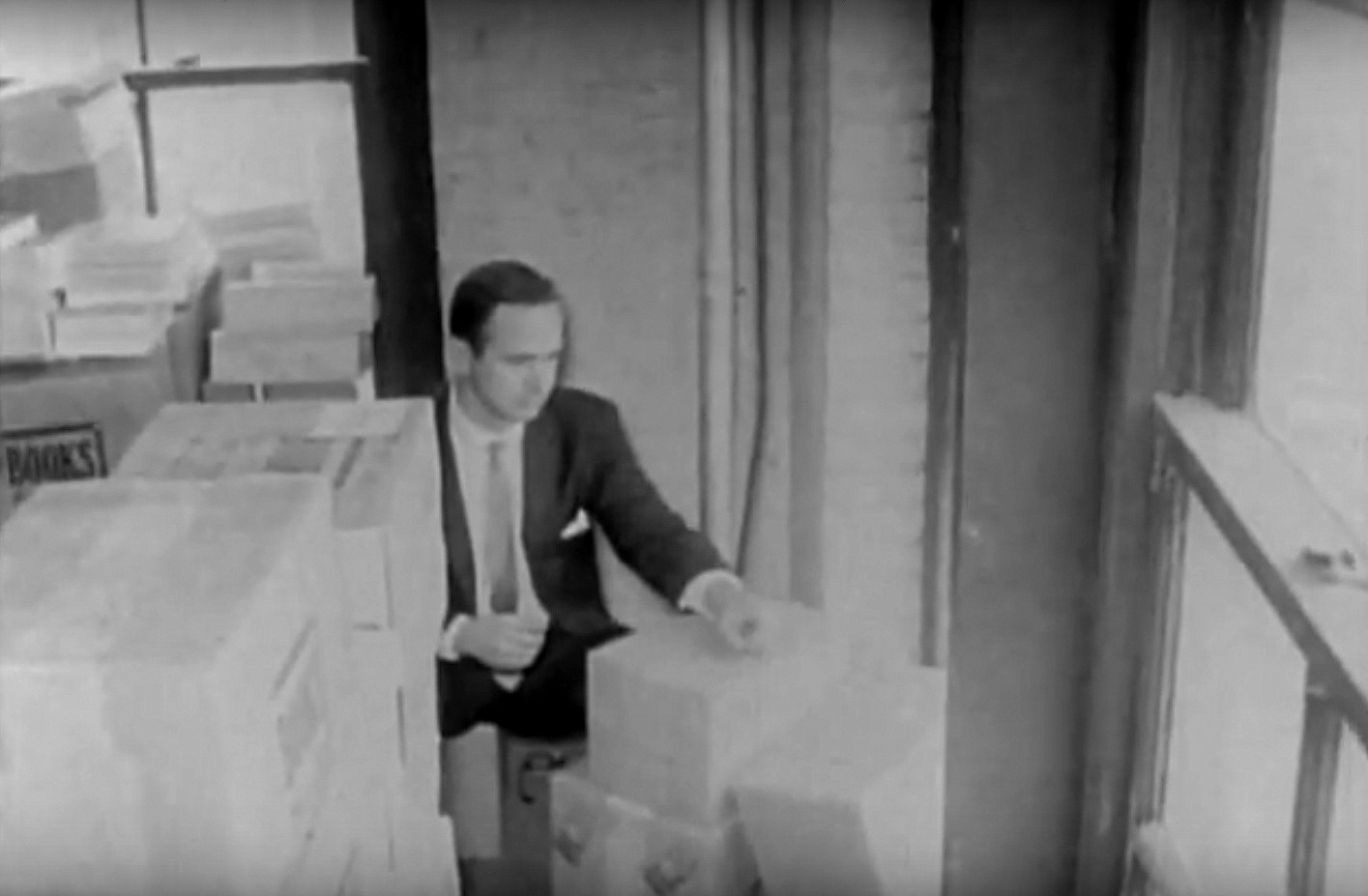
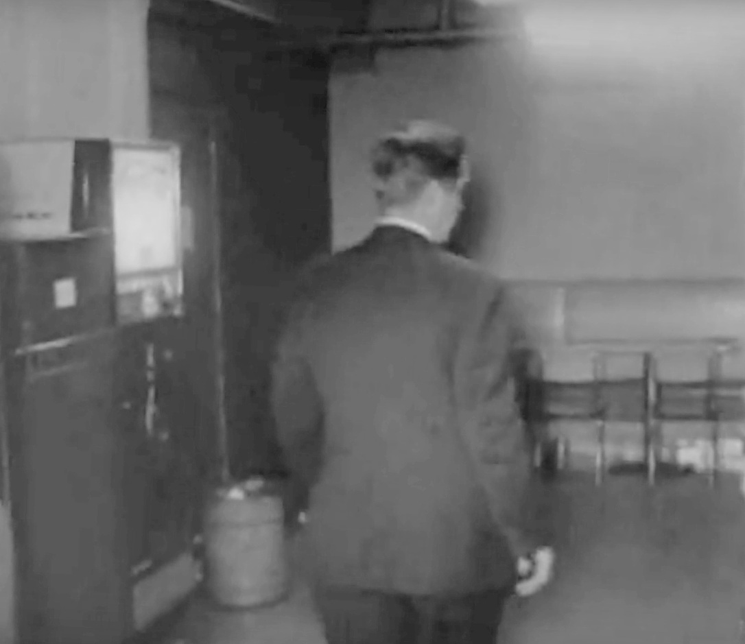
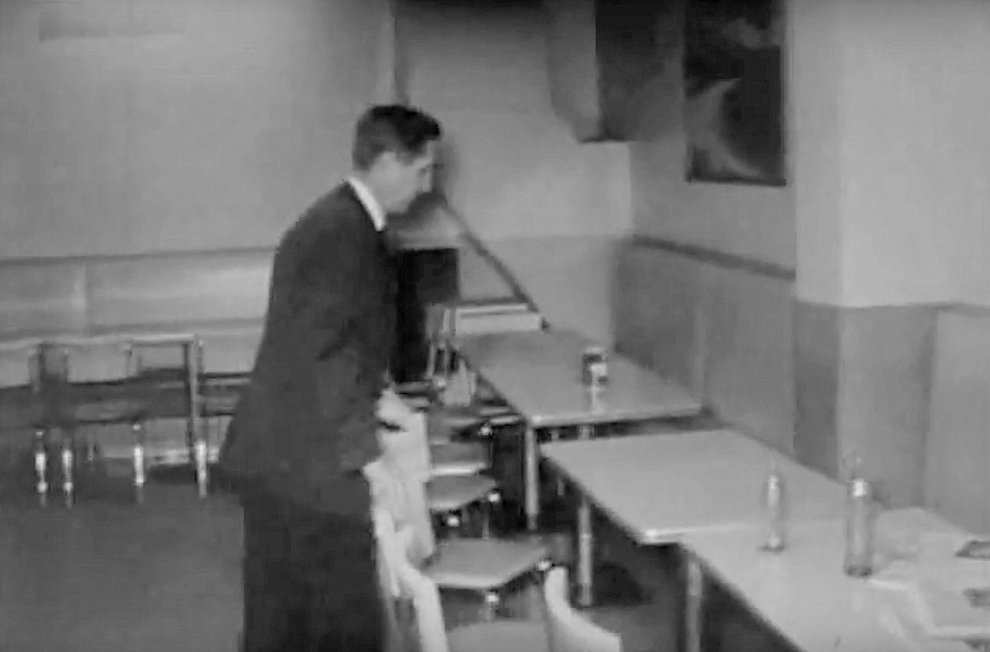
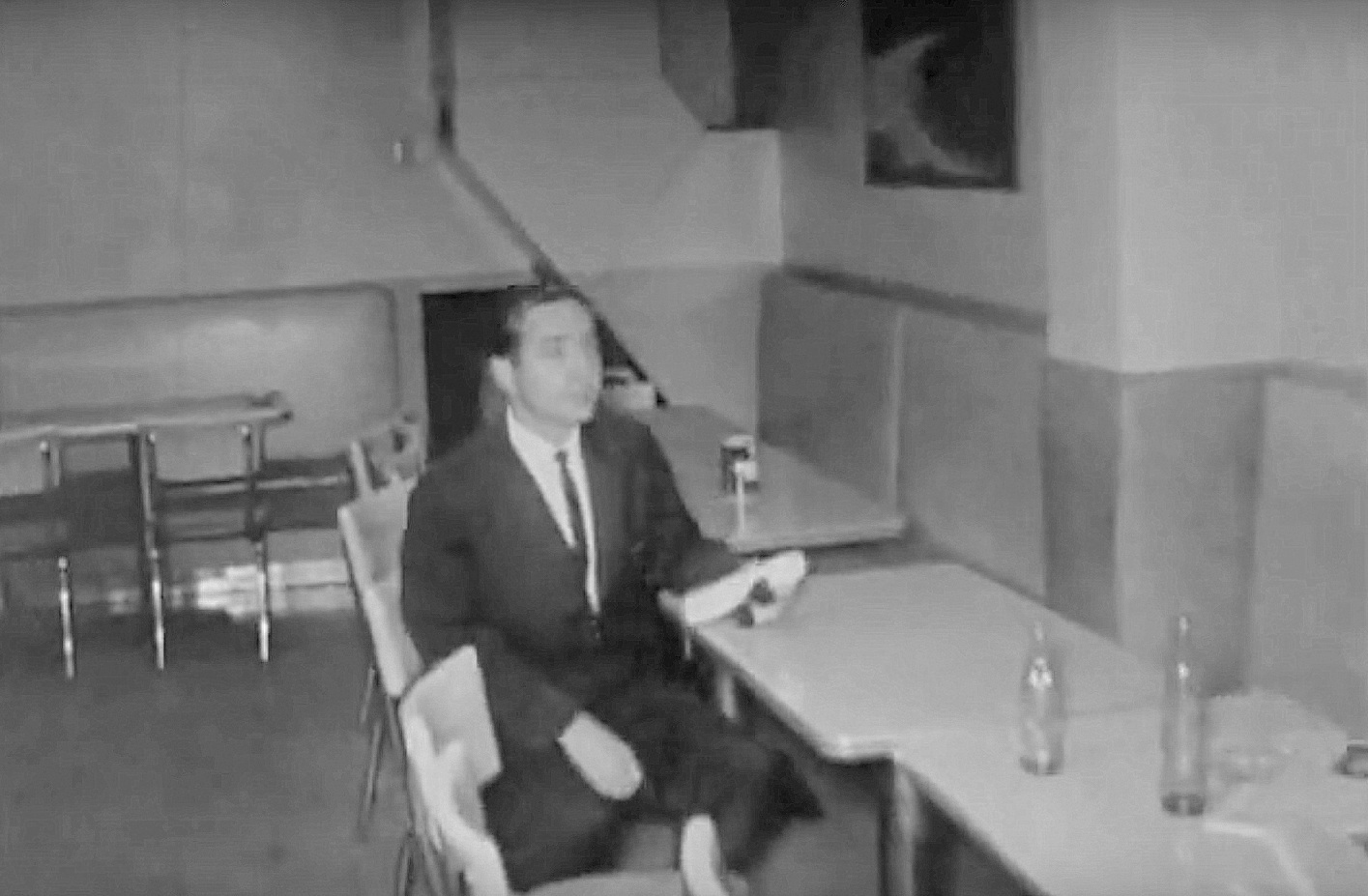
A trip to the second-floor lunchroom, with its vending machines which are, apparently, important in Lee Harvey Oswald’s alibi. These images show Special Agent Talmadge Bailey walking past the vending machines and sitting at a table.

reenactment_tsbd-bldg-lunchroom1

reenactment_tsbd-bldg-lunchroom2

reenactment_tsbd-bldg-lunchroom3

***

Sources & Notes

See Dallas Times Herald photographs that were shot while the Dealey Plaza “reenacting” was going on in my previous post, “The First JFK Assassination Reenactment — 1963,” here. (As for the comment that started me off on this, I’m still not sure whether the cameramen in the car are KRLD employees or not.)

*

Copyright © 2016 Paula Bosse. All Rights Reserved.

Commerce & Record Streets — 1946

streetcar_commerce-record_051046_ceraCommerce St. looking east from Record (click for huge image)

by Paula Bosse

If it’s a photo of downtown in the ’40s, with people on the streets, retail storefronts, and streetcars, I’m going to love looking at it. Like this one. A lot of people might be hard-pressed to identify the location of this photograph, even if they were standing in the exact spot the photographer stood in. If you look at today’s view from the same vantage point (here), just about everything in the immediate foreground (west of the Pegasus-topped Magnolia Building) is gone — except for, most notably, the beautiful MKT Building at Commerce and Market, one of my favorite downtown buildings.

This is the intersection of Commerce and Record streets, when Record still extended from Elm to Jackson; the Old Red Courthouse was behind the photographer, to the left. Today, the Kennedy Memorial is at the left where the people are waiting for a streetcar; the George Allen Courts Building is across the street — at the right, in the block with the travel bureau; and the block containing the Willard and Davis Hat building — across Commerce from the Katy Building — is now a parking lot.

As with every photograph like this I see, I wish I could step into it and walk around the downtown Dallas of 1946. Maybe pop into Ma’s Cafe for a Dr Pepper before I hop on a streetcar and just ride around on it all day until someone kicks me off.

*

Below are a couple of magnified details (both are much larger when clicked).

streetcar_commerce-record_051046_cera-det1

streetcar_commerce-record_051046_cera-det2

Below is a listing of the businesses in this 600 block of Commerce, between Record Street and the MKT Building.

600-block-commerce_1945-directory1945 Dallas directory

(The tall building on the right with the travel bureau on the ground floor is the Plaza Hotel at 202-204 Record Street. The Yonack Liquor Store on the corner is at 200 Record, with entrances on both Commerce and Record.) 

Here’s a detail of a photo taken about the same time, showing an aerial view of Commerce Street.

aerial_commerce-st_1940s_foscue-lib_smuFoscue Map Library/SMU

***

Top photograph was taken on May 10, 1946 by Richard H. Young; it can be viewed on the CERA (Central Electric Railfans’ Association) website, here. (If you’re interested in Dallas streetcars, this page has some GREAT photographs!)

The caption of the photo from the above website: “May 10, 1946 — New Dallas Railway & Terminal Co. double-end PCC car 620, at speed, southbound, turning into Record St. from Commerce St. (Ervay-7th Line).”

The aerial photo was taken by Lloyd M. Long in the 1940s and is titled “Downtown Dallas looking east (unlabeled); it is from the Edwin J. Foscue Map Library, Central University Libraries, Southern Methodist University. This is only a small portion of the full photograph — the full photo is here.

Since there is an exact date for this photo, here is a large Skillern’s ad from that day’s newspaper. Coincidentally, there was a  Skillern drugstore on the northeast corner of Commerce and Record — it is in this photo, behind the lamppost at the bottom left. Let’s see what was on sale May 10, 1946. (I would kill for a set of those Pyrex bowls!)

skillerns-ad_dmn_051046

And, lastly, who doesn’t love a map?

map_commerce-and-record_1952-mapsco 1952 Mapsco

Everything is bigger when clicked!

*

Copyright © 2016 Paula Bosse. All Rights Reserved.


The 101 Bar: Patrick Hannon, Prop. — ca. 1917

101-bar_ca-1917
Pat Hannon’s dreams are about to be dashed…

by Paula Bosse

The 101 Bar was located at 323 North Ervay, on the southwest corner of Ervay and Bryan — it is now the site of Thanksgiving Square. The owner was Patrick Hannon who had worked in saloons in Dallas from at least 1908. The bar pictured above opened around 1917 but lasted only a few months — by the time the 1918 directories were printed, 323 N. Ervay was listed as “vacant.” Pat had worked his way up the competitive saloon trade in Dallas, from bartender to owner, only to be cut down by Prohibition. Had Prohibition not gone into effect in 1918 (with Dallas County voting to start even earlier, in October, 1917), this fine-looking  bar might have had a long, boozy life. Pat disappeared from the directory completely in 1918, but he was back in 1919, with a new occupation: butcher. Meat-cutting is all well and good and certainly pays the bills, but I bet in his idle moments, Pat’s thoughts turned to daydreams of his old Ervay St. bar.

The 1917 Dallas directory showed 183 bars operating in Dallas; the next year, zero.

Bad timing, Pat.

***

Sources & Notes

I’m not sure where the photo came from — some random web page, I think.

Why did Dallas County go dry so early? Because of a “local option” vote in September 1917. The city of Dallas voted against it, but the surrounding communities voted overwhelmingly FOR it. (You could still drive over to Fort Worth for legal beer and hooch, though.) Election results below (click for larger image). 

prohibition_local-option_dmn_102017Dallas Morning News, Oct. 20, 1917

How were things faring a year later?

probibition_dallas-co_dmn_102018DMN, Oct. 20, 1918

This has been a rather tenuously-associated St. Patrick’s Day post (Irish name, bar, green border), but … Happy St. Patrick’s Day!

*

Copyright © 2016 Paula Bosse. All Rights Reserved.

Woodall Rodgers Freeway Under Construction — 1966

woodall-rodgers_squire-haskins_uta_052466
Land cleared, May 1966 (click for gigantic image) (UTA Libraries)

by Paula Bosse

The photo above shows land partially cleared for the construction of Woodall Rodgers Freeway. The view is to the east, with Central Expressway at the top left and Stemmons Freeway at the bottom left. The land cleared was once part of what used to be called “North Dallas,” and before it was bulldozed away, it was a predominantly black residential neighborhood served by several African-American- and Hispanic-owned businesses. The photo above was taken on May 24, 1966. The photo below was taken on December 8, 1966. The freeway was already years behind schedule when these photos were taken, but nobody would ever have believed it would take until 1983 (!!) for Woodall Rodgers Freeway — a “cute” little highway, less than two miles long — to be completed. Oh, but it did.

woodall-rogers-squire-haskins-uta-120866Dec. 8, 1966 (photo by Squire Haskins; UTA Libraries)

In a Dallas Morning News article published on the May 27, 1983 opening of the freeway, Henry Tatum wrote the following:

Dwight Eisenhower was starting his second term as president of the United States. Elvis Presley had passed his physical examination and was headed for a stint in the Army. And Doris Day was singing up a storm on the screen in “Pajama Game.” The year was 1957 and Dallas city fathers decided it was time to build a downtown connection between Central Expressway and Stemmons Freeway. (“Freeway From the Past” by Henry Tatum, DMN, May 27, 1983)

1957!

When it was completed 26 years later — in 1983 — Ronald Reagan was president, Sally Ride was about to become the first woman to go into space, and Madonna was singing up a storm as her first album was being readied for release. That’s a looong time.

***

Sources & Notes

Both aerial photos by Squire Haskins, from the Squire Haskins Photography, Inc. Collection, UTA Libraries, University of Texas at Arlington. The photo from May can be accessed here, the one from December, here.

“Woodall Rodgers”? James Woodall Rodgers was mayor of Dallas from 1939 to 1947. It was announced that what would become a never-ending headache-of-a-highway-project bedeviled by funding squabbles and right-of-way issues would be named in his honor in 1960.

Those two photos are really, really big when you click them. …REALLY big.

*

Copyright © 2016 Paula Bosse. All Rights Reserved.


When Every Skyscraper Was a Distinctive Landmark

skyline_akard-royalSoak it in…

by Paula Bosse

I love this photo, taken from the southern edge of downtown, at S. Akard (running from left to right in the photo) and Royal, a street which once ran one block north of Canton (map below). Today, the convention center would be behind the photographer, and the I. M. Pei-designed City Hall would be pretty much straight ahead. I’m always going to prefer the grittier-looking downtown Dallas of days gone by to today’s shinier, glitzier version. I couldn’t get the exact angle, but today’s view from more or less the same vantage point looks like this, and it just isn’t as interesting. (I’ve never actually heard anyone broach the topic, but am I the only one who thinks that Pei’s City Hall now looks weirdly and hopelessly dated? Kind of tired and stuck in the ’70s? If nothing else, those yucky white flagpoles out front need to go!)

When this photo was taken, you could actually still see all those famous buildings — before they were dwarfed and engulfed by all those over-eager underclassmen!

***

Sources & Notes

Photo from a site managed by Andrew K. Dart, full of photos from negatives he rescued when they were thrown out by KDFW-TV, many from the archives of KRLD. This photo is from a page of Dallas skyline photos, here.

Here’s a map that shows S. Akard and Royal streets, which Mr. Dart identified as being the intersection seen in this photo by zooming in on the street sign (click for larger image):

map_akard-royal_1952-mapsco1952 Mapsco

*

Copyright © 2016 Paula Bosse. All Rights Reserved.

Meet Me In Front of The Rialto — 1945

rialto_MPH_072845“A great big howl of a hit!” (click for larger image)

by Paula Bosse

This photo shows the front of the Rialto theater, once located at Elm and Stone. I love the unavoidable promotion for the Jack Benny movie “The Horn Blows at Midnight,” but I love all that street life even more. And by the way, “Help Keep Dallas Clean”!

***

Photo from the July 28, 1945 issue of Motion Picture Herald.

My favorite young movie-crazy Dallas diarist, Muriel Windham, would absolutely have walked past this (she probably didn’t see it, though, because she wasn’t a big fan of Jack Benny). (For the record, I LOVE Jack Benny!)

Click photo for gigantic image.

*

Copyright © 2016 Paula Bosse. All Rights Reserved.

Dallas’ Mid-Century Skyline

skyline_statler_mercantile_republic_ebayBack then: more sky, fewer parking lots (click for larger image)

by Paula Bosse

Dallas architecture at mid-century: the Mercantile Bank Building, the Republic Bank Building, the Statler-Hilton (from behind!), and … a multi-level parking garage. Dallas is nothing if not a city full of banks, banks (and more banks), flashy hotels, and parking lots. Then and now.

***

Slightly fuzzy postcard from eBay. The Statler-Hilton (which this postcard identifies as the “Hilton-Statler”) isn’t often seen from behind like this in photos (not really its best side). Other than the three main buildings (and the old library, which is as architecturally cool as the other three), I think that just about everything else in this photo is gone. There are now parking lots (…yay…) where the buildings at the right and at the bottom left are seen — there’s even a parking lot where the parking garage once stood! (Dallas really loves its parking lots.) At least we managed not to tear down the most architecturally significant buildings seen here. (Even though the number of downtown parking spaces could be exponentially increased if we pulled those suckers down and replaced them with multi-multi-story garages!)

*

Copyright © 2016 Paula Bosse. All Rights Reserved.

Main & Murphy — ca. 1907

city-national-bank_postcard_bwMain St. looking east

by Paula Bosse

Above, Main Street looking east, taken from Murphy, anchored by the beautiful City National Bank, built in 1903. This block today? One Main Place.  Whatever old buildings were left in this block in 1965 (including the old City National Bank) were bulldozed into oblivion to make way for the skyscraper.

The same view today:

one-main-place_google_2015Google Street View, 2015

***

Sources & Notes

Top image from a postcard found on eBay.

Imagine looking up to the sky from the photographer’s vantage point in the top photo and seeing what things would look like a century later.

Murphy no longer exists — it was between what is now Griffin and Field. A map from 1898 showing the location:

main-murphy_1898-map

See another photo of the same view taken at about the same time, only with horse-and-buggy traffic, here.

*

Copyright © 2016 Paula Bosse. All Rights Reserved.

A-Bomb in Akard Street! — 1950

mcgrath-frank_atomic-aftermath-downtown-dallas_1950See Pegaus up there in the cloud of smoke and debris? (click for larger image)

by Paula Bosse

The image above, from 1950, is a depiction of what downtown Dallas might look like if an atomic bomb were dropped at the corner of Main and Akard (which is weirdly specific).

In 1950 Russia detonated a nuclear bomb during atomic tests and President Truman announced that the United States would increase and intensify research and production of thermonuclear weapons. It was a scary time for the world. The atomic bombings of Hiroshima and Nagasaki were still fresh in everyone’s minds, and news of the even more frightening hydrogen bomb was everywhere in 1950.

The drawing above is by Dallas artist Frank McGrath. It isn’t terribly realistic — Big D probably wouldn’t survive a nuclear blast —  but it’s nice that Frank spared Pegasus from annihilation.

***

Sources & Notes

There were bomb shelters all over the Dallas area. There was a (surprisingly) large shelter on the grounds of Fair Park. Watch a video tour here. And read the Flashback Dallas post “‘Dallas Is a Major Target Area!’ Know Where Your Nearest Fallout Shelter Is.”

Read about the tenor of the times in the article “Hydrogen Bomb — 1950,” here.

The title of this post is a direct reference to a great song by one of my favorite bands, The Jam. Listen to “A-Bomb in Wardour Street,” here. This time it’s nuclear apocalypse in London, but change the accent and, sure, it could be Dallas. (I knew I’d work The Jam in here one day!)

*

Copyright © 2016 Paula Bosse. All Rights Reserved.

Tomorrow’s Weather at Live Oak & Elm — 1955-ish

weather-forecast_elm-live-oak_printed-feb-1956_ebayThe weather, brought to you by Coke…

by Paula Bosse

This photo (which is a little blurry, but the blurriness gives it a kind of dreamy softness) shows the one-time five-point intersection of Ervay, Live Oak (seen above at the left), and Elm (on the right, looking east). On the corner of this busy and confusing intersection, a large sign provided a public service by showing tomorrow’s weather forecast (…whilst subtly encouraging onlookers to hie themselves to the closest Coca-Cola-dispensary). During the day, the sign looked mildly interesting, but at NIGHT…! At night, this sign transformed downtown’s entertainment district into our very own mini Times Square. Here’s what it looked like at night (it’s a giant image — click it!).

ervay-live-oak-elm_haskins_uta_0107531953, Squire Haskins, UTA

And here it is from another angle, about 1948:

elm-ervay-live-oak_weather-sign_ca-1948

And, hold on to yourself: from 1939, in color! (Screenshot of a 1939 film, shot in Dallas, in color. Watch the sign’s flashing, dancing neon in action on YouTube here.)

coca-cola-sign_downtown_1939-film_youtube_screenshot
1939

***

Sources & Notes

I found the top photo on eBay a few months ago. The amateur photo was stamped “Feb. 1956” when the photo was developed, but looking at the clothes people are wearing, one would assume it was taken earlier — probably the previous year.

The first nighttime photo is by Squire Haskins, taken in January, 1953. See my original post — “Ervay, Live Oak, and Elm: Just Another Wednesday Night — 1953” — here. This post includes a map showing Live Oak when it used to intersect with Elm and Ervay.

The second nighttime photo is ca. 1948, probably from the Dallas Public Library. See the notes in this post.

All pictures larger when clicked.

*

Copyright © 2016 Paula Bosse. All Rights Reserved.