Flashback : Dallas

A Miscellany: History, Ads, Pop Culture

Category: Neighborhoods

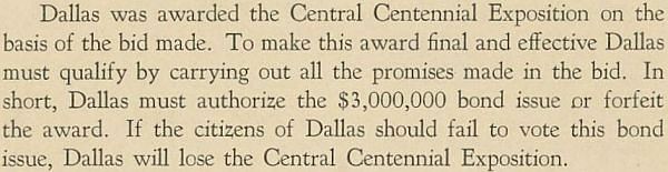
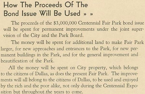
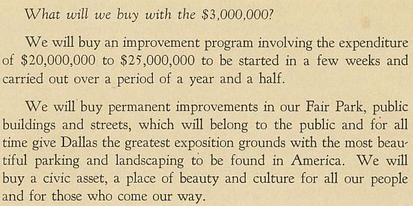
The Fair Park Bond Issue — 1934

centennial-bond-issue_front-cover_cook-collection_degolyer_SMU_sm
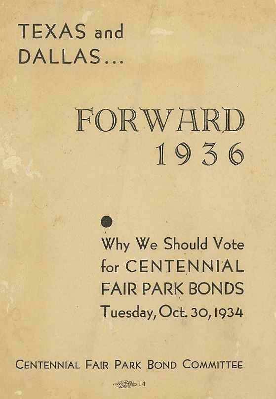
“Forward 1936…”  (DeGolyer Library, SMU)

by Paula Bosse

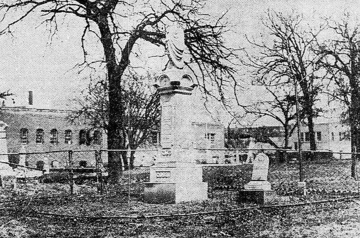
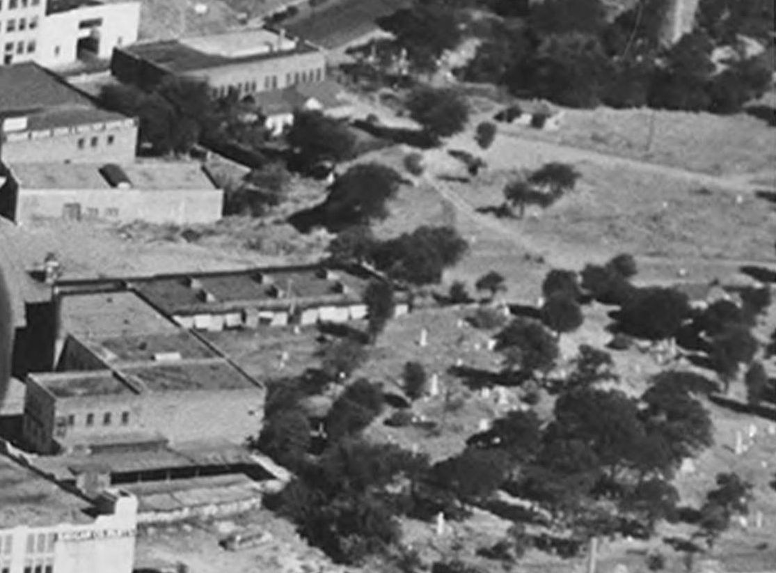
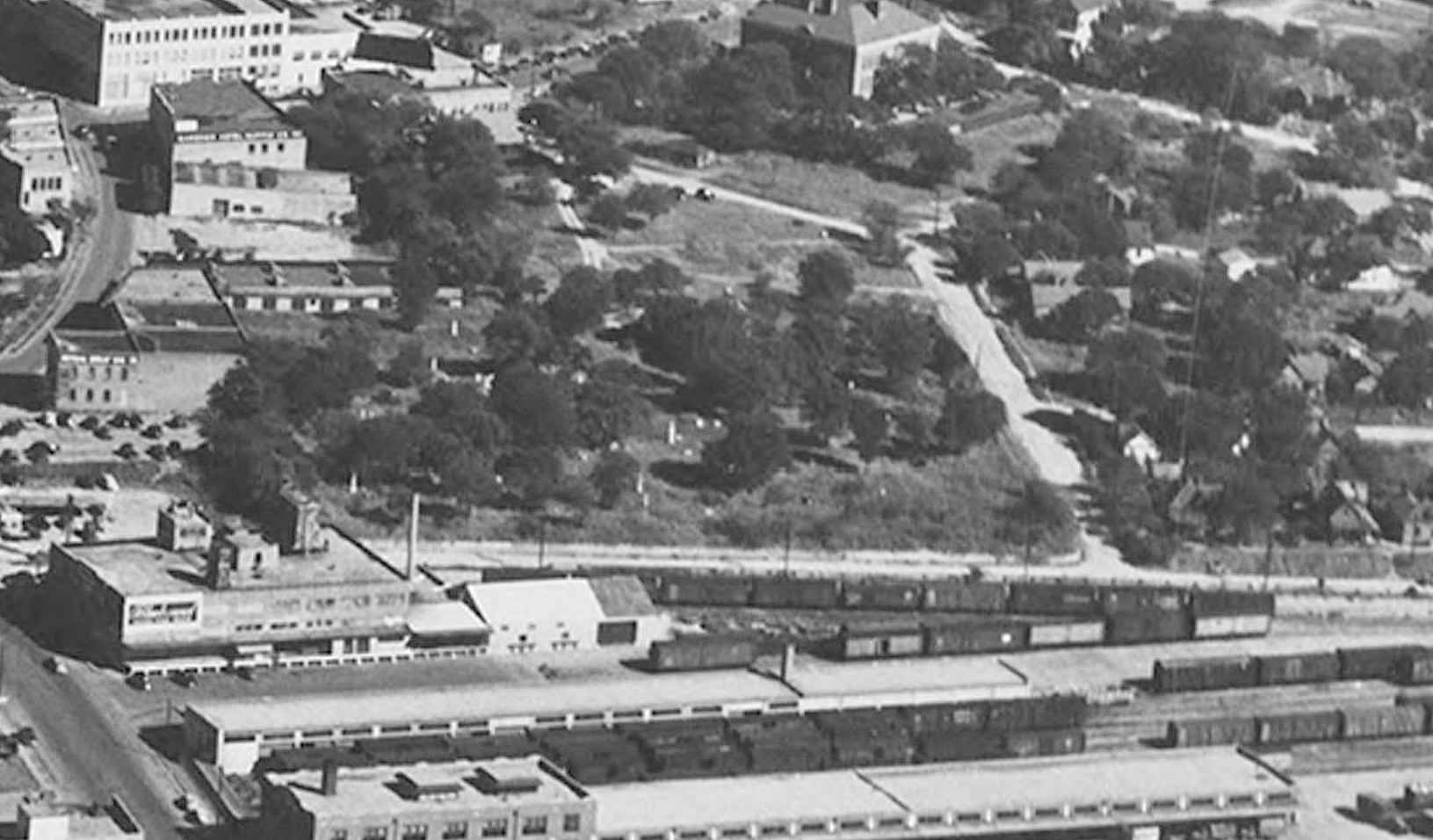
With all the heated discussion currently going on about what the city is going to do with Fair Park, I thought this little pamphlet from 1934 seemed timely. Published by the “Centennial Fair Park Bond Committee” (comprised of all the Dallas movers and shakers one would expect), the get-out-the-vote brochure was issued to explain the $3,000,000 (about $54,000,000 in today’s money, adjusted for inflation) bond issue, the approval of which was essential in order to clinch the honor of hosting the Texas Centennial Exposition in 1936. The entire pamphlet — part of the George W. Cook Collection in the DeGolyer Library — may be read on SMU’s website, here.

centennial-bond-issue_back-cover_cook-collection_degolyer_SMU

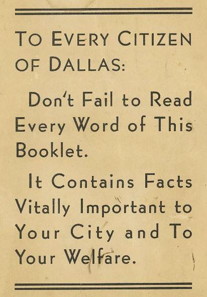
A couple of excerpts:

centennial-bond-issue

centennial-bond-issue_2

centennial-bond-issue_3

*

The issue passed, overwhelmingly, by a 5-1 margin. It’s interesting to note that the voting restrictions on this referendum were … pretty restrictive. Not only was payment of a poll tax required to vote (…one had to pay for the “privilege” of voting…), but one also had to be a property owner — and that property owner was not allowed to vote until a “rendition” was signed downtown in the tax assessor’s office. Many property owners who had signed the necessary paperwork were still unable to vote as they had not paid (or could not afford) the poll tax. It’s pretty obvious here that a substantial number of lower income residents (i.e. non-property owners or property owners unable to afford the poll tax) — including many who lived in the area immediately surrounding Fair Park — were legally prohibited from casting a vote.

6,550 ballots were cast (5462-1088), which represented “little more than one-third of the 18,000 supposed qualified to decide this important issue” (Dallas  Morning News, Nov. 1, 1934). It was declared to be “the largest majority ever cast for a bond issue in [the] history of Dallas” (DMN, Oct. 31, 1934).

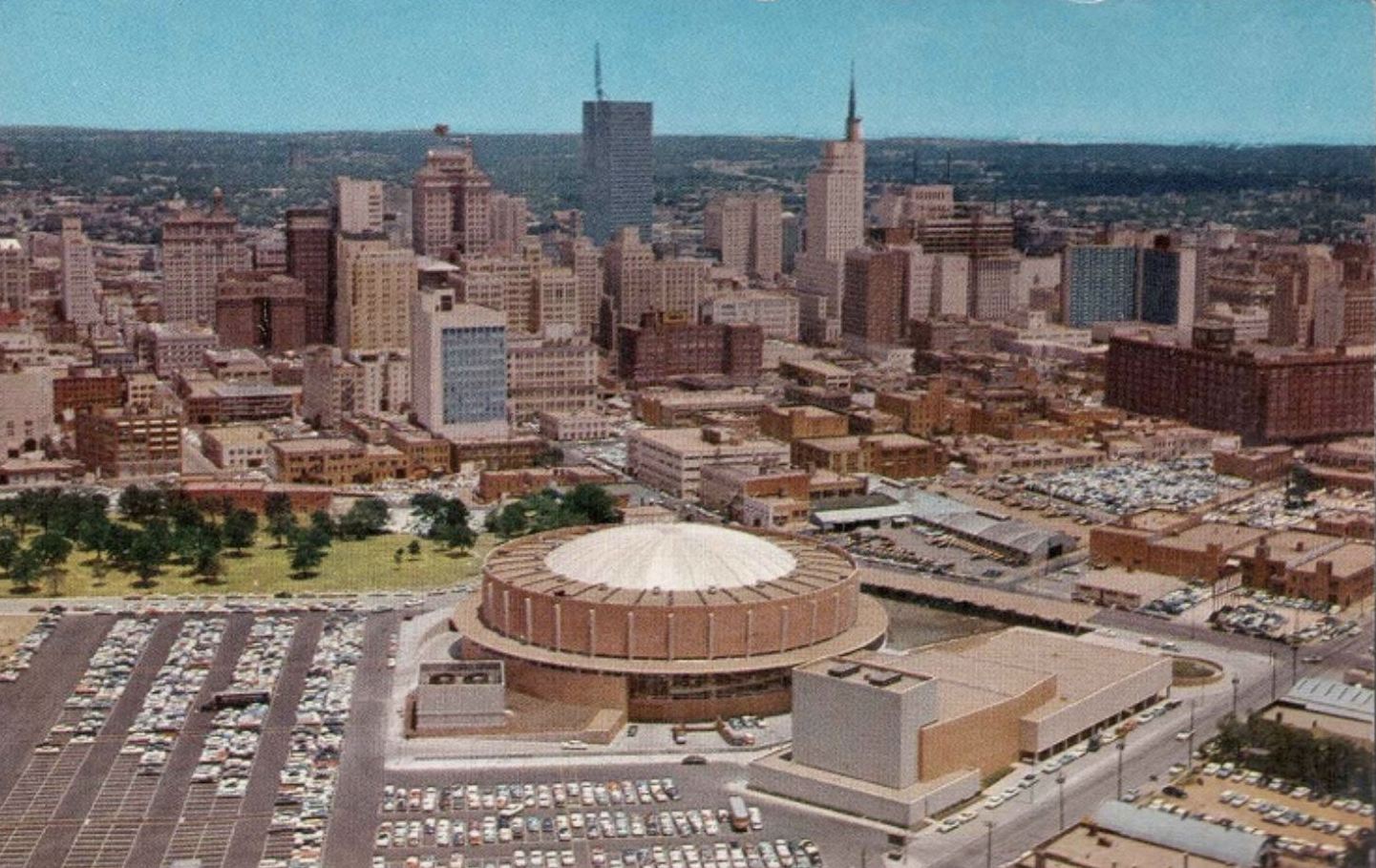
The passage of the October, 1934 bond issue assured that Dallas would host the Texas Centennial Exposition, a statewide celebration which proved to be a huge success and was a tremendous economic boon to the city.

***

Sources & Notes

The pamphlet “Texas and Dallas … Forward 1936: Why We Should Vote For Centennial Fair Park Bonds, Tuesday, October 30, 1934” is part of the George W. Cook Dallas/Texas Image Collection, DeGolyer Library, Central University Libraries, Southern Methodist University; the entire pamphlet is contained in a PDF which may be read and/or downloaded here.

More on this vote can be found in these two Dallas Morning News articles:

  • “OK on Bonds For Huge Fair Up to Voters” (DMN, Oct. 30, 1934) — published on voting day, this article includes the particulars of the voting restrictions
  • “Five-to-One Majority Scored As City Favors Centennial Bonds to Assure Huge Fair” (DMN, Oct. 31, 1934) — the results

Payment of a poll tax was still required to vote in Texas elections until 1966, when the U. S. Supreme Court ruled such taxes were unconstitutional. More about that from the Dallas Public Library, here.

*

Copyright © 2016 Paula Bosse. All Rights Reserved.


The Historic Masonic, Odd Fellows, and City Cemeteries

cemeteries_1920s_photo-e
Tombstone of W. C. C. Akard, 1826-1870… (click for larger image)

by Paula Bosse

The other day I posted a photo of the Dallas skyline and pointed out that the land occupied by Memorial Auditorium/Dallas Convention Center was once the site of a cemetery (or, rather, several cemeteries: the old City Cemetery, the Masonic and Odd Fellows Cemeteries, and the Jewish Cemetery.

By the 1920s, the grounds were overgrown and grave markers were in various states of disrepair; there were about 500 graves, but many of the remains of those buried there had been moved (resulting in more than a few somewhat alarming gaping holes!). As the 1920s were winding down, fewer and fewer burials were taking place in these cemeteries, but people were still being interred throughout the 1920s — some of these appear to have been indigents without funds to be buried elsewhere.

The oldest grave markers dated to the 1850s. Many of those buried there were important Dallasites: mayors, politicians, pioneer businessmen, doctors, and judges — many of the markers bore names which are now part of everyday life in Dallas (names such as Harwood, Ervay, Akard, Crowdus, Browder, Marsalis, etc.). Over the years, cemetery land had been encroached upon bit by bit (by the Santa Fe railroad, for one) causing many graves to be unceremoniously destroyed. As the city grew and this land (which was once beyond the city limits) became more and more valuable for developers, many of the graves were moved and the remains relocated to other cemeteries. But many remained, and there was concern that the land was being neglected. For decades, the city of Dallas was petitioned by civic leaders to officially protect, beautify, and maintain this land. It wasn’t really until the construction of the convention center in the 1950s that these plans began to take shape. Remaining graves and markers are now part of the Pioneer Park Cemetery at Pioneer Plaza.

Below is a detail from an 1882 map, showing the original locations of the four cemeteries, just beyond the southern edge of the city limits. The Masonic Cemetery occupied the northern section, and the Odd Fellows Cemetery occupied the southern section. The City Cemetery adjoined both, immediately to the east (just west of Akard). The tiny Jewish Cemetery is seen on the southeastern edge of the City Cemetery (in later years Masonic Street cut through the City Cemetery land, and the Jewish Cemetery was just south of the street and right next to the old Columbian School). (See the changed boundaries of the cemeteries on a 1905 Sanborn map here.)

map_1882_cemeteries
Jones & Murphy’s Map of the City of Dallas, Texas, 1882 (det.)

*

The photo at the top of this post shows the grave of W. C. C. Akard (1826-1870). (Incidentally, according to a 1939 Dallas Morning News article, he apparently pronounced his name “Ay-kard” rather than “ACK-erd” as we do today.) The photos below show the run-down Masonic-Odd Fellows cemetery in the 1920s.

*

cemeteries_1920s_photo-a

The Masonic and Odd Fellows Cemetery, with the Magnolia Building in the background.

*

cemeteries_1920s_photo-b

Cheek-by-jowl with a growing urban Dallas.

*

cemeteries_1920s_photo-c

I love this photo, with train cars on the Marilla Street tracks and the Butler Brothers building in the distance, just east of where City Hall now stands.

*

cemeteries_1920s_photo-d

Another interesting image, looking to the northwest, with the Santa Fe freight depot (still standing on Young Street near Griffin) at the top right. (The cemetery land was apparently fifteen feet above the surrounding street level.)

**

Below are a few extreme close-ups from aerial photographs by Lloyd M. Long (from the Edwin J. Foscue Map Library, Southern Methodist University — links to the original full photos can be found beneath each image). Cemetery markers are visible in these photos taken from the west.

cemeteries_1938_foscue_smu_longAbove, a detail from a 1938 photo.

*

cemeteries_1939_foscue_smu_longDetail from a 1939 photo.

*

cemeteries_1949_foscue_smu_long
And a detail from a 1949 photo.

*

dallas-convention-center_flickr_coltera

And the “after” photo, with much of the old cemetery land used as the site of Memorial Auditorium.

Below, a short history of the cemeteries, which appeared in the July, 1985 issue of Historic Dallas magazine: “Pioneer Cemetery Tells Story of Struggle” by Shirley Caldwell. (Click to read.)


pioneer-cemeteries_historic-dallas_july-1985_portal
via UNT’s Portal to Texas History

***

More on this cemetery can be found on Julia D. Quinteros de Hernandez’s timeline, here.

A collection of newspaper stories about the adjacent “Old City Cemetery” (some of which describe shocking disturbances of the land and of graves) can be found on Jim Wheat’s site, here.

More on Dallas’ older cemeteries can be found in Frances James’ article “Cemeteries in Dallas County: Known and Unknown” (Legacies, Fall, 1996), here.

Information about how the city dealt with the plight of the cemeteries amidst the looming possibility of development can be found in the Dallas Morning News article “Park Board Protests Motel at Auditorium” by Francis Raffetto (DMN Dec. 18, 1958).

A bird’s-eye view of Pioneer Plaza can be seen on Bing, here (zoom in to see the historic markers in the lower right corner).

All images and clippings are larger when clicked.

*

Copyright © 2016 Paula Bosse. All Rights Reserved.


The Dallas Skyline: Spot the Landmarks

skyline_from-swMid-Century Big D… 

by Paula Bosse

The Dallas skyline is always changing, and it’s always been impressive. The late-’50s/early-’60s version above looks quaint by today’s standards, but it’s one of my favorite skyline periods. I’ve never been a huge fan of the Convention Center, but the rest of it? Pretty great.

In order to make way for the George Dahl-designed Dallas Memorial Auditorium/Dallas Convention Center (which opened in 1957), the old Columbian School/Royal Street School (built in 1893) was demolished. At the time of its razing, it had most recently served as the city’s school administration building and as a book warehouse. Here are a couple of photos of the school, long before the bulldozers arrived.

columbian-school_flanders-site
via James Edwards Flanders site

columbian-school_cook-collection
Cook Collection, SMU

Also interesting was that this land — which the city had been buying up for many years (some as a result of condemnation/eminent domain) also included four pioneer cemeteries. Read more about what happened to those cemeteries here.

dallas-convention-center_flickr-coltera

***

Sources & Notes

Top photo is from a site containing several photos relating to early KRLD radio and TV, with the occasional shot of Dallas streets and buildings, here.

Other sources, if known, are noted.

*

Copyright © 2016 Paula Bosse. All Rights Reserved.

The Esquire Club, The Charm Club, and The Riflettes: James Madison High School — 1970

madison_1971-yrbk_exteriorPhoto op on the front steps….

by Paula Bosse

Browsing through high school yearbooks (as one does), one always finds images of teenagerdom from yesteryear that are charming. I’ve never been a huge fan of the 1970s, but 1970 was still hanging onto the ’60s for dear life before polyester and disco completely took hold and refused to give up.

These photos are from the 1970 yearbook of James Madison High School (the top photo is from 1971, but … close enough). Here are a few tidbits from that annual. Enjoy.

First, the Esquire Club. ‘Nuff said.

madison_1970-yrbk_esquire-club

*

And the Charm Club:

madison_1970-yrbk_charm-club

*

And the crème de la crème of Madison’s fashionable young men and women, Eddie Laury and Carolyn Lester, the “Best Dressed” of 1970. (Eddie, are you wearing ruffled satin and velvet? You win the ’70s!)

madison_1970-yrbk_best-dressed

(All the class favorites were photographed in front of confusing background dioramas. Was it … a wax museum?)

*

The winsomely named “Riflettes”:

madison_1970-yrbk_riflettes

*

The dreaded taking of the SAT (under Mrs. Penn’s watchful eye):

madison_1970-yrbk_sat

*

The fun of marching band:

madison_1970-yrbk_marching-band

*

And my favorite of almost any Dallas high school yearbook photo I’ve seen, the ROTC “Sweethearts”:

madison_1970-yrbk_rotc-sweethearts

Best. Photo. EVER.

***

Sources & Notes

Photos from James Madison High School’s 1970 and 1971 yearbook, The Trojan Archives.

*

Copyright © 2016 Paula Bosse. All Rights Reserved.

The Adolphus, The Oriental, The Magnolia

adolphus_magnolia_oriental_TSHA-1977-annual-mtg_portal_sm
Akard looking north… (click me!!)

by Paula Bosse

This is just great. I’ve never seen this photo, which was taken sometime between 1922 and 1924. Dallas has never looked more … architectural. (Click that photo — it’s worth seeing it bigger.)

The view is looking north on Akard toward Commerce, from some building on or near Jackson Street. The Adolphus Hotel (built in 1912 and still standing) is straight ahead, the shorter Oriental Hotel (1893-1924) is in the middle, and the Pegasus-less Magnolia Petroleum Building (built in 1922 and still standing) towers above both of them.

I don’t think I’ve seen the Oriental from this angle. And I’ve never noticed all those windows in the Magnolia Building that look directly across into other windows. (That must be … strange.) And since I recently posted photos of this same block of S. Akard, I immediately recognized the short building with the odd-shaped cut-out/crest-like decoration in it opposite the Oriental.

Here’s the same view a few years earlier — about 1913, before the Magnolia was built:

adolphus_1913_dpl_via-d-mag-online

I love these photos. And how nice that two of these landmark buildings are still alive and kicking!

***

Sources & Notes

Top photo appeared in the program for the 1977 Texas State Historical Association Annual Meeting of 1977 (held, appropriately enough, in the Baker Hotel, which was built on the corner previously occupied by the Oriental); I found it on the Portal to Texas History site, here. (Dear printers of things like this: please never EVER use brown ink to print photographs. If anyone knows of a cleaner, sharper copy of this great photo, please let me know!)

Second photo is from the Texas/Dallas History Division, Dallas Public Library; I found it posted on the D Magazine site, accompanying the article “How Haunted Is the Adolphus Hotel?” here.

Photos larger when clicked.

*

Copyright © 2016 Paula Bosse. All Rights Reserved.


“Magnolia Building by Night”

magnolia-bldg-night

by Paula Bosse

Still standing. Still beautiful.

See a similar postcard, with a wider view — and a blobbier Pegasus — here.

*

Copyright © 2016 Paula Bosse. All Rights Reserved.

J. L. Long, Woodrow Wilson — 1958

woodrow_long_022758_squire-haskins_UTA_smBuccaneers, Wildcats: represent… (click for B-I-G image)

by Paula Bosse

Another fab aerial photo from Squire Haskins: a 1958 southwesterly shot of J. L. Long Jr. High School (on the left) and Woodrow Wilson High School.

…I am not unfamiliar with these East Dallas institutions. 

***

Sources & Notes

Photo taken above Lakewood by Squire Haskins on Feb. 27, 1958. From the Squire Haskins Photography, Inc. Collection, UTA Libraries, Special Collections — more info here. To see UTA’s super-gigantic image, click the photo!

*

Copyright © 2016 Paula Bosse. All Rights Reserved.

Pacific Avenue: Watch for Trains! — ca. 1917

pacific-akard_park-cities-photohistory_frank-rogersToo close for comfort…

by Paula Bosse

Some people don’t realize that Pacific Avenue used to be lined with the railroad tracks of the Texas & Pacific Railway (hence the name “Pacific”). When trains weren’t barreling down Pacific regularly, the thoroughfare was used by non-locomotive traffic like pedestrians, bicycles, horses, and automobiles. When a huge cinder-spewing train screamed through, everything came to a resigned halt until it passed by. I can’t even imagine what that was like. I wonder how many times people, horses, vehicles, etc. didn’t manage to get out of the way in time?

When Union Station opened in 1916, trains that had previously run through the central business district now went around it (which probably cut the number of people rushed to the hospital with train-related injuries substantially).

The photo above shows Pacific looking east from N. Akard, as a blur of a train whooshes by. The Independent Auto Supply Co. (300 N. Akard) is at the left, and, at the right, the back side of Elm Street businesses, including Cullum & Boren and, to its left, the Jefferson Theater, with “Pantages” painted on the side. (The Jefferson was the Dallas home of the Pantages Vaudeville Circuit from 1917 until 1920, the year the Pantages people bugged out for the greener pastures of the Hippodrome, leaving the Jefferson to start a new relationship with the Loew’s circuit people. At the end of 1925, the Jefferson Theater was actually renamed the Pantages Theater. …Kind of confusing.)

Below, Elm Street in 1918 — what the other side of those buildings looked like. Cullum & Boren’s “CB” logo can be seen painted on the side of its building. (Click photo for much larger image.)

dallas-movie-palaces_1918_dth_020556

But back to Pacific in its scary, sooty, T&P-right-of-way days. This is what things looked like in 1909.

t-and-p-flier_1909_loc

Fast-forward to 1920 — the trains had long stopped running, but the tracks remained, an eyesore and an impediment to traffic. (Cullum & Boren, again, at the right.)

pacific-ave_showing-t-and-p-tracks_1920

And another one.

pacific_ave_ca-1920_legacies_fall-1990

Thanks to the Kessler Plan, those unsightly tracks were finally removed from Pacific in 1923. Below, a photo from 1925. Big difference. Thanks, George Kessler!

pacific_bryan_looking-east_lost-dallas_doty

***

Sources & Notes

Top photo (by Frank Rogers) from the book The Park Cities, A Photohistory by Diane Galloway (Dallas: Diane Galloway, 1989). The photo is credited to John Stull/R. L. Goodson, Jr., Inc./Consulting Engineers.

More info on the 1918 photo of Elm Street, which was featured in the post “Dallas’ Film Row — 1918,” here.

More info on the super-sooty Pacific Avenue photo, here.

More on the de-track-ified Pacific, here.

Not sure of the source of the first 1920 photo; the second 1920 photo is from Legacies, Fall 1990, here.

*

Copyright © 2016 Paula Bosse. All Rights Reserved.


University Park’s “Couch Building” Goes Up In Flames (1929-2016)

goffs_fire_dmn-081216_ashley-landis-photo
Photo: Ashley Landis/DMN (click for huge image)

by Paula Bosse

Yesterday, fire erupted in the old University Park building at the northwest corner of Hillcrest and McFarlin. The building — which housed Goff’s Hamburgers and several other businesses — is, today, a pile of rubble. I’ve always loved this building — every time I’d drive past it I’d smile, happy that the only truly distinctive non-SMU building along that part of Hillcrest was still standing. And now it isn’t.

The building — which was built in 1929 across Hillcrest from McFarlin Auditorium — had a rocky start. SMU really, really didn’t want it to be built.

A. B. Couch (1895-1970) came to Dallas around 1914 from Waco to attend pharmacy school. In 1921, a few years after becoming a pharmacist, he opened his own drugstore, the University Pharmacy, at the southwest corner of Hillcrest and Roberts avenues (Roberts was renamed McFarlin Boulevard in 1928).

university-park-pharmacy_couch_1920-rotunda
Coming soon… (1920 SMU Rotunda yearbook)

Business must have been good, because in February of 1923, Couch bought the vacant property across the street. Three years later, he applied for a permit to build a business on the property, and that’s when the Robitussin hit the fan.

It’s a bit confusing, but, basically SMU, the original owner of the property (and all that surrounded it), put their land west of the campus (west of Hillcrest) on the market, but it could be sold only with specific restrictions — there were several of these restrictions, but the two cited most frequently were that land in this University Park Addition was to be developed solely for residential purposes, and that these homes were to be occupied by white people only. Somehow, in transferring property and re-deeding and re-re-deeding — and all sorts of other real estate transactions I don’t understand — the contract for the large lot purchased by Mr. Couch was drawn up with the restrictions omitted (“an oversight”). Couch was insistent on building businesses on the land he’d purchased, and SMU was adamant that he not be allowed to. Cue the lawsuit. (An overview of this case — in the appeals court — can be read here. It’s interesting, if confusing.)

The court case dragged on and on, through injunctions and appeals, and, finally, in December of 1928, the Supreme Court of Texas ruled in favor of Couch. (Click to see a larger image.)

couch_FWST_120628_supreme-court-of-tx-ruling
Fort Worth Star-Telegram, Dec. 6, 1928

In the spring of 1929, Couch released the drawing of the two-story F. J. Woerner-designed building he planned to build:

couch-bldg_woerner-rendering_1929

He also announced that he would build in this same block, a $125,000, 1,000-seat cinema: the Mustang Theater, which, though not yet built, had been leased for 10 years to R. J. Stinnette, who ran the Capitol Theater downtown. The building was designed by W. Scott Dunne, the architect of many of Dallas’ movie theaters (the Texas Theatre, the Arcadia, the Melba, the Dal-Sec, etc.).

mustang-theater_scott-dunne_rendering_1929

It doesn’t appear that the Mustang Theater was ever built, probably because the Varsity Theater in Snider Plaza (a stone’s throw away) had been announced that very same week (the Varsity opened in the fall of 1929).

So, forget the Mustang. Couch’s building — which was called, yes, “The Couch Building” — opened in 1930 or ’31. Its official address was 3402 McFarlin, but the address of the new location of the University Pharmacy was 6401 Hillcrest. There were a couple of stores next to the pharmacy, and offices upstairs (it seemed a popular location for doctors and real estate agents). Mr. Couch lived next door, at 3404 McFarlin (in a house which was, ironically, destroyed by fire in 1932).

That simple but lovely building stood on that corner for almost 90 years. Until yesterday. Sorry about that, A. B.

a-b-couch_pharmacist_1940sAndrew Bateman Couch, pharmacist

*

Below a photo taken on June 13, 1947, showing the “Highland Park/SMU” streetcar sitting at the end of the line, just south of Snider Plaza, with an 18-year-old Couch Building behind and to the left of the streetcar.


couch-bldg_061347_ebay

Below, the same view of Hillcrest looking south, from the 1965 SMU Rotunda yearbook. (Note that an unrelated University Pharmacy — this one owned by Harold Simmons — is seen at the southwest corner of Hillcrest and McFarlin. Couch sold his drugstore business in 1943, and a new pharmacy, which passed through several hands, opened across the street in Couch’s original 1921 location.)

drag3_smu-rotunda_19651965 SMU Rotunda

goffs_google_november-2015Google Street View, Nov. 2015

goffs_google_nov-2015_frontGoogle Street View, Nov. 2015

goffs_rubble_dmn-photo_081316_ting-shen-photographerDMN photo, Aug. 13, 2016 — Ting Shen, photographer

hillcrest-mcfarlin_map_goffs
Google Maps, Aug. 13, 2016 

***

Sources & Notes

Top and bottom photos are from the Dallas Morning News; see their coverage here, here, and here. That top photo is VERY large on The News’ website — look at all the detail of the brick and decoration.

Footage of the fire and its aftermath, from WFAA, can be watched here (scroll down to see all video footage).

Photo with the streetcar is from eBay; I saw it in the Retro Dallas, Texas Facebook group, posted by Dallas historian Teresa Musgrove Gibson.

Take a look at the 1921 Sanborn map, here. This building would be built at what is the northwest corner of Roberts (later McFarlin) and Hillcrest. University Park is pretty wide open in 1921.

*

Copyright © 2016 Paula Bosse. All Rights Reserved.

Neiman-Marcus Expands — 1927

n-m_construction_1927_pioneers-of-dallas-co-FB-page_coll-frances-james_2The first addition under construction, 1927…

by Paula Bosse

In 1927, construction began on Neiman-Marcus’ first expansion. The addition was adjacent to the famed department store, which had occupied its spot at Main and Ervay since its construction in 1914. (This was the company’s second location – their original store, which opened in 1907 at Elm and Murphy, was destroyed by fire in 1913.) The store had outgrown its old building, and expansion was deemed necessary. The new addition was designed by the Herbert M. Greene architectural firm, led by George L. Dahl. While the new building was going up, the old building was being renovated and updated. 

The photo above shows the construction of the addition, which extended the store’s footprint from Main all the way to Commerce. One of the interesting features of this construction was the look of the site itself.

One of the features of the Neiman-Marcus project is the ornamental barricade, containing window boxes and fashionable silhouettes, which has been put up around the new construction. (Dallas Morning News, May 8, 1927)

It’s the nicest-looking hard-hat area I’ve ever seen!

The new building (which was four floors, but was designed so that sixteen additional stories could be added if needed) opened in October, 1927. Less than a month after the formal opening of this new building, another addition was announced — it opened the following year. With that “third unit” opening in 1928, Neiman-Marcus had increased its size by 50% (there would be further expansions over the years), and its sales were the highest in the company’s history. Also, notable at this time was the fact that a full 40% of the store’s sales were to people who lived “in other cities of the Southwest.”

The formal opening on Oct. 3, 1927 attracted a crowd estimated at more than 25,000 people. Invited guests wore gowns and tuxedoes.

n-m_new-addition_dmn_100227
Expansion completed.

*

n-m_construction_dmn_100227_full-page-ad
Oct. 2, 1927 (full-page ad — click to see larger image)

n-m_addition_dmn_100227_architects
Oct., 1927

***

Sources & Notes

Top photo was posted in the Facebook group Pioneers of Dallas County; it is from the collection of Dallas historian Frances James.

A special section of The Dallas Morning News which coincided with the opening of the expanded store appeared in the October 2, 1927 edition of the paper; in it are several photos and articles.

Read more about the history of the Neiman Marcus building on Wikipedia, here.

*

Copyright © 2016 Paula Bosse. All Rights Reserved