Flashback : Dallas

A Miscellany: History, Ads, Pop Culture

Category: Neighborhoods

Thank You, Preservation Dallas!

wilson-house_FB-page_cover-photoThe historic Wilson House, home of Preservation Dallas

by Paula Bosse

I was invited by the nice people of Preservation Dallas to be part of their Summer Sizzlers Series and to present my first-ever lecture/talk: on how I write the blog and what resources I use. Somehow I managed to stand in front of a packed roomful of people (one of my greatest fears) and talk for 90 minutes (!) — and, surprisingly, I think my presentation was mostly coherent. I have to admit, a lot of it is a hazy blur, but I was happy to find that it was an enjoyable experience. I had a great time, and it was nice to talk to so many people who are as interested in Dallas history as I am.

Thank you Irene Allender, David Preziosi, and Donovan Westover for inviting me and for hosting such a nice event!

preservation-dallas_logo_2016

preservation-dallas_summer-sizzlers

***

Sources & Notes

Photo at top shows the beautiful Wilson House, built in 1899 at the corner of Swiss and Oak and current home of Preservation Dallas. Read more about the house here; read about the Wilson Block Historic District here. Take a virtual Google Street View tour of the wonderful two blocks’ worth of historic houses here. (Photo from the Preservation Dallas Facebook page.)

After the lecture, I had several people ask about the PowerPoint 2016 presentation I’d made. This was the first time I’d ever used PowerPoint, and it worked really well for showing many (MANY!) photographs to the audience. For those of you who came up and asked me about it, the very, very well done YouTube tutorial I used to teach myself PowerPoint is here. It’s in 10 segments — about 3 hours in all — you might not need everything in it, but I found it very helpful.

*

Copyright © 2016 Paula Bosse. All Rights Reserved.

The Twin Standpipes of Lakewood Heights: 1923-1955

lakewood_water-towers_reminiscencesAbrams and Goliad, y’all… (click for larger image)

by Paula Bosse

The two large water towers pictured above loomed over the East Dallas neighborhood of Lakewood Heights for over 30 years. They sat at the southwest corner of what was then known as Greenville Road (not to be confused with Greenville Avenue) and Aqueduct Avenue — the streets are known today as Abrams Road and Goliad Avenue. The towers replaced a previous (single) water tank, which, by the early 1920s, was proving inadequate for the needs of an exploding Lakewood area.

These water tanks — called “standpipes” — were really big: each was 100 feet tall, 60 feet in diameter, and held two million gallons of water. They were erected in October, 1923 and, rather surprisingly, stood until 1955. Even though I grew up in this part of town, I never knew about these tanks until a couple of years ago when I saw a photo in a Dallas history group. It’s hard to believe those industrial behemoths were smack dab in the middle of what is now a jam-packed residential neighborhood.

**

Here are a few photos featuring cameo appearance by the omnipresent tanks. In the first one, from the 1930s, they can be seen at the top right, ghostlike in the distance.

lakewood-shopping-ctr_streetcar-tracks_ca1938_reminiscences

*

Then there’s this fantastic aerial shot of what would later become the fully developed Lakewood area (and beyond). Looking east, White Rock Lake is in the distance, and the two towers — brand new when this photo was taken in 1923, and taller than anything else in the photograph — are at the left.

east-dallas_lakewood_fairchild_1923_cook-coll_degolyer_smu

Let’s zoom in a bit:

east-dallas_lakewood_fairchild_1923_cook-coll_degolyer_smu_det

*

And here is a really wonderful photo which was posted in the Dallas History Facebook group by Mary Doster from the collection of her husband Jim Doster, showing Abrams, looking north, in 1925. (The location of the twin tanks was actually outside the Dallas city limits in 1919 — see the boundary on a 1919 map here.) I never get tired of seeing streetcars, especially traveling down streets I drive everyday.

water-tanks_abrams_dallas-hist-FB-jim-dosterCollection, Jim Doster

**

A few articles about the tanks’ beginning in 1923.

water-towers_dmn_022723Dallas Morning News, Feb. 27, 1923

water-towers_dmn_100723a
DMN, Oct. 7, 1923

water-towers_dmn_100723b
DMN, Oct. 7, 1923

*

Here’s a screenshot from a silent film produced by the City of Dallas waterworks department, showing them at traffic-level, with a view to the northwest from Abrams.

stand-pipes_lakewood_TAMI_water-dept-film_6.39

The tanks were dismantled in 1955 (pertinent articles are listed below, in the “Notes” section). Their fate, post-dismantling? One of them was destined to be reassembled in Tarrant County for the Hurst-Euless-Bedford water system, and the other one was “to be kept as stand-by storage for the city” (DMN, June 7, 1955).

standpipes_dmn_060755
RIP in HEB…

***

Sources & Notes

First two photos from the book Reminiscences, A Glimpse of Old East Dallas.

Aerial photo — titled “East Dallas — 1923” — is a Fairchild Aerial Surveys photograph, from the George W. Cook Dallas/Texas Image Collection, DeGolyer Library, Central University Libraries, Southern Methodist University; more information is here. (I have adjusted the color.)

Screenshot is from a City of Dallas silent film, shot for the water department — the film is in the TAMI collection here, and the standpipes pop up at the 6:39-ish mark. Thanks to John Botefuhr for posting the link to this film on the Lakewood 1925-1985 Facebook group.

More on the tanks’ removal in 1955 can be found in these Dallas Morning News articles:

  • “Familiar Old Landmark To Be Removed” (DMN, March 20, 1955)
  • “Offers Vary on Standpipe” (DMN, April 26, 1955)
  • “East Dallas Landmark Coming Down” (DMN, June 7, 1955 — has photo taken from inside the tank looking up as dismantling was underway)

The present-day view seen in the top photo — looking south on Abrams — can be seen on Google Street View here.

A very interesting Sanborn Map from 1922 — before the twin tanks were built, but still showing the “Lakewood Heights Water Works” — can be found here. There’s, like, nobody living there, man.

I’d love to see other photos of these particular “standpipes” — if anyone has any, forward them to me and I’ll include them in this post. Contact info is at the top.

As always, images are magically larger when clicked.

*

Copyright © 2016 Paula Bosse. All Rights Reserved.


Beautiful South Ervay Street — ca. 1910

ervay_coltera_flickrStreet life in South Dallas

by Paula Bosse

Today, a few hand-colored postcards from around 1910 showing the lovely houses that used to line Ervay Street in South Dallas. Hard as it is to believe today, the stretch of South Ervay from just outside the central business district down to its end at Forest Avenue (now Martin Luther King, Jr. Blvd.), was once a very nice area where many of the city’s most fashionable and well-to-do Jewish families (and, later, African American families) lived. The intervening century has not been kind to South Dallas. I’m not sure of the location in the postcard above, but it certainly looks like a very pleasant neighborhood — one that no longer exists in this mostly blighted area.

*

Below, S. Ervay looking south. The rounded top of Temple Emanu-El can be seen at the left. The light-colored building in the next block was the Columbian Club. The hotel most recently known as the Ambassador (which burned down three years after I originally wrote this post) is set back on a curve of the street and is hidden by the Columbian Club. The red building is the Hughes candy plant (still standing). A Google Street View of this area today can be seen here.

ervay-street_ebay

*

Below, we see a view still looking south, but now much farther down Ervay, almost to Forest Avenue (now MLK). The church on the left is the James Flanders-designed Ervay Street Methodist Episcopal Church (South), built in 1908 at the corner of corner of Ervay and South Boulevard — it’s interesting that a Methodist church was located in the center of Dallas’ largest Jewish residential neighborhood. (More on the church from a Dallas Morning News article from July 1, 1908, here. See this area on a 1922 Sanborn map here.)

ervay-residence_coltera

Not seen in the view above is one house worth mentioning. The house — just out of frame at the left, with the steps leading up to it, was the home of Simon Linz, of Linz Jewelers fame. Here is what the Linz house looked like in 1908:

linz-house_dmn_010108Dallas Morning News, Jan. 1, 1908

Remarkably, this house is still standing. It is currently a funeral home at 2830 S. Ervay. The present-day image below, showing the pretty house and the neatly landscaped yard, is a little deceptive; see what the Google Street View looks like just south — where the Flanders church once stood — here. (If you’re up to it, reverse the Google view and move back toward town.)

linz-house_2830-828-s-ervay_google
Google Street View

Hold on, little house!

This was once such a beautiful part of Dallas….

ervay_postcard_clogenson_postmark-1908

**

Below, a detail of a 1919 map showing S. Ervay down to Forest. The purple star shows the location of Temple Emanu-El and the Columbian Club. The green star shows the location of the Linz house and the Ervay St. Methodist Episcopal church. (Click for larger image.)

e-ervay_map_1918_portal
1919 map via Portal to Texas History

 ***

Sources & Notes

First and third postcards are from Flickr: here and here. Others found on eBay.

*

Copyright © 2016 Paula Bosse. All Rights Reserved.

“Greetings From Dallas, Texas” — 1955

greetings-from-dallas-texasDallas?

by Paula Bosse

Um….

Somehow Anna Belle and her family found the Cotton Bowl. Over yonder, past that ridge.

greetings-from-dallas-texas_back

***

Sources & Notes

Postcard purporting to be “Dallas, Texas” from eBay.

**

UPDATE: A person commenting on Facebook says that he thinks this shows “Cedar Mountain, near where Joe Pool Lake was built” — an area which actually is within the Dallas city limits. I’m not familiar with that area. Does this postcard show this view? Read about the Cedar Mountain Preserve here; and about Joe Pool Lake here. Check out a map that shows the City of Dallas boundary, here.

Read about Cedar Mountain (“…that wooded white rock ridge that runs from Eagle Ford to Cedar Hill…”) in the Dallas Morning News article “Bear Slapped Him But He Survived” by Kenneth Foree (Sept. 1, 1948).

Apologies, Cedar Mountain and Rembrant (sic) Post Card Company, if I have made unfounded sarcastic comments.

**

UPDATE TO THE UPDATE: I have to admit, nothing I’ve posted before has stirred up quite so much controversy. This post has been shared quite a bit, and I’ve dipped into Facebook pages where members are discussing this idyllic photo. Half swear up and down there’s no way this could be anywhere near Dallas, and the other half are pretty certain it’s in the Cedar Hill area.

Is it possible that it could be the Cedar Hill area (aka “The Hill Country of the Metroplex”)? The highest point in North Texas is just a stone’s throw from Dallas. According to the Wikipedia entry, it “stands at an elevation of about 800 feet (240 m) above sea level — the highest point in a straight line from the Red River at the Texas-Oklahoma border to the Gulf Coast.”

The Old Penn Farmstead was a working family farm/ranch from the 1850s until the 1970s (remaining in the Penn family the entire time). Photos show that the fence construction on the Penn property is the same as that seen behind the horsies in the postcard. There were several large-ish farms and ranches nearby, several of which had horses. There were even a couple of “retreats” operating in the area in the late-1940s and ’50s (notably, the 520-acre retreat sponsored by the Dallas Baptist Association).

Even though it’s likely this was just some sort of stock Western-looking photo used by the postcard company, I suppose it could show the unexpected beauty around what is now the Cedar Hill State Park, Cedar Ridge Preserve, Cedar Mountain Preserve, Dogwood Canyon Audobon Center, Joe Pool Lake, Mountain Creek Lake, etc. I mean, I’ve never seen anything around here that looks remotely like this, but a lot of people have some very strong opinions!

Watch a short Texas Parks & Wildlife video about Cedar Hill State Park here; the Penn Farmstead is located here and is seen in the video.

Here’s a 1985 article about the 11,000 nearby acres which would soon be inundated in the construction of Joe Pool Lake. (Click article to see larger image.)

joe-pool-lake_FWST_050685a

joe-pool-lake_FWST_050685b
Fort Worth Star-Telegram, May 6, 1985

**

UPDATE TO THE UPDATE OF THE UPDATE: It appears that the Rembrant Post Card people will tell you whatever you want to believe! The same image has been found without “Dallas” but with “Colorado” on it (see link in comments section). Horrors! So, anyway. After all that, my original sarcastic tone stands. Always trust your inner cynic! At least I learned about Cedar Hill!

UPDATE, ETC.: And now this saga has been taken on by intrepid Dallas Morning News reporter Charlie Scudder! Read his coverage, here.

UPDATES, INCORPORATED: And, somehow, this story ended up in the pages of the actual paper edition of The Dallas Morning News. Lordy.

DMN_080316
DMN, Aug. 3, 2016

*

Copyright © 2016 Paula Bosse. All Rights Reserved.

Dallas Skyline — ca. 1974

skyline_aerial_1974_getty-images_watermarkSo many landmarks! (click for larger image)

by Paula Bosse

I try to avoid using photos with watermarks, but this is a great view of the Dallas skyline, taken by famed photographer Charles Rotkin. Below, another of his photos.

aerial_skyline_corbis_1974

***

Photos by Charles Rotkin. Top photo from Corbis/VCG via Getty Images. Bottom photo ©Charles E. Rotkin/CORBIS (I can no longer find this image on the new Getty site). CORBIS/Getty says that both of these photos were taken on Jan. 1, 1974, but I’ve found that their date info is sometimes inaccurate.

2004 obituary of Charles Rotkin is here.

Click photos for larger images.

*

Copyright © 2016 Paula Bosse. All Rights Reserved.

Dallas Scenes by Florence McClung — 1940s

mcclung_dallas-cityscape_1941_kever-collectionFrom the collection of Mark and Geralyn Kever

by Paula Bosse

Florence McClung (1894-1992) — a painter, printmaker, and pastelist in the circle of Regionalist artists known as The Dallas Nine — lived in Dallas and often painted nearby rural scenes as well as more rugged Western landscapes. I haven’t seen many urban scenes by McClung, but there were two oil paintings that appeared in a one-woman show at the Dallas Museum of Fine Arts in the spring of 1945 which I’d love to find images of: “Triple Underpass” and “Big D,” the latter of which sounds very similar to the one seen above, “Dallas Cityscape,” from the collection of Mark and Geralyn Kever (whose impressive collection of Texas art can be seen in the Jan./Feb. issue of American Fine Art Magazine — jump to page 53 in the PDF to find the story, “Cream of the Crop”). (UPDATE: “Triple Underpass” has surfaced! More here.)

Here’s another urban scene, “Industrial Dallas,” with what looks like the Medical Arts Building in the background.

mcclung_industrial-dallas_david-dike-gallery_jan-2016-catDavid Dike Fine Art

I always love to see artistic renderings of the Dallas skyline, and I really like these two city scenes which are so different from McClung’s usual subject matter.

Florence McClung (née White) was born in St. Louis in 1894. Her family moved to Dallas, and she eventually studied art under several of Dallas’ finest instructor-artists (including Frank Reaugh). After several years as a college art instructor in Waxahachie, she began to participate in numerous group shows, juried shows, and one-man shows, reaching the peak of her career in the 1930s and 1940s. She died in 1992 at the age of 97. Art-wise, that spans the years from Toulouse-Lautrec to Banksy!

I had a hard time finding photos of her, but I managed to find two, including her senior photo which appeared in the 1912 yearbook of Dallas High School (more commonly known today as Crozier Tech) (where, incidentally, she was in the Art Club with Allie Tennant who went on to become a noted sculptor, best known for her Tejas Warrior at the Hall of State in Fair Park).

mcclung_florence-e-white_dallas-high-school_1912
Florence White, Dallas High School yearbook, 1912

mcclung-florence_circa-late-1930s
Florence McClung, circa late 1930s

***

Sources & Notes

I ran across the “Dallas Cityscape” painting on the CASETA (Center for the Advancement and Study of Early Texas Art) site.

The top painting has the title “Dallas Cityscape” and media mentions of it carry the date 1941. I couldn’t find a painting by McClung with that title (admittedly, my sources are limited!). Also, 1941 seems off because construction of the Mercantile Bank Building (seen in the painting) wasn’t completed until 1942. I wonder if it’s possible that this painting actually was the painting McClung titled “Big D” (which was most likely painted in 1944) and was included in her 1945 show at the DMFA? Might those planes have something to do with World War II? Because the Portal to Texas History has been so nice to scan them, McClung’s application for a show at the DMFA can be seen here, and her list of works to be shown is here.

“Industrial Dallas” is from a January, 2016 auction catalogue from David Dike Fine Art.

The Handbook of Texas entry for Florence Elliott White McClung can be found here.

A selection of works by Florence McClung from the Dallas Museum of Art can be found on the SMU Central University Libraries Digital Collections site, here.

UPDATE, Oct., 2018: “Triple Underpass,” from the same period as the two paintings above, has surfaced — more about it can be found in the post “‘Triple Underpass’ by Florence McClung — 1945,” here.

All images larger when clicked.

*

Copyright © 2016 Paula Bosse. All Rights Reserved.


Little Mexico: Turney & Payne — 1940

little-mexico_ca_1940_WPA-GD_DHSLooking southeast, toward Pegasus… (click for much larger image)

by Paula Bosse

Above, a photo taken in 1940 at the intersection of the unpaved Turney Avenue and Payne Street, in Little Mexico — El Barrio — just north of downtown. St. Ann’s school can be seen at the end of the street, and the Villasana Food Store (prop. Rodolfo Villasana, est. 1932) is at the left; in the distance, Pegasus atop the Magnolia Oil Building. (A similar view from 1941 during ongoing street-widening — taken a bit farther back and from a slightly higher elevation — can be seen here.)

In 1941, Turney Avenue was widened and paved and then … lost its name; it became part of the brand new Harry Hines Boulevard.

Hines Boulevard begins at Five Point, where the $100,000 Tom Field Circle will be built and stretches eight miles into Dallas over Turney Street to Cedar Springs, joining Akard at Harwood. (Dallas Morning News, July 23, 1941)

Another view of the area during this period of road work can be seen in the photo below. Ramon Alonzo’s store seen at the lower right was at 2209 Caroline. (The once-familiar “smokestacks” seen in the background belonged to the Dallas Power & Light Company, which sat on land now occupied by the American Airlines Center.)

little-mexico_1941_legacies_fall-1992

Adios, Turney. Big changes are ahead. You’ll never believe how much your old neighborhood is going to change.

**

Here are the residents and businesses along both Turney and Payne as listed in the 1939 Dallas directory, one year before the upheaval began (click to see larger images):

turney_1939-directory
1939 Dallas directory

payne_1939-directory
1939 Dallas directory

To get an idea of where Turney was, here’s a detail from a 1919 map.

map_turney-payne_1919_portal

Today? It’s part of Victory Park. If you took a right on Payne at the sign advertising “milk” (in front of the Villasana gas station), you’d be about two blocks from what is now the American Airlines Center. Yep. A current Google Street View is here.

***

Sources & Notes

Top photo from the WPA Guide and History (which has been fully scanned and may be accessed at UNT’s Portal to Texas History site, here); photo from the collection of the Dallas Historical Society.

More great photos of Little Mexico from this time can be found in the article “Little Mexico and the Barrios of Dallas” by Gwendolyn Rice (Legacies, Fall, 1991), which can be found here. (The photo of Alonzo’s store is from this article.)

Several images of Turney under construction in 1940/1941 can be see in the Department of Public Works collection at the Dallas Historical Society site, here. (The linked image in the first paragraph is from this collection.)

The top photo also appears in Dallas’s Little Mexico by Sol Villasana (his family owned the store and the gas station at the Turney-Payne intersection); see it — and a northward view of the gas station, here.

For those who enjoy articles about road construction, here are a couple of Harry Hines-related News articles which might be of interest:

  • “Dedication Rites Planned For Boulevard; New Highway Named For Harry Hines Opens About Aug. 1,” DMN, July 3, 1941. (Officials were a little optimistic with that August opening — it didn’t officially open until October, 1941.)
  • It’s weird to think of Harry Hines being an actual person, but see a photo of him at the ribbon-cutting, along with another name more familiar to us today as a freeway than as a flesh-and-blood human being, Woodall Rodgers, then mayor: “Ribbon Road Barrier Snipped,” DMN, Oct. 15, 1941.

All pictures and clippings larger when clicked.

*

Copyright © 2016 Paula Bosse. All Rights Reserved.


Gene’s Music Bar, The Lasso Bar, and The Zoo Bar

genes-music-bar_dallas-memorabiliaGene’s Music Bar, S. Akard Street (click for larger image)

by Paula Bosse

In Dallas’ pre-Stonewall days, there were only a handful of gay bars in the city, and they weren’t widely known beyond those who frequented them. Those were the days when “homosexual behavior” was illegal, and vice raids on gay bars and clubs were frequent occurrences. In an interview with the Dallas Voice Alan Ross remembered what the bar scene was like in Dallas in those days (click for larger image):

gay-dallas_dallas-voice_092190_alan-ross
Dallas Voice, Sept. 21, 1990

There was the well-appointed Le Boeuf Sur Le Toit (later renamed Villa Fontana), one of Dallas’ earliest gay bars, located on Skiles Street near Exall Park in the area now known as Bryan Place, and there were rougher, seedier places, generally downtown. Three of those downtown bars (which apparently catered to a “straight” clientele during the day and a gay clientele at night) were Gene’s Music Bar and The Lasso — both on S. Akard, in the shadow of the Adolphus Hotel — and The Zoo Bar, on Commerce, “across from Neiman-Marcus.”

Gene’s Music Bar (pictured above) at 307-09 S. Akard began as a place where hi-fi bugs could sip martinis and listen to recorded music played on “the Southwest’s first and only stereophonic music system.” Not only did it have the sensational Seeburg two-channel stereo system, but it also boasted one of the best signs in town.

genes_dmn_110958
Nov. 1958

The Lasso Bar at 215 S. Akard was in the next block, across from the classy Baker Hotel, and a hop, skip, and a jump from the elegant Adolphus. Its proximity to the impressive Adolphus meant that the Lasso snuck its way into lots of souvenir picture postcards and Dallas Chamber of Commerce publicity photos. Its sign was pretty cool, too.

lasso-bar_postcard

adolphus_lasso-bar_tx-hist-comm

lasso-bar_dmn_031358
March, 1958

The image below gives you an idea of what that block looked like at night, neon blazing. (This super-blurry screenshot is from WFAA-Channel 8 coverage of 1969’s Texas-OU weekend, here — at 6:16 and 9:13.)

lasso-bar_jones-film_WFAA_101169

The Zoo Bar at 1600 Commerce began as a cocktail lounge and often had live piano music. It was across from Neiman’s and it was 3 blocks from Jack Ruby’s Carousel Club (downtown Dallas ain’t what it used to be). It also had a better-than-average sign.

zoo-bar_youtube_19661966

zoo-bar_dth-photo_112263_sixth-floor-museum_portal_croppedNov., 1963

zoo-bar_dmn_092752
Sept., 1952

zoo-bar_matchbook_ebay_2     zoo-bar_matchbook_ebay_1

These three downtown bars, popular as hangouts for gay men, had their heyday in the 1960s and ’70s. By the mid 1970s, the LGBT scene was shifting to Oak Lawn. An interesting article about the uneasy relationship between the “old” Oak Lawn and the “new” Oak Lawn can be found in a Dallas Morning News article by Steve Blow titled “Last Oak Lawn Settlers Brought Controversy” (Dec. 9, 1979).

***

Sources & Notes

Top photo of Gene’s Music Bar is from the blog Old Dallas Stuff.

Color photo of the Lasso and the Adolphus is from an old postcard. Black-and-white photo of the Lasso and the Adolphus is from the Texas Historical Commission site, here.

Blurry shot of Gene’s Music Bar and the Lasso Bar at night is a cropped screenshot from daily footage shot by WFAA-Channel 8 on Oct. 11, 1969 — the night before the Texas-OU game; from the WFAA Newsfilm Collection, G. William Jones Film and Video Archive, Hamon Arts Library, SMU.

Color image of the Zoo Bar and Commerce Street is a screenshot from home movie footage of the 1966 Memorial Day parade in downtown Dallas, shot by Lawrence W. Haas, viewable on YouTube. Black-and-white photo of the Zoo Bar from the Sixth Floor Museum Collection, via the  Portal to Texas History, here (I’ve cropped it). Zoo Bar matchbook from eBay.

Read more about Dallas’ gay bar scene in the article I wrote for Central Track, “Hidden in Plain Sight, A Photo History of Dallas’ Gay Bars of the 1970s,” here.

More on the the persistent arrests and police harassment that went on in gay clubs in Dallas for many, many years can be found in the Dallas Voice article by David Webb, “DPD Vice Unit Wages 50-Year War Against Gay Men” (Aug. 3, 2007), here.

*

Copyright © 2016 Paula Bosse. All Rights Reserved.


Thomas Marsalis’ Spectacular Oak Cliff Hotel: 1890-1945

oak-cliff_cook-coll_degolyer_smu_front
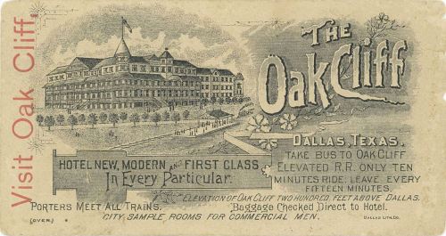
“Visit the Oak Cliff…” (click for much larger image) Photo: SMU

by Paula Bosse

I saw this image yesterday while browsing through the George W. Cook Collection (DeGolyer Library, SMU). It’s from about 1890. It’s great. BUT, the other side of this card is even better:

oak-cliff_cook-coll_degolyer_smu_back

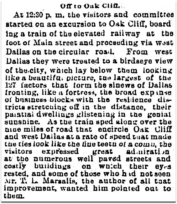
I’m not sure how realistic this drawing is, but it’s great! Oak Cliff never looked so … quaint. The best part is the depiction of the little commuter railway that Oak Cliff developer Thomas L. Marsalis built in the 1880s to handle commuter traffic between Oak Cliff and Dallas — a necessity if his development west of the Trinity was to grow. There were two little steam trains which made a complete circle and offered spectacular views of  Dallas as they headed toward the river. Here’s an account of visitors from Kansas City who enjoyed their scenic ride (click to see a larger image):

oak-cliff-train_dmn_112490
Dallas Morning News, Nov. 24, 1890

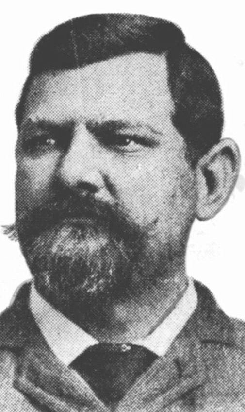
Marsalis had made his fortune in the grocery business, and much of that fortune was funneled into making his vision a reality: Oak Cliff would become a large, beautiful, prosperous community. He spent huge amounts of money developing the then-separate town of Oak Cliff. A wheeler-dealer and an obsessive whirlwind, money was no object to Marsalis as he charged at full speed to make Oak Cliff a booming North Texas garden spot.

marsalis_legacies_fall-2007
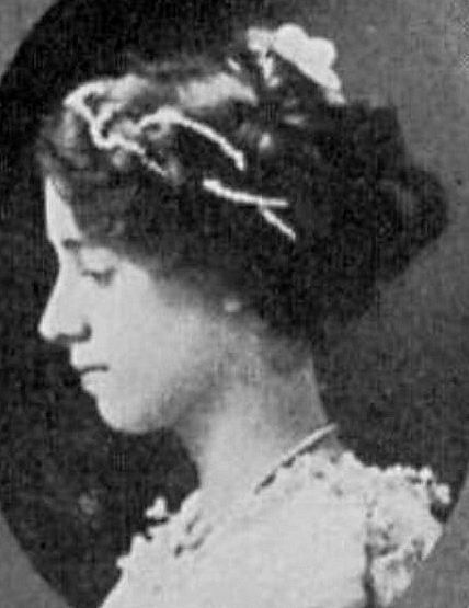
Thomas L. Marsalis — the “Father of Oak Cliff”

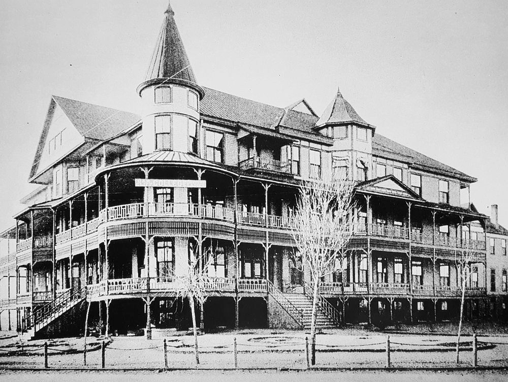
The jewel in T. L.’s O.C. crown was the 100-room resort, the Oak Cliff Hotel (which in its early planning had been called the Park Hotel). Ground was broken on Dec. 21, 1889. Projected to cost $75,000, it is said to have cost over $100,000 when construction was completed, or, over $2.6 million in today’s money.

oak-cliff-hotel_dmn_122289_groundbreaking
DMN, Dec. 22,1889

A thorough description of the spectacular $100,000 showplace can be read in a Dallas Morning News article from May 25, 1890, here. When it opened on July 10, 1890, the News’ coverage of the opening included the following lyrical passage:

When darkness had settled down over the cliff the large hotel showed off to its best advantage, as at a short distance away it looked like some living monster with hundreds of fiery eyes. The lights showing from every window made a startling sight to those who coming upon it had previously seen a dark pile looming up in the night.

oak-cliff-hotel_minutaglio

It was, by all accounts, a popular hotel and social gathering place. But, in November of 1891 — having been open only a little over a year — a notice appeared in the papers that the hotel would be closing for the winter for “renovations.” It never reopened. Marsalis had over-extended himself. His dreams for Oak Cliff began to dim as the stacks of unpaid bills mounted, and he found himself mired in lawsuits for the next several years. He eventually had to admit defeat, and he and his family moved to New York.

Six months after that notice of “renovations” appeared, the huge building was leased to Prof. Thomas Edgerton, who planned to open a “female seminary.”

oak-cliff-college_flickr

The Oak Cliff College For Young Ladies opened  in the fall of 1892. And it was a spectacular-looking schoolhouse.

oak-cliff-college_dallas-rediscoverd_dpl

The college lasted until the beginning of 1899 when it changed hands and became Eminence College for a brief year and a half.

eminence-college_southern-mercury_062299
Southern Mercury, June 22, 1899

After Eminence College appears to have gone bust, the building was vacant by 1901. There was talk that Oak Cliff should purchase the property and reinstall a school, but, eventually, the building went up for auction in September, 1903.

oak-cliff-hotel_dmn_082603_for-sale
DMN, Aug. 26, 1903

The building sold to T. S. Miller, Jr. and L. A. Stemmons for $6,850, a fraction of what Marsalis had spent building it. That’s a pretty steep depreciation.

oak-cliff-hotel_dmn_090203_sold
DMN, Sept. 2, 1903

But, no fear, Hotel Cliff opened on April 18, 1904. Still looking good.

hotel-cliff_degolyer

hotel-cliff_dmn_071104
DMN, July 11, 1904

Hotel Cliff was in business through about 1915. There were some “lost” years in there when it seemed to be in limbo (during some of this time it was undergoing extensive renovation), but in 1921 it re-opened as the Forest Inn.

forest-inn_dmn_042421
DMN, April 24, 1921

forest-inn_bartlett-tribune-and-news_070424
Bartlett News, July 4, 1924

The Forest Inn had a long run — 24 years. In 1945 the property was sold, and T. L. Marsalis’ spectacular resort hotel was demolished. It was estimated that it would take ten weeks to finish the demo job — Marsalis had spared no expense building his hotel, and it had been built to last.

The destruction is a tough job, Jack Haake, wrecking contractor, said. Despite its age, the building is so well built that much time is being required to take it apart. The lumber is of the best grade and much of it still is in good condition, Haake said. Scores of huge 2×6 planks, thirty-two feet long, were used in the building, and that timber is in excellent condition. (“Historic Oak Cliff Hotel Being Razed For New Structure,” DMN, Sept. 10, 1945)

The land apparently remained vacant until Southwestern Bell Telephone announced plans to build a three-story office building on the property in 1954; the building opened the following year. In 1986, the building was renovated and became the Oak Cliff Municipal Center, which still occupies the site.

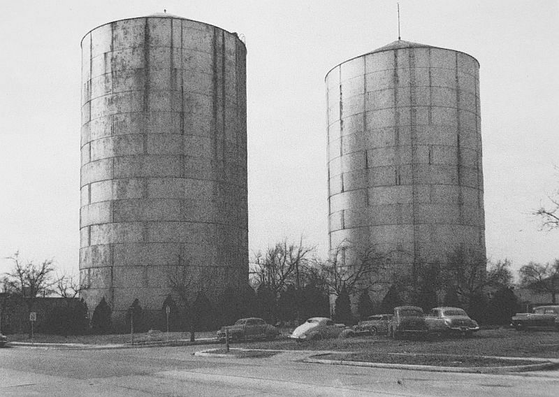
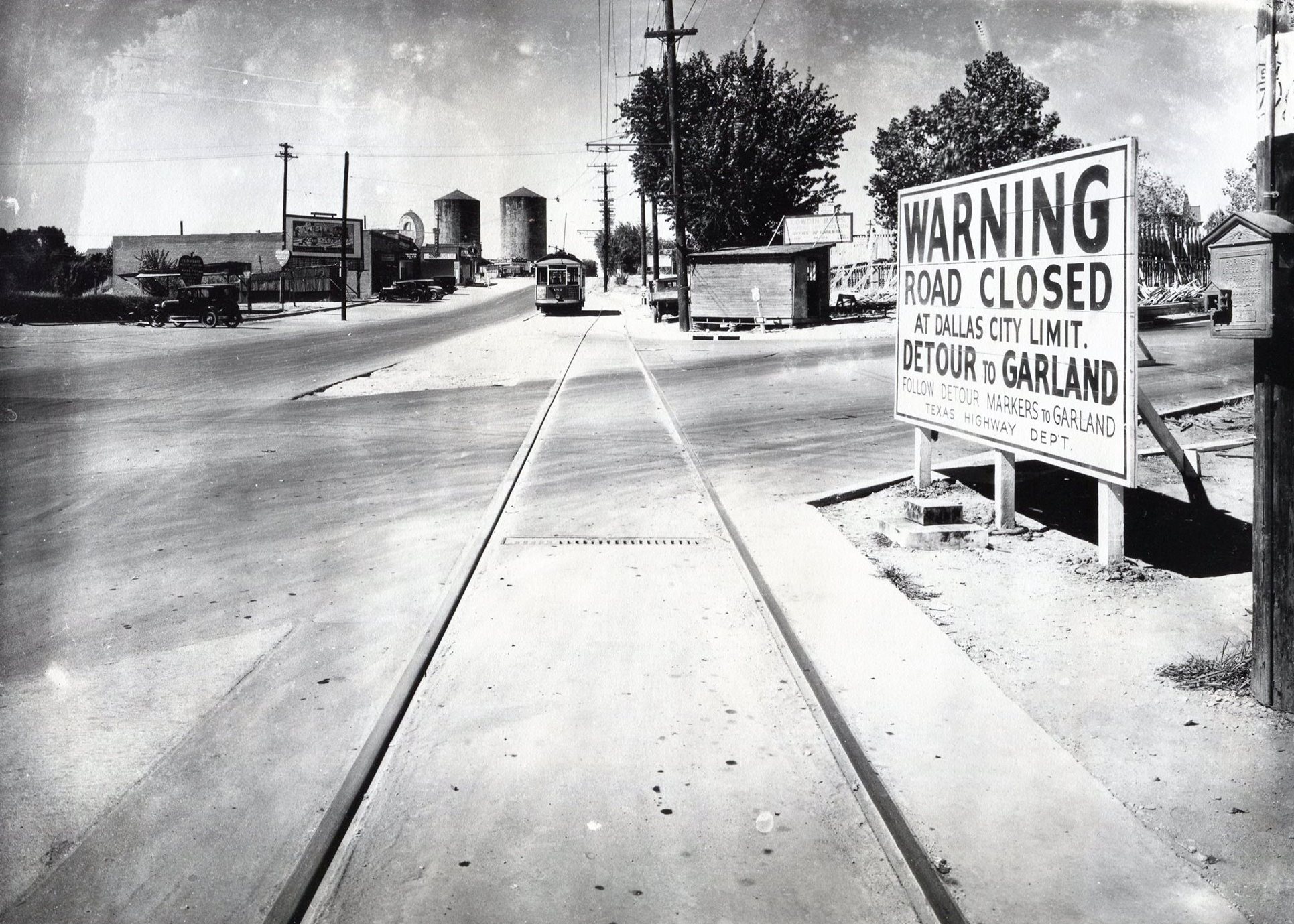
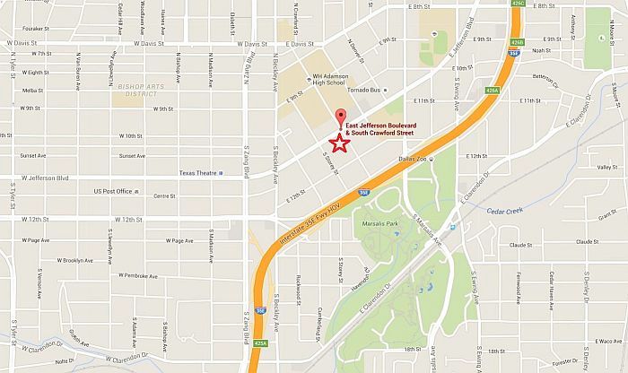
Where exactly was that huge, wonderful hotel that Thomas Marsalis built? It was located at what is now the southwest corner of East Jefferson Blvd. and South Crawford Street. A view of that corner today can be seen here. To get an idea  of how much land the hotel/college once occupied, check out the 1905 Sanborn map, here (and this is after 15 years of explosive growth of Oak Cliff, so it obviously originally had much more open land around it); by 1922, encroachment was well underway, and the property was already being chopped into smaller parcels.

oak-cliff-hotel_map_google
Google Maps

I wonder what Thomas Marsalis would think of Oak Cliff today? And I wonder what Oak Cliff would have become had Marsalis never put his money and energy into its early development?

**

There is a lot of misinformation on various online sources about the timeline of this building. As best I can determine, here is the correct chronology:

  • 1889: groundbreaking for hotel, in December
  • 1890-1891: Oak Cliff Hotel
  • 1892-1899: Oak Cliff College For Young Ladies
  • 1899-1901: Eminence College (also for young women)
  • 1902-1903: vacant
  • 1903: building sold at public auction, in September
  • 1904-1914: Hotel Cliff
  • 1914-1915: Oak Cliff College (reorganized, back for one last gasp)
  • 1915-1920: basically empty, with a couple of token tenants
  • 1921-1945: Forest Inn
  • 1945: demolished

***

Sources & Notes

First two images show both of sides of an advertising card; “Visit Oak Cliff” is from the George W. Cook Dallas/Texas Image Collection, DeGolyer Library, Central University Libraries, Southern Methodist University — more information is here.

Photo of Thomas Marsalis from Legacies, Fall, 2007.

Colorized image of hotel from the front cover of The Hidden City: Oak Cliff, Texas by Bill Minutaglio and Holly Williams. The sign is hard to read, but this may show the building during the Hotel Cliff days.

The detail of an Oak Cliff College envelope comes from the Flickr page for the Texas Collection, Baylor University, here. (Sure hope Mr. Edgerton was able to get a refund on that printing job — having “Oak Cliff” misspelled on official college correspondence probably caused a grimace or two!)

Large black and white photograph of Oak Cliff College appeared in William L. McDonald’s Dallas Rediscovered; photo from the collection of the Dallas Public Library.

Hotel Cliff postcard from the Cook Collection, SMU; information is here.

See the beautiful house Marsalis built for himself (but which he might never actually have lived in) in my post “The Marsalis House: One of Oak Cliff’s ‘Most Conspicuous Architectural Landmarks,'” here.

Thomas L. Marsalis is a fascinating character and an important figure in the development of Oak Cliff, but his post-Dallas life has always been something of a mystery. I never really thought of myself as a “research nerd” until I started this blog, but reading how a few people in an online history group pieced together what did happen to him was surprisingly thrilling. This round-robin investigation began in the online Dallas History Phorum message board, here, and finished as the Legacies article “Where Did Thomas L. Marsalis Go?” by James Barnes and Sharon Marsalis (Fall 2007 issue). If you have some time, I highly recommend reading through the Phorum comments and then reading the article. It’s very satisfying!

All images and clippings larger when clicked. 

*

Copyright © 2016 Paula Bosse. All Rights Reserved.

Dallas Fire Stations — 1901

fire-dept_engine-co-3_gaston-and-college_1901Fire horse in Old East Dallas relaxing between calls (click for larger image)

by Paula Bosse

A few turn-of-the-century photos of Dallas’ fire stations, from a 1901 photographic annual. These seven firehouses were built between 1882 and 1894. One of these buildings is, miraculously, still standing on McKinney Avenue, in the heart of Uptown.

*

At the top, Engine Co. No. 3, at Gaston and College Avenues. In service: January, 1892. Equipment: an Ahrens Steamer, capacity 750 gallons per minute, and a Cooney Hose Carriage. See it on a 1905 Sanborn map here; see the present location (Gaston and Hall) here. (And since I just used it a few days ago, here’s a 1921 Sanborn map, showing Mill Creek running right through the property.)

*

fire-dept_central-station_main-harwood_1901

Above, Central Fire Station, Main and Harwood Streets. In service: October, 1887. Equipment: a double-sixty-gallon Champion Chemical Engine and a City Hook and Ladder Truck. See it on a 1905 Sanborn map here; see the present location here (the site of the old City Hall/Municipal Building).

*

fire-dept_mckinney-leonard_engine-co-1_1901

Engine Co. No. 1, McKinney Avenue and Leonard. Equipment: an Ahrens Steamer, 750 gallons per minute, and a Cooney Hose Carriage. In service: August, 1894. See it on a 1905 Sanborn map here; see the present location here. NOTE: This is the only one of these firehouses still standing. I wrote about it here.

UPDATE: Well, sort of. Thanks to a comment on Facebook, I researched this station a bit more and found that it was rebuilt and modernized at the end of 1909 — using materials from the original building seen above, built on the same plot of land. So instead of being 122 years old, the building on McKinney today is a mere 106 years old.

*

fire-dept_commerce-hawkins_engine-co-2_1901

Engine Co. No. 2, Commerce and Hawkins Streets. In service: January, 1882. Equipment: an Ahrens Steamer, capacity 750 gallons per minute, and a Cooney Hose Carriage. See it on a 1905 Sanborn map here; see a shot-in-the-dark guess at a present location here.

*

fire-dept_ervay-kelly_hose-co-2_1901

Hose Co. No. 2 and Chemical Co. No. 2, Ervay Street and Kelly Avenue. In service: September, 1894. Equipment: a Cooney Hose Carriage and double-sixty-gallon Champion Chemical Engine. See it on a 1905 Sanborn map here; see the present location here (right behind where the word “Cedars” is).

fire-dept_bryan-hawkins_hook-and-ladder-1_1901

Hose Co. No. 1 and Hook and Ladder Co. No. 1, Bryan and Hawkins Streets. In service: January, 1893. Equipment: Preston Aerial Truck with 75-foot extension ladder, and a Cooney Hose Carriage. See it on a 1905 Sanborn map here; see the approximate present location here.

*

fire-dept_commerce-akard_engine-co-4_1901

Engine Co. No. 4, Commerce and Akard Streets, next door to the City Hall. In service: August, 1894. Equipment: an Ahrens Steamer, capacity 1,100 gallons per minute, and a Cooney Hose Carriage. See it on a 1905 Sanborn map here; see the present location here (just out of frame at the right was the City Hall; the block is now the site of the Adolphus Hotel).

*

city-hall_1901_fire-dept-annual_portal

City Hall, Commerce and Akard Streets, now the location of the Adolphus Hotel. Half of the shorter building to the left housed the police department and Engine Co. No. 4.

*

The “Historical” page from the book (click to read).

fire-dept-hist_dallas-fire-dept-annual_1901_portal

**

Since there is no sign of the actual equipment in these photos, here’s what horse-drawn steam engines (Ahrens steamers) looked like at this time. (Photo from the Wisconsin Historical Society).

fire-steam-engine_wisconsin-hist-soc

UPDATE: I found this photo on Flickr, showing equipment from those early days being driven through the streets of Dallas during a fire prevention parade.

fire-department_pumper_flickr_coltera

UPDATE: Lo and behold, a photo from 1900 of Old Tige, the 600 gallons-per-minute steam pumper, built in 1884, which was in service with the Dallas Fire Department until 1921. (Old Tige can be seen in the Firefighters Museum across from Fair Park.) Found at the Portal to Texas History.

old-tige_1900_fire-dept-bk_1931_portal

***

Sources & Notes

Photos by Clifton Church, from the Dallas Fire Department Annual, 1901, which can be viewed in its entirety on the Portal to Texas History, here.

A contemporary map of Dallas (ca. 1898) can be viewed on the Portal to Texas History site, here.

More Flashback Dallas posts on historic Dallas firehouses can be found here.

All photos larger when clicked.

*

Copyright © 2016 Paula Bosse. All Rights Reserved.