Flashback : Dallas

A Miscellany: History, Ads, Pop Culture

Category: Neighborhoods

Exposition Park: No Swamps, No Malaria — 1889

expo-park_ad_dmn_102489-b

by Paula Bosse

In 1889, Parry Bros. were developing 80 acres of Capt. William H. Gaston’s old stomping grounds — aka the Gaston Homestead. The ads came fast and furious. One sentence stands out:

The natural drainage of Exposition Park, under the guiding hand of our civil engineer, has become practically perfect. There are no swamps or other sources of malaria contiguous to this property. 

Sounds good to me!

(I always thought the Fair Park area was prone to flooding, but perhaps the area I’m thinking of is not “contiguous to this property.”)

 *

expo-park_ad_dmn_102489-a

***

Sources & Notes

Ad from The Dallas Morning News, Oct. 24, 1899.

expo-park_ad_dmn_102489-b_sm

*

Copyright © 2023 Paula Bosse. All Rights Reserved.

Businessmen’s Lunchtime Mobilization Drills — 1917

wwi_businessmen_noon-drills_dmn_040117_photo
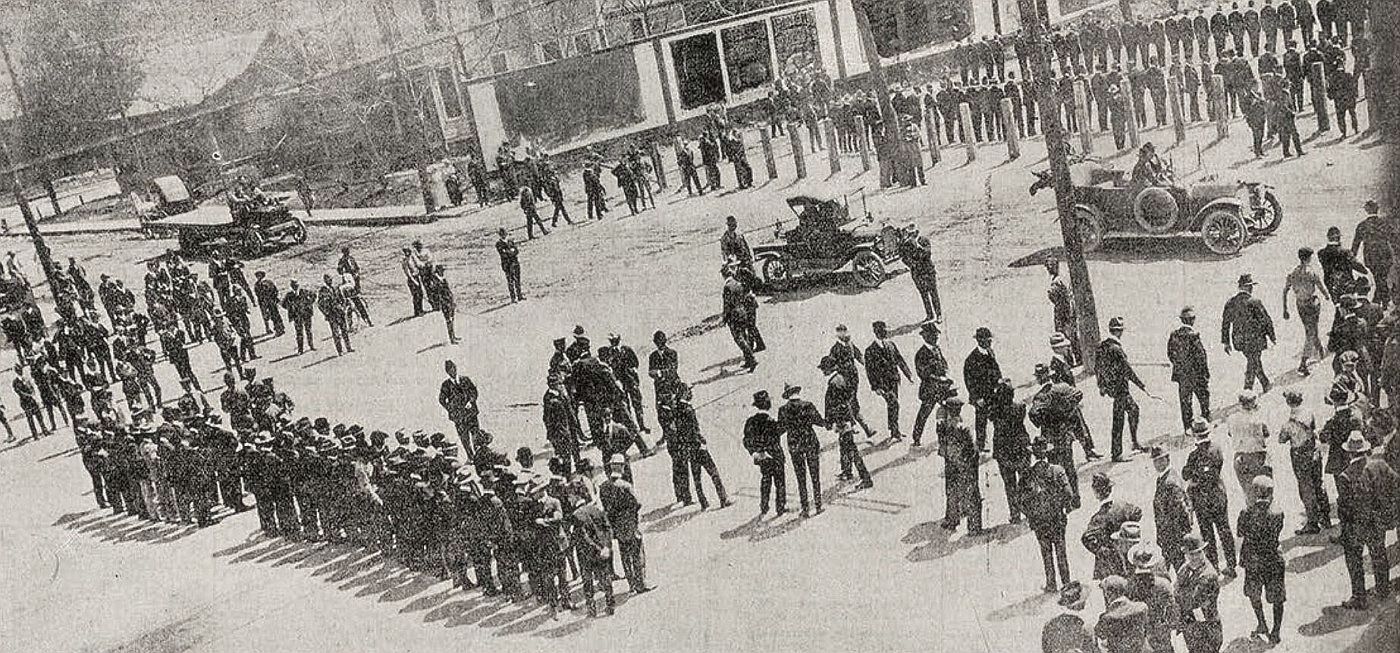
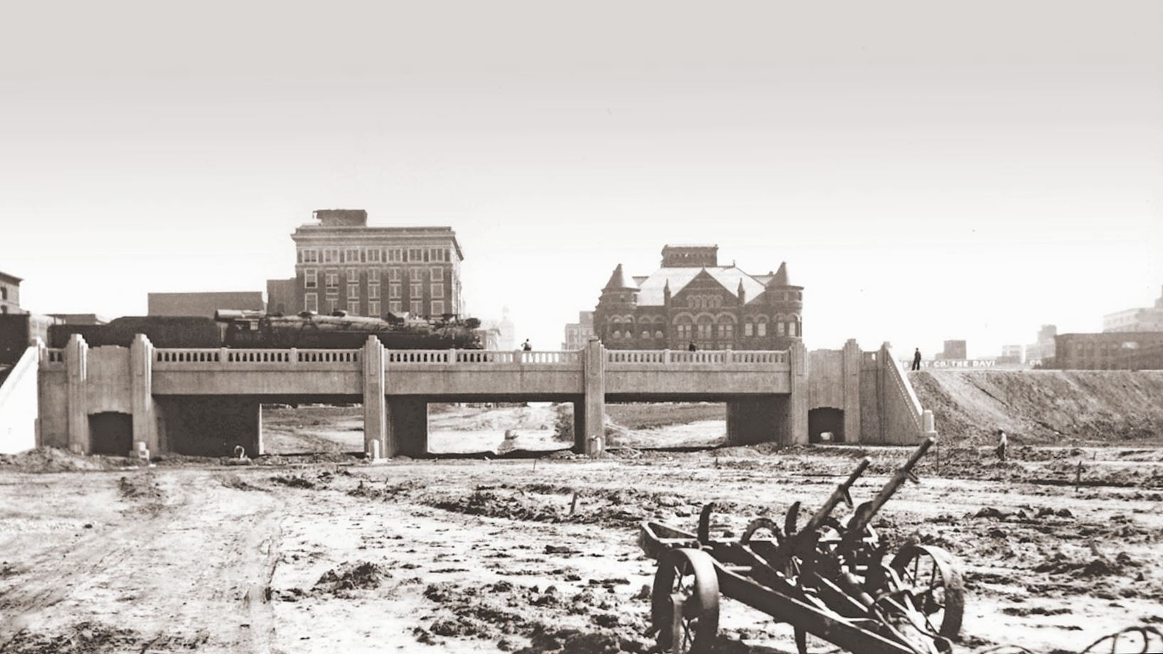
Drilling behind the depot, March 1917

by Paula Bosse

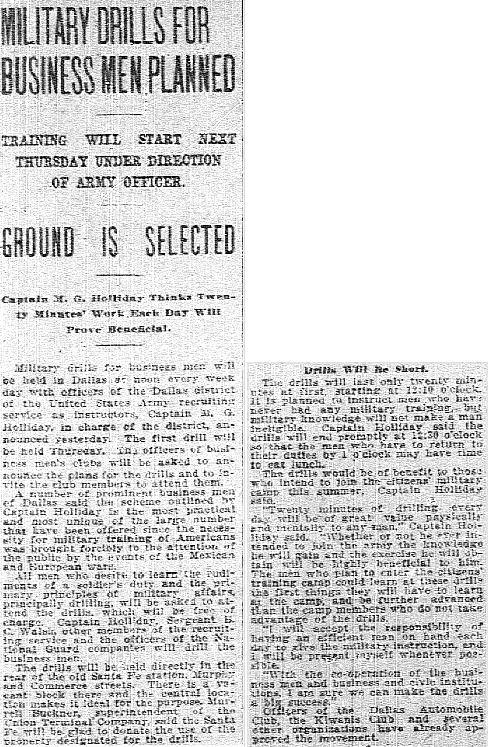
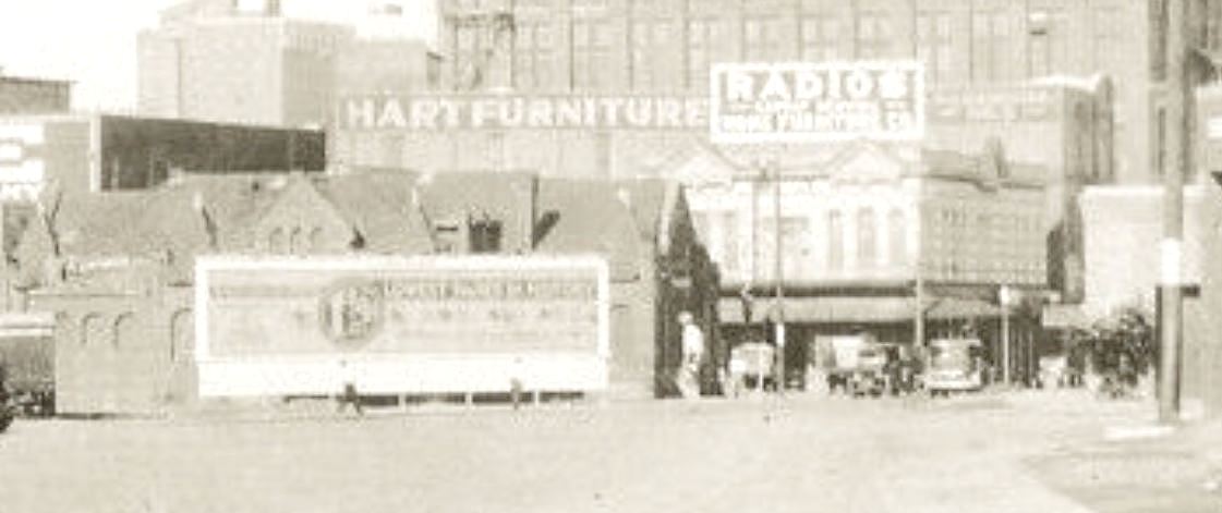
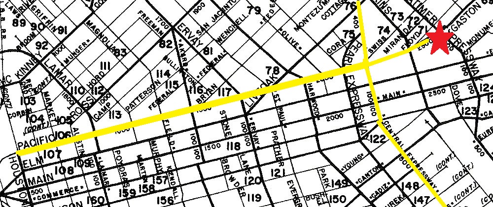
In March 1917, just days before the United States entered World War I, it was announced that there would be lunchtime military training drills in downtown Dallas for any man who wished to participate. This was part of the “Preparedness Movement” which was sweeping the country, in which citizens readied themselves for war. The idea for these drills came from Oswin K. King, a Dallas sportswriter, and they were organized and conducted by Capt. M. G. Holliday, with help from other officers of the Texas National Guard. The drills were held “in the rear of the old Santa Fe station, Murphy and Commerce streets. There is a vacant block there and the central location makes it ideal for the purpose” (“Military Drills for Business Men Planned,” Dallas Morning News, March 25, 1917). (See this location on a 1905 Sanborn map, here.)

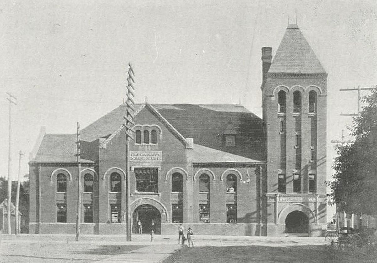
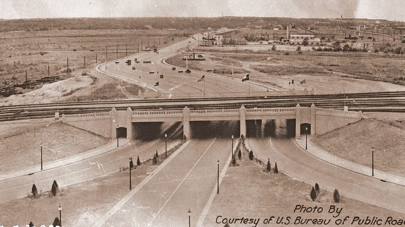
Seems like a good time to insert a photo of the Gulf, Colorado, and Santa Fe depot (when it was still in operation), behind which all this drilling activity was taking place:

santa-fe-depot_ca-1899_fire-dept-souvenir-bk_portalca. 1899, via Portal to Texas History

Military-style drills involving local civilians hadn’t really been done like this before, and news of this swept the country’s newspapers. It was a BIG story. Dallas became the city everyone copied. Cities all over the United States began their own drilling exercises, and Capt. Holliday was kept busy traveling around Texas to advise towns on how to establish such civilian units for themselves. There was a lot of marching in formation going on in April 1917.

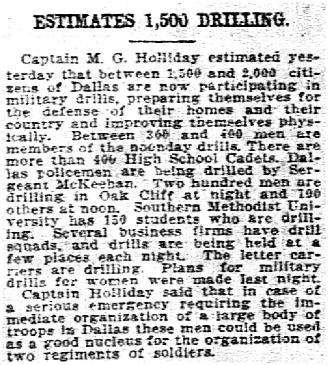
Two weeks in, drill-mania had taken over Dallas. It was estimated that 600 men were showing up daily for the downtown noon drills, and that many more — perhaps as many as 2,000 — had joined smaller groups and clubs which were drilling on their own all over town. There was a large contingent in Oak Cliff, lots of students in high schools and at SMU, policemen, letter carriers, businessmen, etc. There was even a suggestion that women should form their own groups. Any way you looked at it, the endeavor was a success (or at least fervently supported). Capt Holliday said that, should the need arise, a large body of troops could be immediately organized in Dallas — perhaps two regiments’ worth. 

This training lasted about a month, which seems like sufficient time for bank clerks and grocerymen and automobile mechanics and upholsterers to get the hang of doing whatever this was. By the spring of 1917, Dallas was prepared.

**

The April 1, 1917 Dallas Morning News article accompanying the photo above is transcribed here:

DALLAS BUSINESS MEN MOBILIZE FOR MILITARY TRAINING

First City in United States to Start New Drills in Rudiments of Soldier Knowledge

From Few Dozen the First Day to 600 or More Saturday, Shows Rapid Increase of Interest in the Noon Drills. Captain in U.S. Cavalry and Number of Non-Commissioned Officers Instructing Men and Rudiments of Knowledge of Soldier Life

Dallas enjoys the distinction of being the first city in the United States to inaugurate the new mobilization of business men for the purpose of learning the rudiments of military training. There were those who said it could not be done, but the movement has gotten under full swing and the attendance is increasing daily.

Oswin K. King, of the Evening Journal, originated the idea, and becoming enthused of the possibilities, Mr. King suggested the matter to Captain M. G. Holliday of the 12th United States Calvary. Captain Holliday at once took up the plan as suggested by Mr. King and agreed to supervise the work. 

For several days now, hundreds of Dallas business men have been in line on the spacious vacant property to the south of the Commerce Street station of the Santa Fe Railroad. The site is convenient to hundreds of business offices and not over five minutes’ walk from the skyscraper district.

That interest is increasing in the movement is evidenced by the number of business men who are enrolling. From a few dozen on Wednesday, last, to 400 on Thursday, and probably 200 more Friday and Saturday, shows that Dallas men are anxious to learn the rudiments of military training.

The idea is to teach the rudiments of close-order formation, including everything in what is known as the “Soldier’s School Without Arms.”

The instruction will continue indefinitely. Captain Holliday is assisted by several non-commissioned officers and civilian military experts.

*

WWI_noon-drills_dmn_032517DMN, Mar. 25, 1917 (click for larger image)

*

wwi_businessmen_noon-drills_dmn_041317DMN, Apr. 13, 1917

***

Sources & Notes

Top photo from The Dallas Morning News, April 1, 1917, sent to me by Julia Barton (thanks, JB!).

Photo of the Santa Fe depot is from a Dallas Fire Department publication from 1899, provided by the Dallas Firefighters’ Museum to the Portal to Texas History — more information is here.

More Flashback Dallas posts on the WWI era can be found here.

wwi_businessmen_noon-drills_dmn_040117_photo_sm

*

Copyright © 2023 Paula Bosse. All Rights Reserved.

Santa Claus Visits Fair Park — 1969 and 1970

santa_4_WFAA_SMU_122069
The list is ready…

by Paula Bosse

Check out two charming film clips of Santa visiting kids in Fair Park on Dec. 20, 1969 and Dec. 23, 1970 (the links to the clips are below). He arrives, of course, in a helicopter. These events were sponsored by the Negro Chamber of Commerce.

From this clip’s YouTube description:

A Black Santa Claus lands via helicopter in Fair Park as a large crowd of predominantly African American children rush to meet him; children are seen on Santa’s lap as parents stand by; a box of wrapped apples is seen. (A “Black Santa” was an unusual sight in the 1960s, and the concept was much in the news in the 1969 Christmas season as the Southern Christian Leadership Conference (SCLC) had issued a demand that department stores in Cincinnati hire African American Santas or face a boycott, and the story was widely covered around the country.) (Silent)

Watch the full 38-second (silent) clip on YouTube here. Below are some screenshots.

santa_2_WFAA_SMU_122069

santa_3_WFAA_SMU_122069

santa_5_WFAA_SMU_122069

santa_6_WFAA_SMU_122069

santa_7_WFAA_SMU_122069

Santa made a return visit the next year — again via chopper — on Dec. 23, 1970. An article appeared in The Dallas Morning News revealing Santa’s helper to be Issac Debois who was quoted as saying with a chuckle, “I’m the only black Santa Claus from the South Pole.” Watch the full 38-second (silent) clip here.

santa-1970_122370_WFAA_SMU_1

santa-1970_122370_WFAA_SMU_2

santa-1970_122370_WFAA_SMU_3

santa-1970_122370_WFAA_SMU_4

Merry Christmas!!

***

Sources & Notes

All images are screenshots from WFAA-Channel 8 news stories — from the WFAA Newsfilm Collection, G. William Jones Collection, Southern Methodist University.

The first clip (from 1969) is contained in the larger video on YouTube here — the specific short clip is here.

The second clip (from 1970) is contained in the larger video on YouTube here — the specific clip is here.

Read the Dallas Morning News story about the second visit in the DMN archives: “Santa Enjoys Happy Visit, With Gifts” (DMN, Dec. 24, 1970).

Find more Flashback Dallas posts on Christmas here and Hanukkah here,

santa_4_WFAA_SMU_122069_sm

*

Copyright © 2022 Paula Bosse. All Rights Reserved.

Triple Underpass — ca. 1936

triple-underpass_ca-1936_us-bureau-public-roadsThe Gateway to Dallas, or the the Gateway to Oak Cliff?

by Paula Bosse

Above, a fantastic photo showing the new Triple Underpass, about 1936, with the view toward Oak Cliff. (Compare this with a similar view, from the 1950s, here.)

Below, a little earlier, with the view to the east, back toward town.

triple-underpass_construction_looking-east_austin-bridge-and-road-co

The triple underpass was built by the Austin Bridge & Road Company between 1934 and 1936, finishing up just in time to welcome the onslaught of visitors to the Texas Centennial Exposition. I encourage you to visit the company’s public Facebook post here, which includes these and other great photos of this Dallas landmark (including a “then and now” comparison and a history of their involvement in the project). Below is an excerpt from that post:

Once called the “Gateway to Dallas,” the triple underpass near Dealey Plaza was built by Austin Bridge Company and Austin Road Company starting in 1934. The underpass, a joint project with the Texas Highway Department and City of Dallas, created access to the western edge of downtown Dallas under the Union Terminal tracks. Contending with up to 80 trains a day complicated the job, requiring close cooperation with the railway companies. The triple underpass was hailed as a modern marvel, built of concrete with square balusters in a handsome art-deco style. It was unveiled with great excitement in 1936, during Texas Centennial celebrations.

***

Sources & Notes

Top image is a U.S. Bureau of Public Roads photo showing the new underpass, looking to the west.

Both photos and the excerpt are from a post on the Austin Bridge & Road Facebook page, which you can find here.

triple-underpass_ca-1936_us-bureau-public-roads_sm

*

Copyright © 2022 Paula Bosse. All Rights Reserved.

1400 Block of Main Street, ca. 1946

main-street_century-room_ca-1946_bell-collection_DHS_detThe Century Club, the Adolphus Bar, and the Manhattan Cafe await…

by Paula Bosse

A few years ago, I went in to the Dallas Historical Society a few times a week to volunteer. I ended up basically cataloging an entire collection of photos taken by a man named James H. Bell — and I really enjoyed it. Bell wasn’t a professional photographer, he was just a guy who liked to take a lot of photographs. The photos were all taken, as I recall, in 1946 and 1947, when he was apparently visiting Dallas — which I gather was his hometown — on a trip from his new home in California. He took a lot of pictures of places around Dallas that no one really bothered to document: businesses, street life, houses. He was also something of a pinball and jukebox aficionado, because a large number of his photos had coin-operated machines in them. Like a LOT. He also liked buses. And he seemed to always have his camera with him.

The photo above (which, sadly, I’ve had to crop because of image issues) shows the south side of the 1400 block of Main Street. I’ve never seen a photo from this period of the Main Street entrance to the Adolphus Hotel. That cool 1936 deco sign for the Century Room is great (even though it looks a little out of place next to the overly ornate early-20th-century arch next to it). (See the full wonky image — apologies for the low resolution — all my fault — here.)

I can tell you exactly why Bell took this photo: he saw a coin-operated machine being unloaded from a truck (or loaded into a truck). There were others photos in this collection taken in similar circumstances. I don’t know whether he was following jukebox and pinball trucks around town (a very definite possibility…), or whether he just happened upon these coin-op machine deliveries, camera at the ready. Whatever the case, he got a nice action-photo of a jukebox delivery in the wild, while, at the same time, he secured for posterity a nice historical image of everyday life on Main Street. And, we have the added bonus of seeing the long-gone sign for the swanky Century Room nightclub.

This was the Dallas Historical Society description I wrote for the full photo:

Downtown Dallas, 1400 block of Main Street. South side of Main, with Akard intersecting at left. Partial view of the Southwestern Life Building (southeast corner of Main and Akard, with Travis cigar stand at street level); Andrews Building (southwest corner of Main and Akard); C C Liquor Store (1412-B Main); Elko Camera Store (1410 Main); Ragir’s (1412 Main); Adolphus Hotel, rear entrance (with Century Room nightclub sign); Adolphus Bar (1406 Main); the Marquee restaurant (1404 1/2 Main); Paul R. Brown’s Restaurant. Also: a sign for Manhattan Cafe or Cafe Manhattan, pedestrians, 1940s vehicles, workman securing a pinball or other coin-operated machine into back of pickup truck.

*

And here’s what it looked like at night:

adolphus_neon_outdoor-electric-advertising_southwest-business_sept-19361936

***

Sources & Notes

This photo was taken by James H. Bell in about 1946, and it is from the James H. Bell Collection at the Dallas Historical Society. The Accession Number is 2017.48, and the Object ID is V.2017.48.531. 

Ad for Outdoor Electric Advertising is from Southwest Business magazine, Sept. 1936, Periodicals Collection, Dallas Public Library.

main-street_century-room_ca-1946_bell-collection_DHS_det_sm

*

Copyright © 2022 Paula Bosse. All Rights Reserved.

Thanks-Giving Square — 1976

thanks-giving-square_thanksgiving-square_1976_postcard_ebay

by Paula Bosse

Happy Thanksgiving! It seems like a good day to look back at Thanks-Giving Square, the triangular one-acre park in downtown Dallas bounded by Pacific, Bryan, and Ervay. It was originally envisioned in 1961 by Dallas businessman Peter Stewart as a needed quiet refuge and chapel in the middle of a busy city — a calm space set aside for “spiritual gratitude.” It took several years before architect Philip Johnson was brought on to the project in 1971. After more than 15 years from its original conception, its official public dedication was on Nov. 28, 1976, three days after Thanksgiving.

Check out some of the progress reports on the project which appeared over the years on WFAA-Channel 8 News:

Architect Philip Johnson (whose other Dallas projects include the Kennedy Memorial, The Crescent, and the Cathedral of Hope, etc.) talks briefly about Thanks-Giving Square and its underground component, and also shows off a 3-D model (from July 1971):

*

Business owners whose shops were in buildings on the land which was about to be leveled were forced to move out, and many were not happy (from April 1972):

*

Construction is underway (November 1976):

*

And, lastly, Channel 8 weatherman Troy Dungan checks out the progress as the dedication day approaches (November 1976):

*

For a bit of street-level context, here’s a photo showing some of the buildings that were razed (at the right, directly across from the Republic Bank Building) in order to make way for Thanks-Giving Square:

kodachrome_bryan-n-ervay_1954_shorpyvia Shorpy.com

*

Below is a detail from a newspaper ad for MetroBank which appeared in August, 1976, with a nice little stylized illustration of the triangular TGS and its swirly chapel (click for larger image).

thanks-giving-square_metrobank-ad_det_080276

*

Speaking of the “swirly” design, in a 1982 article about TGS, Dallas Morning News architect deity David Dillon described this structure as “Philip Johnson’s Dairy Queen chapel,” which, presumably, might not have been met with amusement by internationally acclaimed architect Johnson, who probably wouldn’t have appreciated the comparison of his work to an ice cream cone. Interestingly, that description appeared in a 1982 article about Stewart’s dismay that the tall buildings which loomed over TGS (including Thanksgiving Tower) were, basically, blotting out the sun — little TGS was more often in shadow than in sunlight:

Stewart urged the city to pass a sun and shadow ordinance that would preserve the remaining downtown view corridors from high-rise development […] but the [preliminary] ordinance got such a cool reception from downtown developers that it was dropped quickly. (“Computer Study Sheds Light On Thanks-Giving Square Problem” by David Dillon, Dallas Morning News, July 4, 1982)

I bet it got a cool reception!

***

Sources & Notes

Postcard found on eBay.

Videos from SMU’s WFAA News Film Collection, which can be found on the SMU Jones Film Collection YouTube channel.

Thanks to Noah Jeppson for passing along a link to the huge Thanks-Giving Foundation Collection of photos and documents, viewable on the University of North Texas’ Portal to Texas History, here.

Read about the history of Thanks-Giving Square (or as it’s often written, Thanksgiving Square) on Wikipedia, here.

Read the D Magazine article “The Park That Peter Built” (which seems to end abruptly) about the history of Thanks-Giving Square by Jane Sumner from Nov. 1, 1977 here.

thanks-giving-square_thanksgiving-square_1976_postcard_ebay_sm

*

Copyright © 2022 Paula Bosse. All Rights Reserved.

Highland Park High School Rodeo Club — 1973

rodeo_HPHS-yrbk_1973

by Paula Bosse

HPHS had a rodeo team? It was apparently a thing, at least in 1973 — they even participated in the Fat Stock Show in Fort Worth.

Seeing as these are Highland Park students, I can only imagine the guys seen above ultimately became partners in a law firm called Barton, O’Connor, Rohlfs, Goss, Bibby & Fitch.

There were other “rodeo” mentions in the yearbook, including this double-page ad which read “The Original Highland Park Rodeo Club.” I mean, kids are wearing t-shirts. I don’t know whether this was an elaborate “ironic” put-on, or whether it was real, but, I have to say, either way, I’m a fan!

rodeo_original-roadeo_HPHS_1973_a

rodeo_original-roadeo_HPHS_1973_b

rodeo_HPHS_1973_det

rodeo_HPHS_1973

***

Sources & Notes

Photos from the 1973 Highland Park High School yearbook, The Highlander.

rodeo_HPHS-yrbk_1973_sm

*

Copyright © 2022 Paula Bosse. All Rights Reserved.

East on Elm

elm-street_gentrys_city-of-dallas-websiteShouldn’t there be cars?

by Paula Bosse

There has been some heavy-duty editing to this post!

Here’s an interesting photo I stumbled across last night on the City of Dallas website. There wasn’t any information about it, but it appears to be a view to the east, taken from the 1400 block of Elm Street (where Exchange Place — originally Scollard Court — intersects). See what it looks like today on Google Street View here.

The main landmarks are what I call the Wilson Building Jr. (the tall dark building in the distance, located on Elm near Ervay), the Praetorian Building (the tall white building at the right, at Main and Stone), and L. W. Gentry’s photography studio in the middle of the photo at the right.

Gentry’s was upstairs at 1304 Elm from about 1904 until about 1911. In 1912, Gentry moved a block down the street to 1502 Elm, at Akard, where he took over the upstairs studio of photographer J. C. Deane. (I wrote about Deane and this building here.)

There is a sign reading “Empress” at the left. That was the Empress Theatre, which was at 1409 Elm from about 1912 to 1915. Directly across the street is a 3-story building with a sign for the Spirella Corset Parlors at 1410 Elm.

Back to the left, across the street, is the hard-to-read sign for Studebaker Bros. of Texas at 1405 Elm. Directly across the street is the new Kress Building (you can see part of the distinctive “K” from the company’s logo at the top right). Kress was at 1404-8 Elm — the building was erected in 1911 and opened that same year in November.

The “new Wilson Building” was also built in 1911, and Gentry’s took over the space above T. J. Britton’s store at Elm and Akard in 1912. And all these places appeared in the 1912 directory (except for the Empress, which was open in 1912 but might not have made the listing deadline). So I’m going to guess that this photo is from 1912 or 1913.

gentry_1912-directory_1502-ELM1912 Dallas directory, Elm Street

But this photo looks older than 1912. So many horses! The only vehicle not pulled by a horse in this photo is the streetcar. Where are the cars? In 1911, Dallas was pretty car-crazy — you’d expect to see at least ONE horseless carriage in there somewhere. It doesn’t sound like a lot, but in 1911, there were about one thousand automobiles registered in Dallas County, and the city was quickly becoming a major distribution hub for car companies (“Dallas Automobile Center of the Southwest,” Dallas Morning News, Dec. 31, 1911). (Check out this photo from 1911 taken a couple of blocks away. The only animals seen are actually riding IN an automobile!) Were cars banned from Elm Street? Seems unlikely. …I’m pretty sure I’m overthinking this.

(Ironically enough, the full entry for Studebaker Bros. which appears in the 1912 directory reads: “Carriages, wagons, buggies, street sprinklers, harness.” Nary a mention of an automobile. That arrived the following year.)

It might just be that I’ve had a very stressful couple of weeks, and it was really late when I originally wrote this. But I’ve had a refreshing night’s sleep, and I’m still fixating on this car thing. (Shouldn’t there be cars on Elm Street in 1912?) So I’m just going to stop looking at this photo, assume that it was snapped when all cars in the area were just out of frame, and wrap this thing up.

**

Here are a few zoomed-in details.

elm-street_gentrys_city-of-dallas-website_det1

elm-street_gentrys_city-of-dallas-website_det2

elm-street_gentrys_city-of-dallas-website_det3

I love these decorative lamp posts (more examples can be seen in a post I really enjoyed writing, “The Grand Elm Street Illumination — 1911”).

***

Sources & Notes

Photo found on the City of Dallas website, here (banner photo).

I have edited this after seeing the reader comment below. I realized that I was basing the original location on Lemuel W. Gentry’s first studio, which was a block or two west from the one seen in the photo. (I kept saying to myself, “That building looks so much like the one the Deane studio was in.” Because… it was the exact same building!) Thanks, NotBob.

Here’s a closer shot of Gentry’s studio around 1915 — on the southeast corner of Elm and Akard, right across the street from the new Queen Theatre. (This photo originally appeared in this post.)

queen_cinema-treasures

NOW we see cars!

elm-street_gentrys_city-of-dallas-website_sm

*

Copyright © 2022 Paula Bosse. All Rights Reserved.

“It’s Big, It’s Fantastic!” — State Fair of Texas, 1949

sfot_1949_ebay_aWhen dinosaurs roamed Fair Park…

by Paula Bosse

Uh, hmm. Let’s see….

Dinosaur? Check.

Wearing a cowboy hat? Check.

Wearing a bandana? Check.

Wearing spurs? (!) Check.

With buck teeth? Check.

Looming over an art deco building? Check.

It must be time for the fair!

***

Sources & Notes

Postcard found on eBay.

sfot_1949_ebay_a_sm

*

Copyright © 2022 Paula Bosse. All Rights Reserved.

Pacific Avenue Warehouse District

pacific-warehouse-district_ebayLooking west on Pacific, from about Good Street

by Paula Bosse

Wandering around the eBay “sold” archives, I came across this unusual photo taken in a not terribly scenic part of town. After checking addresses of these businesses in the 1932 city directory, it looks like the photographer (who appears to have been seated in a car) snapped this shot on N. Pacific Avenue, a block or so west from Good Street (now Good-Latimer). Deep Ellum-adjacent. The view is southwesterly, toward downtown. The businesses are mostly warehouses. See what this view looks like today, 90 years or so later, via Google Street View, here.

I was excited to see two familiar 19th-century buildings which I’ve written about and feel a weird kinship with: the abandoned and shuttered old Union Depot (which I wrote about here) and the Union Depot Hotel (which I wrote about here) — located about where Pacific takes a slight jog to the right. It’s like seeing old friends.

Here are some rather grainy magnifications of the eBay “snapshot” (click to see larger images).

*

Below: the Western States Grocery Co. was located at the southwest corner of Hawkins and Pacific. The Home Furnishings Co. was at 2301-2311 Elm Street (at Preston). Many of the buildings in this view (except for the 5-story-ish tall building straight ahead and to the right) can be seen in this 1921 Sanborn map. (Is that the pre-Pegasus Magnolia Building seen in the distance behind the 5-story building at the right? If so, that would mean that this photo was taken before 1934.)

pacific-toward-downtown_ebay_det-1

*

The building seen below in the foreground at the left is the old Union Depot. I’ve seen so many photos of this building — but it looks TINY here! Just across the street (railroad tracks) from it (in the building seen immediately below the “Radios” sign) is the old Union Depot Hotel. The H&TC railroad used to run between them — Central Avenue later (basically) became Central Expressway. I was really excited to see these two buildings.

The taller building seen in the background, behind the Hart Furniture sign, can be seen in this 1921 Sanborn map — the 5-story building at the southwest corner of Pacific and Preston was home to the Fulton Bag and Cotton Mills (another story was added around 1935).

pacific-toward-downtown_ebay_depot-and-hotel

*

The Combs Transfer & Storage Co., the Packer Transfer & Storage Co., and the Baldwin Piano Ware Room were all at 2507-2509 Pacific. It looks like the two buildings seen in this detail (the short one and the taller one) have somehow miraculously survived the insane redevelopment of everything on all sides of it (I’ve haven’t been to Deep Ellum in a few months, but these two buildings seem to be the ones which you can see in the most recent Google Street View). Also, looming like a ghostly whisper in the background (above “Combs”) is the Medical Arts Building.

pacific-toward-downtown_ebay_medical-arts-bldg

*

I wonder why someone decided to take this photo? I’m glad they did, because it’s not a view I’ve ever seen. I love finding photographs taken in places that most people wouldn’t think were interesting enough to document for posterity. Like this one. Thanks, anonymous photographer!

*

I just picked the closest historical map I had easy access to — the 1952 Mapsco. My guess is that the photograph is from the 1930s. The star is about where the photo was taken — just west of what is now Good-Latimer, just before Pacific becomes Gaston — with a view to the west.

pacific-toward-downtown_mapsco_19521952 Mapsco (det.)

***

Sources & Notes

Photo found on eBay — it looks like the item sold a couple of weeks ago, in Sept. 2022.

pacific-warehouse-district_ebay_sm

*

Copyright © 2022 Paula Bosse. All Rights Reserved.