Lordy, it was hot today. At one point I looked at my phone and it told me it was 112° (but thanks to the chill factor, it felt like a refreshing 110°). It’s 10:00 p.m. and it’s 100°. That’s too many degrees.
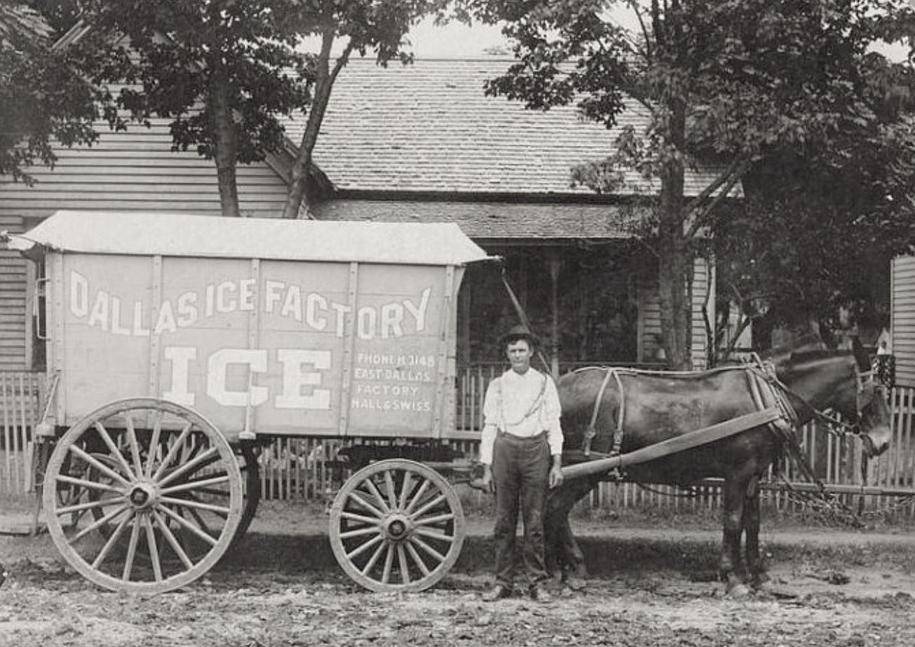
Above is a photo of a horse-drawn Dallas Ice Factory wagon and its driver. There was probably ice in there.
Here’s an ad from 1888 showing the factory:
1888 Dallas directory
Here’s an ad from 1894 not showing the factory:
1894 Dallas directory
Here’s a link to an 1899 Sanborn map showing you where the Dallas Ice Factory was located (in Old East Dallas, at Swiss and Hall): link.
That’s about all I can muster. It’s too dang hot.
***
Sources & Notes
Photo from a 2011 eBay listing, reproduced in The Dallas Observer by Robert Wilonsky; now owned by Peter Kurilecz.
Ads from Dallas directories.
Heat from the sun.
And here’s an ice-factory-related post I actually did some work on, when I wasn’t feeling like a sweaty, limp dishrag (…a long, long time ago…): “Oak Lawn Ice & Fuel Co.”
The fleet… (click to see larger image) / Photo: Krystal Morris
by Paula Bosse
Above, another great Dallas photo shared by a reader — this one shows the Oak Lawn Ice & Fuel Co., which sold ice to independent dealers and to retail customers. Krystal Morris sent in the family photo — her great-great-grandfather J. F. Finney is standing next to the horse-drawn wagon.
The first mention I found of the Oak Lawn Ice & Fuel Co. was in a notice of “New Texas Charters” in Dec., 1912 (there was a classified ad from Dec., 1909, but that appears to be either another company with the same name or an earlier incarnation of the business seen above). Below, an ad from 1913:
1913
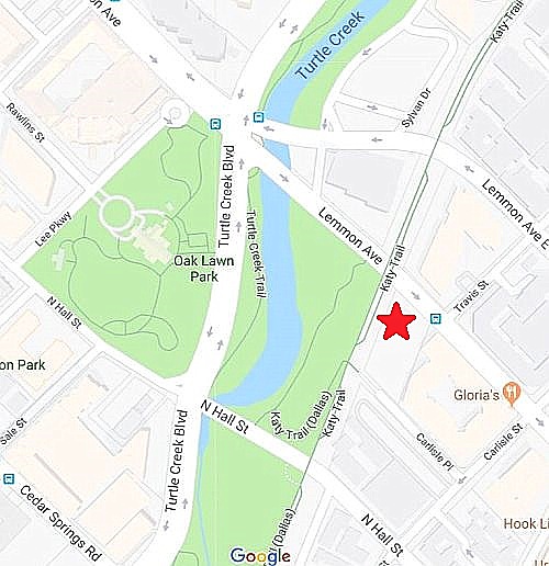
The company was located at 3307 Lemmon Avenue, at the MKT railroad track (now the Katy Trail) — on Lemmon between the railroad tracks and Travis Street (see the location on a map composed of two badly-cobbled-together Sanborn maps from 1921 here). The location is marked on a present-day Google map below (click to see a larger image):
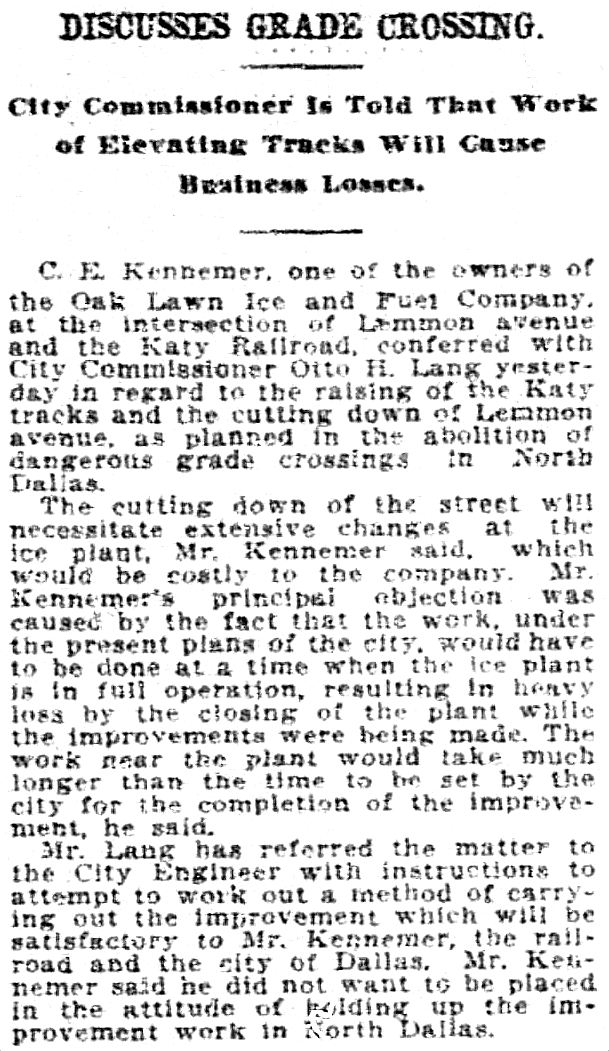
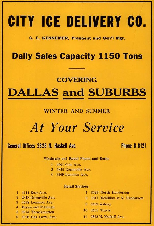
In 1917, the City of Dallas, in partnership with the Missouri, Kansas & Texas Railroad began to eliminate grade crossings in the Oak Lawn area — one of those crossings was at Lemmon Avenue: Lemmon was to be lowered and the MKT tracks were to be raised. Oak Lawn Ice & Fuel Co. General Manager Clarence E. Kennemer (who, along with his brothers, operated something of an ice empire in Texas) was concerned about the negative impact of this construction on his business. (All images are larger when clicked.)
Dallas Morning News, Jan. 31, 1917
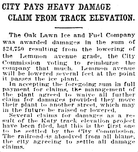
To the surprise of many, the ice company was awarded damages by the city.
DMN, Dec. 6, 1917
Things apparently continued fairly well until 1920 when the company began to experience tensions with its residential neighbors. Early in the year, city building inspectors responded to nuisance complaints and ordered the company to move its horse stables as they were too close to adjoining residences (ice delivery even into the 1940s and possibly 1950s was often done via horse-drawn wagons). Later the same year, still-unhappy neighbors filed suit to “force the company to remove its plant from the thickly settled residence district” (DMN, Dec. 1, 1920). The ice company appears to have won the lawsuit, since the company (under various names) was at 3307 Lemmon until at least 1939 or ’40, but these problems might have led them to build a new plant at Cole and what is now Monticello in 1922 (as with the Lemmon location, this new plant was also built alongside the MKT tracks). The mere prospect of this new icehouse was met with loud protests by the new neighborhood — before construction even began — but a judge ruled in favor of the ice people. Construction went ahead, and the plant was a neighborhood fixture for many years. (See the location on a 1921 Sanborn map here; “Gertrude” — near the top edge — was the original name of Monticello Avenue.)
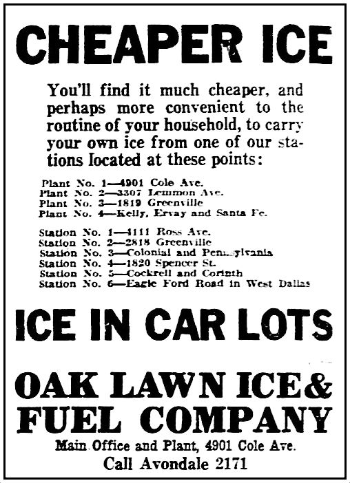
In 1923, ads for the Oak Lawn Ice & Fuel Co. began displaying both addresses: the original location, 3307 Lemmon, was now being referred to as “Plant No. 2,” and the new location, 4901 Cole, was being referred to as the “Main Office/Plant No. 1.”
1923 Dallas city directory
By 1924 the company expanded as it absorbed other ice companies.
1924
By 1925, “Oak Lawn Ice & Fuel Company” had become “American Ice Co.” (another C. E. Kennemer enterprise).
1925
By 1933, American Ice Co. was swallowed up by City Ice Delivery Co.
1934 Dallas city directory
In the late 1930s or early 1940s City Ice Delivery Co. was acquired by Southland Ice (the forerunner of the Southland Corp., owners of 7-Eleven convenience stores). The Lemmon Avenue location became a meat-packing plant sometime in the mid-’40s (if neighbors were bent out of shape by an ice company, imagine how they felt about a meat-packing plant!); the Cole location became a 7-Eleven store and later a Southland Corp. division office.
*
But back to Jonathan F. Finney, the man standing next to the ice wagon in the top photo. He came to Dallas from Alabama around 1916 and bought a house at 3001 Carlisle Street, where he lived for most of his life in Dallas. His occupation was “ice dealer,” and he seems to have worked in both the wholesale and retail areas, as a driver, a salesman, and even for a while the owner of his own company. His great-great-granddaughter Krystal Morris (supplier of these wonderful family photos) says she believes he was the manager of the Oak Lawn Ice & Fuel Co. The 1932 directory lists him as foreman of the City Ice Delivery Co., and as he lived at 3001 Carlisle, it seems to make more sense he was working at the Lemmon Ave. location (which was less than half a mile away from his home) rather the Cole Ave. location. The actual address of the photo at the top is unknown, but it may show the Lemmon Ave. location when Finney was working as an independent ice dealer, standing beside his own wagon.
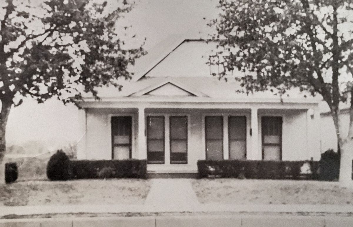
Below, the Finney family around 1920 (J. F., daughters Thelma and Viva Sue, and wife Wenona), and below that, their house at 3001 Carlisle (which was at the corner of Carlisle and Sneed — seen in a 1921 Sanborn map here).
Finney family, circa 1920 / Photo: Krystal Morris
3001 Carlisle, Finney family home / Photo: Krystal Morris
J. F. Finney, born in 1885, died in Dallas in 1962, long after the era of necessary daily ice deliveries to residences and businesses. The occupation listed on his death certificate was “painter” but I have a feeling “once an iceman, always an iceman.”
***
Sources & Notes
All photographs are from the family photos of Krystal Morris and are used with her permission. Thank you, Krystal!
The history of ice delivery is very interesting, especially to those of us who have never lived in a house without an electric refrigerator. Here are links-a-plenty on the subject:
“Icehouses — Vintage Spaces with a Cool History” by Randy Mallory (Texas Highways, Aug., 2000) here (additional photos can be found in the scanned issue on the Portal to Texas History site, here)
“Keeping Your (Food) Cool: From Ice Harvesting to Electric Refrigeration” by Emma Grahn on the Smithsonian National Museum of American History blog, here
“Delivering the Ice: Ice Wagons” — from an online exhibit based on an exhibit that was on display at the Woods Hole Historical Museum in Woods Hole, Massachusetts during the summer of 2015, here
“Portals to the Past: Golden Days of Home Delivery (ice, as well as bread, milk, groceries, etc.) by Waco historian Claire Masters, here
“The Iceman Cometh” by Dick Sheaff from the Ephemera Society of America blog, here
Here’s a fantastic little clip of a woman ice deliverer manning the tongs (and wearing heels):
*
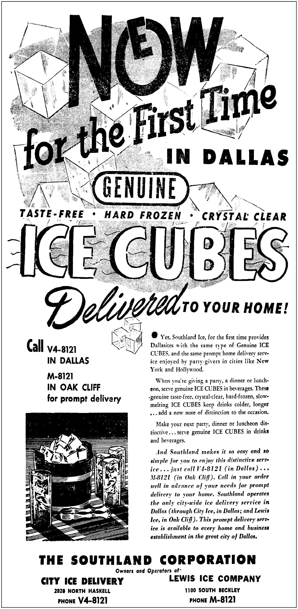
And, lastly, the Southland Corp. to the rescue with an ad from Dec., 1948 with news of the arrival in Dallas of “genuine” ice cubes! “Now for the first time in Dallas: Genuine Taste-Free, Hard Frozen, Crystal Clear Ice Cubes delivered to your home!”
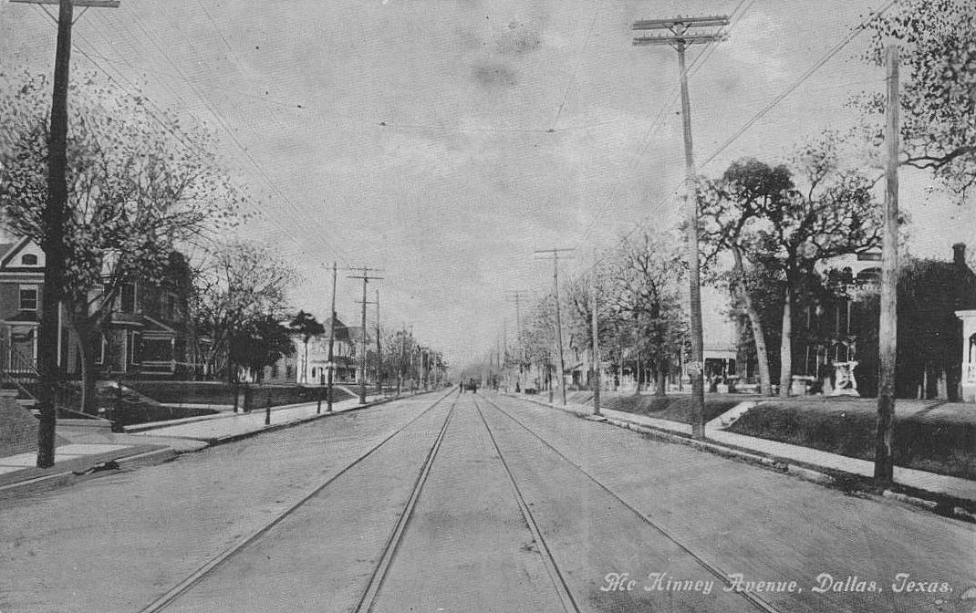
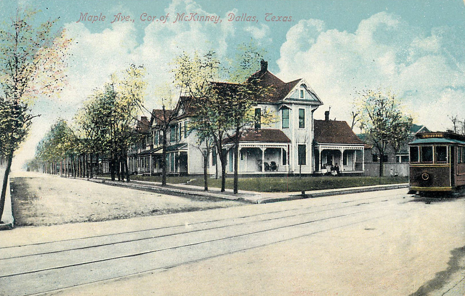
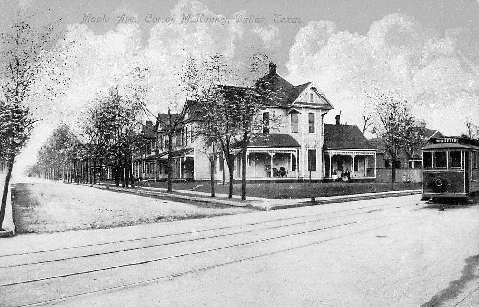
McKinney Ave., large houses, streetcar tracks… (click for larger image)
by Paula Bosse
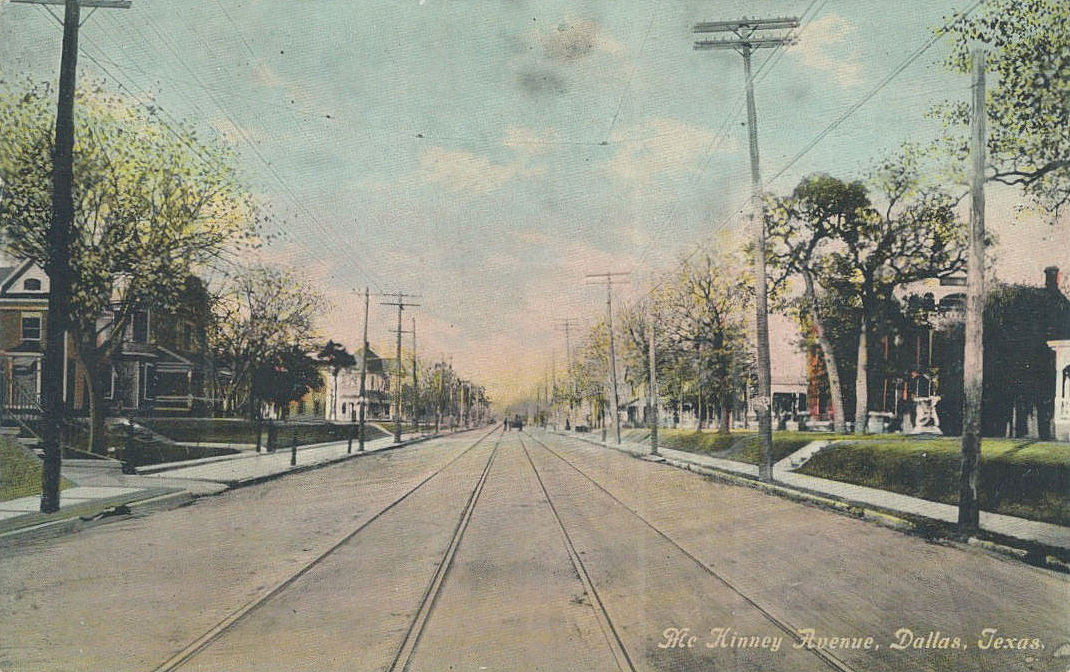
Just a quick post of two picture postcards of McKinney Avenue (the images drained of their added color give a more realistic idea of the original photographs). These views are unrecognizable in today’s Uptown.
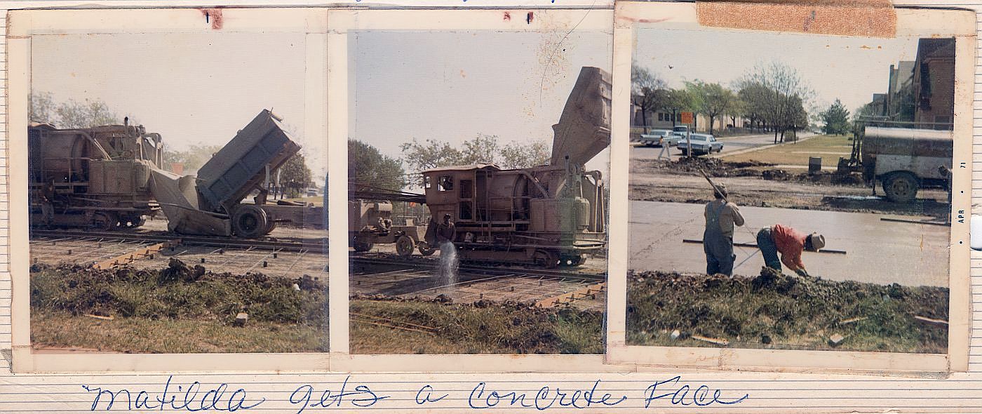
“Matilda gets a concrete face”… (click for larger image)
by Paula Bosse
A couple of days ago I wrote about the history of Matilda Street in regard to its role as a railway for the Sherman-Denison interurban and the Belmont streetcar line. I noted that I had childhood memories from the 1970s of Matilda being a dirt street — which seems hard to believe these days since it carries a fair amount of traffic and is generally a quicker drive than Greenville Avenue, one block west.
In response, one of the many Milazzo siblings (whom I remember not as individuals but as one large flock of children who regularly accompanied their parents to visit my father’s bookstore in the 1970s and ’80s) sent me some photos from a family album showing, yes, Matilda Street being paved! They lived in the 5700 block of Goodwin, and the photos were taken in 1971, from their yard, looking east across Matilda.
The streetcar tracks were abandoned in 1955 but were not removed — it took a full sixteen years for them to be paved over! Before that? Dirt street. If you look closely at the Google Street View capture from Oct. 2017, you can see the old rails peeking through.
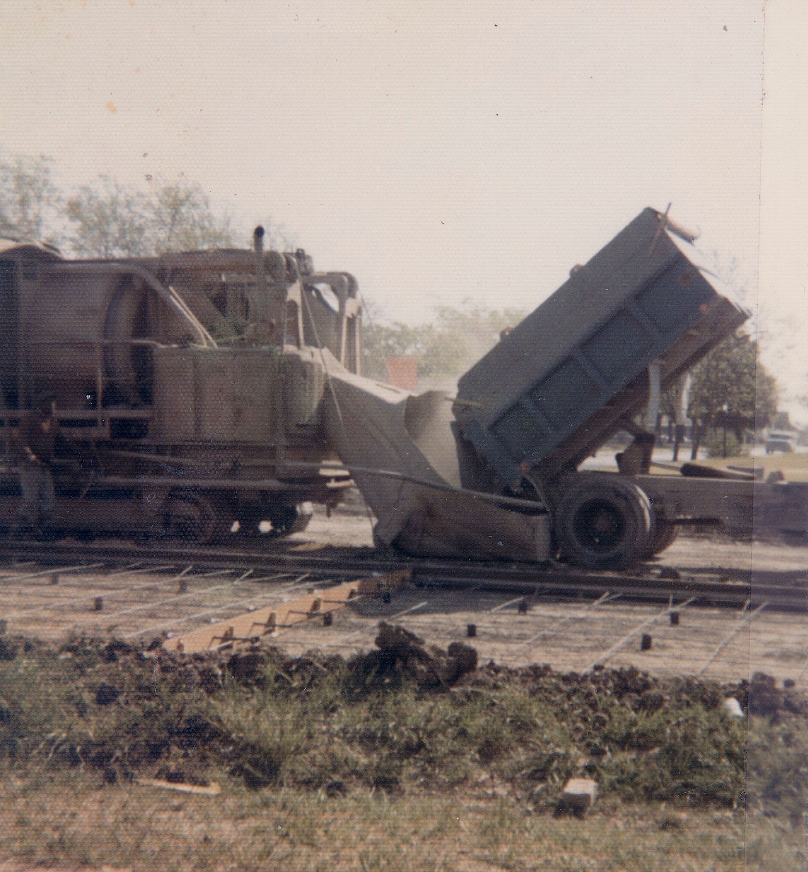
Below are three photos from the Milazzo’s family album showing the Matilda “street improvements.” The construction vehicle seen in the first two photos is pretty weird-looking — like a cross between a locomotive and a tank. In fact, at first I thought the thing was actually running on the rails it was working to pave over, until I saw that what I had thought were train wheels look more like tank treads. Whatever it is, it doesn’t look like something you’d expect to see on a residential street in the 1970s. In the third photo, you can see part of Robert E. Lee Elementary School at the left. (All photos are larger when clicked.)
Thank you, Milazzo family!
***
Sources & Notes
Photos from the collection of the Milazzo family, used with permission. The third photo shows a date-stamp of April, 1971.
The related Flashback Dallas post “Ghost Rails of the Belmont Streetcar Line” is here.
Matilda & Richmond, April, 2018… (photo: Dan Parr)
by Paula Bosse
I grew up on Ellsworth, between Greenville Avenue and Matilda — just south of Mockingbird, just north of the M Streets. When I was a child, Matilda was only partially paved — in my neighborhood, maybe only from Mockingbird down to Kenwood? Otherwise, it was a dirt street (!) — and this was in the ’70s! Right around Kenwood was a weird mound which might not have looked like much to an adult, but to a child it was pretty strange. I can’t remember if the rails were visible — I’m pretty sure they were.
That line was the Belmont Line, which ended (began?) at Mockingbird (I think there was a later extension of sorts, but I think Mockingbird was the end of the line for streetcar passengers). As a kid, I knew that Matilda had been a long-gone streetcar line, but never having seen a streetcar outside of a movie, I couldn’t really imagine what it must have been like to have streetcars (and an interurban! — more on that below) moving up and down a street which was less than a block from my house.
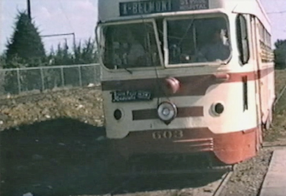
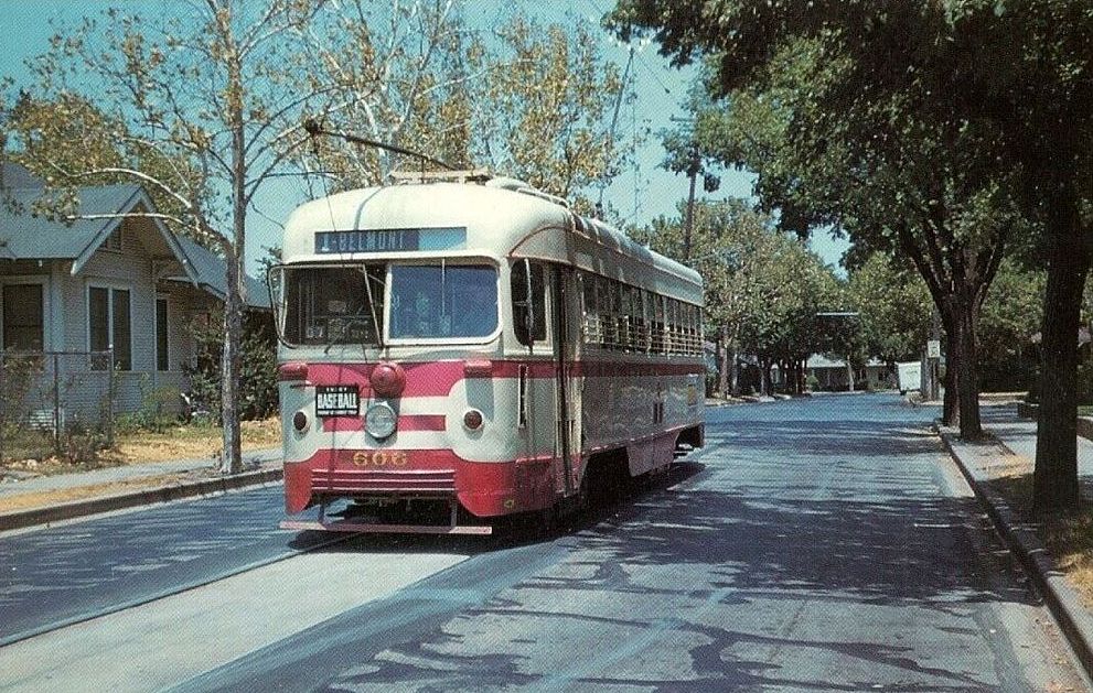
A few years ago I stumbled across the YouTube video below and was surprised to see actual footage of that streetcar rolling up Matilda. The first five minutes of the video contains 16mm footage (both black-and-white and color) shot around Dallas in 1953 and 1954 by Gene Schmidt. It’s GREAT! You’ll see streetcars-galore moving past all sorts of familiar and vaguely familiar sights around the city, from Oak Cliff to downtown to way out to Mockingbird and Matilda. It ends with the Belmont-Seventh car (car 603) pulling to the end of the line — the view is looking south down an unpaved Matilda Street from Mockingbird, with a glimpse of the Stonewall Jackson playing field at the left, on the other side of the fence. (The Matilda footage begins at 4:17.)
*
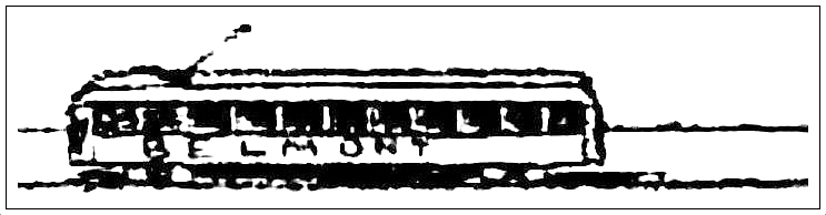
Matilda, south from Mockingbird, ca. 1954 (Gene Schmidt)
Above, a screen capture from the video showing Matilda looking south from just south of Mockingbird. Stonewall Jackson Elementary School is at the left. Today the view looks like this.
*
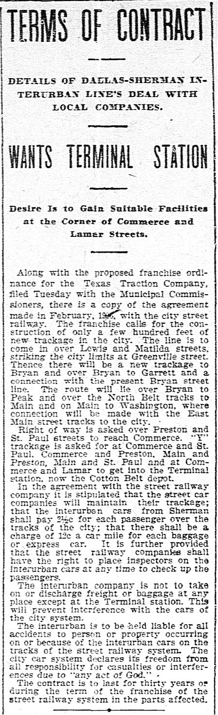
Before the streetcar arrived, Matilda was the artery that led the Texas Traction Company’s Sherman/Denison interurban into Dallas. This electric interurban service from the north, which closely followed the H&TC railroad line, arrived in Dallas in 1908, back when the official entry-point into the Dallas city limits was just off Matilda, near Greenville Avenue and Bryan Street.
DMN, Jan. 16, 1908 (click to read)
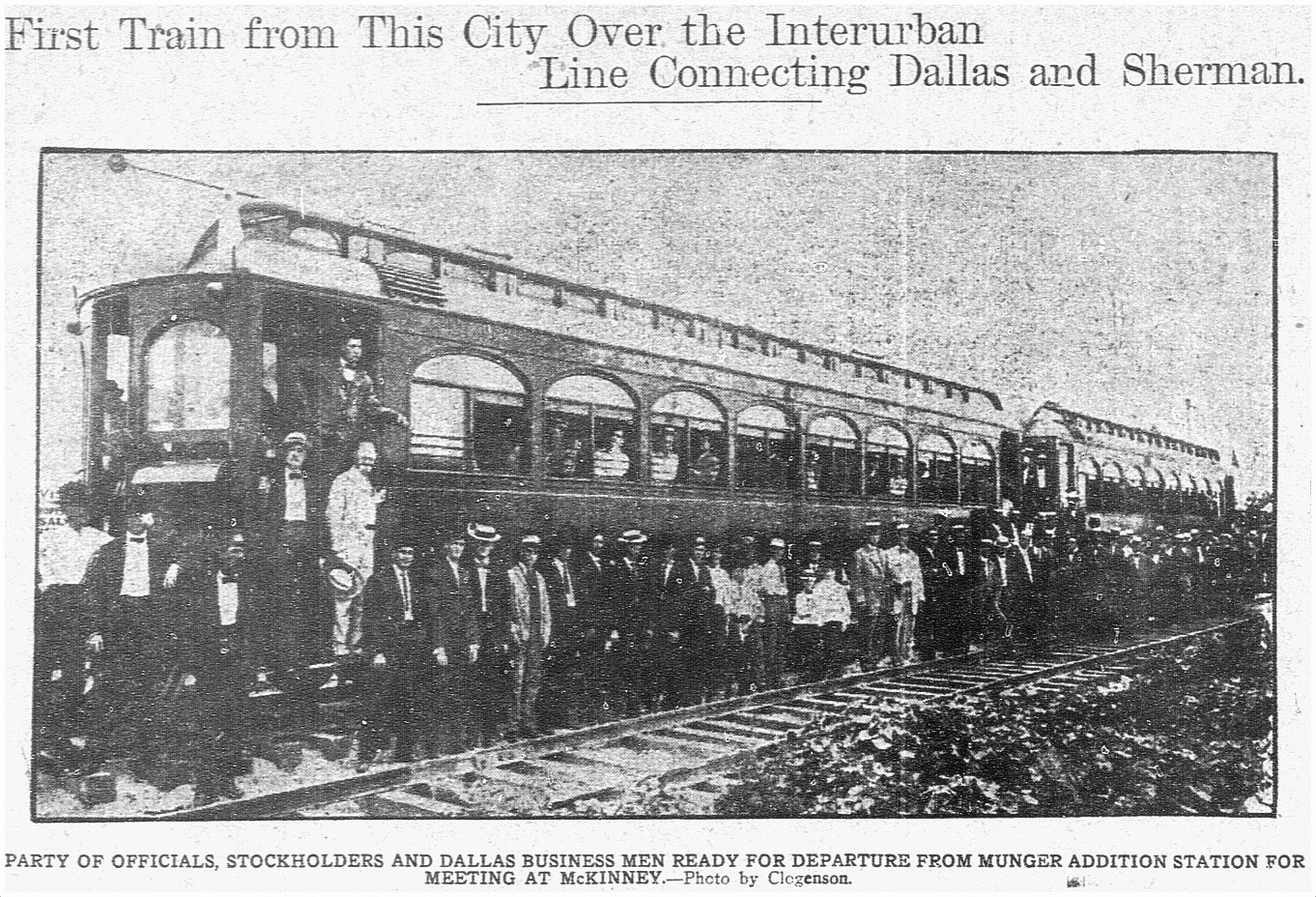
The interurban route connecting Sherman/Denison with Dallas opened on July 1, 1908 and lasted for 40 years, until its final run on December 31, 1948. (Read the Dallas Morning News article on the 1908 inaugural trip for big-wigs, “Many Make Trip Over Interurban,” July 1, 1908, here. Below is the accompanying photo. Image that running up and down Matilda — and, later, along other streets in Dallas — several times a day!)
DMN, July 1, 1908
Dallas’ ever-increasing population began to move northward and eastward, necessitating public transportation which would connect these developing areas with the rest of the city. One of the early “suburban” lines was the Belmont Line, which branched off the Bryan Street line and served the Belmont Addition and beyond; it opened in 1913, but these early days appear to have been more of a private “dinky” service (see SMU’s dinky car on the beyond-the-city-limits tracks at Hillcrest and McFarlin, here). The Belmont line — as well as the Vickery Place and Mount Auburn lines — became part of the city’s official streetcar system in 1922.
Before the dinky service, riders were able to get on and off the large interurban cars at stops between Mockingbird and the area around Bryan and Greenville Ave. Even though interurbans and streetcars were able to travel on the same rails, it took years for dedicated streetcar tracks to be laid along Matilda.
This detail of a real estate ad shows that the Belmont line had reached at least as far as Richmond by 1914 (I felt I had to include this because the finger is pointing at the exact location of the exposed rails in the photo at the top!):
May, 1914 (detail from Lakewood Heights real estate ad — see full ad here)
By 1922 the Belmont line had extended north to Velasco; by 1925 it had gotten to McCommas; by 1936 it had made it up to Penrose; and by 1939 it had finally reached Mockingbird (in time for the opening that year of Stonewall Jackson Elementary School, located at Mockingbird and Matilda).
Dallas streetcars began to be phased out in 1955, and the Belmont line was one of the first to go — its last run was March 6, 1955: “The Belmont-Seventh streetcar line will go out of existence Sunday to be replaced by service with new Diesel buses” (Dallas Morning News, March 6, 1955). The new bus route in the Lower Greenville area would, for the most part, be along Greenville Avenue, one block west of unpaved Matilda Street.
In March, 1955, it was reported that the abandoned Belmont-Seventh streetcar tracks were deeded to the city by the Dallas Railway and Terminal Co., with the understanding that they would eventually be paved over. The tracks were on Matilda, Bryan, Cantegral, Live Oak, St. Paul, King’s Highway, Edgefield, Seventh, Bishop, and Colorado. In April, 1956, it was reported that the City Council had approved the sale of the streetcar viaduct over the Trinity River and the Matilda street right-of-way.
But what about that paving of Matilda? Mrs. K. E. Slaughter had thoughts on the matter in a letter-to-the editor in April, 1955:
Since removal of the Belmont streetcar line in part — Matilda and Bryan streets — would it not be advantageous to develop this section into an important use to the heavy automobile traffic? Matilda now is no more than useless tracks built up between a cow path. (DMN, April 7, 1955)
“Cow path” — ha!
Another annoyed News reader wrote in 1963 — eight years after the tracks had been abandoned — about the useless unpaved thoroughfare:
The abandoned almost-private right of ways, such as Matilda, nearly two miles south from Mockingbird, received by the city in a deal to permit an all-bus operation, have not yet been paved or otherwise improved. (DMN, Oct. 21, 1963)
I’m not sure when that paving finally happened — early ’70s? — I think it must have been done in stages. I don’t remember a time when the stretch between Mockingbird and Kenwood wasn’t paved, but I do remember Matilda being a dirt road south of Kenwood. I don’t have a good recollection of the year, but kids remember all sorts of weird things, and those mysterious mounds were pretty memorable. (UPDATE: See photos of Matilda being paved at Goodwin in 1971 here.) I wish I’d known what an interurban was when I was a child. That would have made my neighborhood seem a whole lot more interesting! Heck, it used to the Gateway to Sherman!
I’ve long despaired of having missed the streetcar age. But it’s nice to know that one ran so close to the house I grew up in.
End of the line, ca. 1954… (Gene Schmidt)
***
Sources & Notes
Top photo taken by Dan Parr on April 15, 2018; it was originally posted to the Facebook group Dallas History Guild and is used here with permission. (Thanks, Dan!) The photo was taken at Matilda and Richmond, looking south on Matilda. See it on Google Street View, here. (Roadwork along Matilda is awful at the moment, but much-needed. Apparently it is being reduced to three lanes for automobiles with two bike lanes being added — read about it in the Lakewood Advocate, here.)
YouTube video shot by Gene Schmidt in 1953 and 1954; the direct link is here.
Another interesting video on YouTube was made by the City of Allen and contains period footage of the interurban that served North Texas. It’s a breezy 6-and-a-half minutes, and it includes some cool shots of Dallas.
If you want to see a whole bunch of North Texas interurban photos, check out this great 83-page PDF compiled by DART, “History of the Interurban Railway System and Monroe Shops,” here.
Speaking of DART, they posted a cool 1925 map of streetcar and interurban lines, here — click the map to see a larger image. (In 1925, the Belmont line ended on Matilda at McCommas).
ALSO extremely cool is a Google map showing Dallas’ Historical Streetcar (and Interurban) Lines laid over a present-day Google map, here. Zoom in and out. Very useful!
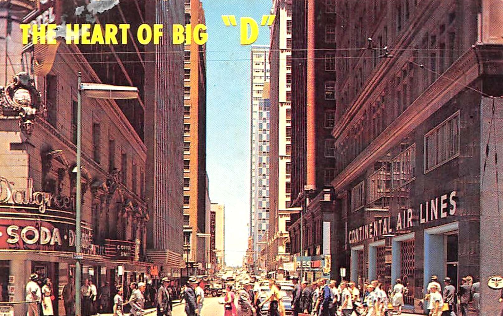
A postcard view of Akard, looking north from Commerce; the “canyon” is anchored at the south end by the Baker Hotel (behind the photographer), the Walgreens in the Adolphus Hotel building, and the Continental Air Lines ticket office in the Magnolia Building.
Looks like a hot, painfully sunny day in the canyon. Personally, I’d get out of the sun and hit that soda fountain….
***
Sources & Notes
This postcard is currently being offered on eBay, here. The seller is in Transylvania.
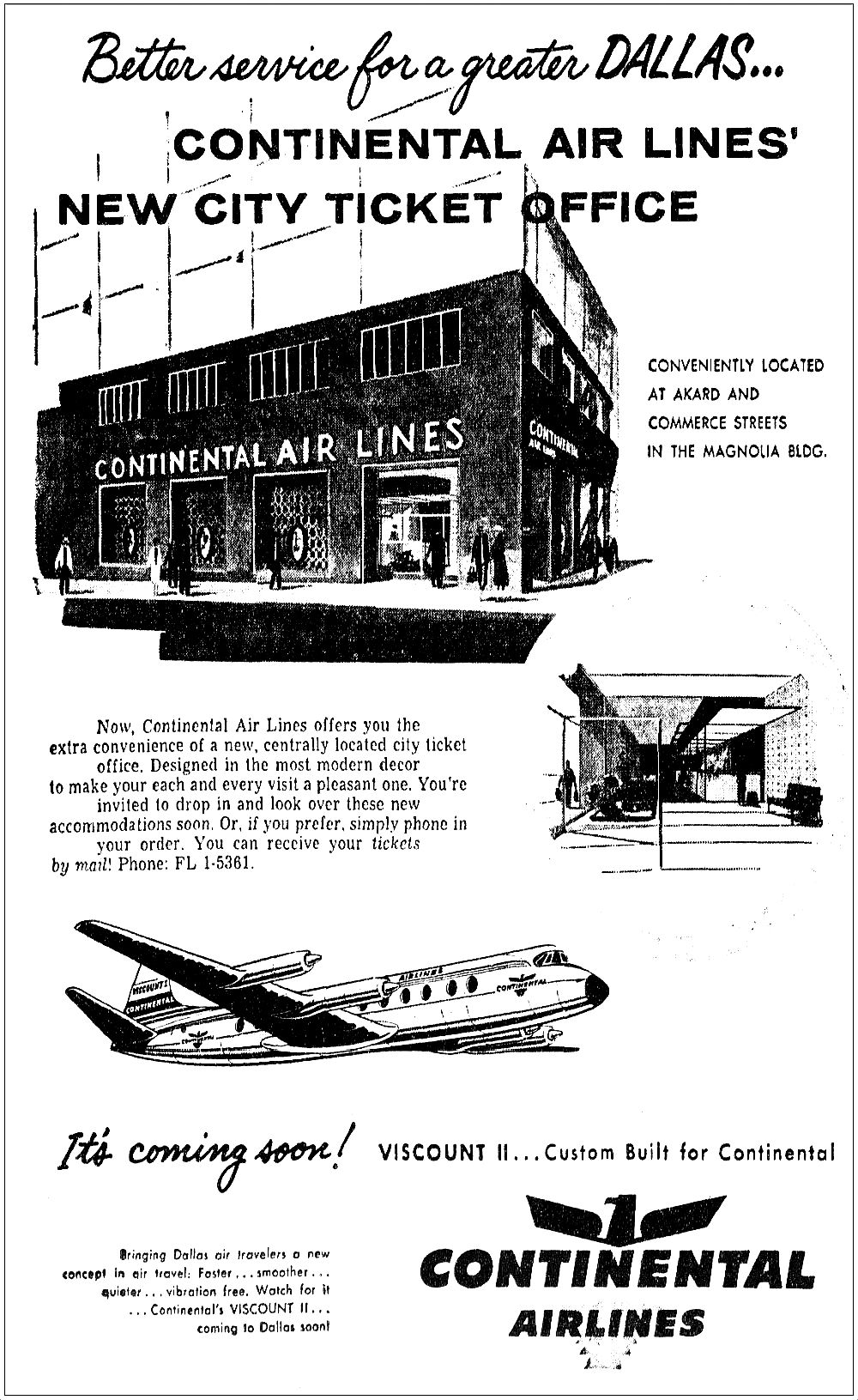
The Continental Air Lines ticket office opened in the Magnolia Building in early 1958 (click for larger image).
January, 1958
For more info on the buildings that lined the “canyon,” see the Flashback Dallas post “The ‘Akard Street Canyon’ — ca. 1962,” here.
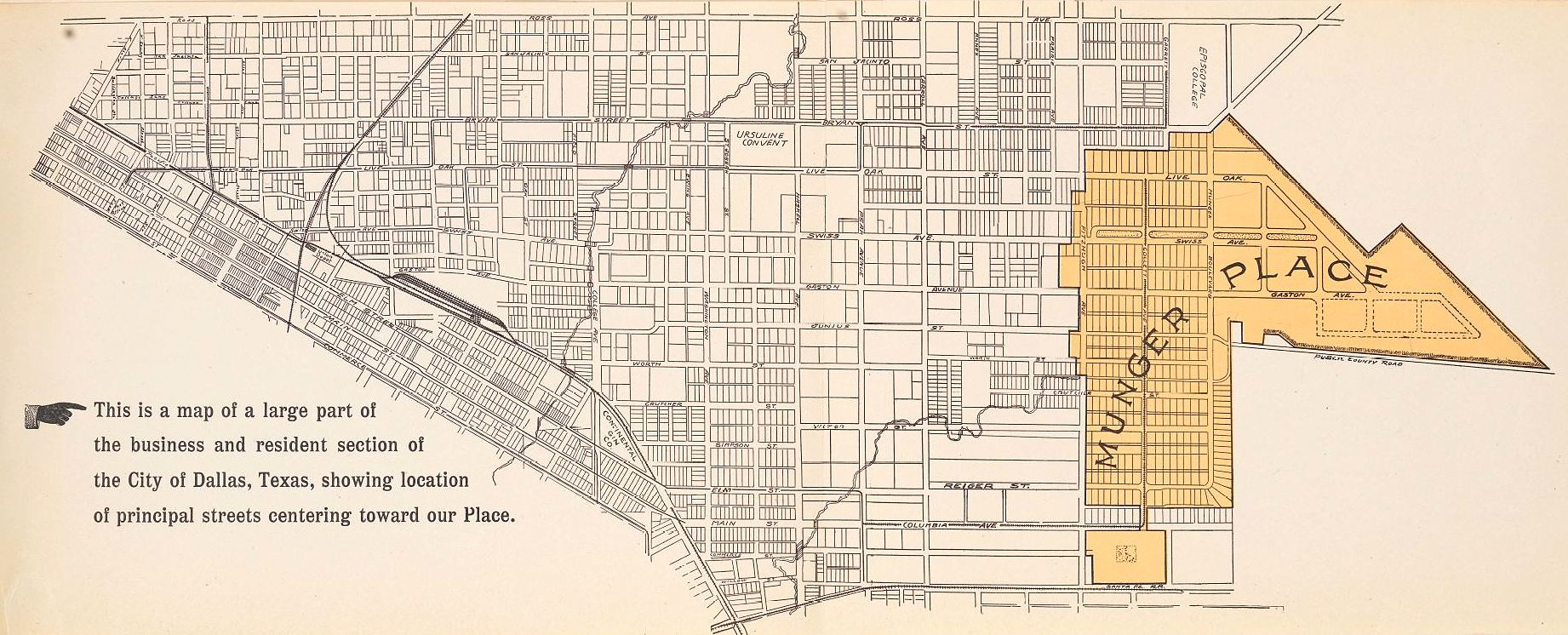
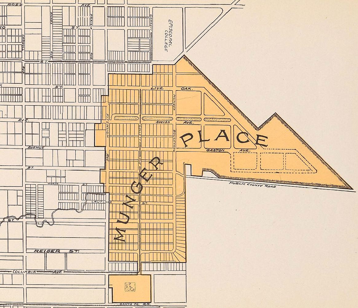
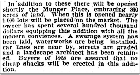
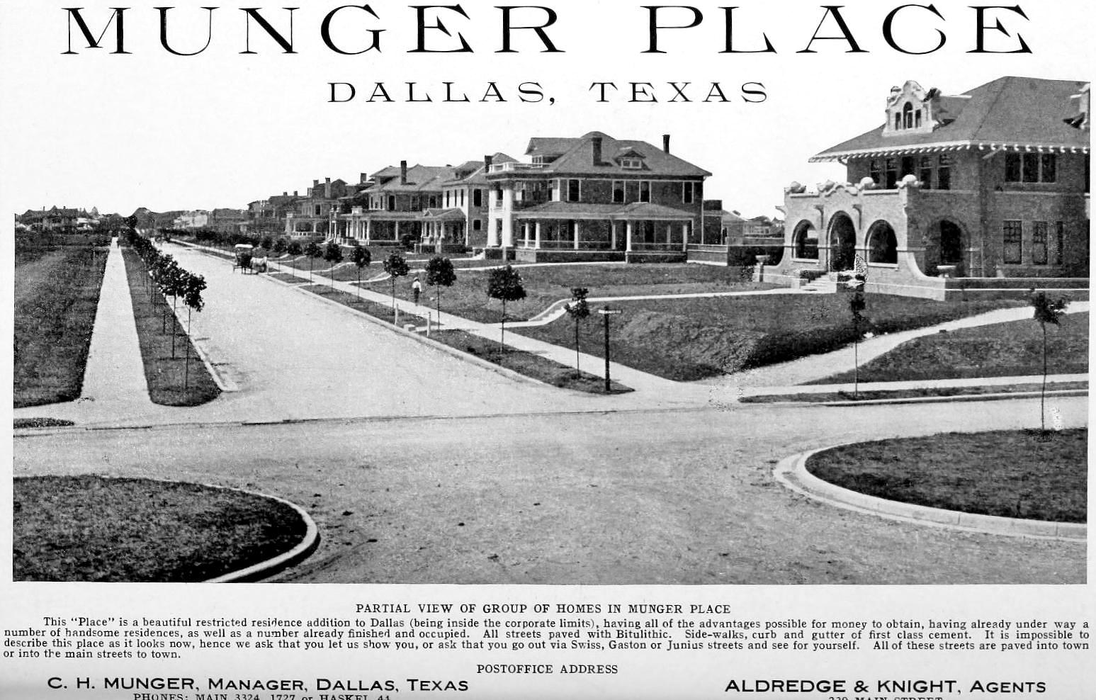
Here are a few photos from a great item found in the collection of SMU’s DeGolyer Library: a promotional booklet on the wonders to be found at the new East Dallas development called Munger Place. The photos show the construction of what would become one of the most exclusive neighborhoods in Dallas, developed by Robert S. Munger (of Continental Gin Co. fame) and his son C. H. Munger. (His son’s first name was “Collett” — as in “Collett Avenue,” which I had always thought was named after one of the elder Munger’s daughters. But it turns out that “Collett” was the maiden name of C. H.’s mother. I’ve only ever heard the street name pronounced like the woman’s name “Colette,” but I have a feeling it might have originally been pronounced as rhyming with “wallet.”) (UPDATE: According to a Munger relative, the street name *should* actually be pronounced to rhyme with “wallet.”)
Location, location, location. Not quite within the city limits at this time, but close. (All images are larger when clicked.)
*
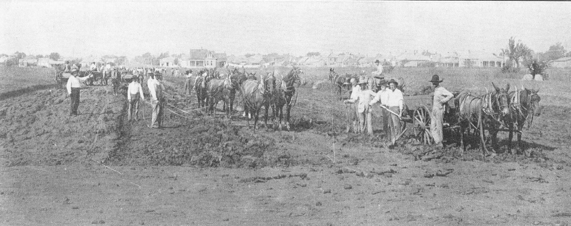
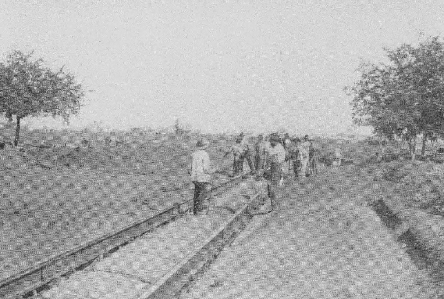
Caption: “At work.”
*
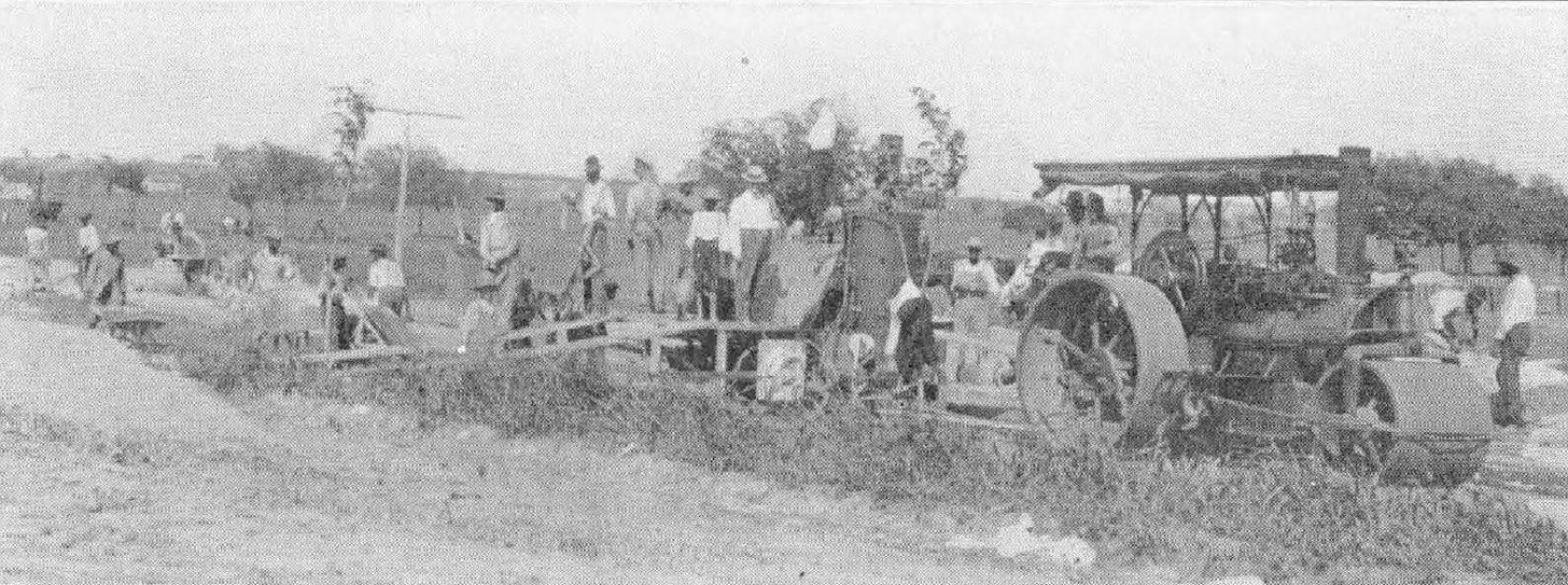
Paving.
*
Caption: “Building street railroad.” (This appears to be Collett Avenue.)
*
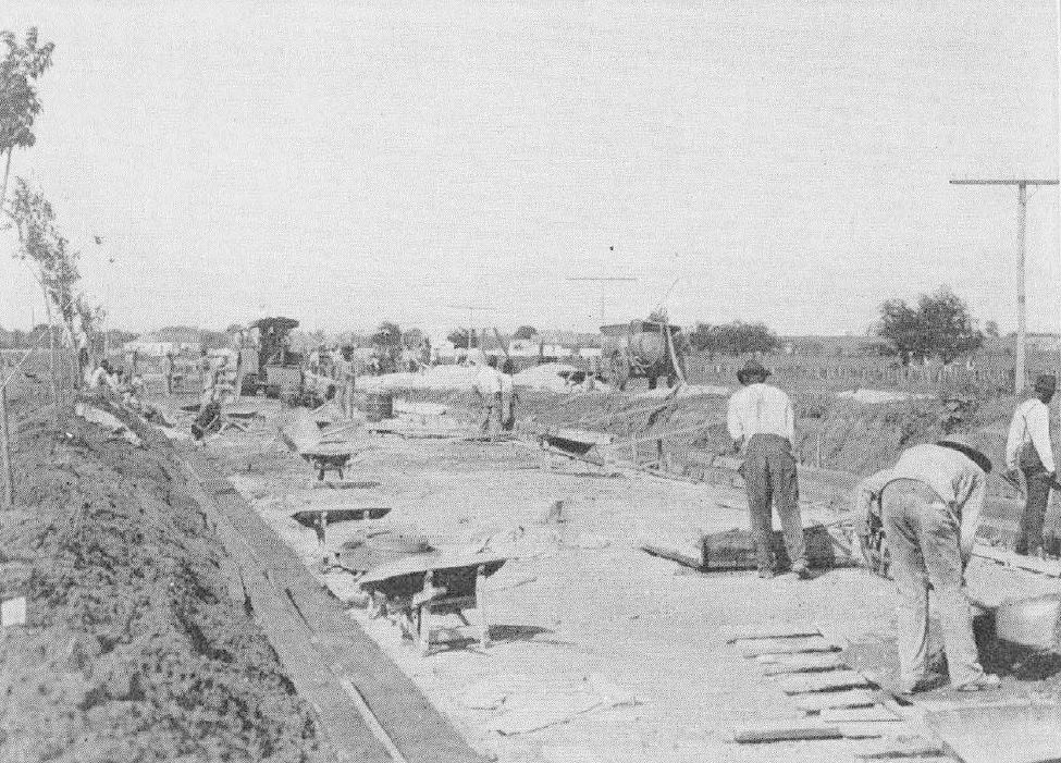
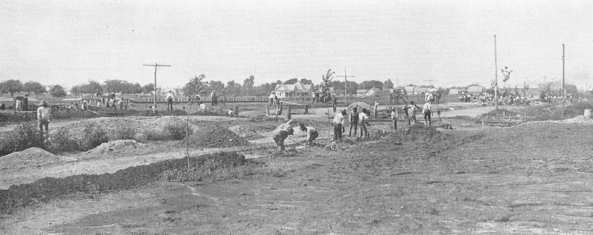
Caption: “At work at intersection of Collett Avenue and Junius Street.”
*
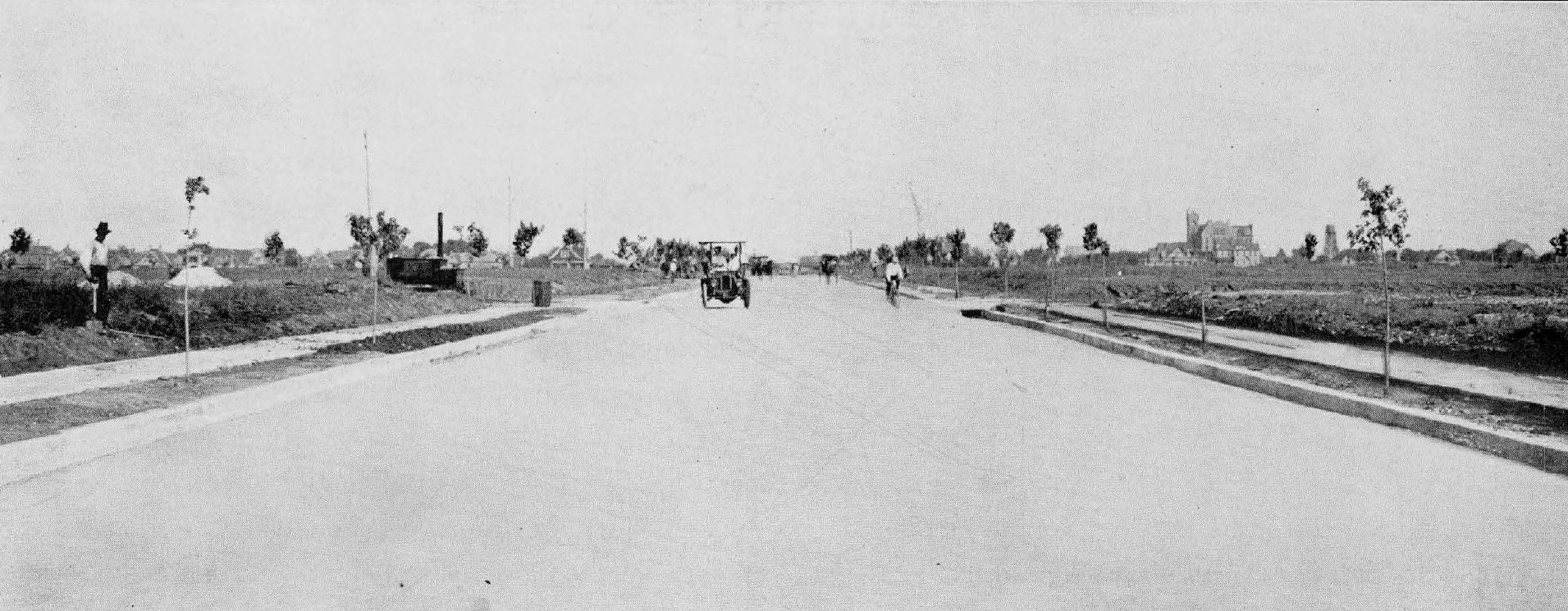
Caption: “Collett Avenue, looking toward St. Mary’s from Junius Street.”
*
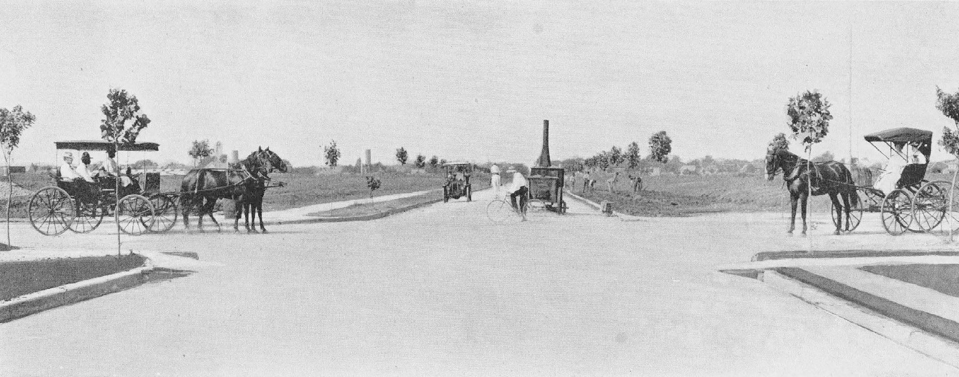
Caption: “Gaston Avenue — looking toward the city at intersection of Collett Avenue.” (Today this intersection looks like this.)
*
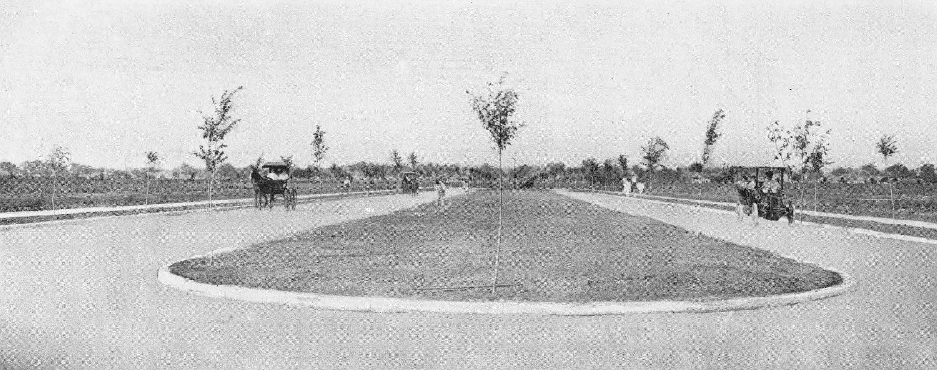
Caption: “Swiss Avenue — this was a corn field, with barb wire fences and hedges, about a year ago.”
*
Map of Dallas, circa 1905, with Munger Place highlighted.
*
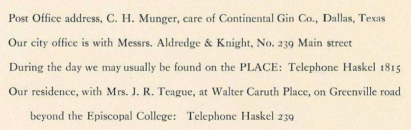
Think you might want to live in “The Place”? Here’s who you need to contact (interesting that the Walter Caruth house is mentioned here…):
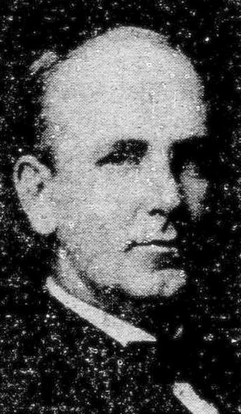
Collett Henry Munger — who lived in Munger Place, at 5400 Swiss — died from a heart attack at the young age of 48.
C. H. Munger (1879-1928)
*
The earliest mention of “Munger Place” I found in The Dallas Morning News was this classified from May 21, 1905:
May 21, 1905
Work was well underway by 1906:
DMN, Sept. 1, 1906
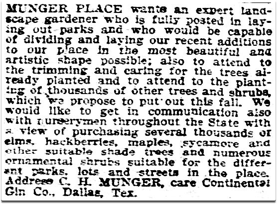
A call for “an expert landscape gardener” went out that same year:
Oct. 14, 1906
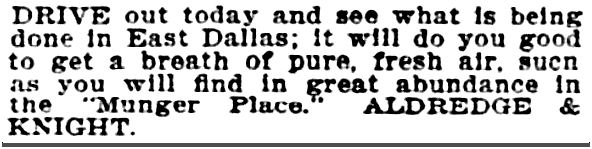
Not yet ready for lots to go on sale, the public was invited to head to East Dallas to take a look at the progress (“bring your friends and visitors to the Fair”).
Oct. 21, 1906
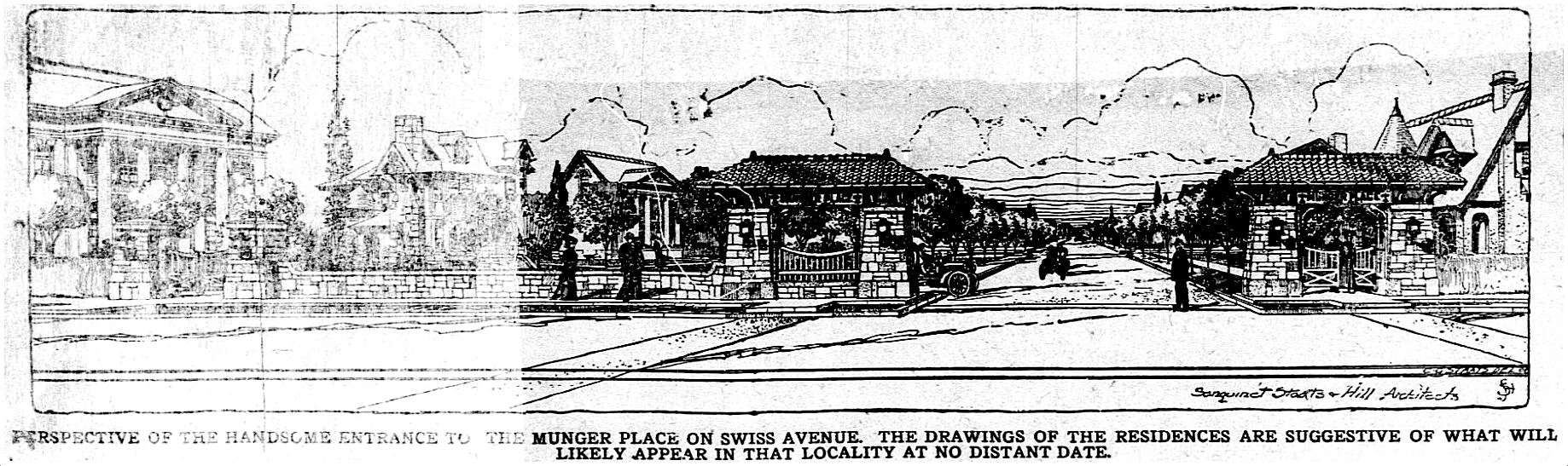
This rendering of the Swiss Avenue entrance was, interestingly, prepared by the architectural firm of Sanguinet, Staats & Hill, who designed several Munger Place residences (including Collett Munger’s).
DMN, Jan. 1, 1907
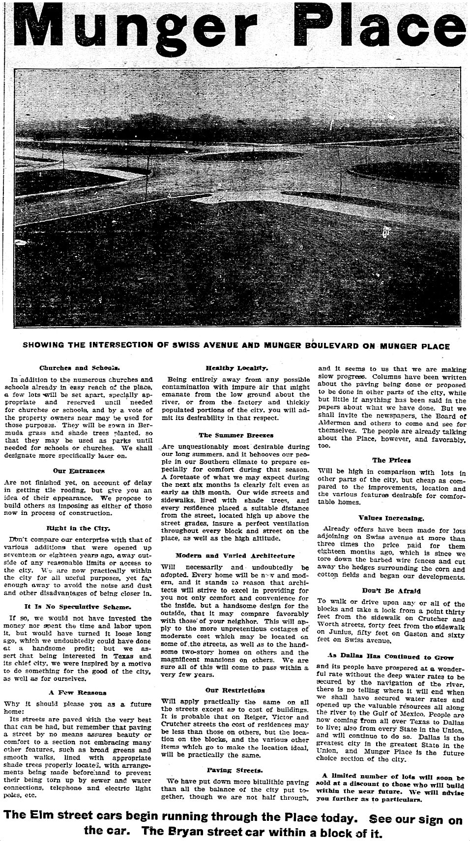
A sort of “teaser” ad (with a great photo of the intersection of Swiss and Munger) appeared in March, 1907:
March 24, 1907
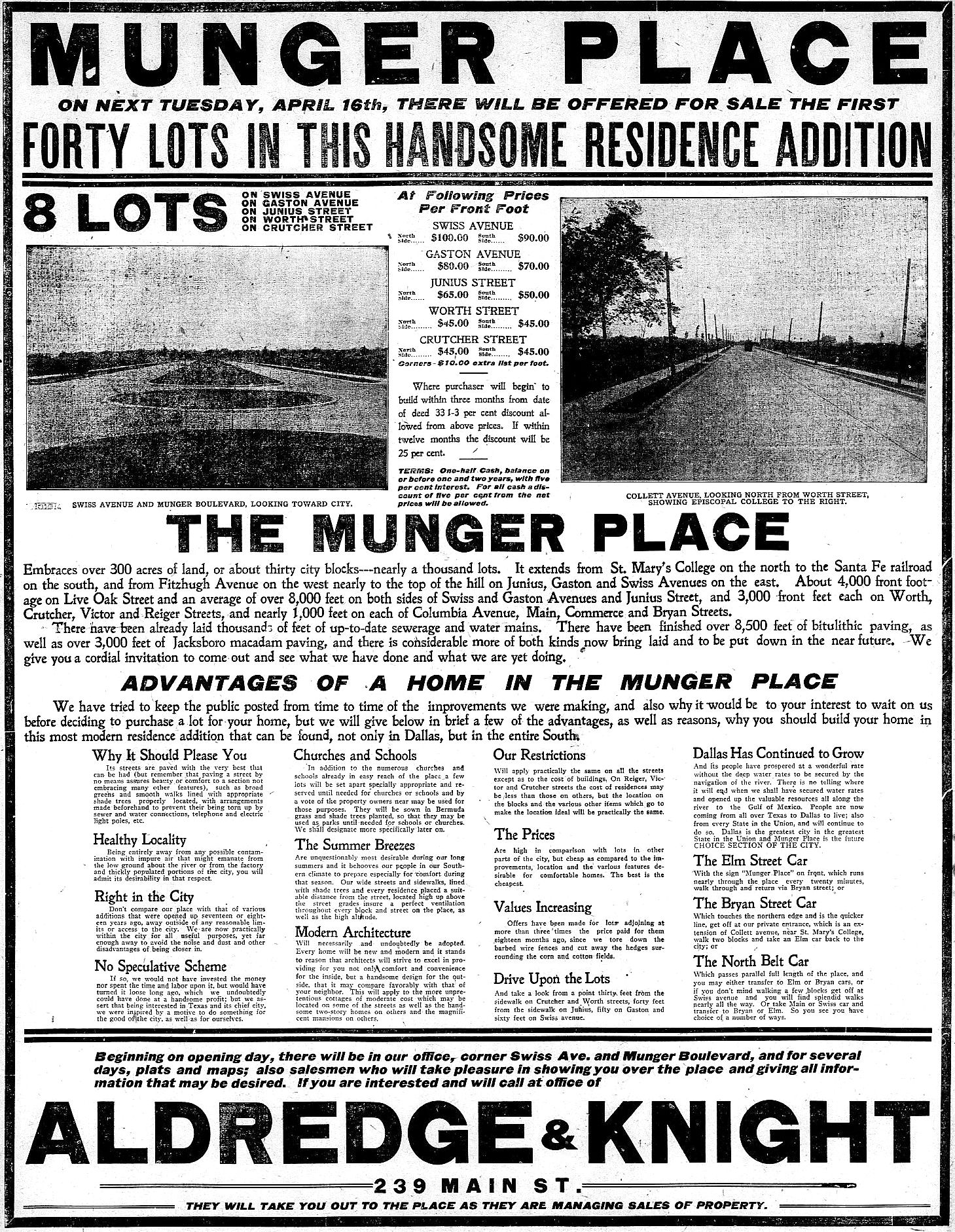
In April, 1907, it was announced that finally lots would be available for purchase (but only 40…), with big discounts for those who promised to build immediately.
April 14, 1907
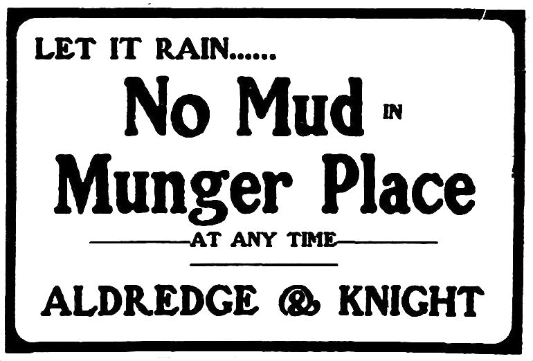
“Let it rain…. NO MUD IN MUNGER PLACE at any time.” Apparently a big selling point in 1907!
May 3, 1907
By 1909 things were really starting to come together for what quickly became one of the most exclusive (and highly restricted…) neighborhoods in the entire city.
Worley’s Dallas directory, 1909 ad
***
Sources & Notes
Photos of Munger Place under construction, map, and text on yellow background are from the promotional booklet “Munger Place: Dallas, Texas,” from the collection of the DeGolyer Library, Central University Libraries, Southern Methodist University; the entire booklet has been scanned by SMU and is available for free download here.
The last image is an ad from the 1909 Worley’s Dallas directory.
Read “Munger Place: Report of Nomination for Landmark Designation as a City Historic District” prepared by the City of Dallas Department of Urban Planning (1980), here.
More on Munger Place and the Munger family can be found is these Flashback Dallas posts:
Fender-bender in front of NDHS… (click for larger image)
by Paula Bosse
Odd stuff shows up on eBay. This photo shows a damaged Circle T Brand frozen-food Volkswagen delivery van at the intersection of McKinney Avenue and North Haskell (with North Dallas High School making a partial cameo in the background). The view today? See it here.
Circle T was one of the many brainchilds of the Southland Corp.’s Thompson family: it manufactured and distributed frozen foods (initially meats and Mexican food) which were sold in the company’s 7-Eleven stores. The company began in 1954 and was located just a couple of blocks from this photo, at Haskell and Central. (In 1954 they announced one of their first specialty products: frozen queso. I’ve never even considered that frozen queso would exist, but 60-some-odd years ago it was flying off shelves at the neighborhood 7-Eleven.)
The Southland Corp. sold off Circle T in 1966.
Below, an ad for Circle T’s frozen steaks, from 1954 (click ad to see larger image).
June, 1954
And because I’m nothing if not pedantic, here’s an ad for VW trucks and vans, from 1961 (which appears to be the date on the van’s license plate in the photo):
Feb., 1961
And speaking of Volkswagens, the first Dallas car dealer to import Volkswagens appears to be Clarence Talley — the first ads are from 1954. While I was searching for the link to the eBay listing of the above photo (which I could not find…), I serendipitously stumbled across this 1950s photo of Clarence Talley on N. Pearl, with appearances by the Medical Arts Building and the Republic Bank Building. Thank you, eBay.
***
Sources & Notes
Photos from eBay: could not find the link to the first one, but the second one sold a couple of months ago, and the archived listing is here.
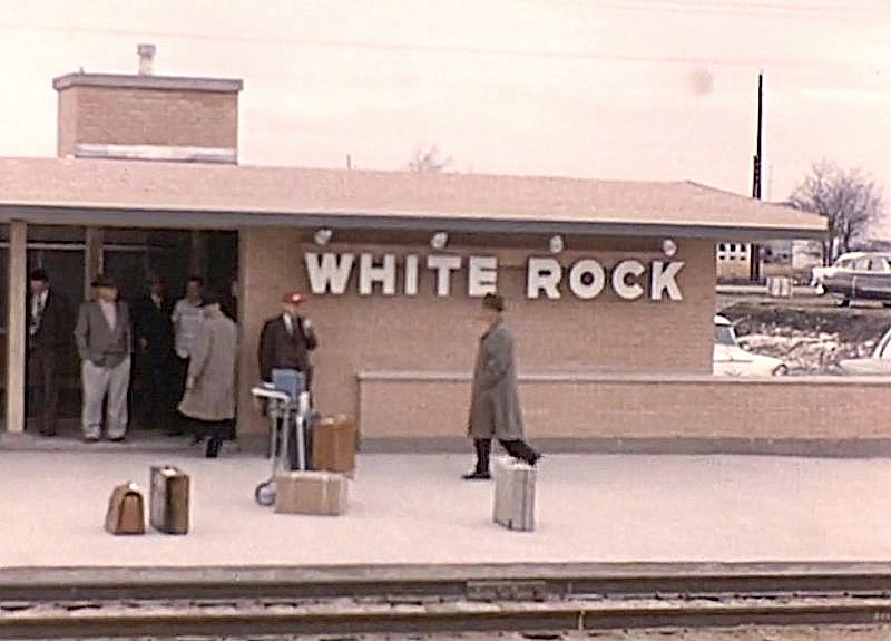
I was so happy to get word from UNT media librarian and film/video archivist Laura Treat this morning that she had come across film footage of White Rock Station, the first suburban train depot built in the Southwest by the Santa Fe Railway (in 1955). The footage is from the “Spotlight on North Texas” collection, a collaborative project between the University of North Texas Libraries and the Texas Archive of the Moving Image (TAMI) to preserve North Texas film history. This footage is from home movies donated by Mr. Peter Pauls Stewart.
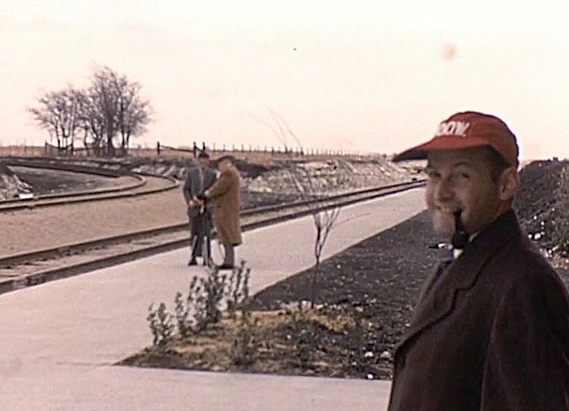
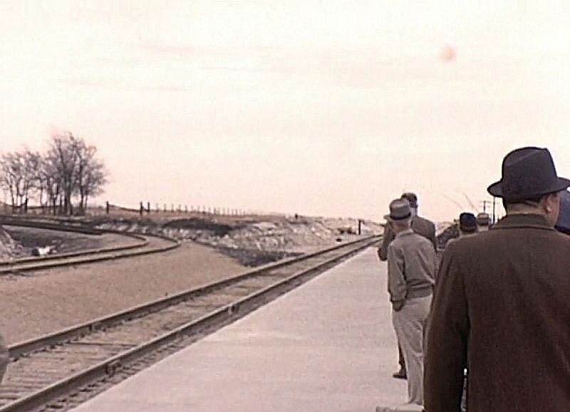
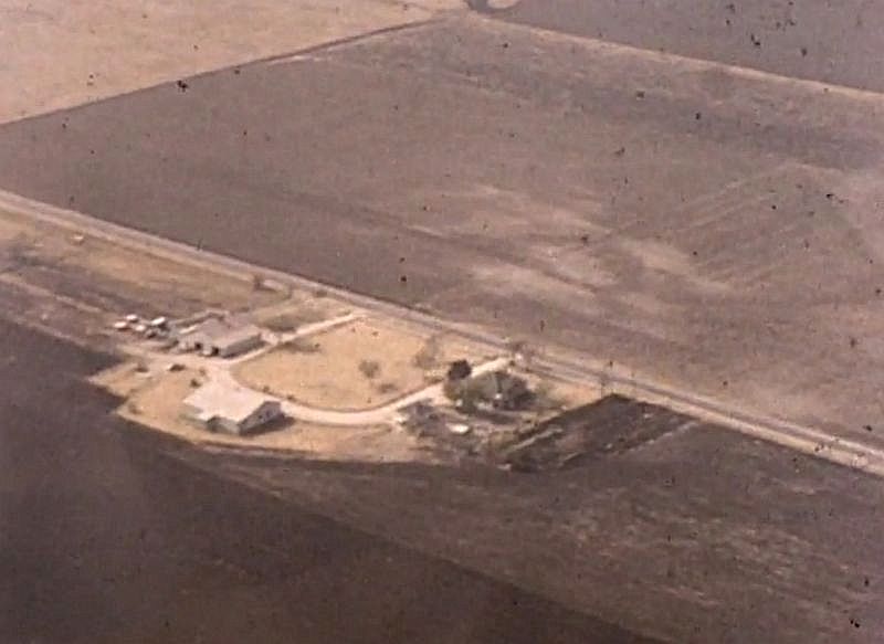
The 4-minute clip starts off with footage shot from a helicopter, showing brand new highways cutting through wide open land, followed by scenes of cute children and their cute dog, and then, beginning at the 3:00 mark, chilly-looking scenes of White Rock Station (which was located at about Jupiter and Kingsley on the edge of Garland, and which, today, looks disappointingly different) and a group of mostly men, some with cameras who appear to be train enthusiasts, waiting for the arrival of the Texas Chief. Doesn’t really look like Texas, does it? Below are some screenshots — watch the full clip on the Texas to Portal History site, here.
*
Above, two men set up a camera on a tripod as Mr. Stewart — the man who donated the footage — smiles at the camera and waits for the much-anticipated arrival of the train (which, be warned, is never actually seen in this film!).
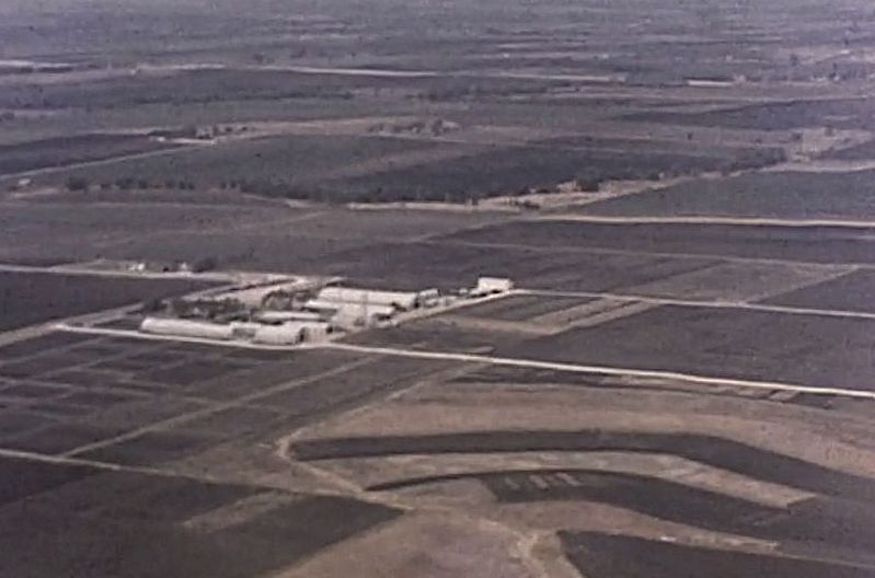
Below a couple of aerial shots of the North Texas countryside.
UPDATE: In the comments below, Danny Linn writes about the aerial footage seen in the first minute or two of the clip: “… at the very beginning [of the clip is] a clear view of the old Highland Park Airport off Coit Road just north of Forest Lane. This portion of the clip also shows a fairly new Central Expressway near the future crossroad of LBJ Freeway.” Thank you, Danny! I assumed part of what we saw was in the LBJ-area, but wasn’t sure — another view of that area can be seen in a fairly startling photo of Preston and Valley View in 1958, here.
***
Sources & Notes
The main page of this clip (titled “The Peter Pauls Stewart Films, No. 5 — Helicopter and Railroad Rides”) can be found here, on the Portal to Texas History website; it is from the Spotlight on North Texas collection, UNT Media Library, University of North Texas. (Click picture to watch clip in a new window.)
I have to admit that I had never heard of White Rock Station until I wrote about it in 2015, a post which has been surprisingly popular. The post — “White Rock Station” — can be found here.

 Ice…
Ice…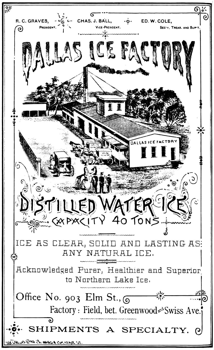 1888 Dallas directory
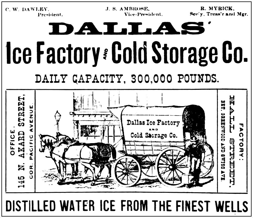 1894 Dallas directory