Flashback : Dallas

A Miscellany: History, Ads, Pop Culture

Category: Automobile

“Classified System” Parking Stations — 1930s

classified-system_colteraIs that a ship? And an iceberg? (click for larger image)

by Paula Bosse

Here’s a cool little ad for what was basically a parking garage that also sold gas and tires (and which seems to have had a ship on top of its building … a building which might be shaped like … an iceberg?). This snazzy-looking garage was at 501 N. Akard (at Patterson) — it was one of several “Classified System” garages that dotted downtown from the early 1930s until at least the early ’70s. The Akard location was station No. 1.

Below, an ad from 1935 informing patrons that they could drive in, have tires installed, and pay for them sometime in the future — for as little as 50 cents a week (which would come out to about $35 a month in today’s money). “YOU DON’T NEED CASH.” (Click ad to see a larger image.)

classified-parking_dmn_061535
1935 ad

classified-parking_dmn_061535_det

I love the kooky design of the building, but that ship is just … odd. I like it, I just don’t get it. Maybe that’s the “classified” part.

***

Sources & Notes

Color image is a matchbook cover found on Flickr, here.

*

Copyright © 2017 Paula Bosse. All Rights Reserved.


Traffic at Ross and Pearl — 1920s

ross-and-pearl_galloway_park-cities
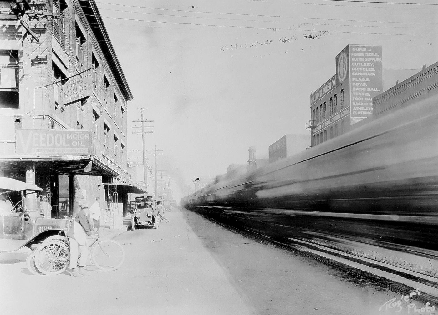
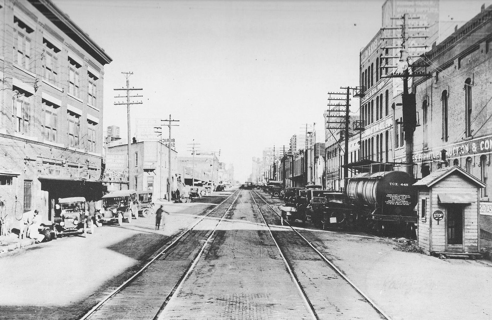
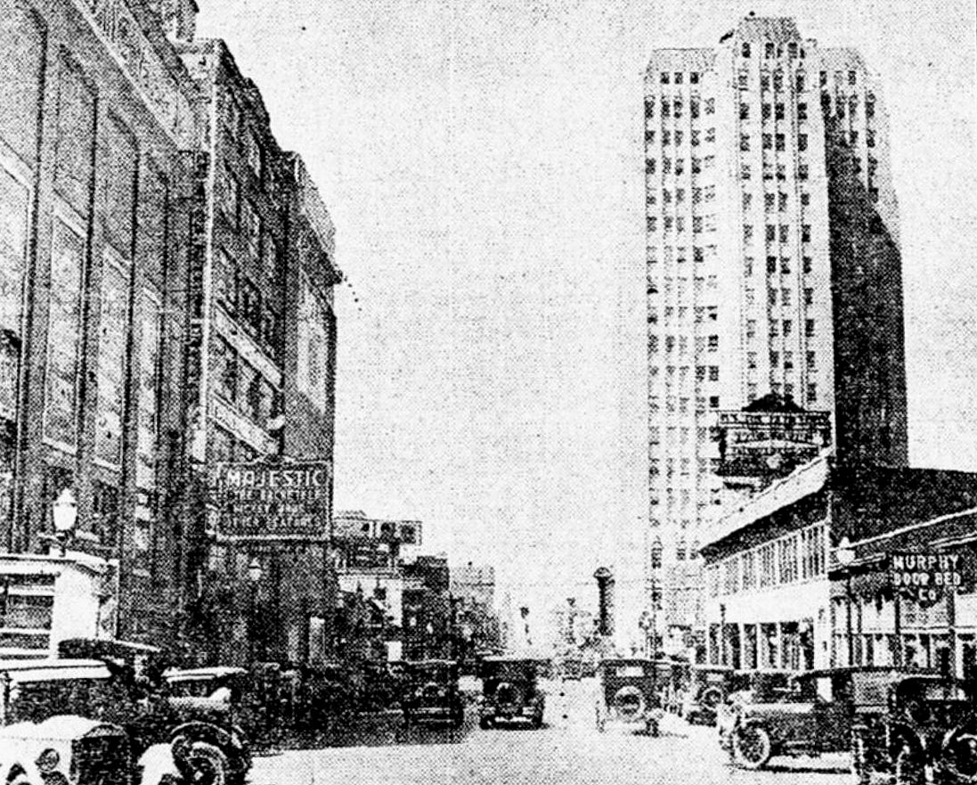
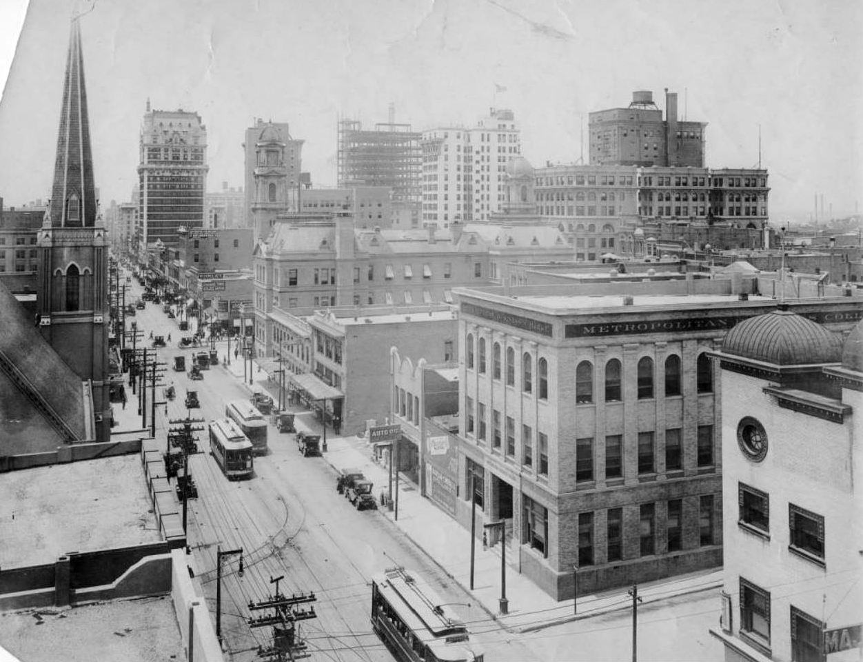
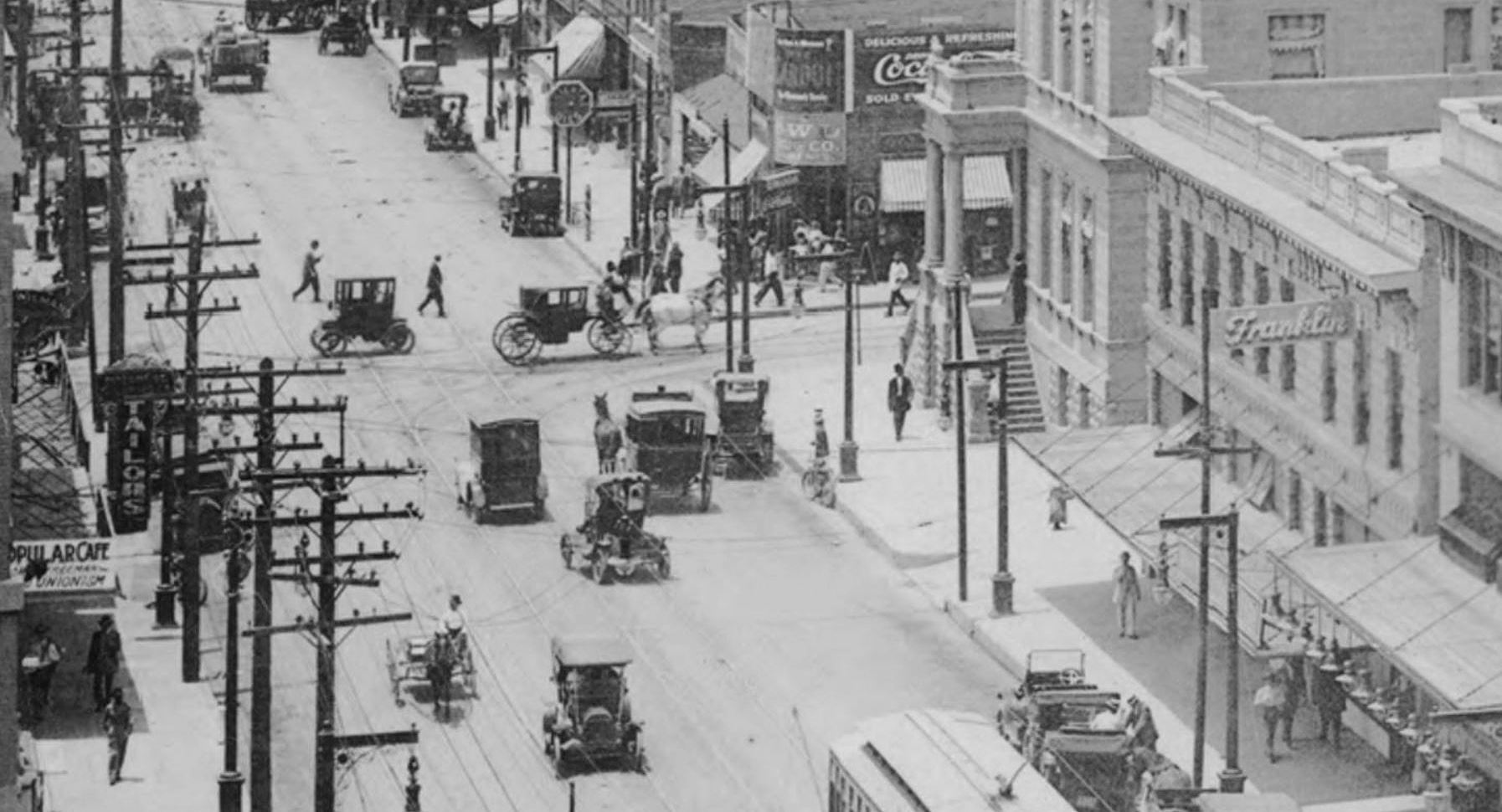
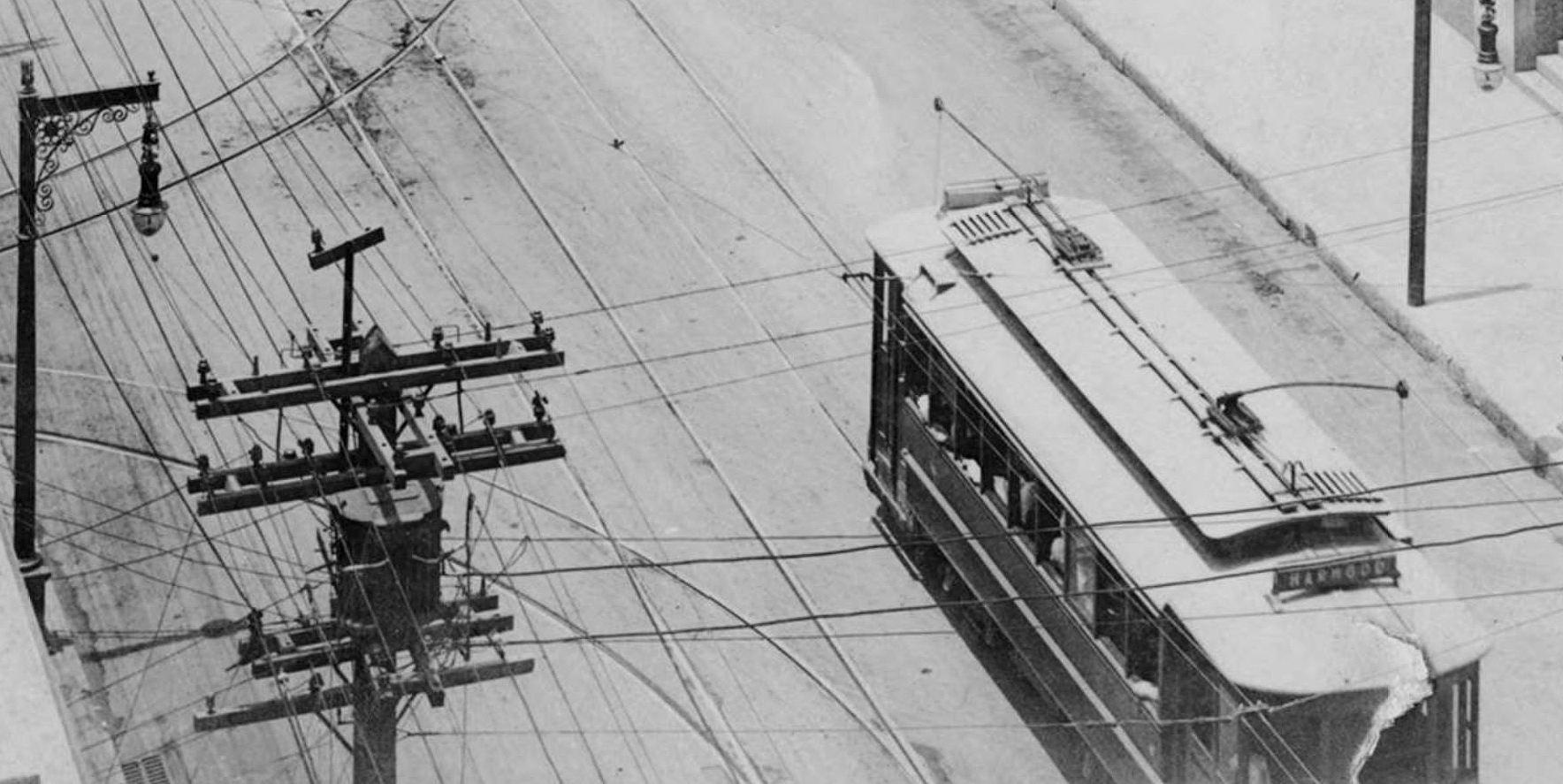
Looking northeasterly on Ross from N. Pearl (click for larger image)
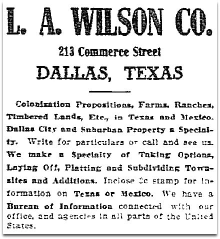
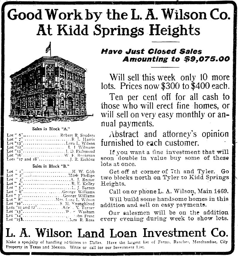
by Paula Bosse

The photo above shows the intersection of Ross and Pearl. The streetcar tracks ran along Pearl. We’re looking northeasterly on Ross. To the left, out of frame, would be the Sacred Heart Cathedral (renamed Cathedral Santuario de Guadalupe in 1977). The photo comes from Diane Galloway’s wonderful book The Park Cities, A Photohistory. Her caption:

Traffic jams such as this one at Ross and Pearl Streets during the twenties encouraged Dallasites to pack up and move to newer developments away from the city.

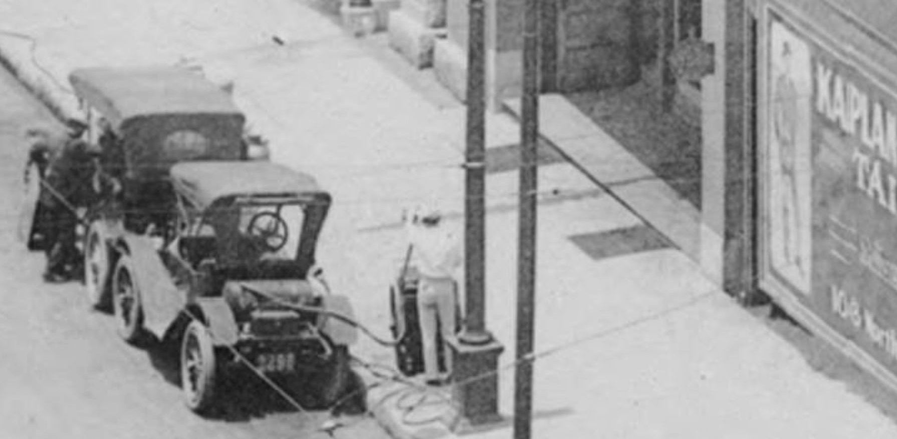
With the crowd of people at the left, I think the traffic in this photo might have been caused by church-going motorists. The license plates on the cars seem to match those from 1927 and 1928 (links to license-plate-dating sites at bottom of post).

That impressive house at the top left with the pointed turret? At the time of this photograph, it was the George A. Brewer Undertaking Company. Like the two-blocks-away Belo Mansion, which was converted into the Loudermilk-Sparkman funeral home in 1926 (seen here), this spectacular house was once a private residence. It was built by Charles F. Carter (1848-1912), a wealthy cotton merchant, sometime between 1892 and 1895. It took up a huge lot at what is now the northeast corner of Ross and Crockett (see it at the bottom left of the 1921 Sanborn map, here). Here’s what the house looked like, circa 1894. (All pictures are larger when clicked.)

carter-house_church_dallas-through-a-camera_ca-1894_SMU

And, below, you can just see part of the house in a 1910 photo of the new-ish Cathedral at the corner of Ross and Pearl.

 sacred-heart-cathedral_1910_dpl

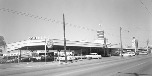
In 1920 or ’21 the Brewer Undertaking Co. moved into this house at 2303 Ross Avenue and operated as one of the city’s most prominent funeral homes until 1931 when they moved into a new location farther down Ross. When Brewer moved out, the beautiful house was demolished. In its place … a used car lot. Argh. In 1940, Lone Star Olds (later Lone Star Cadillac) moved in, eventually bought up the whole block, and became one of Dallas’ legendary car dealerships. It moved from its Ross Avenue location in 1985.

lone-star-cadillac_ross-ave_squire-haskins_uta

*

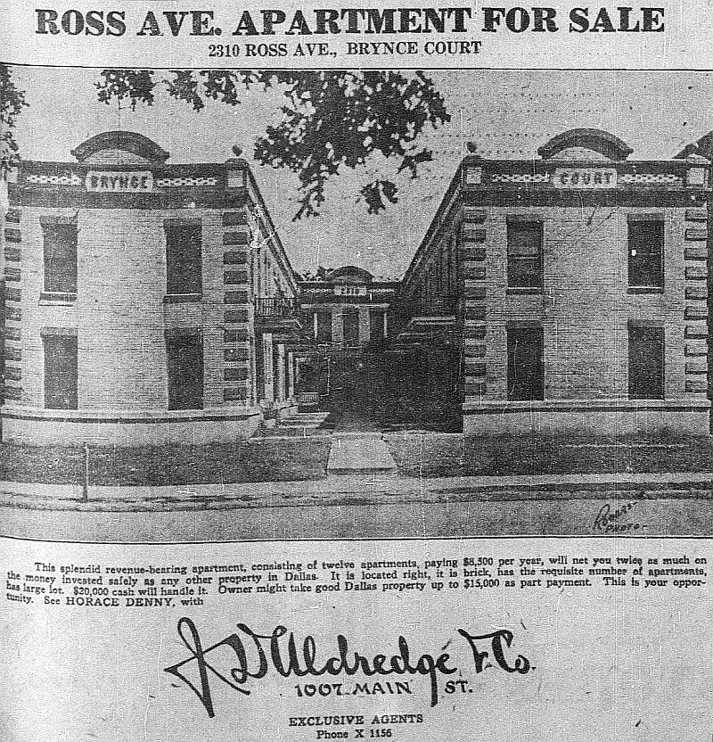
Also, even though it isn’t really visible in the top photo, across the street from the old Carter house — at 2310 Ross — was Brynce Court, a u-shaped apartment building. I haven’t been able to verify this, but The Dallas Morning News had a blurb about the “First Apartments” in the city which read as follows:

Dallas’ first apartment complex was a two-building development at 2310 Ross Ave. Built in 1919 [note: it appears to have been built in 1912], Brynce Court was the first set of apartments housed in more than one building.” (DMN, Jan. 7, 1984)

I mention this because it’s a cool little factoid, but also because I stumbled across a photo of it in an ad while looking for info on Lone Star Olds-Cadillac. So I have to show it. Surprisingly, this apartment block (which probably looked a lot less charming after fifty years) stood at that location until at least 1964.

brynce-court_dmn_051521
Dallas Morning News, May 15, 1921

brynce-court_dmn_042212
DMN, April 22, 1912

*

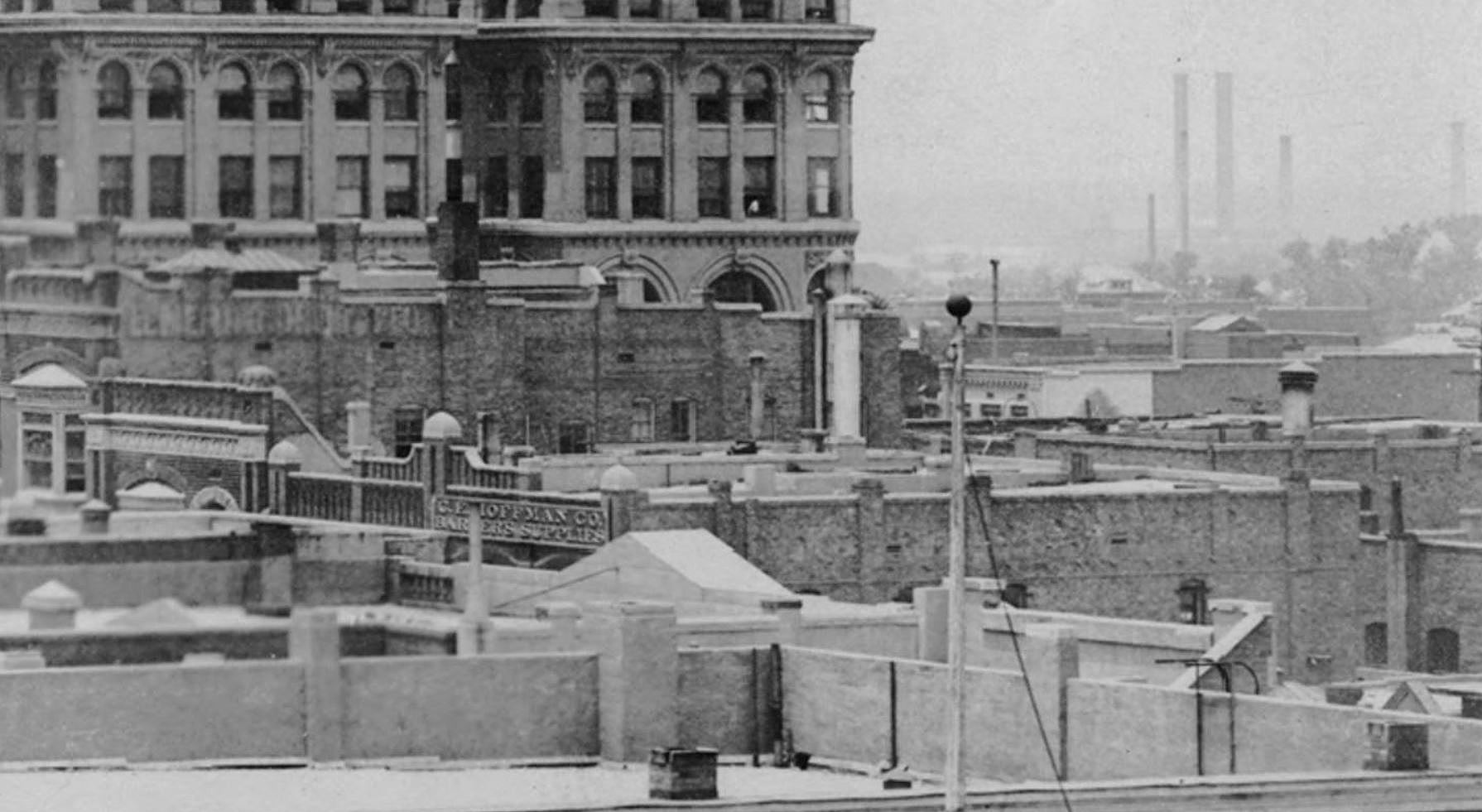
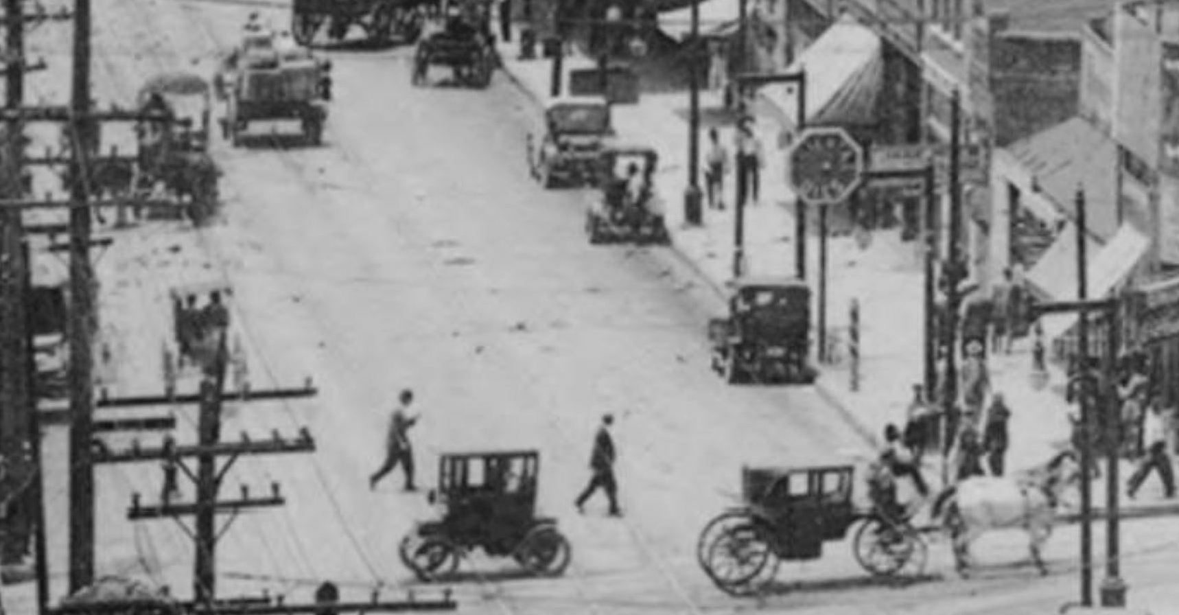
I always like to look at things in the background of old photos. Here’s an extremely blurry magnified detail from the top photo, showing a two-story building of shops and businesses at Ross and Leonard. Included in these businesses is the Imperial Drug Store — it’s a little hard to make out, but the vertical sign with white letters appears to read “DRUGS” (this building can be seen in the 1921 Sanborn map mentioned above).

ross-pearl_dallas-rediscovered_det

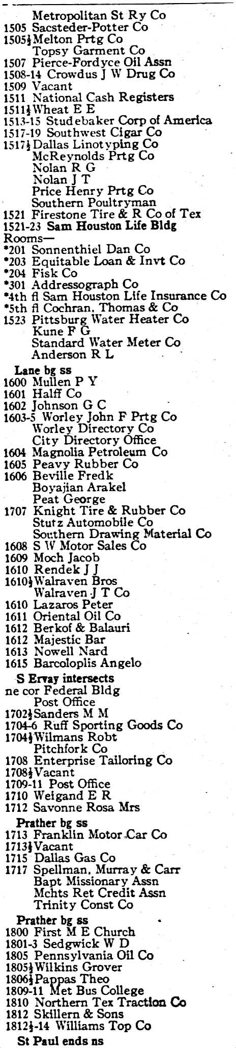
Below, the businesses and residences along Ross Avenue — between  N. Pearl and Leonard — from the 1927 Dallas directory.

ross-avenue_1927-directory

Ross and Pearl these days looks nothing like that top photo. See what the same view looks like today, via Google Street View, here. At least the Cathedral lives on.

***

Sources & Notes

Top photo from Diane Galloway’s book The Park Cities, A Photohistory (Dallas: privately published, 1989); from the collection of John Stull/R. L. Goodson, Jr., Inc., Consulting Engineers.

Photo of the C. F. Carter House is from the book Dallas, Texas Through a Camera, a collection of photos by Clifton Church.

Photo of the Cathedral of the Sacred Heart from the Dallas Public Library, taken in 1910.

(Cropped) photo of Lone Star Cadillac by Squire Haskins from the Squire Haskins Photography, Inc. Collection, University of Texas at Arlington Special Collections; more info is here (click thumbnail on UTA page to see much larger image).

Info on dating Texas license plates can be found here (PDF), here, and here. (If the first link doesn’t open, Google “The History of Texas License Plates.” It’s a report issued by the Texas Department of Transportation. It’s 255 pages long (!) and it’s exhaustive!)

Click pictures to see larger images.

*

Copyright © 2016 Paula Bosse. All Rights Reserved.

Pacific Avenue: Watch for Trains! — ca. 1917

pacific-akard_park-cities-photohistory_frank-rogersToo close for comfort…

by Paula Bosse

Some people don’t realize that Pacific Avenue used to be lined with the railroad tracks of the Texas & Pacific Railway (hence the name “Pacific”). When trains weren’t barreling down Pacific regularly, the thoroughfare was used by non-locomotive traffic like pedestrians, bicycles, horses, and automobiles. When a huge cinder-spewing train screamed through, everything came to a resigned halt until it passed by. I can’t even imagine what that was like. I wonder how many times people, horses, vehicles, etc. didn’t manage to get out of the way in time?

When Union Station opened in 1916, trains that had previously run through the central business district now went around it (which probably cut the number of people rushed to the hospital with train-related injuries substantially).

The photo above shows Pacific looking east from N. Akard, as a blur of a train whooshes by. The Independent Auto Supply Co. (300 N. Akard) is at the left, and, at the right, the back side of Elm Street businesses, including Cullum & Boren and, to its left, the Jefferson Theater, with “Pantages” painted on the side. (The Jefferson was the Dallas home of the Pantages Vaudeville Circuit from 1917 until 1920, the year the Pantages people bugged out for the greener pastures of the Hippodrome, leaving the Jefferson to start a new relationship with the Loew’s circuit people. At the end of 1925, the Jefferson Theater was actually renamed the Pantages Theater. …Kind of confusing.)

Below, Elm Street in 1918 — what the other side of those buildings looked like. Cullum & Boren’s “CB” logo can be seen painted on the side of its building. (Click photo for much larger image.)

dallas-movie-palaces_1918_dth_020556

But back to Pacific in its scary, sooty, T&P-right-of-way days. This is what things looked like in 1909.

t-and-p-flier_1909_loc

Fast-forward to 1920 — the trains had long stopped running, but the tracks remained, an eyesore and an impediment to traffic. (Cullum & Boren, again, at the right.)

pacific-ave_showing-t-and-p-tracks_1920

And another one.

pacific_ave_ca-1920_legacies_fall-1990

Thanks to the Kessler Plan, those unsightly tracks were finally removed from Pacific in 1923. Below, a photo from 1925. Big difference. Thanks, George Kessler!

pacific_bryan_looking-east_lost-dallas_doty

***

Sources & Notes

Top photo (by Frank Rogers) from the book The Park Cities, A Photohistory by Diane Galloway (Dallas: Diane Galloway, 1989). The photo is credited to John Stull/R. L. Goodson, Jr., Inc./Consulting Engineers.

More info on the 1918 photo of Elm Street, which was featured in the post “Dallas’ Film Row — 1918,” here.

More info on the super-sooty Pacific Avenue photo, here.

More on the de-track-ified Pacific, here.

Not sure of the source of the first 1920 photo; the second 1920 photo is from Legacies, Fall 1990, here.

*

Copyright © 2016 Paula Bosse. All Rights Reserved.


Radio Mobile Units — ca. 1940

kfaa_mobile-unit_wfaa-fam-albumWhat? You’ve never heard of KFAA? (click for larger image)

by Paula Bosse

Check out these pre-war mobile units for radio stations WFAA and WBAP. The unit above actually had its own call letters — KFAA — and was licensed as a separate station. (That logo!) The caption, from a 1941 promotional booklet issued by stations WFAA (Dallas), WBAP (Fort Worth), and KGKO (Wichita Falls):

The WFAA Mobile Unit shown here is a complete short wave broadcasting station on wheels. The unit has its own call letters, KFAA, because it is a self-contained and separately licensed station. The amazing array of facilities contained in this one-and-one-half-ton truck includes a transmitter, generator, receiving equipment, public address system and pre–amplifiers. The transmitter tower on top of the truck can be raised to a height of 35 feet, making it possible to pick up the mobile unit’s signals for re-broadcast from a distance of 50 miles.

Here’s the WBAP/KGKO unit:

wbap-mobile-unit

Fort Worth Star-Telegram Mobile Radio Unit – with Chief Engineer R. C. “Super” Stinson, left, and A. M. Woodford, production man, handling a remote or “nemo” pickup from Burnett Park, Fort Worth. The WBAP-KGKO Mobile Unit carries six short wave transmitters and receivers besides a power plant capable of generating electricity for a small town of 500 people. This unit “swam” through a recent flood in Brady, Texas, established communication from the stricken area and received the congratulations of the Texas Highway Patrol. It also played a star role in the Amarillo storm.

***

Photos from the booklet WFAA, WBAP, KGKO Combined Family Album (Dallas-Fort Worth, 1941).

Why were arch-rivals WFAA (owned by The Dallas Morning News) and WBAP (owned by The Fort Worth Star-Telegram) co-publishing a promotional booklet? Because they shared the same transmitter and had an extremely odd broadcasting agreement. Read about it in my previous post “WFAA & WBAP’s Unusual Broadcasting Alliance,” here.

Click those photos!

*

Copyright © 2016 Paula Bosse. All Rights Reserved.

Downtown Parking Innovations

ad-nichols-bros-parking-garage_1945-directory-detSplendiforous parking garage, 1945

by Paula Bosse

Here are a couple of ways developers have attempted to cope with the parking needs of downtown Dallas. I’m not sure how long either of these parking garages lasted, but I give them both A’s for effort.

First, 1945: Nichols Bros. Garage & Rent-a-Car Service at 1320 Commerce (just east of Field). Just look at all these amenities — women and chauffeurs are not forgotten.

…Fluorescent lighting — Air-conditioned waiting room for customers — Beautiful powder room for women — Waiting rooms for chauffeurs — Complete facilities for auto storage, washing, lubrication and motor tune-up service.

ad-nichols-bros-parking-garage_1945-directory1945 Dallas directory

I don’t know how long this lasted, but if you’re going to have a garage downtown, it might as well look like that one!

*

pigeon-hole-parking_dallas_1962_sign

Then in 1954, the 8-story Dallas Carpark at Jackson and St. Paul arrived (a second one at Jackson and Lane was under construction that same year). It was a franchise of the Pigeonhole Parking System of Spokane, utilizing “car-parking machines” invented by Leo Sanders of Spokane, Washington. I’m not exactly sure how these worked, but cars were hoisted and lowered on elevators, and the whole parking process, from start to finish, was conducted without an attendant ever actually touching the cars. Again, I don’t know how long this endeavor was in business (at least through the early 1960s), but — parking-garage-history neophyte that I am — I’ve never heard of such a thing. (There’s a video showing how it worked — thanks, “Not Bob” for posting this in the comments)!

*
UPDATE: “Found” film footage of a family’s trip to Dallas in 1962 actually shows this pigeon-hole system in action. The whole short video is interesting, but the pigeon-hole footage is what got me really excited — it begins at the 1:32 mark.

*
A couple of screenshots:

pigeon-hole-parking_dallas-1962

pigeon-hole-parking_dallas-1962_b

***

Sources & Notes

Nichols Bros. ad from the 1945 city directory.

The 1951 Universal Newsreel segment can be found on Vimeo here (thanks to “Not Bob”).

1962 YouTube video of found footage can be seen here (thanks to Robert Wilonsky of The Dallas Morning News for posting this link!).

See photos and read about the elevator-centric Dallas Carpark at Jackson and St. Paul in these Dallas Morning News articles:

  • “Parking Gets Lift in Downtown Area” by Robert F. Alexander (DMN, Sept. 26, 1954) (with photos)
  • “Pigeonhole Parking Now in Operation” (DMN, Oct. 10, 1954)

See several photos of the “pigeon-hole” parking system in other parts of the country in the article “Pigeon Hole Parking — An Amusement Park Ride for Your Car,” here. Here’s one in Portland, Oregon (the Dallas Carpark was 8 levels high):

pigeon-hole-parking_portland-oregon_oldmotorblog

*

Copyright © 2015 Paula Bosse. All Rights Reserved.

Pacific Avenue — 1925

pacific_bryan_looking-east_lost-dallas_dotyThe back side of Elm, looking east…

by Paula Bosse

Elm Street gets all the glory as Theater Row, but what about Pacific? It had those very same theaters. …Sort of. Pacific gets overlooked a lot. When I see photos like this one — which shows Pacific Avenue looking east from Bryan — I always think of it as a photo showing the back side of Elm rather than as a photo showing Pacific. Always a bridesmaid, never the bride.

This photo was taken only a few short years after the Texas & Pacific railroad tracks were removed from Pacific, making it into an automobile and pedestrian thoroughfare only — no more frightening, smoke-belching trains rumbling right down the middle of the street. The city was hoping that Pacific would become a heavily commercial area like Elm, Main, and Commerce, but it never really reached those lofty heights.

I’ve always wondered if the theaters that lined Elm ever considered having entrances/box offices on both Elm and Pacific. I think that they were really only willing to slap a few posters and paint their names on their back, Pacific-facing walls. Elm Street was glitzy and glamorous. Pacific was not. Back in those early days when people were still trying to get used to Pacific Avenue being newly liberated from its railroad tracks, it might have been seen as something of an afterthought — as more of a very wide alley with traffic than as a contender for one of Dallas’ major streets.

But back to the theaters. In the photo above, we see the Old Mill at 1525-27 Elm (where “The Snob” was playing, featuring John Gilbert and Norma Shearer), the Capitol at 1521-23 Elm (which had Alla Nazimova in “The Redeeming Sin”), and the Jefferson Theater at 1517 Elm (featuring Harley Sadler’s repertory company appearing in “Honest Hypocrites and Saintly Sinners” between vaudeville acts). All of these were playing in May, 1925.

It’s interesting that the only business seen here on the south side of Pacific that had an address on both Elm and Pacific was Van Winkle’s Book Store (before it moved a couple of doors up Elm, it was at 1603 Elm/1614 Pacific). Note the sign advising “Free Passage to Elm Street” — several businesses allowed people to cut through their stores to get to the next street over because the blocks were incredibly long and would sometimes have necessitated pedestrians going three blocks out of their way just to get to their destination.

Other notable landmarks in the photo above: the Medical Arts Building (on the left) and the Dallas Athletic Club.

Here’s a view of Pacific from around the same time, looking west, from about Harwood.

pacific-looking-west_dmn_041430
1930

Most interesting detail in this photo? That Murphy Door Bed Co. sign!

***

Sources & Notes

Top photo from Lost Dallas by Mark Doty (Charleston: Arcadia Publishing, 2012).

*

Copyright © 2015 Paula Bosse. All Rights Reserved.

Selling Kidd Springs Heights, 1909-1910

gaston-bldg_1910_cook-degolyerThe L. A. Wilson Co. is having a sale! (photo: SMU)

by Paula Bosse

The above photo shows a car-and-buggy convoy belonging to the L. A. Wilson Land, Loan & Investment Company, stretched out in front of the Gaston Building at Commerce and S. Lamar. There’s a “Sale To Day” and they’re really pushing property in the Kidd Springs Addition in Oak Cliff. The date “April 20, 1910” is written on the back of the photo, and if that’s true, the big show here might be rooted more in desperation than in enthusiasm. The Wilson company began selling the 30-or-so lots in the new Kidd Springs Heights neighborhood in July of the previous year. An ad that appeared seven months before this photo was taken announced that there were only ten lots left. It looks like this was an impassioned display to make Kidd Springs seem more exciting and move that remaining property. People love parades.

(This is another great photo to zoom in on to see the details. All images are larger when clicked.)

gaston-bldg_1910_cook-degolyer-det1

gaston-bldg_1910_cook-degolyer-det4

gaston-bldg_1910_cook-degolyer-det5

The L. A. Wilson Co. was a fairly large real estate company founded by Missouri-born Lewis A. Wilson (1851-1926); at the time of this photo, the company’s offices were in the Gaston Building at 213 Commerce. (In the photo immediately above, I think the man with the moustache is Mr. Wilson.)

wilson_dmn_070409-detDallas Morning News, July 4, 1909 (ad detail)

The first ad announcing the sale of lots in the Kidd Springs Heights area of Oak Cliff appeared on July 4, 1909. It included the two blocks north of what is now W. Canty, bounded by Turner Ave. on the west and N. Tyler (and Kidd Springs Park) on the east.

ad-wilson_dmn_070409-text

ad-wilson_dmn_070409-photosDMN, July 4, 1909

Four weeks later, a huge half-page ad ran in The Dallas Morning News, full of wonderful reasons why life would be better in Kidd Springs Heights:

The newest theory of scientists is that one should sleep at least eighty or ninety feet above the level of the city – and thus escape the germs which are particularly active during the hours of darkness. Here then is the place for your home. Here then is the place for investment. Kidd Springs Heights is higher than the top of the court house. Up where the cooling breezes are found on the hottest of hot days; where the air is ozone-laden; where the nights are cool and refreshing and where insomnia soon becomes naught but a dim memory.

The effusive sales copy is definitely worth a read (click ad below to read the full sales pitch).

wilson_kidd-springs-heights_dmnn_090109DMN, Aug. 1, 1909

Six weeks later the following self-congratulatory ad appeared. (It’s interesting to note that of the twenty lots sold, two of them had been sold to Mrs. L. A. Wilson, and one each had been sold to the two salesmen. The next year’s telephone directory showed that the Wilsons lived on Live Oak, and the two salesmen lived in boarding houses.)

wilson-kidd-springs_dmn_091209DMN, Sept. 12, 1909

It wasn’t until 1921 that the tiny little Kidd Springs Heights was annexed to the city of Dallas.

annexed_dmn_051421DMN, May 14, 1921

Things may be different today, but in 1909, these were the boundaries of Kidd Springs Heights.

kidd-springs-heights_google_2015

The most interesting odd thing about Kidd Springs Heights? There appear to be two brick archways placed (very awkwardly) across Turner Avenue from one another — each spanning the sidewalk. I can’t find any information about these, but it looks as if they were set right at the northern boundary of the Kidd Springs Heights Addition. Old maps (such as this one from 1919) show no development to the north of this boundary up into at least the ’20s (it doesn’t look as if this addition is even in Oak Cliff proper), so I guess they were there before those sidewalks and served as a welcoming gateway to a new development where germs did not dwell after nightfall.

arch_google
900 block of Turner Avenue (Google Street View)

(Check out both of these markers on Google Street View, here. It’s pretty strange-looking.)

If anyone has information on these markers, please pass it along!

***

Sources & Notes

Top photo is titled “L. A. Wilson Land Loan Investment Company, Gaston Building, Commerce Street” — the photographer’s name and the date are written on the back: W. R. Lindsay, April 20, 1910. It is from the George W. Cook Dallas/Texas Image Collection, DeGolyer Library, Central University Libraries, Southern Methodist University, and it can be viewed here. I have adjusted the color.

Lewis A. Wilson’s biography can be read in A History of Greater Dallas and Vicinity (1909), here. His photo:

wilson_hist-greater-dallas

The Kidd Springs Wikipedia entry is here.

The Sanborn map from 1922 showing this tiny neighborhood at about the middle of the page on the right can be found here. Note how few lots actually have houses built on them. (Taft is now W. Canty; Edwards is now Everts.)

The Murphy & Bolanz map can be seen here. (If the link doesn’t work, you may need to download the plug-in — information on how to do that is here.)

*

Copyright © 2015 Paula Bosse. All Rights Reserved.

Horses, Carriages, Horseless Carriages: Commerce Street — 1913

new-skyline_c1912_degolyer_smuWest on Commerce, from about St. Paul (click for larger image) / SMU

by Paula Bosse

The photo above is from the indispensable collection at SMU’s DeGolyer Library. It shows a very busy Commerce Street in 1913, taken from the top of the YMCA building at St. Paul, looking west. The two landmarks at either end of Commerce are the first location of the Majestic Theatre at 1901 Commerce (northeast corner of Commerce and St. Paul), seen in the bottom right corner, and the Adolphus Hotel at the top left. I love this photo, mostly because it shows horse-drawn conveyances and automobiles sharing the streets in an already car-crazy Dallas, something that might not be that noticeable at first glance until you start zooming in to see magnified details. Let’s zoom in. Way in. (All images much larger when clicked.)

1-rooftops-skyline

2-traffic-skyline-1

Dallas has begun to look like a big city.

3-traffic-skyline-2

Below, the building on the right with the steep steps is the old Post Office/Federal Building at Ervay. The Mercantile Bank Building was built on that site in 1942.

4-traffic-skyline-3

I love the detail below for a couple of reasons: first, the car at the curb at the lower right is parked next to what is purported to be the first gas pump in Dallas (the sign next to it that looks like a stop sign says “Oriental Oils” — more below); secondly, the ratio of cars to horses is pretty even.

5-traffic-skyline-4

A block east of the Oriental Oil gasoline feuling station is the Pennsylvania Oil Company feuling station, at 1805 Commerce. When I first saw this last year, I was so excited to discover this seemingly mundane little detail that I wrote an entire post about these early curbside gas pumps (read “Oriental Oil Company: Fill ‘er Up, Right There at the Curb” here).

7-gas-skyline-1

And a couple more close-ups of this exotic thing which I still find inexplicably fascinating.

8-gas-skyline-2

9-gas-skyline-3

So many wires, and tracks. The Harwood streetcar is cool, but that streetlight is cooler.

10-lamp-skyline-1

11-lamp-skyline-2

Below, a listing of most of the businesses seen along this stretch of Commerce, from the 1913 Dallas directory.

commerce-street_1913-directory***

Original photo is titled “New Skyline from Y.M.C.A., 1912 & 1913,” taken by Jno. J. Johnson, from the DeGolyer Library, Central University Libraries, Southern Methodist University; it can be viewed here. I have corrected the color.

The current Google Street View of Commerce looking west from St. Paul can be seen here. Very different.

UPDATE: This photograph is from 1913. The Busch Building (later the Kirby Building) began construction on the steel superstructure of the building at the end of December, 1912. The building had reached 13 stories by May, 1913 and was completed in November or December, 1913. I have updated the title from “ca. 1912” to “1913.”

All of these images are really big. Click them!

*

Copyright © 2015 Paula Bosse. All Rights Reserved.

“Our First Joy Ride” — 1911

mule-joyride_pop-mechanics_jan-1912Mules taking a load off, Main & Ervay, 1911

by Paula Bosse

Flipping through the pages of a Jan. 1912 issue of Popular Mechanics — as one does — I came across a photo of a truckload of joyriding mules which was accompanied by this explanatory text:

mule-joyride_pop-mechanics_jan-1912-text

Ah, a publicity stunt. A Chicago newspaper offered a bit more background, and gave us the delightful phrase “joy-riding equine debutantes.”

mules_chicago-inter-ocean_102311
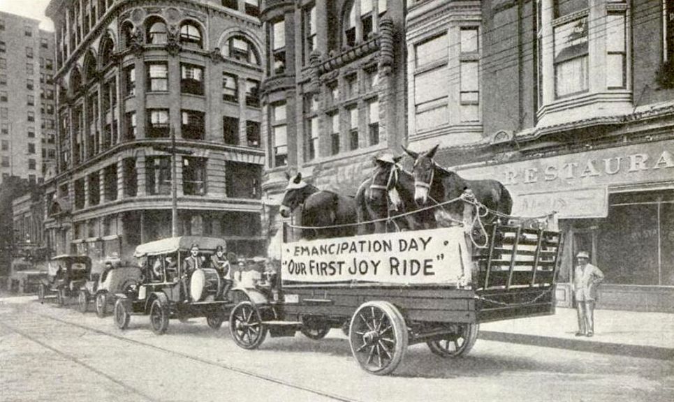
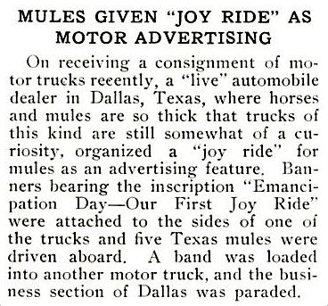
Chicago Inter Ocean, Oct. 23, 1911
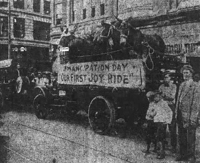
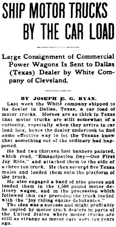
Another report added that the mules were “adorned with a collection of discarded women’s hats and bonnets elaborated with all the old ribbons, feathers and similar gee-gaws […] securely tied on with pink and red mosquito netting…. The procession was headed by Dallas’ most prominent business men in a brand new White 1912 ’30.'” (Automobile Topics magazine, Oct. 28, 1911)

Despite the fact that this, let’s face it, pretty unusual “parade” happened on Main St., with apparent participation by “prominent businessmen,” I can find no mention of it in local newspapers. Maybe because it was a publicity stunt and there was no advertising fee collected by the papers. The story ran in a handful of newspapers (Chicago, San Francisco, Washington, DC), and the Washington Post ran the photo below under the headline “New Way to Advertise Motor Trucks.”

mules_washington-post_102211Washington Post, Oct. 22, 1911

The White Motor Company (makers of the mule-laden truck) must have been quite taken with the unnamed entrepreneur’s banner, because they used the exact same wording on a banner draped on one of their trucks which was a featured attraction on Transportation Day at the 1915 Panama-Pacific International Exposition in San Francisco.

Let’s hope the original Dallas guy got a little something out of all this.

*

On further investigation into The Case of the Joyriding Mules, it appears that this was the brainchild of the General Manager of the White Motor Co., A. E. Creeger (or perhaps that of one of his gung-ho underlings). In a 1912 article in The Dallas Morning News, Creeger talks about the relatively soft truck market in Texas (!), and it’s easy to see why he was doing all he could to draw attention to his company’s line of trucks — even if it meant loading them up with “emancipated” livestock.

And here’s one of his ads from almost exactly one year after the mule stunt:

white-motor-co_dmn_101312Oct. 13, 1912

***

Sources & Notes

Top photo appeared in the January, 1912 issue of Popular Mechanics.

The “parade” (which took place sometime in the middle of October, 1911) is seen heading west on Main Street, just about to pass Ervay. The inescapable Wilson Building dominates the photo, with the tall, white Praetorian Building in the background. The restaurant at the right — at 1705 Main — was the California Restaurant, a Dallas eatery specializing in Chinese food since at least the 1890s.

*

Copyright © 2015 Paula Bosse. All Rights Reserved.

Jack Wilkie’s Texaco Station, Beacon & East Grand

wilkie-texacoA man with a bow-tie will be with you presently….

by Paula Bosse

Above, Jack Wilkie’s Texaco service station at 5523 East Grand. It’s a shame gas stations are rarely this interesting anymore. The station opened in 1937 and was at this location well into the 1940s. Below, the same view today, with that tall brick building in the background of both photos. (I’m not sure what that building is, but while I was waiting for a friend in the Kalachandji’s parking lot a few months ago, I remember thinking what a strange building it was — especially when seen from the side. It’s had some weird additions made to the original building.) This part of East Dallas still has pockets of charm, but it’s never again going to be as cool as it was when Jack Wilkie’s service station was holding down the fort at the corner of Beacon and E. Grand.

wilkie-google

***

Sources & Notes

Top image from Flickr, here.

Second image from Google Street View.

*

Copyright © 2015 Paula Bosse. All Rights Reserved.