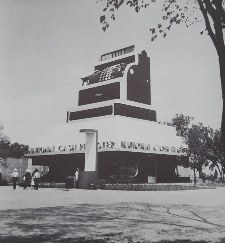
 Before Big Tex we had Big Till (click for larger image)
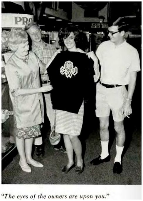
by Paula Bosse
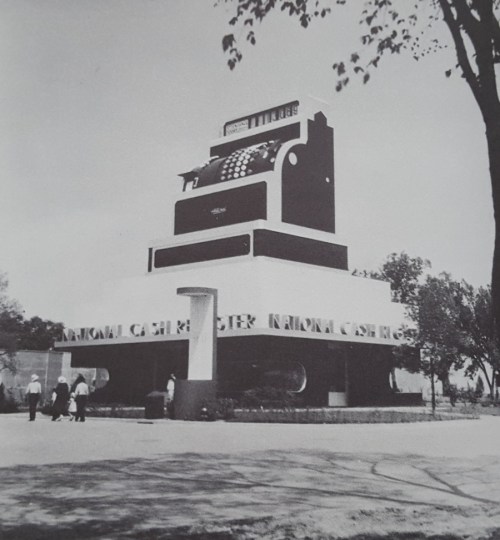
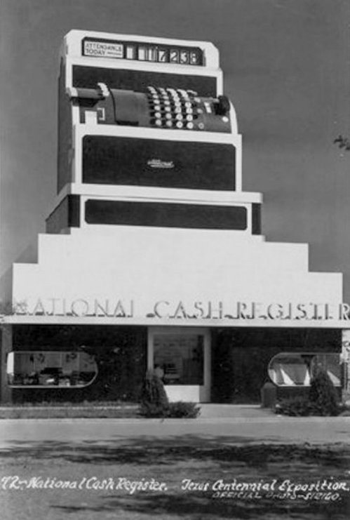
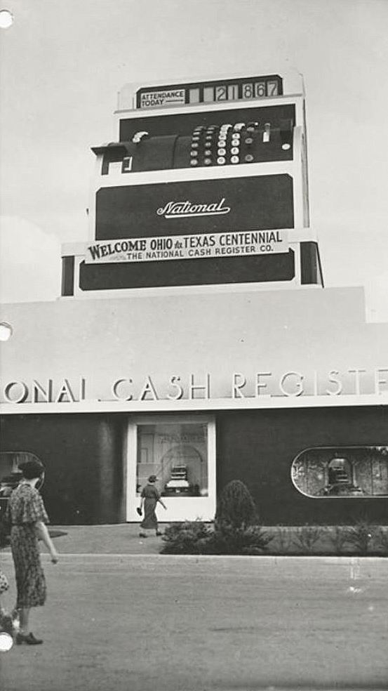
What’s not to love about a 65-foot-tall cash register? And how appropriate that this larger-than-life attraction was featured at the bigger-than-big Texas Centennial Exposition at Fair Park in 1936. This building, shaped like a very large National Cash Register (made under the auspices of noted designer Walter Dorwin Teague), served two purposes: its interior was an exhibit space to show off the company’s line of cash registers, and its exterior served as a giant tally board which was updated hourly to display the number of Centennial visitors. A similar giant cash register had been a popular feature at the Chicago World’s Fair in 1933/34, and it was decided to commission one for the Texas Centennial (another one would show up at the New York World’s Fair in 1939).
At the risk of turning into a blog-realized Monty Python sketch (“This is Uncle Ted at the front of the house. This is Uncle Ted at the back of the house. And this is Uncle Ted at the side of the house….”), let’s take a look at this great big cash register from several slightly different angles.
**
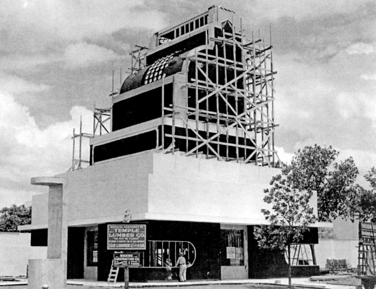
Here it is under construction.

*
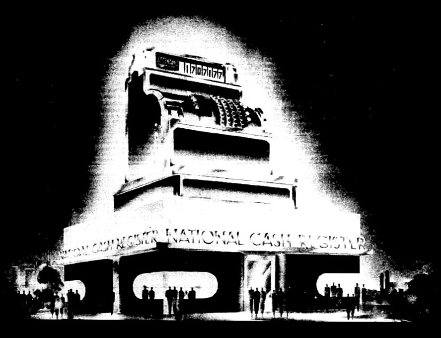
Here it is glowing in an ad with a tantalizingly dynamic illustration (click to see the illustration larger).
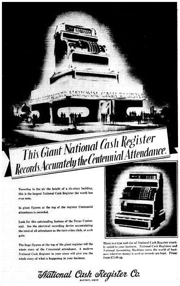 June, 1936
That text?
Towering in the air the height of a six-story building, this is the largest National Cash Register the world has ever seen.
In giant figures at the top of the register Centennial attendance is recorded.
Look for this outstanding feature of the Texas Centennial. See the electrical recording device accumulating the total of all attendance as the turn-stiles click, at each gate.
The huge figures at the top of the giant register tell the whole story of the Centennial attendance. A modern National Cash Register in your store will give you the whole story of what is happening in your business.
*
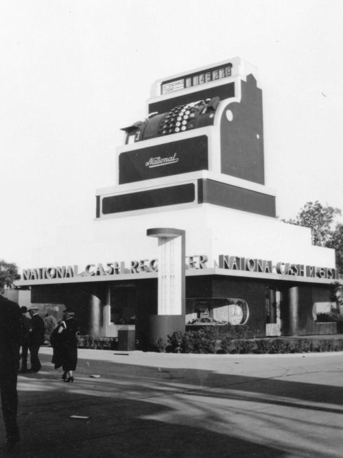
Here it is in a photo that, admittedly, looks a lot like the top photo — but take a closer look — those shrubs have gotten shrubbier.
*
And here it is towering over Mr. Fred S. Benge of Norman, Oklahoma, the Centennial’s millionth visitor. According to the report below, when Mr. Benge passed through the gates into Fair Park on June 25, 1936 (less than three weeks after the opening of the Exposition), the giant cash register numbers flipped over to “1,000,000” and the poor man was “pounced upon” by Centennial officials eager to make a spectacle of the momentous occasion. (In this photo, and two others I’ve seen, Mr. Benge does not look particularly amused at the situation.)
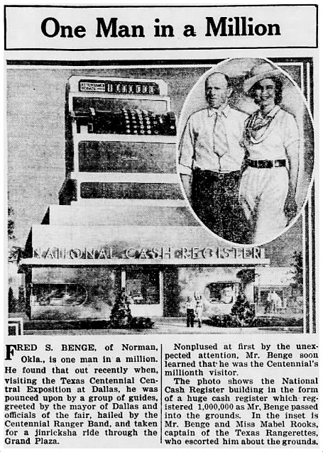 The Greenfield (Indiana) Daily Reporter, Aug. 6,, 1936
UPDATE: Another photo of a somewhat stoic-looking Benge is here. An entertaining article about Mr. Benge’s big day is here. I sure hope Fred didn’t mind being described as a short and bald-headed jobless mechanic.
*
And here’s the “official photo,” which is a little bland and dowdy, but at least you can see what it looked like head-on.
*
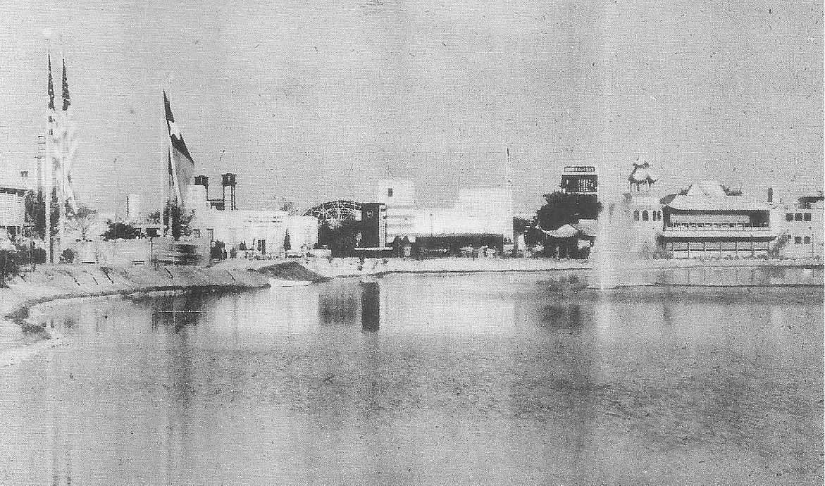
And here it is, as seen from the other side of the lagoon.

*
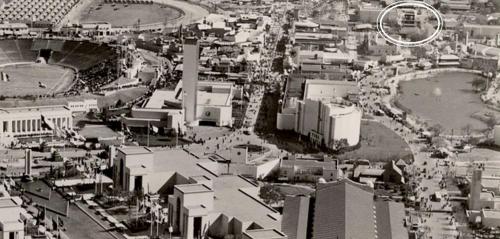
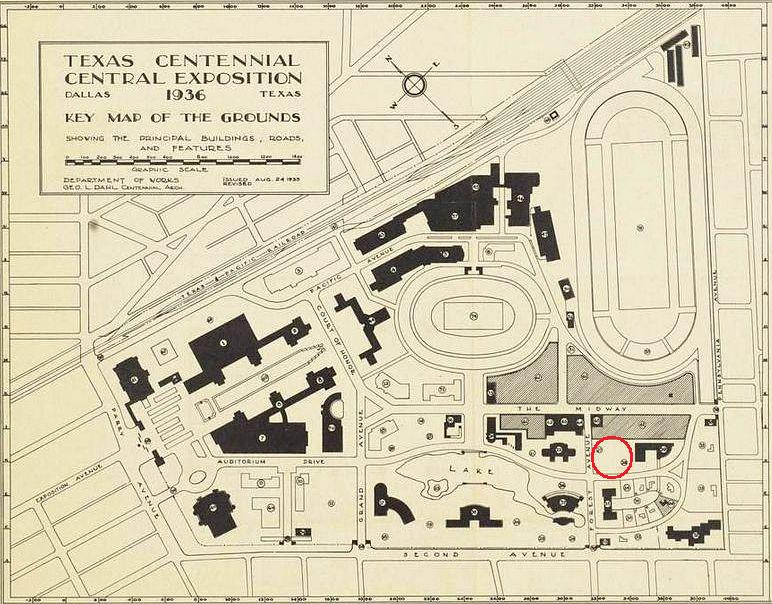
Where exactly was this “six-story cash register” located? I believe it was at San Jacinto/1st Avenue & Forest Avenue (now MLK). I think it might have been one of the two unnamed attractions I’ve circled on the “Key Map of the Grounds.” (See the full unmarked map, from the University of Texas at Arlington, via the Portal to Texas History, here.)

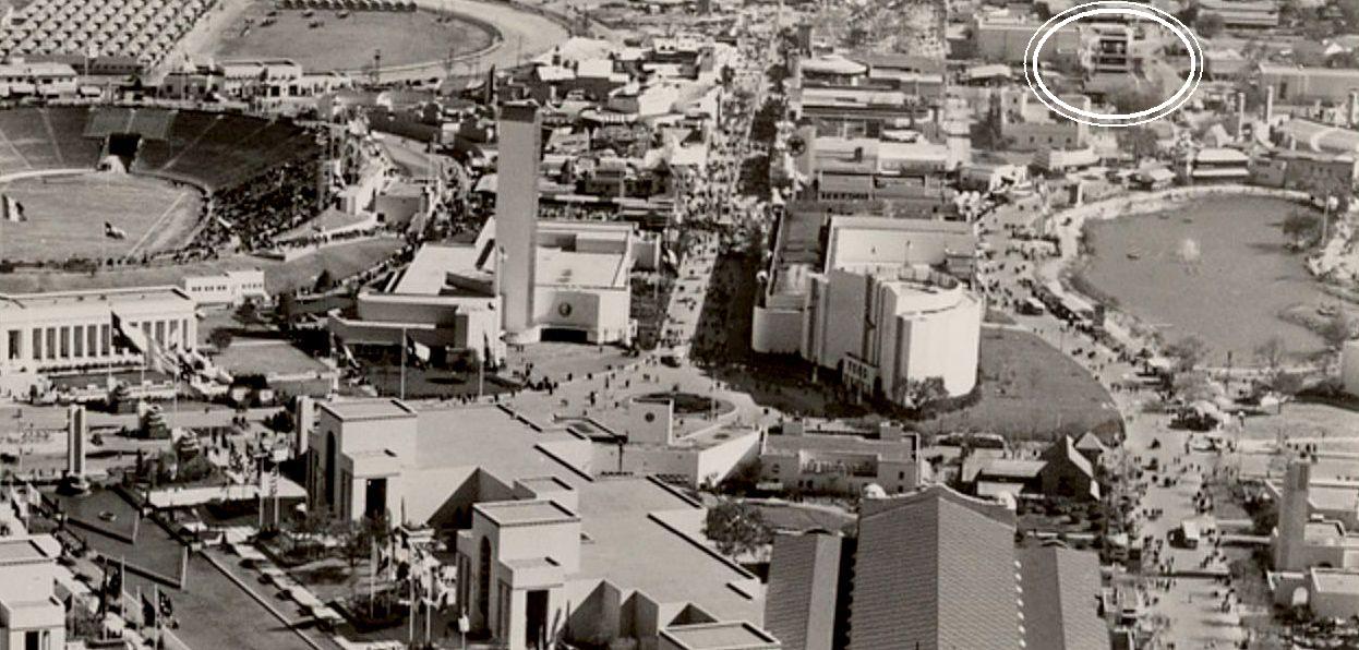
You can see it in a detail from a photo of the Centennial fairgrounds I posted previously (see that post here) — the cash register is circled at the top right.
 (click for larger image)
I’ll just keep adding new photos as I come across them. Below are two photos from the George W. Cook Dallas/Texas Image Collection, DeGolyer Library, SMU (info is here and here). One of them shows a family standing in front of it — since Big Tex hadn’t arrived on the scene yet, this was as good a giant “thing” to stand in front of as anything!


***
Sources & Notes
Top photo is from The Year America Discovered Texas: Centennial ’36 by Kenneth B. Ragsdale (College Station: Texas A&M University Press, 1987); the photograph is from the collection of Texas author Elithe Hamilton Kirkland (Love Is a Wild Assault) who worked as the director of school publicity for the Centennial.
The State Fair of Texas Archives photo of the cash register under construction is from Fair Park by Willis Cecil Winters (Charleston, SC: Arcadia Publishing, 2010). Another photo of the NCR register can be seen in Winters’ book here — in the bottom photo, it is the dark square in the background, left of center — you can see how it towered over everything around it.
The “shrubbier” photo is in the collection of the Dallas Historical Society, but I found it here, not identified as being the one at the Texas Centennial (if you click the picture in this interesting article, it will be super-super-gigantic).
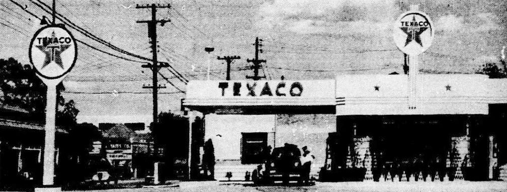
Walter Dorwin Teague (1883-1960) was the man who not only designed the National Cash Register exhibit building, he also designed other Centennial-related attractions, including the Ford Building and the nearby cool-looking new-concept moderne Texaco station (at Commerce & Exposition). Read about him here.
 1936
1936
There were hopes that the Texas Centennial Exposition would attract in excess of ten million visitors over its six-month run, but the final numbers were just under six-and-a-half million. Pity. We had that great big tally machine sitting there and everything. Waiting.
Most pictures larger when clicked.
*
Copyright © 2015 Paula Bosse. All Rights Reserved.

 Hillcrest, looking south, just north of McFarlin (click for larger image)
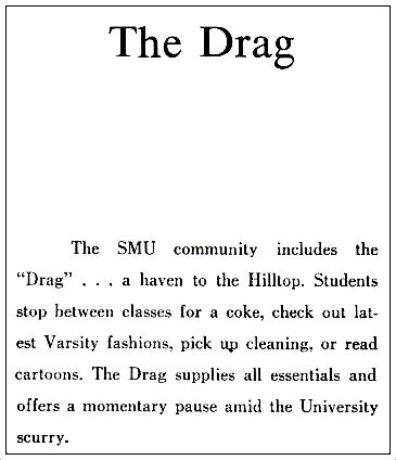 *
* *
* *
*

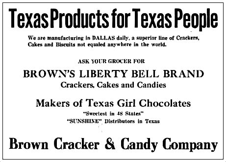
 Dallas Morning News, April 3, 1903
 DMN, April 6, 1903

 DMN, Dec. 20, 1903
 1922 city directory
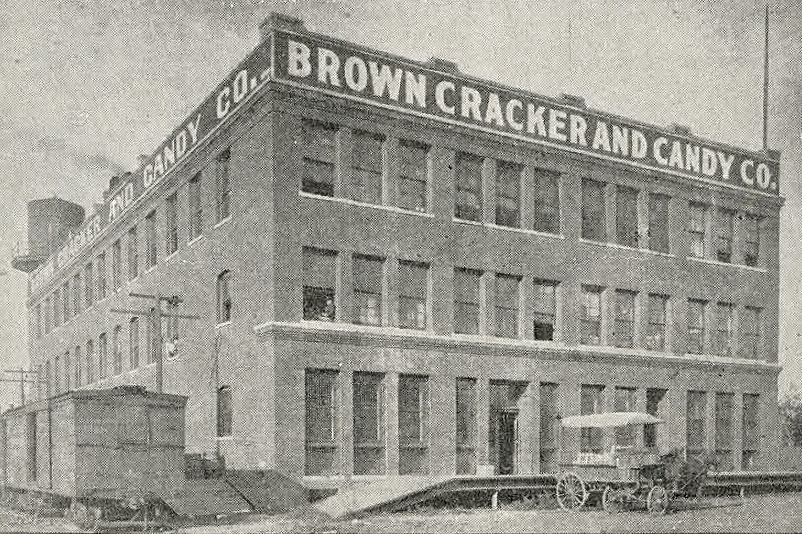
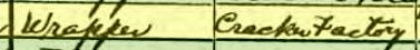 Bessie Manning’s occupation, 1920 census
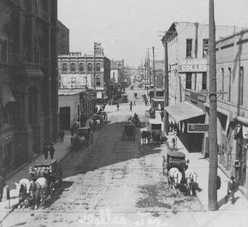
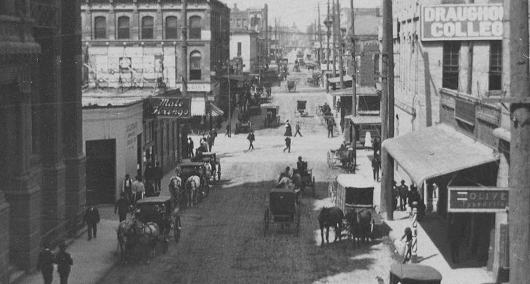


 via Dallas Public Library


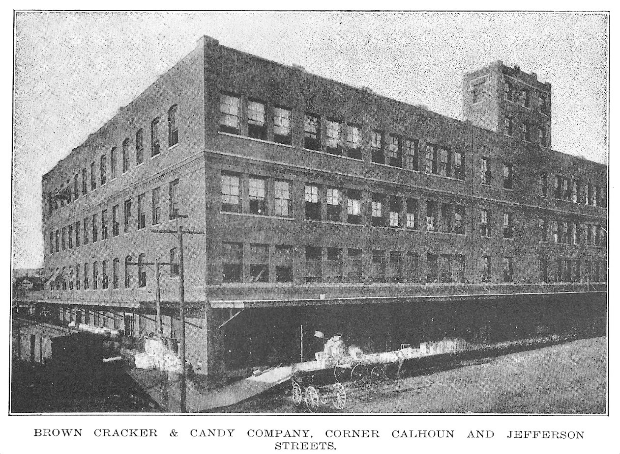
 DMN, Feb. 1, 1931
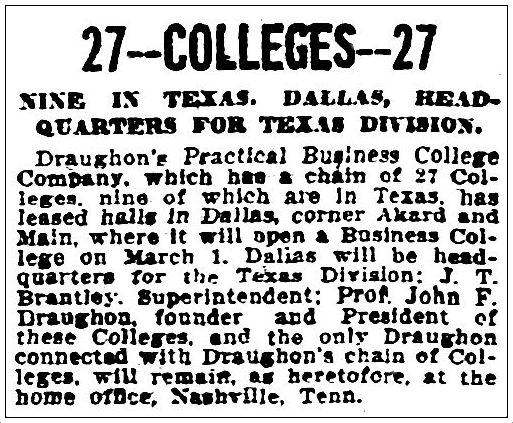
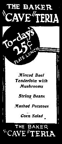 DMN, Feb. 15, 1932
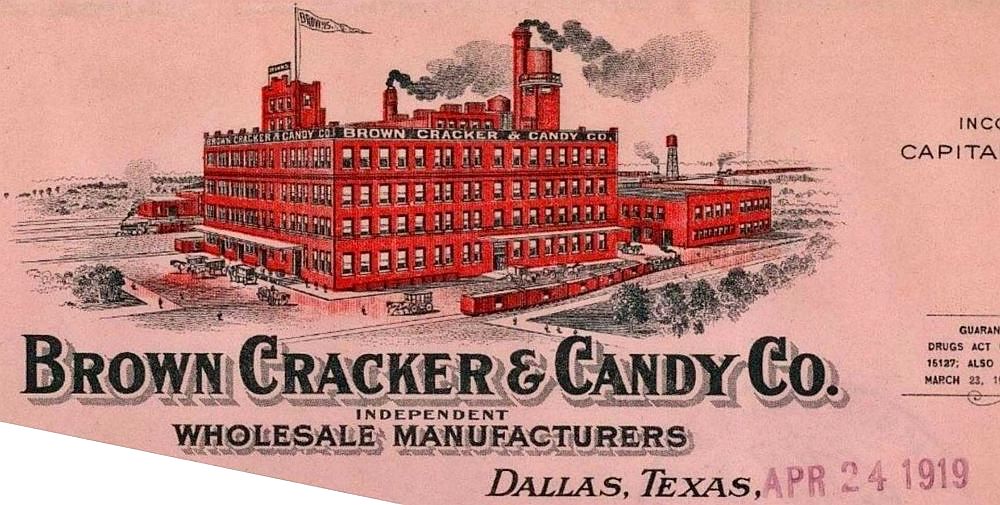
 Corsicana Daily Sun, Mar. 16, 1932