Flashback : Dallas

A Miscellany: History, Ads, Pop Culture

Category: Interurbans

Cedar Crest, L. O. Daniel’s Country Home

daniel-l-o_cedar-crest_flickr_coltera
Still standing on West Jefferson Blvd. in Oak Cliff

by Paula Bosse

While looking for something on W. Lee “Pappy” O’Daniel (former governor and U.S. senator), I came across the image above, which I had mistakenly labeled “O’Daniel” rather than “Daniel.” It had nothing at all to do with W. Lee O’Daniel but, instead, showed a house belonging to L. O. Daniel. Who was L. O. Daniel? I’d never heard of him.

Lark Owen Daniel Sr. (1866-1927) was a wealthy businessman who made big money from… hats! He sold a lot of hats through his wholesale millinery company, and he was also involved in some spectacular real estate dealings (a newspaper article in 1907 mentioned he had just sold a couple of lots on Elm Street for $30,000 — if you believe online inflation calculators, that would be the equivalent of almost a million dollars in today’s money!). As a proven earner of big bucks, he was also the first president of the Dallas Chamber of Commerce.

Even before that huge real estate sale, Daniel was swimming in hat-cash. In 1901 he bought 27 acres near the Fort Worth Interurban rail line and built a 5,000-square-foot, 3-story, 15-room Victorian mansion. He named the house “Cedar Crest.” I don’t know if it was technically in Oak Cliff at that point, but it was definitely outside the Dallas city limits. This is the way Daniel’s address appeared in the 1910 city directory:

daniel-l-o_directory_19101910 Dallas directory

And here’s a photo of an interurban trundling along, uncomfortably close to the house:

cedar-crest_interurban_oak-cliff-advocate

The luxurious splendor of the somewhat isolated Cedar Crest apparently emitted a high-pitched siren-call which was frequently heard by area bandits: it was burgled quite a few times (at least 3 times in one 12-month period). After one incident in which a burglar wandered through the house in the dead of night and woke Mrs. Daniel as he stood over her as she lay in bed, Oak Cliff police said that they found no trace of the trespasser but saw where he had hitched his horse and get-away buggy, out back in the orchard. In another incident a few months later, Mrs. Daniel — who had been alerted by an employee that the family car was about to be stolen from the “automobile house” — ran out to the garage armed with a revolver and fired three shots at the thieves, scaring them away (I don’t think she was attempting to fire warning shots — I think she fired AT them). This may seem extreme, but the newspaper noted that the value of the car (in 1915) was an eye-watering $4,000 (more than $110,000 in today’s money!). I don’t know where Mr. Daniel was during all this, but Mrs. Daniel was not about to let that car go anywhere!

One summer, the Daniels rented out Cedar Crest while they vacationed elsewhere. The ad in the paper specified that only “responsible parties without small children” were welcome. I hate to keep harping on about the money, but a two-month stay at L. O.’s “beautiful country home” would set some responsible childless person/s back a cool $300 (almost $9,000 in today’s money). (Who would pay such an exorbitant amount of money to stay in an un-airconditioned house in North Texas during the height of the summer?)

daniel_house-for-rent_summer-1912
Summer 1912

L. O. Daniel died in Feb. 1927. His business empire was closed down, and the large Cedar Crest swath of land he owned was put up for sale in 1929.

daniel_cedar-crest_april-1929April 1929

I’m not sure what happened with that specific transaction, but his son, L. O. Daniel Jr., ended up breaking that land up into parcels and selling residential lots as part of the “L. O. Daniel Jr. Addition,” beginning in about 1940.

daniel-addition_june-1940_mapJune 1940

daniel-addition_nov-1940November 1940

*

This beautiful house is — somehow — still standing. It is located at 2223 West Jefferson in Oak Cliff, facing Sunset High School (see it on Google Street View here). Over the years the mansion fell into disrepair, but in the early ’80s the house was restored by two men — Martin Rubin and Earl Remmel — and it received historical landmark status in 1984. Cedar Crest was purchased a few years ago and has gone through additional restoration/renovation — it currently serves as the impressive law offices for the firm of Durham, Pittard & Spalding.

There are lots of photos online. View some on the Zillow site — which show what it looked like before it was recently updated — here. See some really beautiful photos on CedarCrestOakCliff.com, here. I particularly love this one:

cedar-crest_entry_cedar-crest-oak-cliff-dot-com

**

It shouldn’t have been so hard to find a photo of L. O. — but this is about all I could find. Followed by a hats-hats-hats! ad.

daniel_l-o_photo

daniel_oct-1915_adOct. 1915

***

Sources & Notes

Postcard at top (circa 1909) found a few years ago on the Flickr stream of Coltera (not sure if he’s still posting there — if not, that’s a shame, because he had amazing things!).

Photo of the interurban from the 2017 Oak Cliff Advocate article “Law Firm Renovates Historic Mansion on Jefferson” by Rachel Stone (click the link at the bottom of the article to read a piece published in Texas Lawyer which includes information on specific restoration/renovation work done on the house).

There are so many great homes in the L. O. Daniel area — look at a whole bunch on the L. O. Daniel Neighborhood Association website here.

Also recommended is the 2019 Candy’s Dirt article “What’s in a Name For L. O. Daniel?” by Deb R. Brimer.

daniel-l-o_cedar-crest_flickr_coltera_sm

*

Copyright © 2022 Paula Bosse. All Rights Reserved.

Interurban Miscellany

interurban_dallas_photo_ebay_redWooden, red… (click for larger image)

by Paula Bosse

Just a few miscellaneous photos from the days of the Interurban, the electric railway which ran through Dallas from 1908 to 1948.

The photograph above has the following written on the back: “The Texas Electric has a whole flock of fast interurbans. Most are steel and painted blue. This older wooden car is red and was used on the Dallas-Denison run. Dallas, Tex.”

Below, “Evolution of Transportation,” a postcard featuring “Miniature Interurban Exhibit, Showing a Model Suburban Home and the Splendid Service Between Dallas, Fort Worth and Cleburne.”

interurban_evolution-of-transportation_postcard_ca-1916_ebayvia eBay

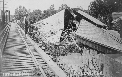
An Interurban mishap:

interurban_mishap_ebayvia eBay

A couple of pleasant waiting-shelters, circa 1925:

interurban-stop_neighbors-pamphlet_portal_1925via Portal to Texas History

interurban-shelter_neighbors_1925via Portal to Texas History

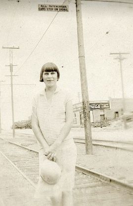
Another stop, with a sign (“ALL INTERURBAN CARS STOP ON SIGNAL”):

interurban-stop_flickr-lynneslensvia Lynne’s Lens Flickr photostream

And the Interurban Terminal, downtown, ca. 1925 (located at 1500 Jackson St. at Browder, still standing, converted to residences):

interurban-terminal_1925_neighbors-pamphlet_portalvia Portal to Texas History

***

Sources & Notes

Top photo found on eBay. “Robert M. Hanft, Brainerd, Minn.” is printed on the back. Hanft (1914-2004) was a rail enthusiast and photographer — his obituary is here.

The Texas Interurban route connected with Dallas in 1908 and continued for 40 years until being discontinued in 1948. More at the Handbook of Texas here, and at Wikipedia here; a look at the stops can be seen in an illustration here.

Check out these two Interurban pamphlets with lots of great photographs, scanned in their entirety by UNT’s Portal to Texas History:

  • Making Neighbors of the People of Dallas and Kaufman Counties, and the Towns of Terrell, Forney, Mesquite and Dallas (20 pages, Texas Interurban Railway) — read it here.
  • Making Neighbors of the People of Dallas and Denton Counties, and the Towns of Denton, Garza, Lewisville, Carrollton, Farmers Branch and Dallas (24 pages, Texas Interurban Railway) — read it here.

More Flashback Dallas posts on the Interurban can be found here.

interurban_dallas_photo_ebay_red_sm

*

Copyright © 2020 Paula Bosse. All Rights Reserved.


Interurban Coming Through

interurban_commerce-street_dart-archives
Street traffic used to be a lot different… (click for larger image)

by Paula Bosse

Great photo of Interurbans trundling down Commerce Street, past the Adolphus Hotel. …Wish I’d been there.

***

Sources & Notes

Photo is from the Dallas Area Rapid Transit archives, but I neglected to note a linkable source. (Click photo to see a larger image.)

*

Copyright © 2019 Paula Bosse. All Rights Reserved.

10th and Lancaster, Oak Cliff — ca. 1902

oak-cliff_tenth-and-lancaster_mcafee_degolyer_SMU_ca-1902Lancaster, intersecting Jefferson & E. 10th… 

by Paula Bosse

This photo, taken around 1902, shows a northward-view of an intersection of the (then) soon-to-be-annexed (or a just-annexed) Oak Cliff: Lancaster (the dark road running at a slight diagonal to the upper left of the photo), E. 10th St. (crossing Lancaster behind the “Eselco 10¢ Cigars” sign and running horizontally in the middle of the photo), and Jefferson, which contains the double tracks of the then-new Dallas-Fort Worth interurban railway.

The location of this photo can be seen on a 1905 Sanborn map here (in that map, 10th St. is at the right edge — to see the area just south of Jefferson — where the photographer snapped his photo — that map is here). The view today? Lancaster (which became N. Lancaster just north of E. 10th) no longer exists immediately north of 10th — that land is now occupied by Hector P. Garcia Middle School  — the location seen in the 116-year-old photo above can be viewed on Google Street View, here.

Let’s zoom in on this photo. Though grainy, it’s still really exciting to see views of Oak Cliff, just after the turn of the century (Oak Cliff was annexed by Dallas in 1903 but had been a thriving community for many years before that). Below, a couple of men are seated on a bench beneath a sign that says “Interurban Ticket Office,” a bicycle lies at the curb, men stand on the corner, and a horse-drawn buggy is parked underneath a sign that says “drugs.” Eselco brand cigars were ten cents apiece at the time (about $3.00 in today’s money). The “ticket office” sign helps date this photo, as the Dallas-Fort Worth interurban service (through Oak Cliff) began in July, 1902. (All photos are larger when clicked.)

oak-cliff_tenth-and-lancaster_mcafee_degolyer_SMU_ca-1902_det-1

On the east side of Lancaster, a two-story building with “Britton & Collins Drugs” painted on the side dominates the block. The drug store was owned by T. Jefferson (“Jeff”) Britton and J. Willie Collins. Tennessee-born Britton (1874-1926) had opened a well-known drug store in downtown Dallas at the southeast corner of Elm and Akard in the late 1890s (seen here in 1900) — this attempt at an expansion into Oak Cliff does not seem to have lasted long: I find listings for this OC location in only the 1902 and 1903 city directories.

oak-cliff_tenth-and-lancaster_mcafee_degolyer_SMU_ca-1902_det-2

britton-and-collins-drug-store_1902-directory1902 Dallas city directory

Back to the interurban service (the arrival of which was, no doubt, both a welcomed convenience as well as a financial boon to Oak Cliff residents and businesses): here are the double tracks of the Northern Texas Traction Co., running along Jefferson. (More on this interurban line is at the bottom of this post.)

oak-cliff_tenth-and-lancaster_mcafee_degolyer_SMU_ca-1902_det-3

Below is a detail from a 1905 map showing this confusing intersection of E. 10th, Jefferson, N. Lancaster, and S. Lancaster. (As with all images in this post, click to see a larger picture.)

oak-cliff_tenth-and-lancaster_worleys-map-greater-dallas_1905_det

***

Sources & Notes

This photo — titled “10th and Lancaster, Oak Cliff, 1900” — is part of the George A. McAfee photographs collection, DeGolyer Library, Southern Methodist University; more information about this photo can be found here.

According to the DeGolyer Library, the photo has the following notation written on the back: “10th & Lancaster. Oak Cliff — looking toward Dallas. Taken 1900.” I think the photo was taken a little later — somewhere between mid-1902 and very early 1904: the Britton & Collins drug store was listed in only two Dallas directories (1902 and 1903), and the interurban service from Dallas to Fort Worth (which passed through Oak Cliff and past the “Tenth St. Station”) did not begin until July, 1902.

Everything you could possibly want to know about the Dallas-Fort Worth interurban line, including mechanical specs and several photographs, can be found in a PDF of the July 18, 1903 issue of the Street Railway Journal, here (scroll down to the link for the specific issue) (the 10-page article “The System of the Northern Texas Traction Company” begins on p. 82 — lots in this article on “Lake Erie” at Handley).

A few newspaper snippets from the first month following of the launch of the Dallas-Fort Worth interurban service.

oak-cliff_interurban_dmn_070102Dallas Morning News, July 1, 1902 (click to see larger image)

oak-cliff_interurban_dmn_070702_first-week-operationDMN, July 7, 1902

The one-way fare to FW from Dallas was 70¢, and a round-trip fare was $1.25 (a rather hefty $20 and $36, respectively, in today’s money, adjusted for inflation).

oak-cliff_interurban_tenth-station_dmn_071702DMN, July 17, 1902

oak-cliff_interurban_tenth-station_dmn_071102DMN, July 11, 1902

oak-cliff_interurban_el-paso-herald_072102El Paso Herald, July 21, 1902

*

Copyright © 2018 Paula Bosse. All Rights Reserved.

Ghost Rails of the Belmont Streetcar Line

matilda-richmond_dan-parr-photo_FB-dallas-history-guild_april-2018Matilda & Richmond, April, 2018… (photo: Dan Parr)

by Paula Bosse

I grew up on Ellsworth, between Greenville Avenue and Matilda — just south of Mockingbird, just north of the M Streets. When I was a child, Matilda was only partially paved — in my neighborhood, maybe only from Mockingbird down to Kenwood? Otherwise, it was a dirt street (!) — and this was in the ’70s! Right around Kenwood was a weird mound which might not have looked like much to an adult, but to a child it was pretty strange. I can’t remember if the rails were visible — I’m pretty sure they were.

That line was the Belmont Line, which ended (began?) at Mockingbird (I think there was a later extension of sorts, but I think Mockingbird was the end of the line for streetcar passengers). As a kid, I knew that Matilda had been a long-gone streetcar line, but never having seen a streetcar outside of a movie, I couldn’t really imagine what it must have been like to have streetcars (and an interurban! — more on that below) moving up and down a street which was less than a block from my house.

A few years ago I stumbled across the YouTube video below and was surprised to see actual footage of that streetcar rolling up Matilda. The first five minutes of the video contains 16mm footage (both black-and-white and color) shot around Dallas in 1953 and 1954 by Gene Schmidt. It’s GREAT! You’ll see streetcars-galore moving past all sorts of familiar and vaguely familiar sights around the city, from Oak Cliff to downtown to way out to Mockingbird and Matilda. It ends with the Belmont-Seventh car (car 603) pulling to the end of the line — the view is looking south down an unpaved Matilda Street from Mockingbird, with a glimpse of the Stonewall Jackson playing field at the left, on the other side of the fence. (The Matilda footage begins at 4:17.)

*

belmont-line_matilda-from-mockingbird_youtube-cap_ca1954Matilda, south from Mockingbird, ca. 1954 (Gene Schmidt)

Above, a screen capture from the video showing Matilda looking south from just south of Mockingbird. Stonewall Jackson Elementary School is at the left. Today the view looks like this.

*

Before the streetcar arrived, Matilda was the artery that led the Texas Traction Company’s Sherman/Denison interurban into Dallas. This electric interurban service from the north, which closely followed the H&TC railroad line, arrived in Dallas in 1908, back when the official entry-point into the Dallas city limits was just off Matilda, near Greenville Avenue and Bryan Street.

1908_interurban_sherman-dallas_dmn_011608
DMN, Jan. 16, 1908 (click to read)

The interurban route connecting Sherman/Denison with Dallas opened on July 1, 1908 and lasted for 40 years, until its final run on December 31, 1948. (Read the Dallas Morning News article on the 1908 inaugural trip for big-wigs, “Many Make Trip Over Interurban,” July 1, 1908, here. Below is the accompanying photo. Image that running up and down Matilda — and, later, along other streets in Dallas — several times a day!)

interurban_sherman-dallas_dmn_070108
DMN, July 1, 1908

Dallas’ ever-increasing population began to move northward and eastward, necessitating public transportation which would connect these developing areas with the rest of the city. One of the early “suburban” lines was the Belmont Line, which branched off the Bryan Street line and served the Belmont Addition and beyond; it opened in 1913, but these early days appear to have been more of a private “dinky” service (see SMU’s dinky car on the beyond-the-city-limits tracks at Hillcrest and McFarlin, here). The Belmont line — as well as the Vickery Place and Mount Auburn lines — became part of the city’s official streetcar system in 1922.

Before the dinky service, riders were able to get on and off the large interurban cars at stops between Mockingbird and the area around Bryan and Greenville Ave. Even though interurbans and streetcars were able to travel on the same rails, it took years for dedicated streetcar tracks to be laid along Matilda.

This detail of a real estate ad shows that the Belmont line had reached at least as far as Richmond by 1914 (I felt I had to include this because the finger is pointing at the exact location of the exposed rails in the photo at the top!):

1914_matilda-richmond_lakewood-heights-ad_det_050314
May, 1914 (detail from Lakewood Heights real estate ad — see full ad here)

By 1922 the Belmont line had extended north to Velasco; by 1925 it had gotten to McCommas; by 1936 it had made it up to Penrose; and by 1939 it had finally reached Mockingbird (in time for the opening that year of Stonewall Jackson Elementary School, located at Mockingbird and Matilda).

Dallas streetcars began to be phased out in 1955, and the Belmont line was one of the first to go — its last run was March 6, 1955: “The Belmont-Seventh streetcar line will go out of existence Sunday to be replaced by service with new Diesel buses” (Dallas Morning News, March 6, 1955). The new bus route in the Lower Greenville area would, for the most part, be along Greenville Avenue, one block west of unpaved Matilda Street.

In March, 1955, it was reported that the abandoned Belmont-Seventh streetcar tracks were deeded to the city by the Dallas Railway and Terminal Co., with the understanding that they would eventually be paved over. The tracks were on Matilda, Bryan, Cantegral, Live Oak, St. Paul, King’s Highway, Edgefield, Seventh, Bishop, and Colorado. In April, 1956, it was reported that the City Council had approved the sale of the streetcar viaduct over the Trinity River and the Matilda street right-of-way.

But what about that paving of Matilda? Mrs. K. E. Slaughter had thoughts on the matter in a letter-to-the editor in April, 1955:

Since removal of the Belmont streetcar line in part — Matilda and Bryan streets — would it not be advantageous to develop this section into an important use to the heavy automobile traffic? Matilda now is no more than useless tracks built up between a cow path. (DMN, April 7, 1955)

“Cow path” — ha!

Another annoyed News reader wrote in 1963 — eight years after the tracks had been abandoned — about the useless unpaved thoroughfare:

The abandoned almost-private right of ways, such as Matilda, nearly two miles south from Mockingbird, received by the city in a deal to permit an all-bus operation, have not yet been paved or otherwise improved. (DMN, Oct. 21, 1963)

I’m not sure when that paving finally happened — early ’70s? — I think it must have been done in stages. I don’t remember a time when the stretch between Mockingbird and Kenwood wasn’t paved, but I do remember Matilda being a dirt road south of Kenwood. I don’t have a good recollection of the year, but kids remember all sorts of weird things, and those mysterious mounds were pretty memorable. (UPDATE: See photos of Matilda being paved at Goodwin in 1971 here.) I wish I’d known what an interurban was when I was a child. That would have made my neighborhood seem a whole lot more interesting! Heck, it used to the Gateway to Sherman!

I’ve long despaired of having missed the streetcar age. But it’s nice to know that one ran so close to the house I grew up in.

belmont-line_matilda-mockingbird_youtube-cap_ca1954End of the line, ca. 1954… (Gene Schmidt)

belmont-car_lakewood-heights-ad-det_050314

***

Sources & Notes

Top photo taken by Dan Parr on April 15, 2018; it was originally posted to the Facebook group Dallas History Guild and is used here with permission. (Thanks, Dan!) The photo was taken at Matilda and Richmond, looking south on Matilda. See it on Google Street View, here. (Roadwork along Matilda is awful at the moment, but much-needed. Apparently it is being reduced to three lanes for automobiles with two bike lanes being added — read about it in the Lakewood Advocate, here.)

YouTube video shot by Gene Schmidt in 1953 and 1954; the direct link is here.

Another interesting video on YouTube was made by the City of Allen and contains period footage of the interurban that served North Texas. It’s a breezy 6-and-a-half  minutes, and it includes some cool shots of Dallas.

If you want to see a whole bunch of North Texas interurban photos, check out this great 83-page PDF compiled by DART, “History of the Interurban Railway System and Monroe Shops,” here.

Speaking of DART, they posted a cool 1925 map of streetcar and interurban lines, here — click the map to see a larger image. (In 1925, the Belmont line ended on Matilda at McCommas).

ALSO extremely cool is a Google map showing Dallas’ Historical Streetcar (and Interurban) Lines laid over a present-day Google map, here. Zoom in and out. Very useful!

streetcar_belmont_color_ebayeBay

belmont-streetcar_new-moon_1940_palace_ebay1940, eBay

belmont-streetcar_1954_ebay1954, eBay

*

Copyright © 2018 Paula Bosse. All Rights Reserved.

The Katy Building, Commerce Street

m-k-t_katy-bldg_flickr_coltera“The Katy Serves the Southwest…” (click for larger image)

by Paula Bosse

A couple of days ago I posted a photo of an M-K-T train leaving Dallas and, today, coincidentally, I came across a photo of the Katy Building, the railroad’s headquarters, at Commerce and Market. This photo shows Commerce looking west toward the Old Red Courthouse from Austin Street. An interurban car is heading east.

See the same view today, via Google Street View, here.

A photo I really love — which shows a view from about the same time looking east on Commerce — can be seen in a previous post, “Commerce & Record Streets — 1946,” here.

***

Photo from Flickr, here.

*

Copyright © 2016 Paula Bosse. All Rights Reserved.

Collision on the Streetcar Viaduct — 1929

interurban_trestle_1946_denver-pub-lib_lgThe new streetcar viaduct, 1946

by Paula Bosse

For many, many years there was a special trestle that spanned the Trinity River which was for the exclusive use of streetcars and Interurbans. There were also trestles and viaducts for the exclusive use of trains and automobiles. Below is a photo showing the  viaductal activity in 1935, with the streetcar trestle — sometimes called the “Street Car Viaduct” or the “Trinity River Viaduct” marked in yellow and the Old Red Courthouse and Dealey Plaza (then under construction) marked in orange.

viaducts_1935_foscue_smu

The viaduct immediately above it was the Houston Street viaduct, for automobiles.

For many, a streetcar ride across the viaduct seems to have been a little on the harrowing side. There were no guardrails to prevent a car from going over the side, and even when the original wooden trestle had been bolstered with stronger materials, it was still described by commuters as being rickety. I like this quote of a man remembering a typical ride in the 1950s:

I always enjoyed the slight tingle of fear I experienced on the trestle over the river, as one could not see the trestle itself from the car window. One had the feeling of being suspended with no support when looking out the window.

And these two memories:

The streetcar trestle ran parallel to the Houston St. Viaduct where the current newer bridge is to downtown. No railings and just depended on gravity to hold the cars on the rails. The cars would buck and sway as they crossed the river bottoms as the motormen made up time on their schedules. Seemed like they were really going fast to me at the time, but probably not in today’s terms.

*

The [newer streetcars] used to scare me to death rocketing across the Trinity River high in the air with no sidewalls except just over the river itself! You were able to look straight down from high above ground… those newer cars had softer springs and the faster they went, the more they rocked side to side over the less than flat tracks!

Here’s a photo when it was in its original rickety state, back in 1895 (this is a detail of a larger photo, taken on the Oak Cliff side of the river, with the trestle — and the not-yet-old Old Red Courthouse — visible in the background).

trolley_oak-cliff_det1

Here it is in 1914 at river-bottom level, with a happy little trolley chugging along with the Oak Cliff/Houston Street viaduct looming over and in front of it. (This is a detail of a larger photo in the George W. Cook Collection, DeGolyer Library, SMU — here).

streetcar-trestle-cook-coll_smu_det_1914

And here’s a sturdier version of the viaduct, in 1946.

streetcar-crossing-trinity_1946-denverpublib

But now to the collision on the viaduct, which happened on the morning of November 23, 1929. Back then — at that iteration of the viaduct — the trestle had only a single track. While one streetcar or Interurban car crossed the bridge toward Oak Cliff, a car wanting to cross over from Oak Cliff had to wait until the westbound car had made its mile-long trip. That must have made for a lot of impatient riders. Even though the so-called “block signal” system worked well for the most part, there were the occasional accidents, including the one involving three cars on Nov. 23, 1929. Below, a front-page report of the collision(s) from The Waxahachie Daily Light (click for larger image).

streetcar-trestle-collision_waxahachie-daily-light_112329Waxahachie Daily Light, Nov. 23, 1929

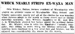
The Waxahachie paper even had a local angle (although it’s unclear just how this man “nearly lost all of the clothes he was wearing”).

streetcar-trestle-collision_waxahachie-daily-light_112329-sidebarWaxahachie Daily Light, Nov. 23, 1929

Since it happened during the morning rush hour, just about every other newspaper in Texas scooped The Dallas Morning News, which wasn’t able to run its story until the next day (and its report was surprisingly dull).

The UP wire story that ran in the Joplin, Missouri paper was far more exciting.

streetcar-trestle-collision_joplin-MO-globe_112429Joplin Globe, Nov. 24, 1929

Thankfully none of the streetcars fell off the trestle, but I’m sure that possibility was probably the daily fear/resigned expectation of generations of nervous travelers.

**

The most interesting thing in the DMN article is the last paragraph:

Plans in the making for the new street car crossing of the Trinity River call for a double track over the channel, eliminating the necessity of waiting on block signals.

In February 1931, that new double-track streetcar viaduct opened for business, and I’m sure there was a citywide sigh of relief.

 **

One last little amusing tidbit about this viaduct: it was not unheard of for those having indulged in excessive amounts of alcohol to try to drive their automobiles (either on purpose or by accident) over this already-kind-of-scary trestle intended for electric-powered railway use only.

streetcar-trestle-mexia-weekly-herald_011333_drunk-motoristMexia Weekly Herald, Jan. 13, 1933

trestle_beaver-valley-PA-times_120852
Beaver Valley (Pennsylvania) Times, Dec. 8, 1952

***

Sources & Notes

Top photo titled “T. E. clouds, sky, city, from east levee close to wooden trestle 320 just passed, at rear, car 320 on Trinity River Bridge, Dallas, Tex.,” taken on Feb. 16, 1946 by Robert W. Richardson, is from the Western History/Genealogy Dept., Denver Public Library.

Photo showing the viaducts across the Trinity is titled “Central Levee District,” taken on May 20, 1935 by Lloyd M. Long, from the Edwin J. Foscue Map Library, Southern Methodist University; the labeled photo is here, the unlabeled photo is here.

Don’t know what “block signaling” is? Wikipedia to the recue.

 Lastly, just because I like it, a magnified detail from the top 1946 photo, showing a streetcar at the downtown end of the viaduct.

interurban_trestle_1946_det-streetcar

*

Copyright © 2016 Paula Bosse. All Rights Reserved.

The Interurban Parlor Car: Perusing the News in Comfy Chairs

interurban-interior_tx-historian_jan81(Click for larger image)

by Paula Bosse

The height of comfort!

You know this photo was taken for promotional purposes, because none of the men has a reeking cigar clenched between his teeth.

***

Texas Electric Railway Interurban ad reprinted in Texas Historian, Jan. 1981.

Interurbans were great. I wish we still had them. Read about what they were, here.

*

Copyright © 2015 Paula Bosse. All Rights Reserved.

Interurbans: Freight Movers?

interurban-passenger_freight_1940sPeople-mover, above; freight-mover, below… (click for larger image)

by Paula Bosse

When I saw this photo, I had no idea what I was looking at — what was that odd-looking thing in the foreground? A couple of rail enthusiasts informed me that it was an interurban freight engine on rail tracks beneath the old elevated interurban/streetcar trestle that spanned the Trinity. This is the Dallas side, with the Dallas Morning News building and the Hotel Jefferson in the background, to the north. (You can see the tracks running right next to the DMN in a photo in a previous post, here.) According to one of the experts:

The interurban did some exchange of freight cars with the regular railroads and the exchange tracks were under the streetcar/interurban viaduct. This track merged with the streetcar tracks at the foot of the viaduct right next to the DMN.

The interurban, though primarily a mover of people, also hauled freight. With more than 200 miles of track across North Texas, the Texas Electric Railway was the largest interurban railway operator in the South. But its glory days were starting to wane as the popularity of automobiles increased. By the ’20s, freight-moving was added to the company’s services, generating welcomed revenue.

The interurban freight depot — seen below in 1946 — was located just east of Ferris Plaza. At the left, part of a railroad freight car is visible, in the middle, an interurban freight car, at the right, an interurban (passenger) streetcar, and at the far right, an automobile. And some crazy person walking.

freight_interurban_denver-pub-lib_1946

But the automobile eventually proved too popular, and more and more people began using trucks for hauling. After 40 years in business, the Texas Electric Railway interurban ceased operations in 1948.

*

When searching around for possible other images of engine 903 (as seen in the top photo), I found it hanging out over on eBay — described as being in the “Waco car house yards” in 1944. Small world.

engine-903_ebay

***

Top image found on Flickr, here.

Photo of the freight depot taken by Robert W. Richardson on April 27, 1946; from the Western History/Genealogy Dept., Denver Public Library, viewable here.

Bottom photo (cropped) from a  currently active eBay listing, here.

Interurban freight operation Wikipedia entry here.

Texas Electric Railway: Handbook of Texas entry here; Wikipedia entry here.

MANY photos of various Texas Electric Railway freight motors and locomotives, here.

And, lastly, great photos from around Dallas in CERA’s “Texas Electric and the Journey to DART,” here.

(Thanks to Bob J. and Robert P. for their helpful info!)

Click pictures for larger images.

*

Copyright © 2014 Paula Bosse. All Rights Reserved.
Waiting For a Streetcar on a Sunny Winter Day in Oak Cliff — 1946

jefferson-addison_denver-pub-lib_1946Addison St. & Jefferson Blvd. in Oak Cliff — Feb., 1946 (click for larger image)

by Paula Bosse

I love streetcars, photos from the 1940s, fashions of the ’40s, and views of the Dallas skyline. And here are all of these things, in one great, GREAT photograph. We see people waiting for the streetcar on a sunny Saturday in February, 1946 — in Oak Cliff, at E. Jefferson Blvd. and Addison St. The people at the left (outside Helen’s Sandwich Shop) are about to catch the car that has just crossed the Trinity River and head into Oak Cliff; the people on the right are waiting to go to Dallas. The Oak Farms Dairy is just out of frame at the top left, and Burnett Field is just out of frame at the bottom right. The Dallas skyline looms across the Trinity.

Below, I’ve zoomed-in a bit and cropped this fantastic photograph into two images to show, a bit more intimately, details of an ordinary moment in an ordinary day of ordinary people. What once was such a commonplace scene — people waiting for a streetcar or interurban — now seems completely out of the ordinary and quaintly nostalgic. (Nostalgic on its surface, anyway — not shown is the interior of the car which had specific black-only and white-only seating areas for passengers.) (As always, click for larger images.)

jefferson-addison-det1

jefferson-addison-det2

***

Photo by Robert W. Richardson, taken on February 2, 1946. From the Western History/Genealogy Dept., Denver Public Library, viewable here. More on rail enthusiast, writer, photographer, and preservationist Bob Richardson, here.

The same stop can be seen in this undated photo (source and photographer unknown):

oak-cliff-streetcar-stop_addison-jefferson

Streetcars ran back and forth across the Trinity River on a special trestle just south of the Oak Cliff Viaduct/Houston Street Viaduct. It had been in use since 1887 (through various renovations) and was demolished in the early 1970s to build the present-day Jefferson Street Viaduct.

To see a photo by the same photographer showing a streetcar actually on the trestle over the Trinity, see the post “Crossing the Trinity River Viaduct — 1946,” here.

Streetcar enthusiasts are incredibly, well, enthusiastic, and they keep precise track of where cars operated over their life spans. The car from the photo — Dallas Railway & Terminal Co. car #605 — was a PCC streetcar, built by the Pullman-Standard company in 1945; it was sold to the MTA in 1958 and was in operation in Boston for many years. See cool photos of the very same streetcar in operation over the years in both Dallas and Boston, here (scroll down to “605”). To see what the retired car looked like in 2002 — a bit worse for wear — click here.

A distinctly less-wonderful view from roughly the same location, seen today, is here.

map_jefferson-addison_googleGoogle

Click pictures for larger images.

*

 Copyright © 2014 Paula Bosse. All Rights Reserved.