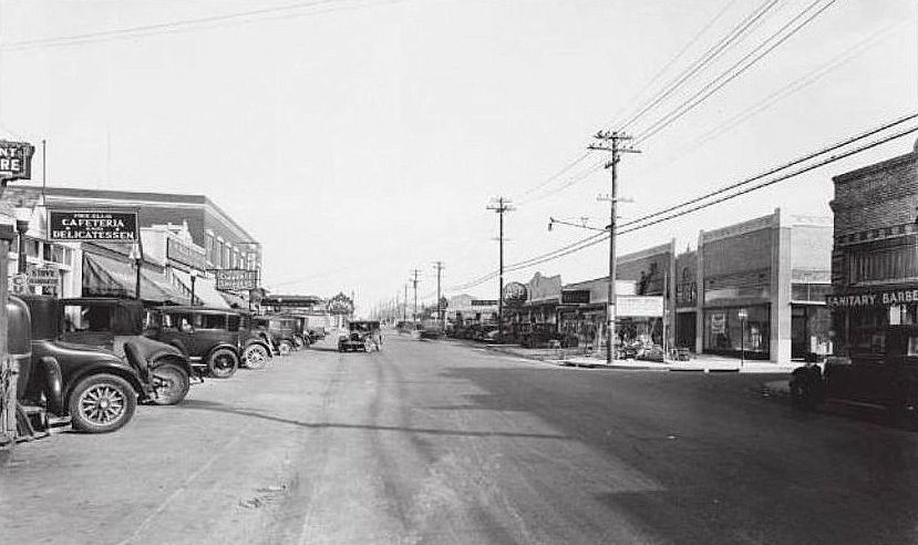
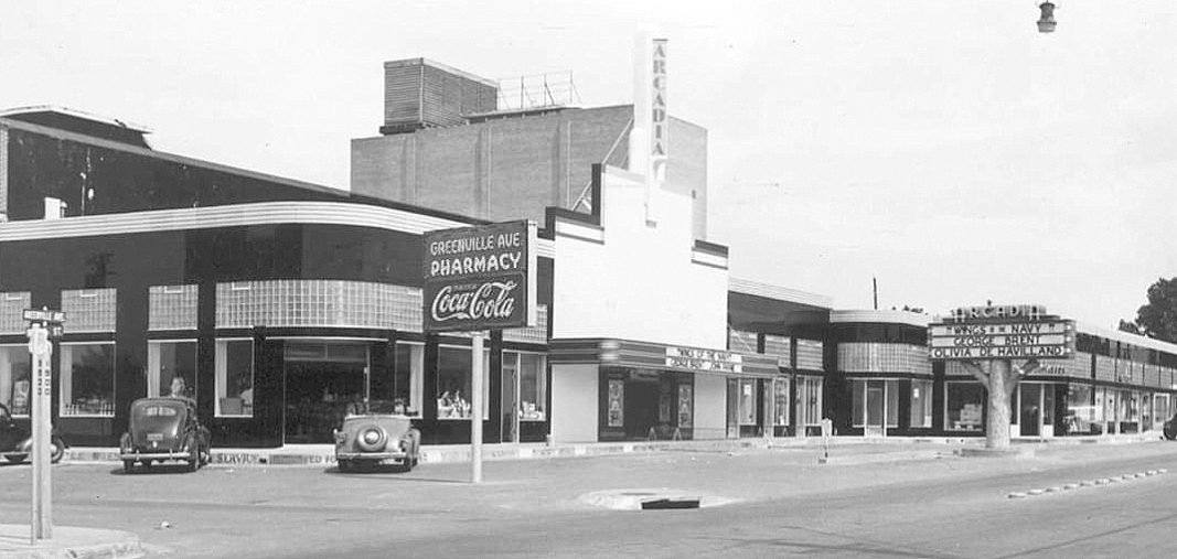
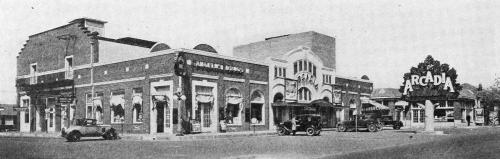
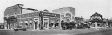
 The 2000 block of Greenville Avenue, 1930… (click for larger image)
by Paula Bosse
I’ve written about the Arcadia Theatre before (here and here), but until I discovered the above photo from 1930, I’d never really thought about what had been on that site previously (the northwest corner of Greenville Avenue and Sears Street, now the home of a Trader Joe’s). There’s a lot going on in that photo, not the least of which is the fabulous Arcadia “tree” sign/marquee, made of sculpted concrete.
Greenville Avenue in the 1920s had a small business district with buildings clustered between Ross Avenue and Belmont, an area which many now call “Lowest Greenville” (the stretch of Greenville a little farther north which is now generally refered to as “Lower Greenville” was being developed but was not really an area of note yet — and “Upper Greenville” — which I don’t really hear people say anymore — was a rural highway which passed through small communities and was mostly surrounded by a lot of open farmland).
A look at city directories of the early 1920s suggests that business owners were trying to establish “Belmont” as the name of the area between Ross and Belmont, and many used the word in their business name (“The Belmont Pharmacy,” for instance). But things began to change in 1922 as development picked up, and “Belmont” suddenly became “Belmont-Vickery” (in a nod to the Vickery Place neighborhood), and then that very quickly became “Bel-Vick” or “Belvick” (a couple of rebel business owners went with “Belvic” but that didn’t seem to catch on). In the 1927 directory there were eight Belvick businesses, almost all of which were in the 1800 and 1900 blocks of Greenville, the blocks seen in the photo below (you can see the Arcadia “tree” in the distance on the left).
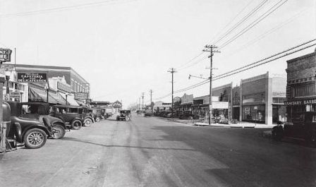
Greenville Avenue, 1930 (Dallas Public Library)

1927 Dallas directory
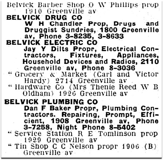
At least one business came up with a cutesy “Belvick” logo:
Belvick Plumbing logo, 1928
(One of these businesses, Belvick Electric Co., ended up on Garland Road, owned by the family of “King of the Hill” writer and producer Jim Dauterive, a name which should be familiar to all “King of the Hill” fans; I wrote about that tidbit of hyper-trivia at the end of this post.)
There was even a small theater at 1804½ Greenville Ave. for a year or two, pre-dating the Arcadia by five years. The Belmont Theatre opened in Sept. 1922, but when it changed ownership a few months later it became, you guessed it, the Belvick Theatre. I hope patrons didn’t get too attached, because it was out of business by the time the 1924 directory was published. Here’s what that building looked like in 2012 (sadly, it no longer looks anything like this) — the theater was, I believe, in the right half of the building.
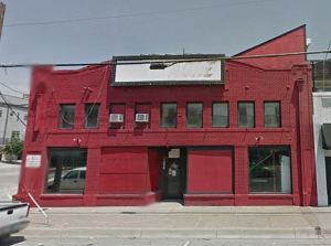
Google Street View, 2012
In 1923, a Greenville Avenue developer, Albert J. Klein, built a large building called the Angelus Arcade in the 2000 block of Greenville, at Sears Street. Here are a couple of woefully fuzzy classified ads for the under-construction “Greenville Market Place” and a list of the types of “first-class” businesses wanted to occupy the new arcade (click for larger-but-still-hard-to-read images).
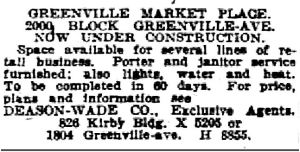
July, 1923
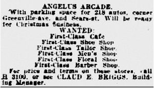 Nov., 1923
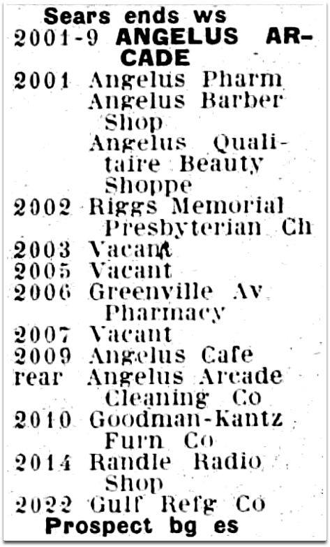
The arcade had several tenants and served as something of a public meeting place for the neighborhood — politicians frequently appeared in front of the large building to give speeches or talk to crowds in impromptu town-hall-like meetings. Like the use of “Belvick,” the name “Angelus” showed up in many of the less-than-imaginitively-named (first-class) businesses:
 1927 Dallas directory
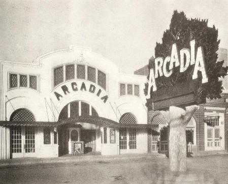
In 1927 Klein made a deal with the Dean Theatre company to build a new movie theater on the same premises as the Angelus — there would be additions and modifications made to the building, but it would still be home to several other businesses — there’d just be a movie theater inside. It would continue to be an “arcade.” Even though one newspaper article attempted to tie the name “Arcadia” to the new theater’s Italian garden motif which suggested a pastoral harmony with Nature, it seems more likely that people were already calling the building “the arcade,” and “Arcadia” was the next logical step.
The Arcadia Theatre opened on Nov. 4, 1927 with the Mary Astor movie “The Sunset Derby.” A newspaper report noted that “in spite of its remote location” the crowd-size was healthy. Patrons could even pop next door for a chicken dinner if so inclined.
 1928
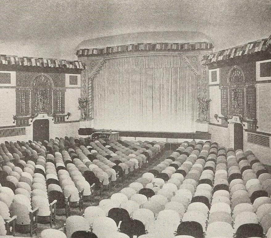
1928
One of the unusual things about the theater was the seating. The backs of the chairs were in a variety of colors (desert sand, cafe au lait, light blue, orchid, green, and “Chinese red”) which were placed in a randomly pattern throughout the auditorium. I think the operators probably thought this design-breakthrough was quirky and cutting edge, but it just looks a little odd. The Dallas Morning News described this feature as being reminiscent of a fun carnival; the Arcadia publicity person wrote that “the effect is as startling as it is pleasing.” …I’ll give you “startling.”
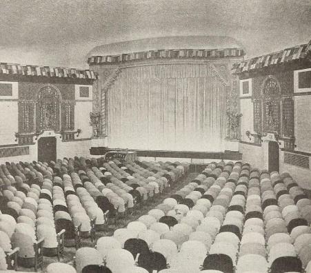 1928
1928
*
Below are a few more images of the Arcadia Theatre through the years.
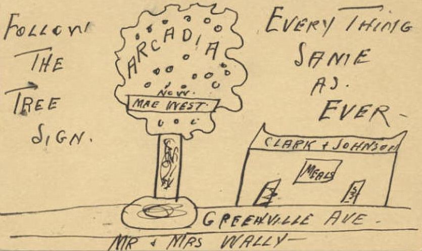
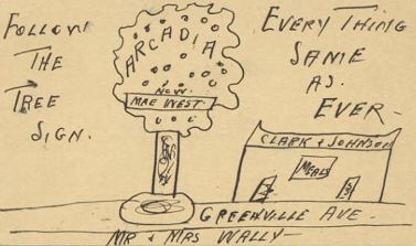
First, just an odd little postcard from 1934 which found its way into SMU’s archive — a drawing of that cool tree!
 via George W. Cook Collection, DeGolyer Library, SMU
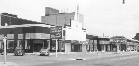
 1941
1941
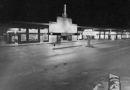
The Deco years, and a painfully pruned tree, in the daytime, and at night:
 1941, via Dallas Historical Society
 via DeGolyer Library, SMU
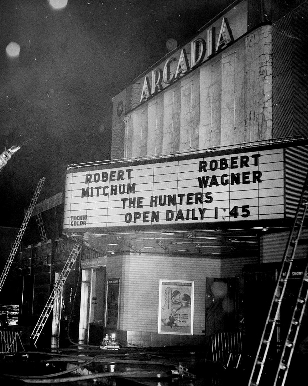
There were a few fires over the years — here’s one from November, 1958.
 Dallas Firefighters Museum, via the Portal to Texas History
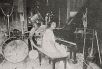
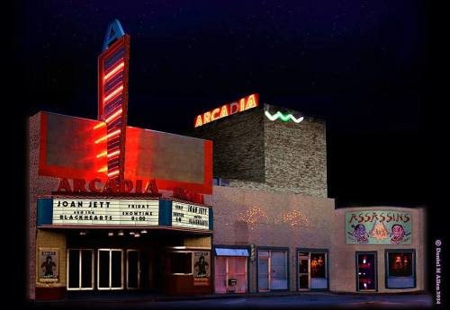
Eventually its days as a second-run suburban theater dwindled, and it became a live-music venue for a while in the 1980s, as seen in this absolutely fabulous photo from 1985 (Joan Jett played the Arcadia on June 13, 1985) taken by Dan Allen, owner of super-cool clothing boutique Assassins.
 ©Daniel M. Allen 2014, via Facebook
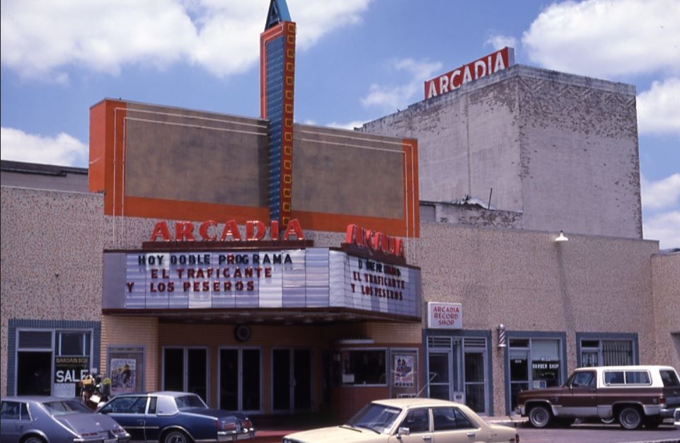
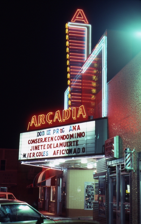
It also showed Spanish-language films for a few years.
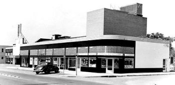
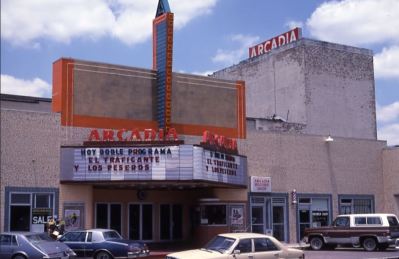 via American Classic Images
 via American Classic Images
But, ultimately, a fire ended it all, on June 21, 2006: 120 firefighters responded to a six-alarm blaze caused by a fire that originated in a restaurant — all the businesses in the block were destroyed.
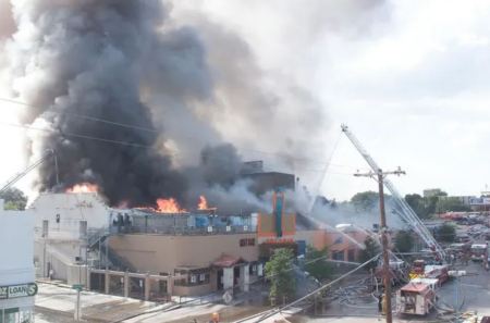 via Cinema Treasures
Bel-Vick hasn’t been the same since. RIP, Angelus/Arcadia.
***
Sources & Notes
Top photo from Exhibitors Herald World, June 7, 1930.
The 1930 view of Lowest Greenville, looking north from Alta, is from the Frank Rogers Collection, Dallas Public Library; titled “[Lower Greenville Avenue],” the call number is PA84-9/49.
The two photos from 1928 are from Exhibitors Herald World, June 9, 1928. To see the full 4-page article on the still-new Arcadia (with many photos of the interior) as well as a 2-page article from April 12, 1930 about how the Angelus Arcade building had been renovated to accommodate a theater — complete with floor plan — see a PDF here.
More on the Arcadia Theater — including additional photos of the ever-changing facade — can be found in these Flashback Dallas posts:
**
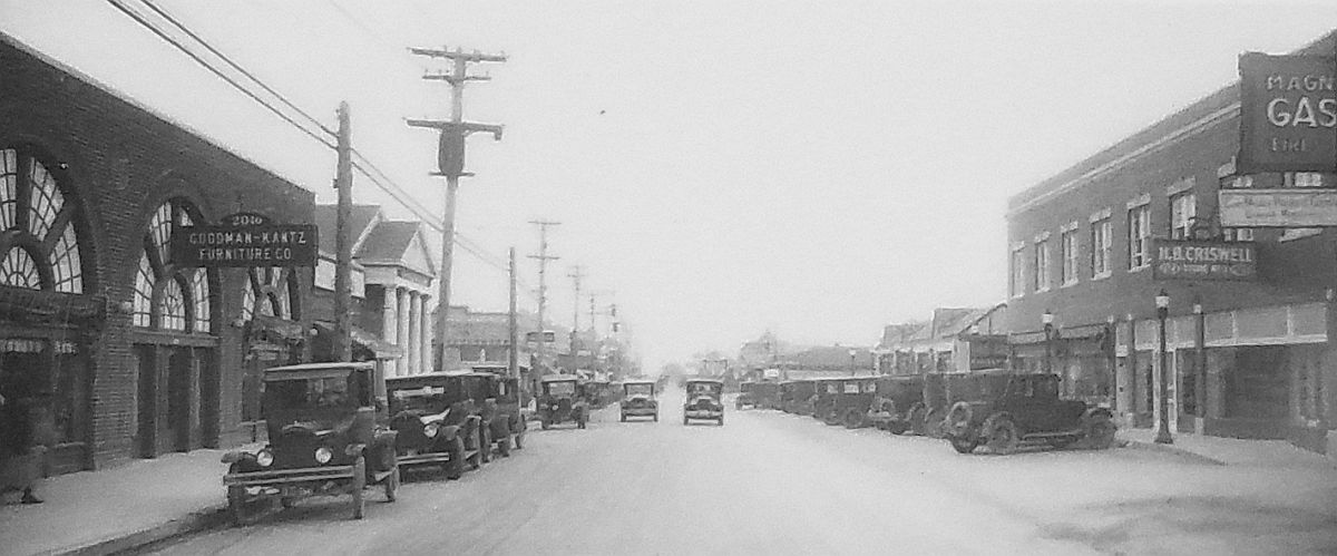
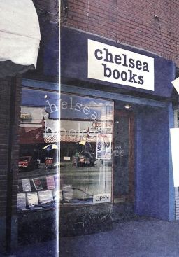
Here are a couple more photos of Greenville looking south from Sears, one from 1927 with buildings I’ve never seen, and one from 1930 with brand new buildings replacing those unfamiliar ones. Here’s the first, from 1927, which shows an unusual building with arches and a church (?!), Riggs Memorial Presbyterian Church, at the northeast corner of Greenville and Oram. (I used to have a little bookstore — Chelsea Books — at 1925 Greenville, in the space occupied by Criswell Furniture in this photo.)

1927, Dallas Public Library, call number PA78-2/1047
And then, just three short years later… bye-bye, weird building and church. The buildings seen in the 1930 photo below are still standing (except for the gas station at the southwest corner at Sears). I love that this street has been immediately recognizable for decades, even though there has been some unfortunate architectural revision going on in ol’ Bel-Vick in recent years.
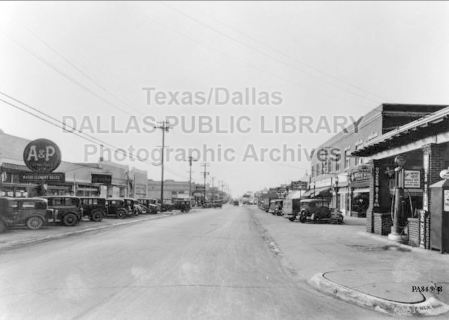
1930, Dallas Public Library, call number PA84-9/48
And here’s a detail from a 1931 Fairchild Aerial photo showing the Angelus/Arcadia at the center left (you can see the tree sign).
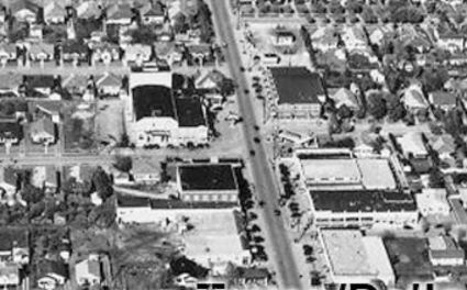
Dallas Public Library, call number PA83-32/16
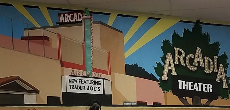
And, finally, the mural inside Trader Joe’s, located on the spot of Arcadia Theater.

*
*
Copyright © 2020 Paula Bosse. All Rights Reserved.

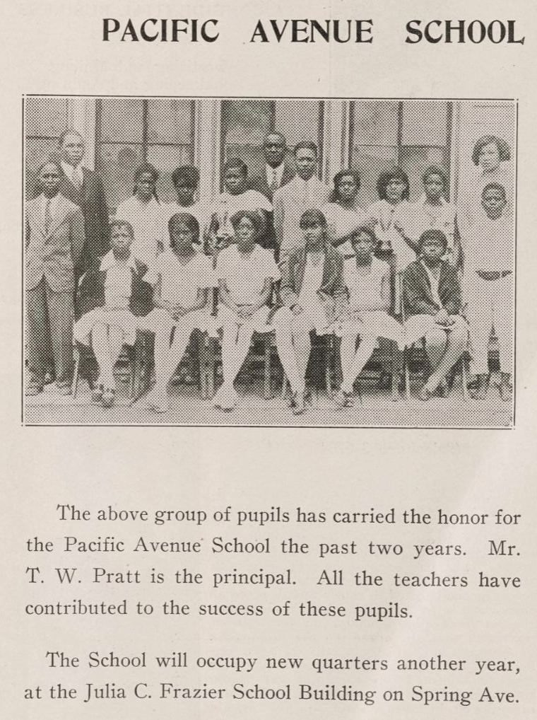
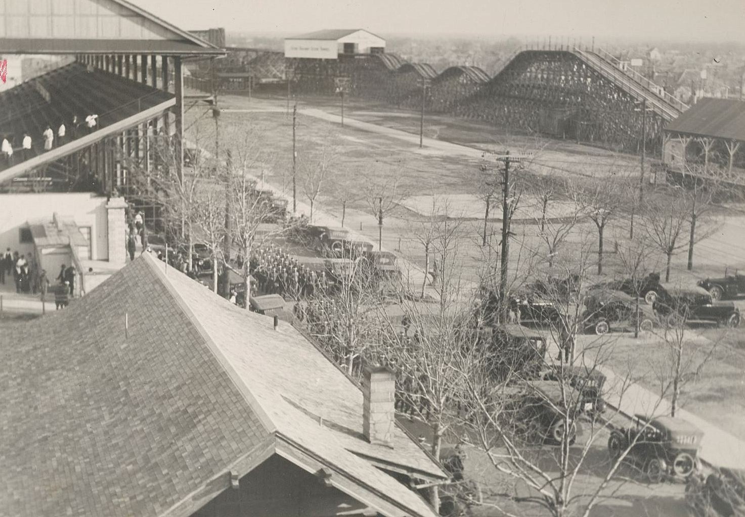 Not your typical boot camp setting…