Dallas in “The Western Architect,” 1914: Businesses
by Paula Bosse
The continuing week-long look (…well, it looks like that’s going to be more like a two- or three-week-long look…) at the Dallas buildings featured in the July, 1914 issue of The Western Architect plods on. Today: business buildings. Nine of these ten buildings are, remarkably, still standing (some are even still recognizable!), and, as seems to be the trend with architecture of this period in Dallas, the powerhouse firm of Otto Lang and Frank Witchell dominates.
*
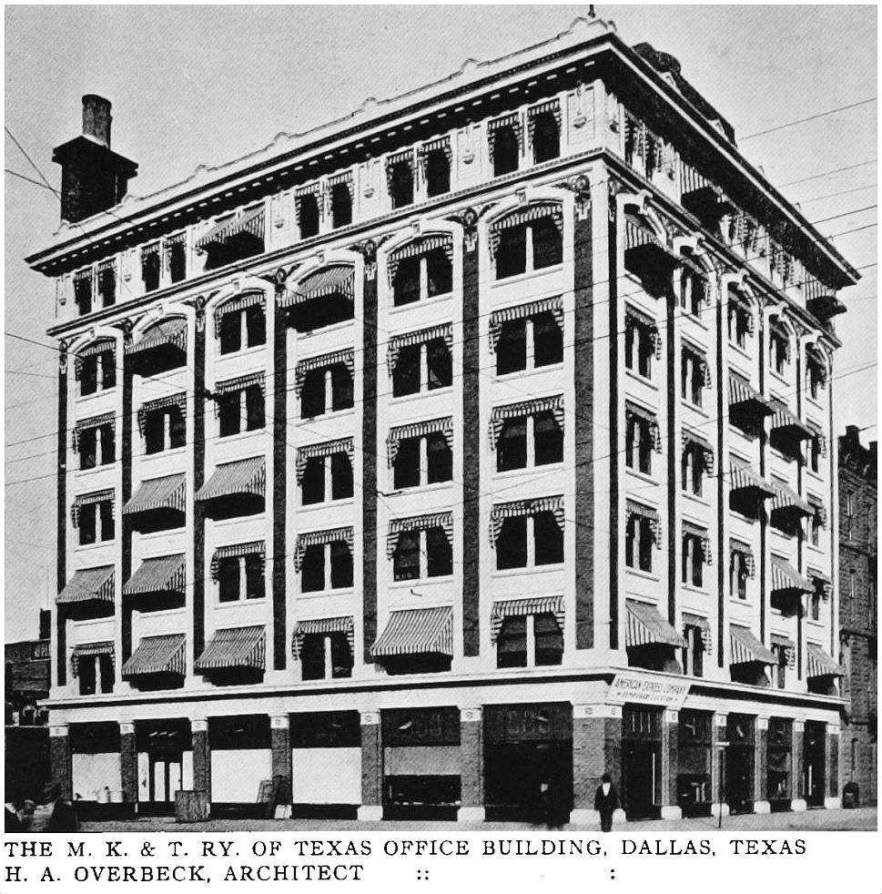
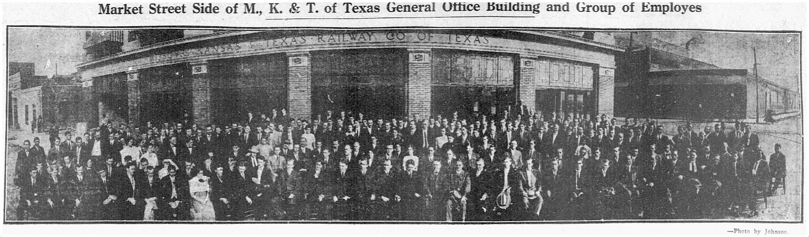
1. MKT BUILDING / KATY BUILDING, Commerce & Market, designed by architect H. A. Overbeck (who also designed the nearby Criminal Courts Building). This building (seen above) was built in 1912 as the general offices of the Missouri, Kansas & Texas Railway; it has been spiffed up in recent years and is one of my favorite downtown buildings. An article appearing at the time the offices opened described the building as being faced with dark brick (“gun metal shade”) and light colored terracotta. The wide-angle photo below, which shows employees in front of the new building, is interesting because of the buildings seen to the left and right (all images in this post are larger when clicked). (See the building on a 1921 Sanborn map here.)
 Dallas Morning News, Dec. 1, 1912
*
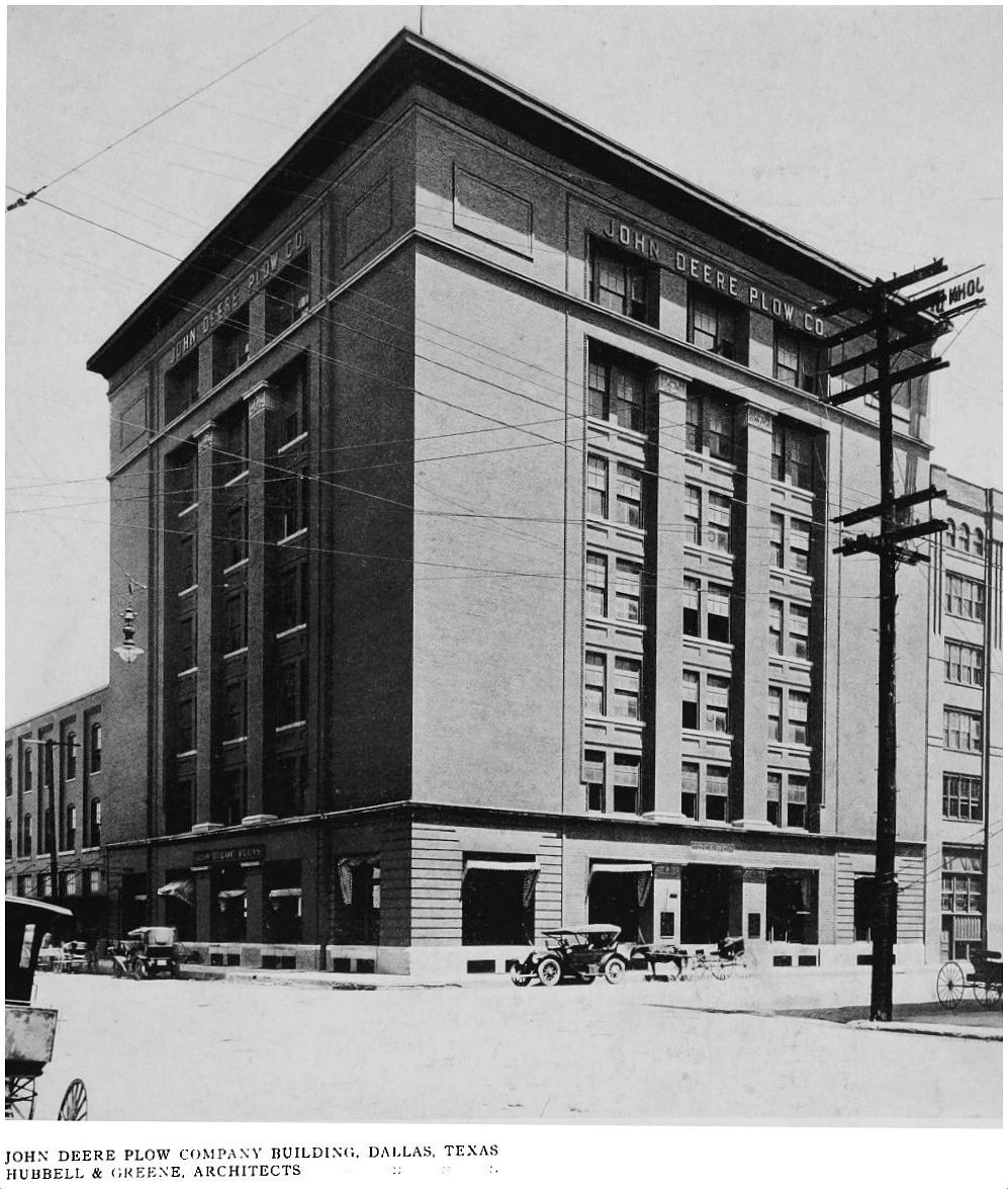
2. JOHN DEERE BUILDING, 501 Elm Street (northeast corner of Elm & Houston), designed by Hubbell & Greene. This building was built about 1901/1902 for the Kingman Texas Implement Co. (construction permits were issued the same week in 1901 as its also-still-standing-across-the-street-neighbor, the Southern Rock Island Plow Co., better known as the Texas School Book Depository). It is thought to be the earliest example of Sullivan-esque architecture in Dallas. The John Deere Plow Co. moved into the building around 1907 and built the warehouse, which extends back to Pacific. After the Deere Co. moved out, it was the home of apparel manufacturing and wholesaling offices for many years. (See it on a 1921 Sanborn map, here.)
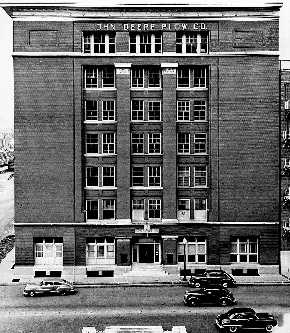 ca. 1949, via Flickr
*
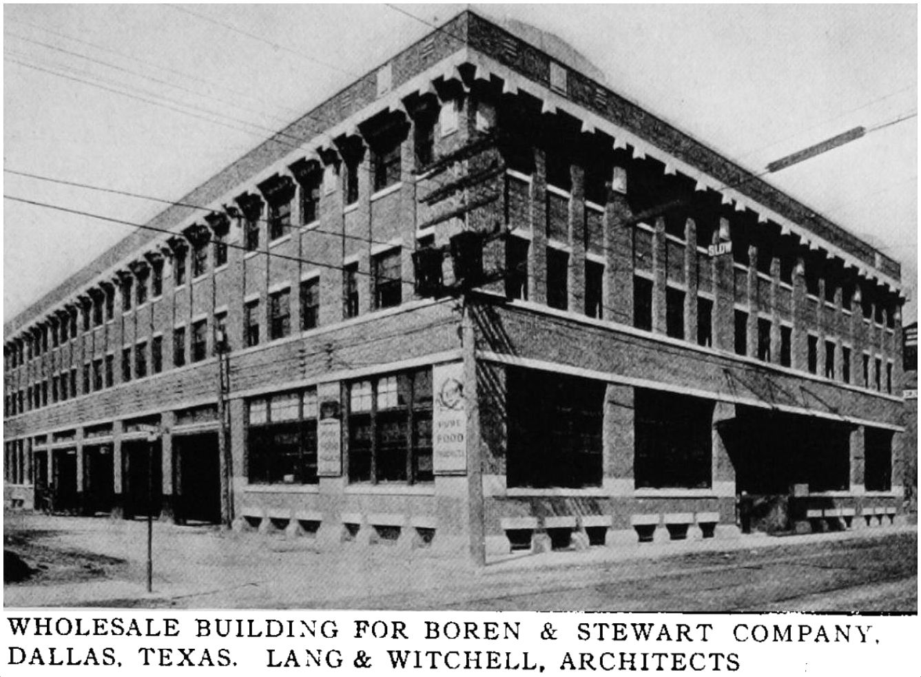
3. BOREN & STEWART BUILDING, 1801 N. Lamar (at Hord), designed by Lang & Witchell. This attractive building was built in 1913 in what is now the Historic West End District — the building is still standing. Boren-Stewart, billed in ads at this time as “Dallas’ oldest grocery house,” had been established in the late 1880s by Robert H. Stewart and Benjamin N. Boren. At the time of the construction of this new building, its president was R. H. Higginbotham (whose Swiss Ave. house was also featured in The Western Architect); its treasurer was A. W. Cullum, who would go on to form the Tom Thumb grocery store chain. (See it on a 1921 Sanborn map here.)
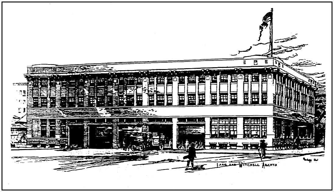 Lang & Witchell drawing, 1913
*
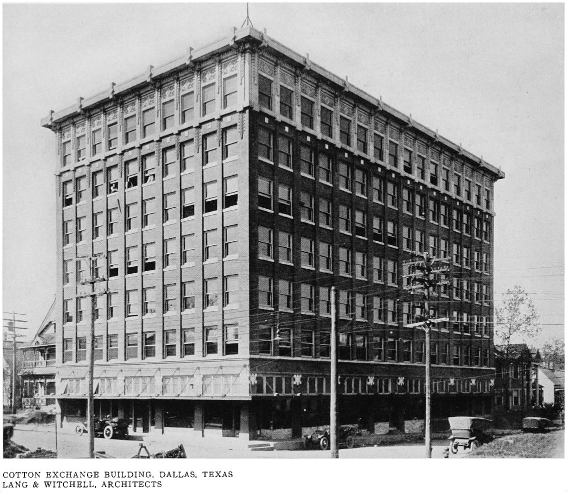
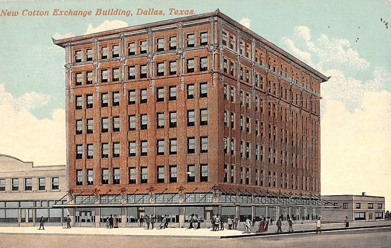
4. COTTON EXCHANGE BUILDING, 401 S. Akard (southwest corner of S. Akard & Wood), designed by Lang & Witchell. Built in 1911, this was the hub of the cotton market in Dallas, a city which, in a 1912 article in The Dallas Morning News, was described as “the greatest and largest interior cotton market in the world, handling cotton worth $100,000,000 per year” (about 2.7 billion dollars in today’s money!). The Dallas Cotton Exchange was handling up to one-third of the cotton grown in Texas and Oklahoma. This handsome building was vacated by the cotton people in 1926 when their much larger new exchange building went up at St. Paul and San Jacinto. (Read about the Dallas cotton traders unhappiness with not being acknowledged as one of the country’s most important exchanges in a March 20, 1912 article in The Dallas Morning News here.) (See this building on a 1921 Sanborn map here.) This is the only building in this group of ten that is no longer standing — the site is now occupied by a parking lot.
*
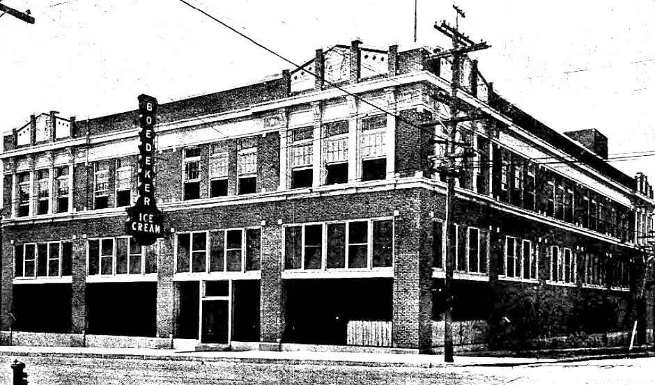
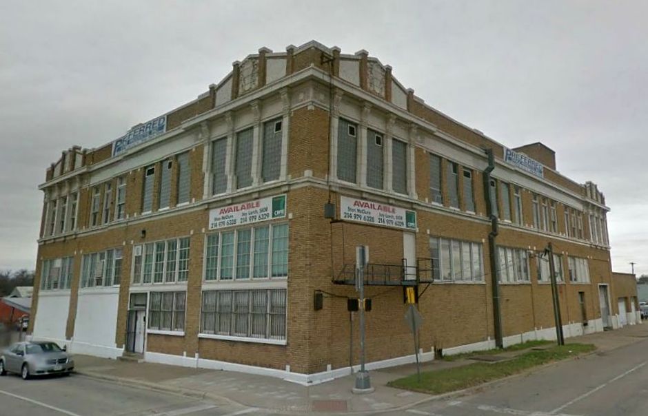
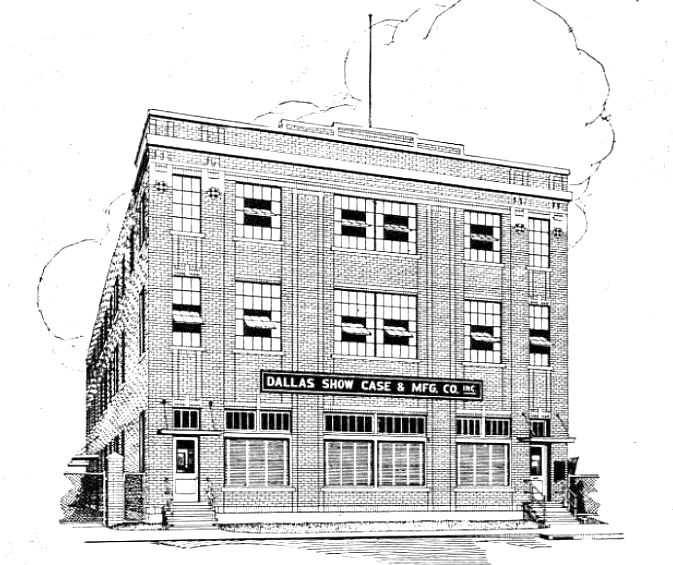
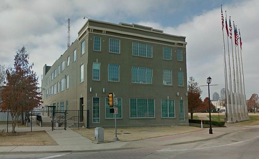
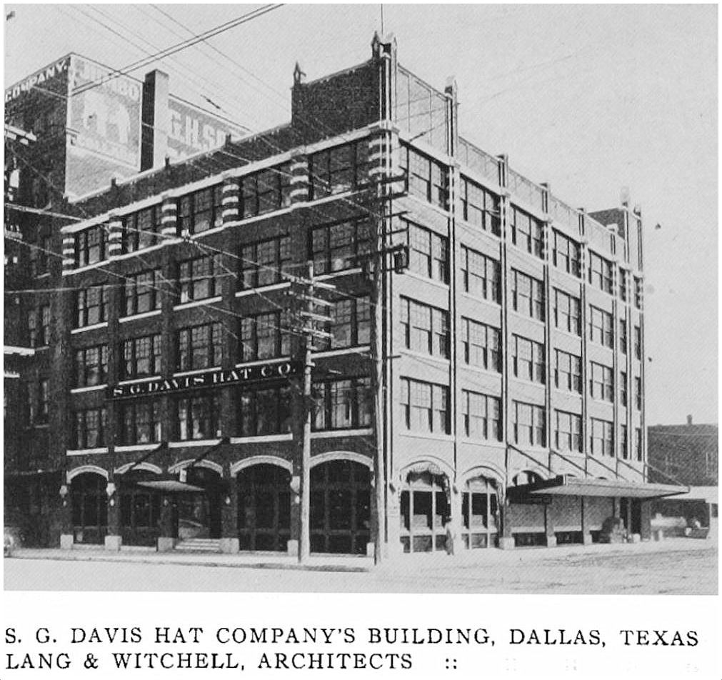
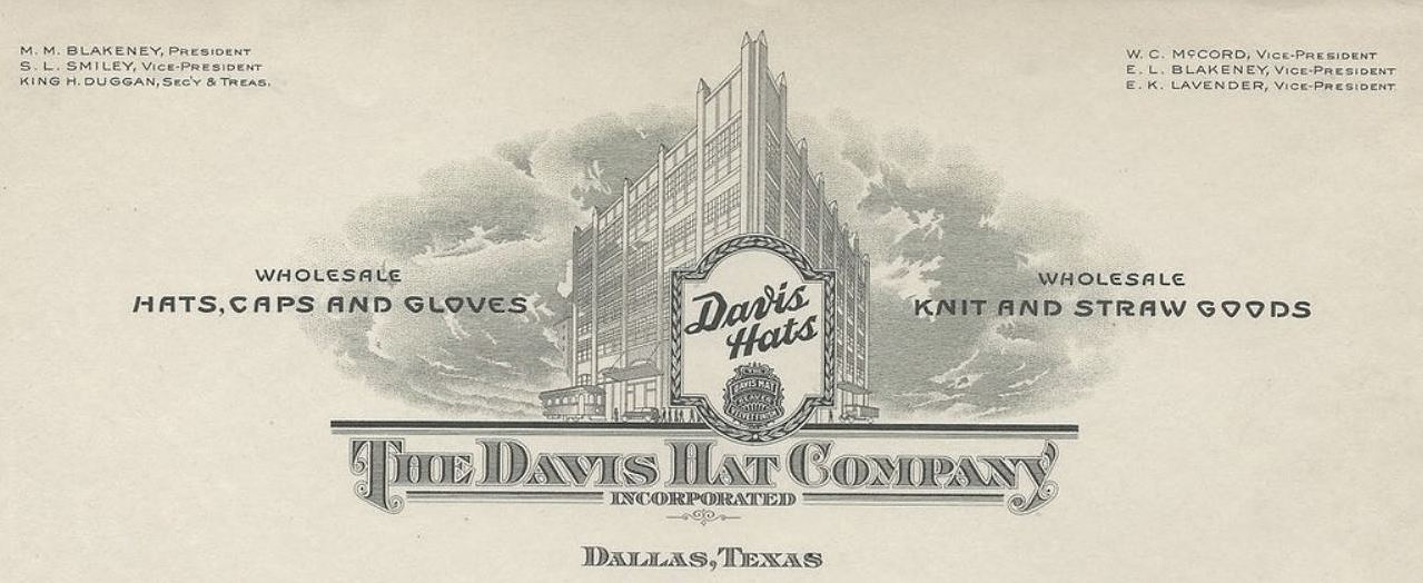
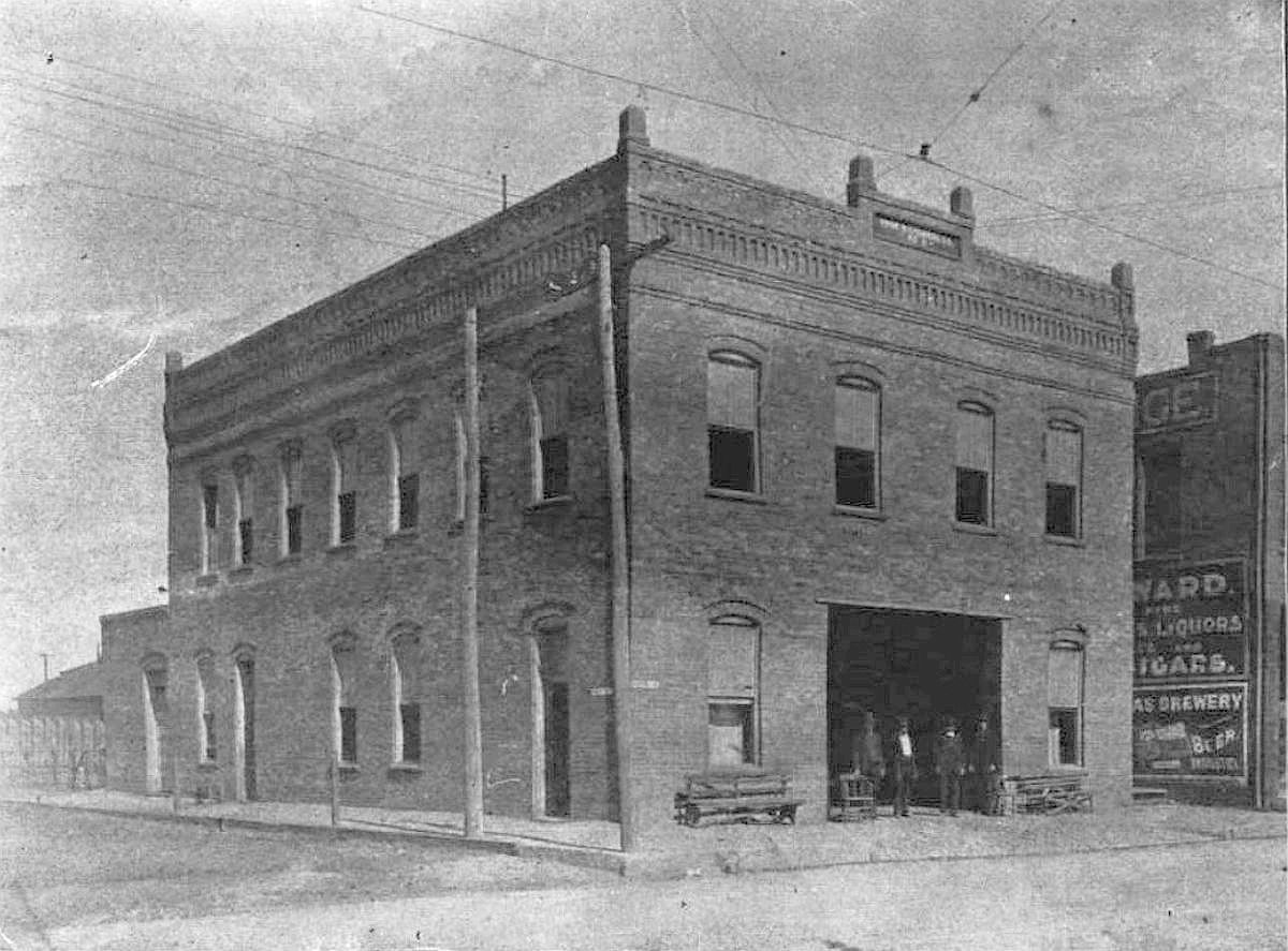
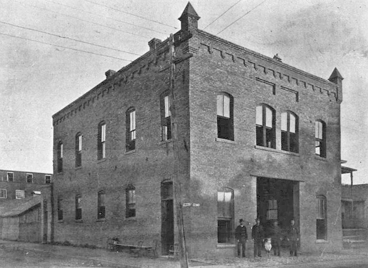
5. S. G. DAVIS HAT CO. BUILDING, 800 Jackson St. (southeast corner of Jackson and S. Austin), designed by Lang & Witchell. When it was built in 1913 it was advertised as “facing the new Union Depot” (which hadn’t yet been built and was three blocks away). The Davis Hat Company — a manufacturer and wholesaler of men’s hats — was established in Dallas in 1900. This building might be familiar to many people for its “Office Equipment Co. sign painted on the back exterior. (See the location of this building on a 1921 Sanborn map, here.)
*
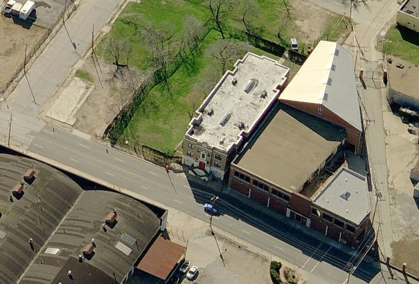
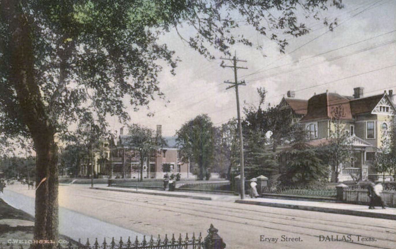
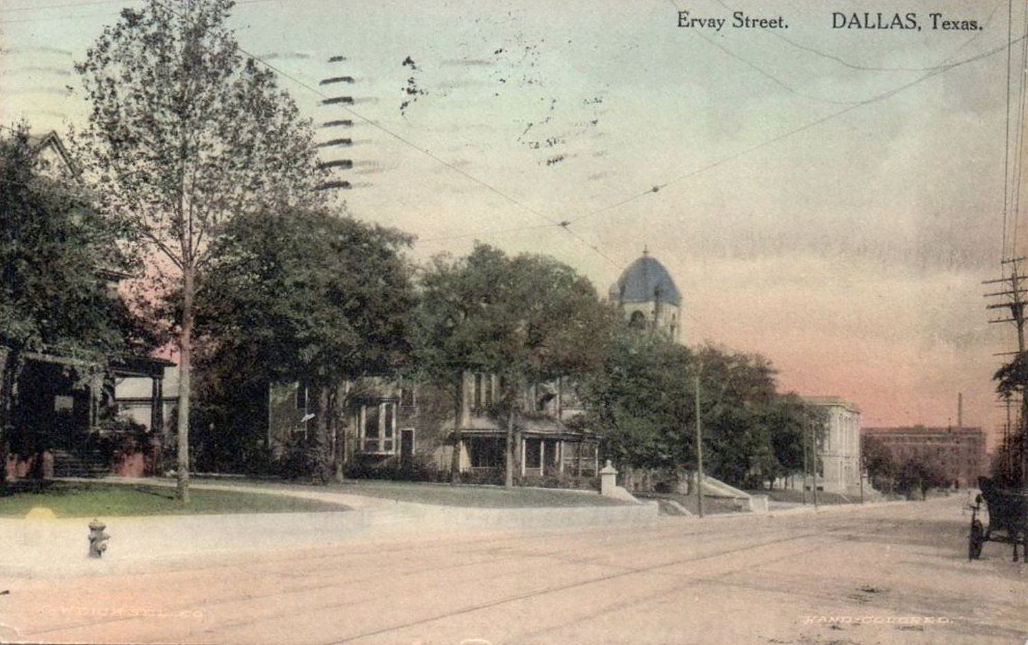
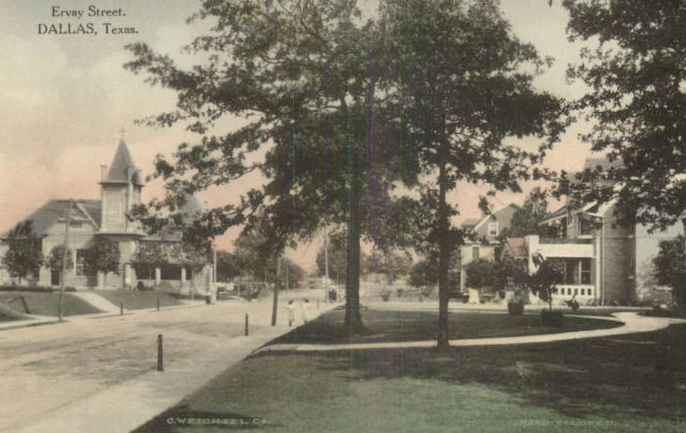
6. BUTLER BROTHERS, 500 S. Ervay (between Young and Marilla, immediately east of City Hall), designed by Mauran, Russell & Crowell Architects (Harre Bernet, Dallas representative). This massive building (11 acres of floorspace before any additions were made) was one of the branches of the Chicago company which was known at the time as the largest wholesale business in the world. Construction began in 1910 (see a photo of the work in progress, by Vilbig Brothers Construction, here) and, over the years, various additions were made. When Butler Bros. sold the building in 1951, it had grown to 670,000 square feet and soon became home to the newly branded Merchandise Mart. The building still stands (as residences), but it doesn’t look a lot like it did a century ago: it was apparently resurfaced in the 1960s and currently sports a regrettable exterior color, which makes it look a bit like a large Hampton Inn. (See it on a 1921 Sanborn map, here.)
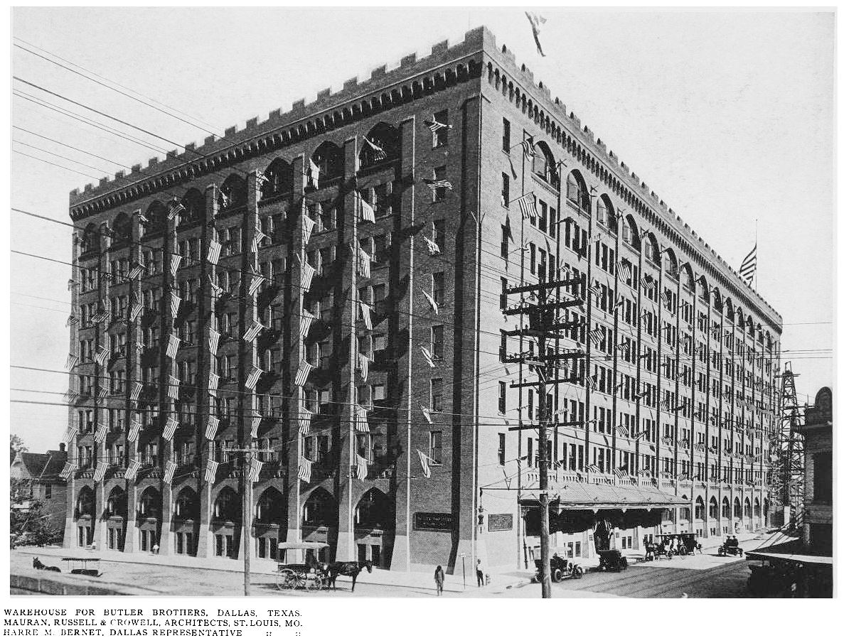
It even had its own artesian “deep well.”
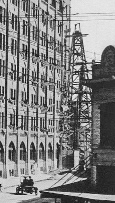
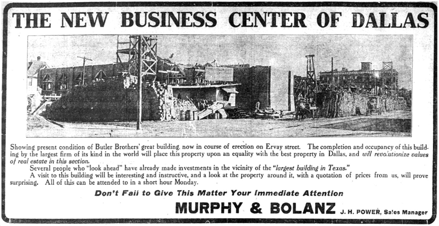 November, 1910
*
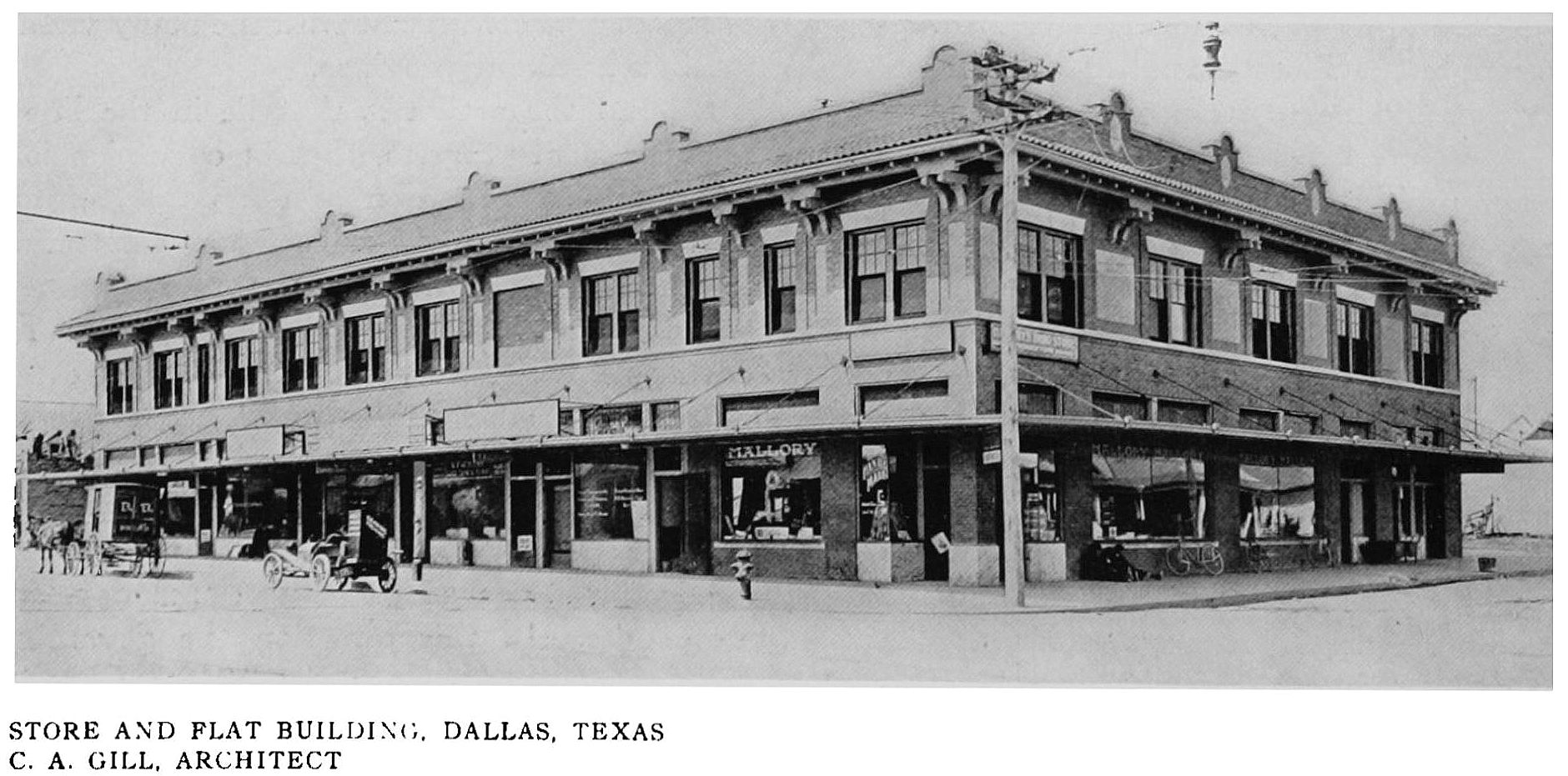
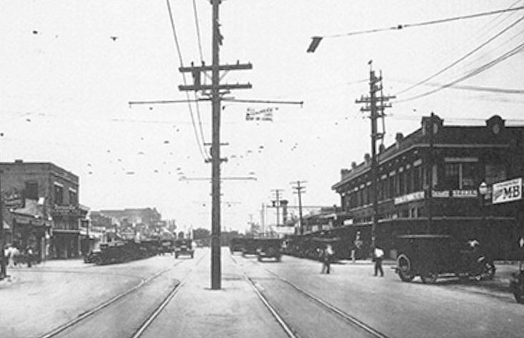
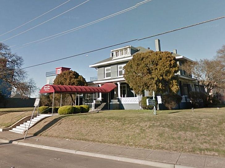
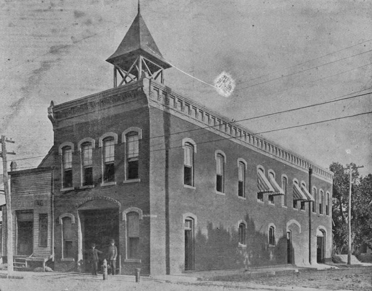
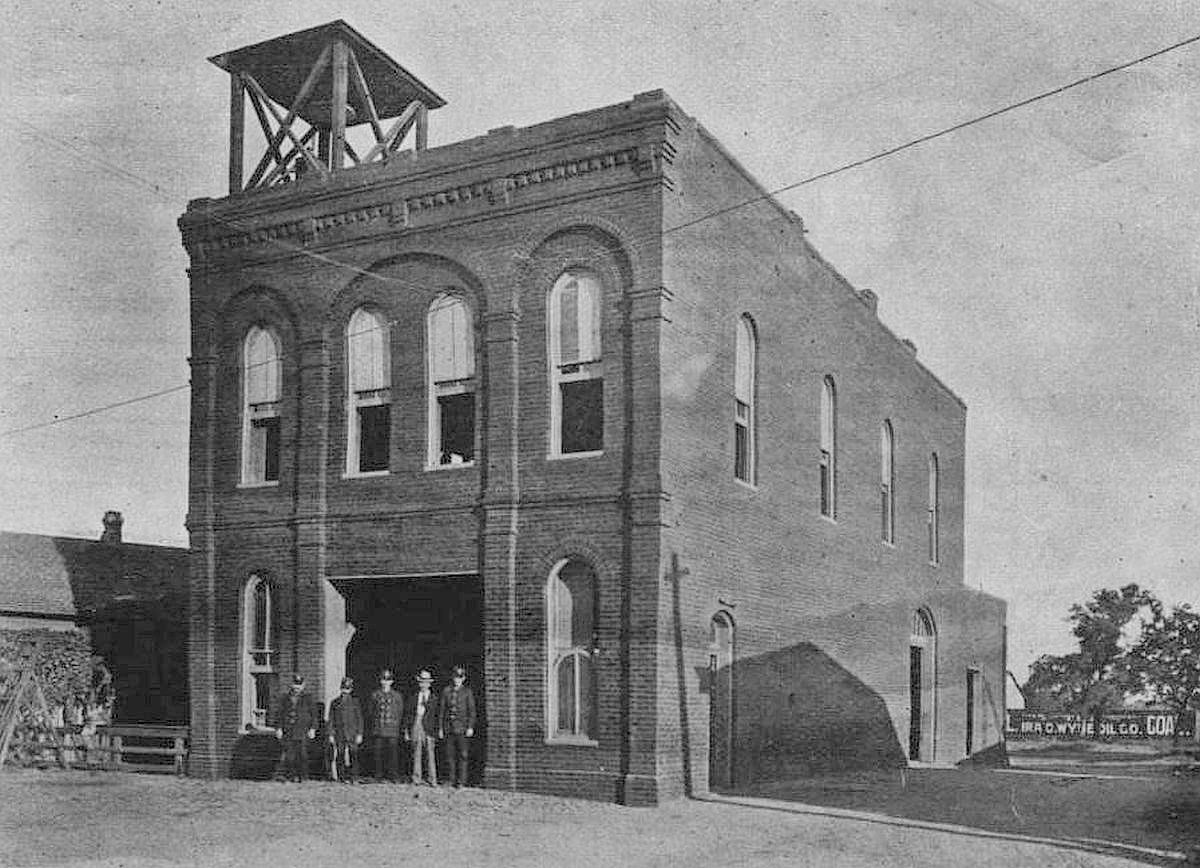
7. “STORE AND FLAT BUILDING,” northwest corner of West Jefferson & Tyler, designed by C. A. Gill. Luckily I recognized this building — because I love it and have written about it before — because, otherwise, there’s very little to go on to determine its location. It was built in 1911 or 1912 for use as retail establishments on the ground floor and apartments (“flats”) and the occasional doctor’s offices on the second floor. Still looking good in Oak Cliff. (See it on a 1922 Sanborn map, here.)
 1929 (Dallas Public Library photo, via Oak Cliff Advocate)
*
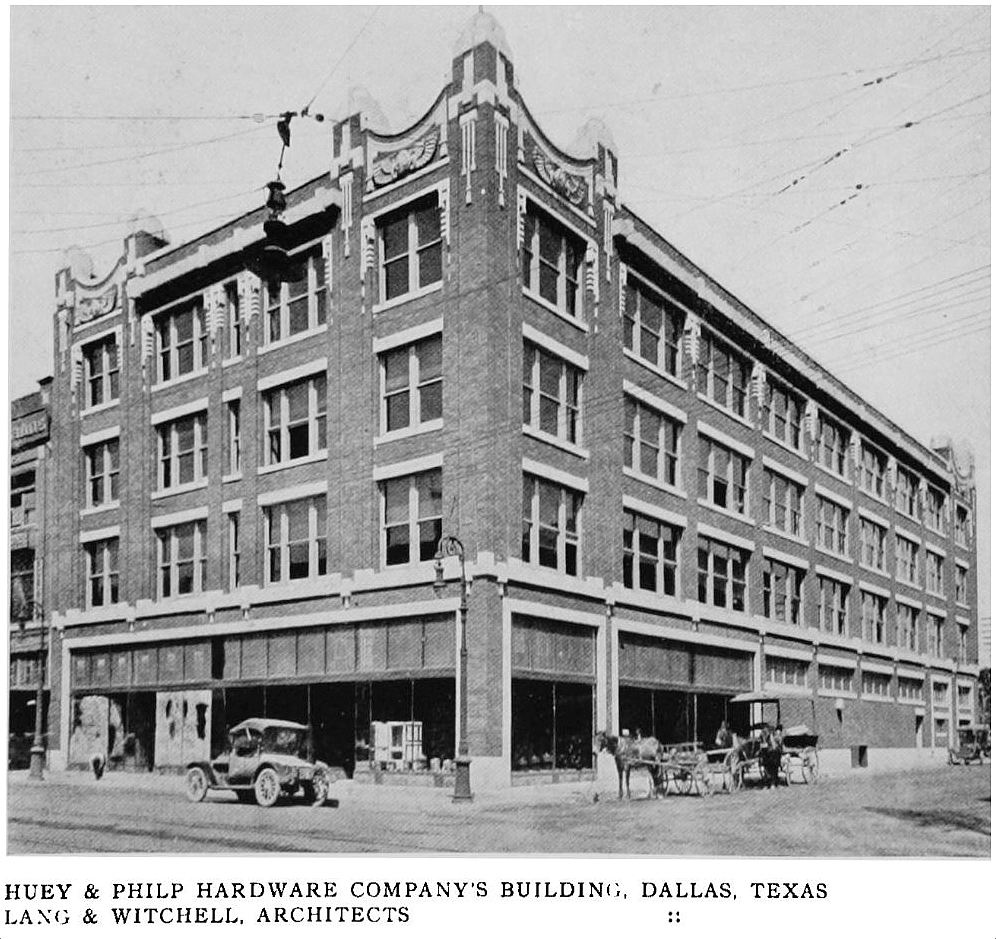
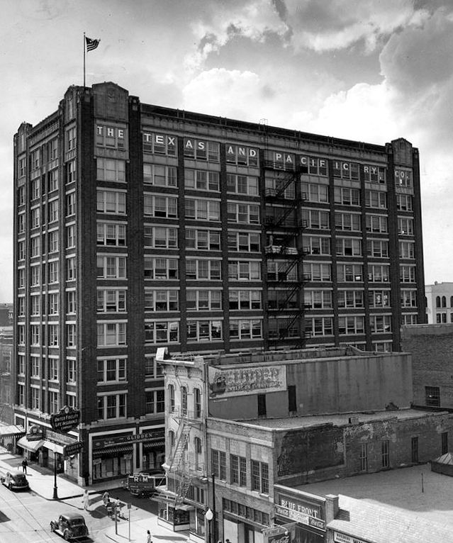
8. HUEY & PHILP BUILDING, 1025 Elm Street, designed by Lang & Witchell. Built in 1913-1914 for the Huey & Philp hardware company (founded in Dallas in 1872 by Joseph Huey and Simon Philp) — this building is still standing, but you’d probably never ever guess it. First off, it looks nothing like it once did: it’s much taller now and it was one of the many downtown buildings that went through bizarre refacings in the 1950s and ’60s — beautiful buildings were stripped of all their character and uglified, for reasons I can’t fathom. Anyway, the other reason it’s hard to believe this is the same building is that, when it was built, it sat on the northwest corner of Elm and Griffin; now it sits on the northeast corner. How does something like that happen? In the 1960s, Griffin was “realigned” and widened, in order to provide a north-south artery through downtown’s west side — part of this road construction meant that Griffin suddenly cut right through the 1000 block of Elm (it also did away with poor little Poydras Street). The old Griffin can still be seen in the Griffin Plaza walkway (here — with the old Huey & Philp/Texas & Pacific building to the left, now a hotel and looking nothing like the century-old building it is). Crazy. Huey & Philp closed its retail business in 1934 but continued for several decades as wholesalers. (Read more about this building at Noah Jeppson’s Unvisited Dallas site, here. And see a street-level early-1920s photo in the UTA collection here, with the Sanger’s building in the background at the left.) (See it on a 1921 Sanborn map, here.)
 via Unvisited Dallas
*
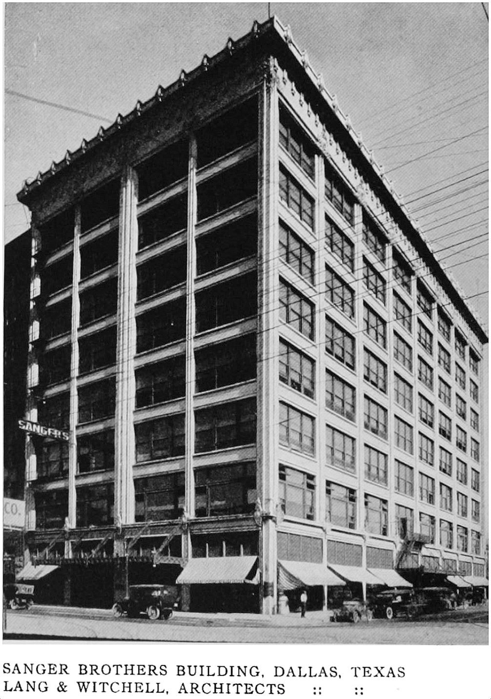
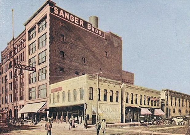
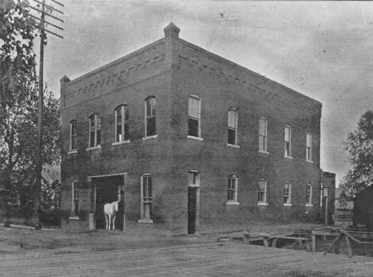
9. SANGER BROTHERS BUILDING, Main & Lamar, designed by Lang & Witchell. One of the earliest Dallas business institutions (the Sanger brothers arrived in Dallas in the 1870s, at about the same time as Simon Philp), Sanger’s slowly acquired a ton of downtown real estate (for warehouses, etc.), but this building — their retail department store — was their centerpiece, and it grew and grew over the years. The expansion(s) of 1909 and 1910 included the addition of two floors to their already 6-story building, the building of a new 8-story addition which went up at the corner of Main and Lamar, and then when that was completed in 1909, another addition matching the rest of the store was built on the Elm Street side, resulting in a store taking up half a block of prime real estate (they would eventually own the entire block). More than a century later — now as part of El Centro College — the building still looks good. (See it on a 1905 Sanborn map, here, and a 1921 map, here.)
Here’s what it looked like before this flurry of construction began:
*
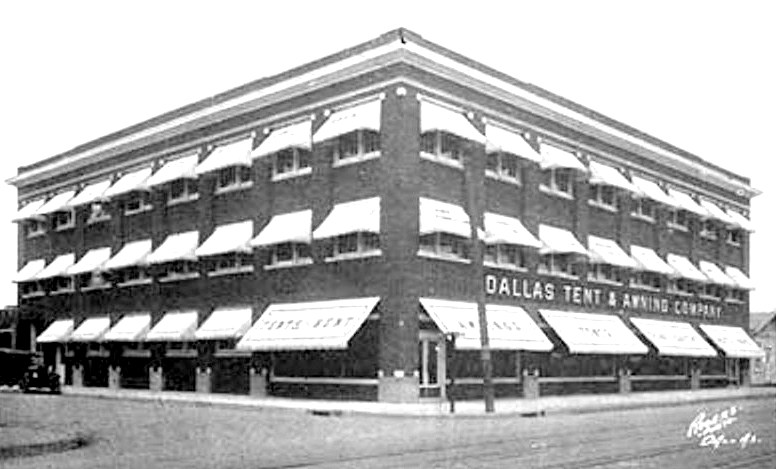
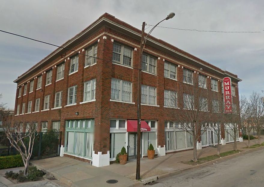
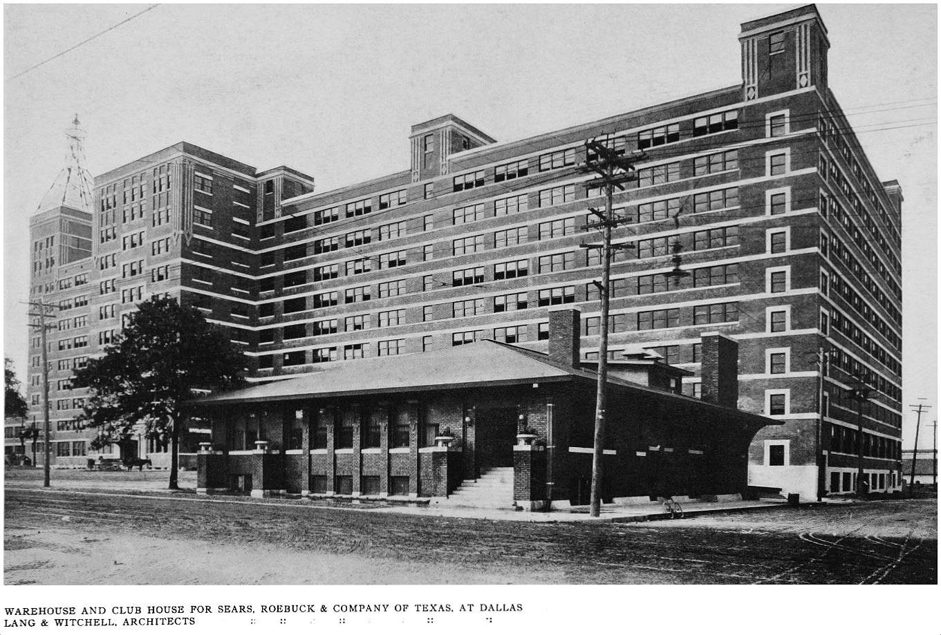
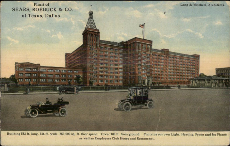
10. SEARS, ROEBUCK & COMPANY OF TEXAS WAREHOUSE AND CLUB HOUSE, S. Lamar & Belleview, designed by Lang & Witchell. When Sears, Roebuck & Co. decided to open their first branch outside of Chicago, their choice was Dallas. A huge warehouse was built along South Lamar in 1910. Then, in 1912 a second huge warehouse was built. And, in 1913 a third one. This growth was pretty spectacular. All three of these buildings were designed by Lang & Witchell (building 3 is the one seen below). The massive Sears complex is now known as South Side on Lamar, and it’s beautiful. (More on this clubhouse is here.) (See the Sears buildings in a 1921 Sanborn map, here.)
**
Next: the Adolphus Hotel.
***
Sources & Notes
The Western Architect, A National Journal of Architecture and Allied Arts, Published Monthly, July, 1914. This issue, with text and critical analysis in addition to the large number of photographs, has been scanned in it entirety by the University of Illinois at Urbana-Champaign as part of its Brittle Books Program — it can be accessed in a PDF, here (the Dallas issue begins on page 195 of the PDF). Thank you, UIUC!
In this 7-part series:
- “Dallas in ‘The Western Architect,’ 1914: Park Cities Residences”
- “Dallas in ‘The Western Architect,’ 1914: Residences of East Dallas, South Dallas, and More”
- “Dallas in ‘The Western Architect,’ 1914: Skyscrapers and Other Sources of Civic Pride”
- “Dallas in ‘The Western Architect,’ 1914: Businesses
- “Dallas in ‘The Western Architect,’ 1914: The Adolphus Hotel”
- “Dallas in ‘The Western Architect,’ 1914: Leisure, Etc.”
- “Dallas in ‘The Western Architect,’ 1914: City Buildings and Churches”
*
Copyright © 2018 Paula Bosse. All Rights Reserved.


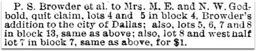
 1911 directory,

 Galveston News, Mar. 24, 1883
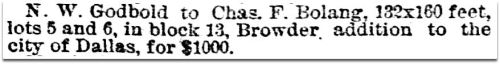 Galveston News, Mar. 24, 1883
 Galveston News, July 2, 1883
 1886 Dallas directory
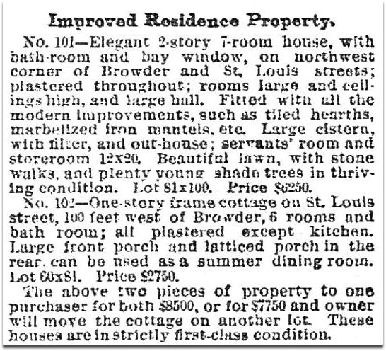
 1888 Dallas directory
 DMN, Feb. 13, 1889
 1889 Dallas directory
 1889 Dallas directory
 1891 Dallas directory
 1897 Dallas directory


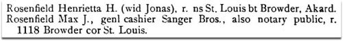
 June, 1924
 Aug., 1924
 July, 1925
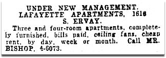 Oct., 1931
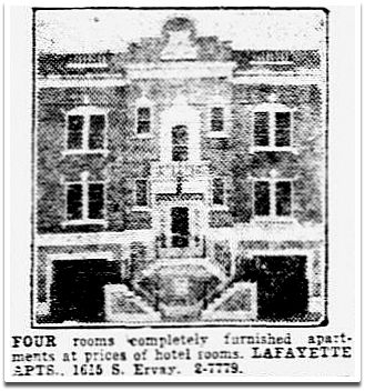 Oct., 1932